History
The western part of Talcott Woods was a farm woodlot associated with the original Talcott Farm until its time of donation, with the gentler slopes to the north seeing the greatest use. During the 1950s, UVM Extension used 14 acres of the woodlot as a demonstration area, but since then, little management activity has occurred.
Present Use
The Rubenstein School currently uses Talcott Woods for teaching courses in dendrology (identification of trees) and forest measurements. A 2023 timber harvest is planned with goals of removing invasive species and increasing tree structural and age-class diversity.
Driving Directions
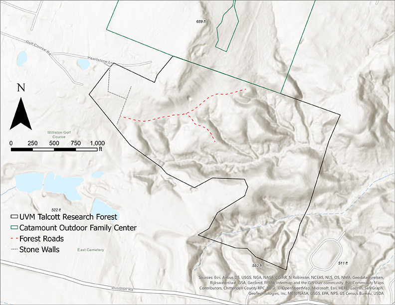
Before visiting the Talcott Forest, be aware that there are no parking facilities or direct road access to this forest. Following Route 2 east out of Burlington, you will pass through Taft Corners and eventually come to Williston Village. Once in the village you will come to a four-way stop sign with a white church on the corner. Take a left onto North Williston Road. Exactly 1 mile down this road, turn right onto Governor Chittenden Road. About a 1/2 mile down this road, you will see a parking sign for Catamount Outdoor Family Center. This represents the nearest parking access to the forest. From here, walk across the road, and follow the dirt road south past the white farmhouse. Talcott Woods lies directly south of the Catamount Community Forest. Note that user fees for Catamount Community Forest and Catamount Outdoor Family Center may apply when using this access.
Download a trail map of Talcott Woods (PDF).