Post-Meeting Content
FEMC has made available as much content from the meeting as possible. You can:
- Watch videos of the invited speakers at the plenary session
- Read abstracts, download presentations, and view video from the contributed talks sessions, and
- View the posters presented at our poster session
In addition, FEMC will again be publishing a proceedings for the conference by the end of March 2022.
Welcome and Introductory Remarks
A brief update on the Forest Ecosystem Monitoring Cooperative network, structure, services, and future.
VIDEOPlenary Session
Keynote Presentations

Green Responders: Examining the role of environmental groups during times of acute and chronic disturbance
Dr. Erika Svendsen, ,
VIDEO PRESENTATION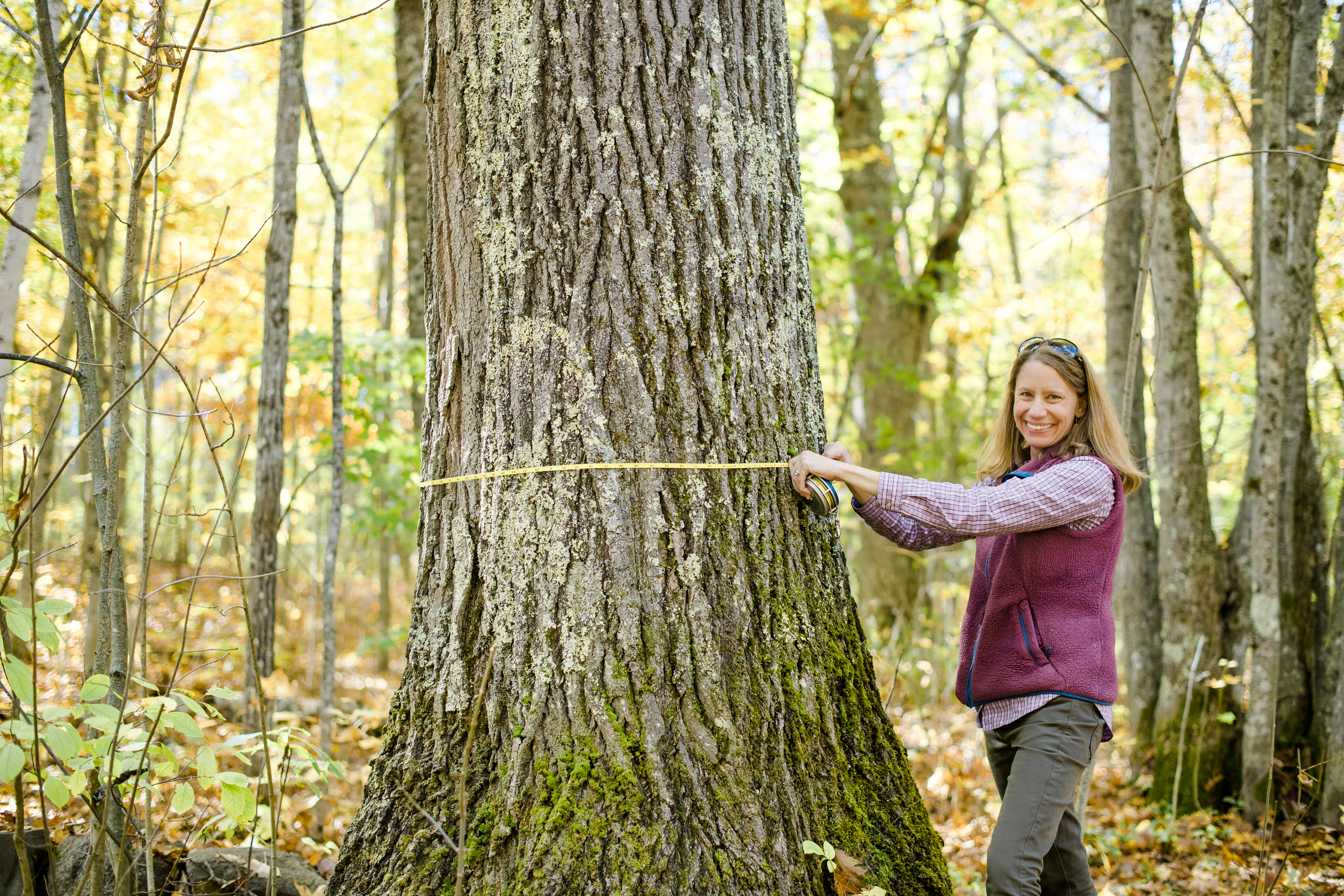
Forest ecosystem change through the lens of plant functional traits: measurement, management and monitoring
Dr. Julia Burton, ,
VIDEOContributed Talks
Four parallel tracks of 20-minute presentations contributed by cooperators on various forest ecosystem research, monitoring and outreach activities
Session 1
| Forest Disturbance Moderator: FEMC | Forest Recreation Moderator: FEMC | Changing Communities Moderator: FEMC | Translational Science Moderator: FEMC |
|
|---|---|---|---|---|
Dragonfly Larvae as Mercury Biosentinels: From National Parks to National Forests Kate Buckman ABSTRACT VIDEO PRESENTATION | Climate change adaptation among urban and rural foresters in the Northeastern US: an assessment of motivations, practices, and barriers Tessa McGann ABSTRACT VIDEO PRESENTATION | Vermont's Resilient Right-of-Ways Project Karl Honkonen ABSTRACT VIDEO PRESENTATION | Living on the edge in a warming world: distributions and thermal refugia of forest insects across the northeastern United States Michael T. Hallworth ABSTRACT PRESENTATION | |
Dragonfly Larvae as Mercury Biosentinels: From National Parks to National Forests Sarah Nelson, Appalachian Mountain Club Presenter: Kate Buckman, Dartmouth College Mercury (Hg) pollution is a persistent threat to global environmental health. In northern New England, atmospheric inputs of Hg from long-range transport and legacy point-source pollution can affect rural and developed areas alike, leading to bioaccumulation of Hg in aquatic food webs across the region. The forested landscapes in New England are known to enhance methlymercury bioavailability to food webs, making many forested ecosystems susceptible to Hg pollution. The Dragonfly Mercury Project (DMP) is a nationwide study led by the National Park Service (NPS) and U.S. Geological Survey (USGS), in collaboration with Dartmouth College and the Appalachian Mountain Club. It has established a surveillance network for Hg in protected lands across the US by engaging community volunteers in the collection of dragonfly larvae as Hg biosentinels. The data generated through the DMP allowed for the creation of an integrated impairment index that informs wildlife and human health Hg risk based on dragonfly larvae Hg concentrations. However, NH and VT locations are not well represented within the past DMP data, due to the scarcity of national park lands in these states. Sampling in National Forests provides an opportunity to expand across a larger land base targeting under-sampled areas. This includes incorporating managed lands, such as National Forests, to help identify the potential influences of land management practices on mercury accumulation and transport. Beginning in 2020, we piloted DMP sample collection in National Forests at four ponds in the White Mountain National Forest. Preliminary results from these ponds (mean~125-150 ppm, dry weight of Hg) indicate that dragonfly larvae pose moderate risk to upper-level predators, similar to most results for other national parks in the Northeast region. USDA and FEMC funding has allowed us to expand our community involved Hg biomonitoring efforts into additional new sites in the White and Green Mountain National Forests in 2021. Preliminary data from these recent sampling efforts and past data from the DMP will be presented and discussed. | ||||
Climate change adaptation among urban and rural foresters in the Northeastern US: an assessment of motivations, practices, and barriers Tessa McGann, University of Vermont Presenter: Tessa McGann, UVM Presently, forests across the globe are facing change at a rate and scale not previously experienced. Due to the timing, severity, and compounding nature of stressors related to climate change and shifting socioeconomic demands, stakeholders around the world fear the disruption of the fundamental function and form of their forests and greater socio-ecological systems. Accordingly, urban and rural foresters are called to adapt their management to changing and uncertain conditions. However, studies of foresters across North America and the globe have documented significant gaps between the recommendation and implementation of adaptive management, with varying explanations. Despite previous research conducted in the northeastern United States, questions remain regarding the current nature, extent, and drivers of adaptation, particularly among urban foresters across the region. The research presented here is based on qualitative analysis of 32 in-depth semi-structured interviews with urban and rural foresters (n = 15 and n = 17, respectively) across New England and New York. According to the perspectives of those charged with choosing and implementing adaptive management, we present a summary of the i) important environmental drivers of adaptation; ii) commonly employed adaptive strategies; iii) significant barriers to adaptation; and iv) discussed approaches to working through named barriers. The goal is to provide stakeholders with a snapshot of the current state of adaptive management of forested systems across the region, both urban and rural, with a focus on opportunities for greater learning and support. | ||||
Vermont's Resilient Right-of-Ways Project Karl Honkonen, USDA Forest Service Presenter: Karl Honkonen, USDA Forest Service The goal of this project was to develop a collaborative and integrated approach to advance green stormwater infrastructure (GSI) in roadside environments, targeted at communities in the Lake Champlain basin that have the greatest need to manage stormwater runoff from developed urban centers and rural back roads. | ||||
Living on the edge in a warming world: distributions and thermal refugia of forest insects across the northeastern United States Jason Loomis, Vermont Center for Ecostudies Presenter: Michael T. Hallworth, Vermont Center for Ecostudies Insect populations across the planet are experiencing precipitous declines, are ubiquitous within food webs, and serve as bioindicators of ecosystem health. As such, understanding their response to climate change is drastically needed. We used 1,289,559 insect observations of 16,336 species from museum collections, field studies, and community scientists to better understand 1) how forest insects are distributed across New England and 2) help inform conservation efforts given forecasted climate change scenarios. This work couples species distribution models, remotely sensed data, and climate projection models to identify current & anticipated distributions, and climate refugia of forest insects across the northeast. Our results identify how climate forcing impacts diversity hotspots for forest insects and allows stakeholders to locate and prioritize conservation/restoration efforts. | ||||
Updates on Federal Pest Deregulation and Status of Pests of Regional Concern Judy Rosovsky ABSTRACT VIDEO PRESENTATION | Forest on the Move: Tracking Climate Related Changes of Treelines in Montane Systems of the Northeast Jordon Tourville ABSTRACT VIDEO PRESENTATION | Cooperative Forest and Wildlife Habitat Management in Central Wisconsin Joshua Benes ABSTRACT VIDEO PRESENTATION | Assessing the Resiliency of Oak Forests Logan Johnson ABSTRACT VIDEO PRESENTATION | |
Updates on Federal Pest Deregulation and Status of Pests of Regional Concern Judy Rosovsky, VAAFM Presenter: Judy Rosovsky, VT Agency of Agriculture, Food and Markets The US Department of Agriculture Animal Plant Health Inspection Service Plant Protection and Quarantine has deregulated or has taken steps to deregulate several pests from their Plant Pests and Diseases Program, including the emerald ash borer, chrysanthemum white rust, the light brown apple moth and the velvet longhorned beetle. The possible effects of these changes will be discussed and a brief mention will be made about which communities are able to participate in decision making about these regulations. Updates on recent pests of regional concern will be provided, especially on the spotted lanternfly, whose range continues to expand. Other pests of concern and their potential for forest disruption include beech leaf disease, the box tree moth, the brown-tailed moth, oak wilt, a few of the recent Exotic Wood Boring Bark Beetle trap finds and the Asian Giant Hornet. | ||||
Forest on the Move: Tracking Climate Related Changes of Treelines in Montane Systems of the Northeast Jordon Tourville, SUNY-ESF Presenter: Jordon Tourville, SUNY-ESF, AMC High elevation forests and mountain alpine zones are integral parts of the cultural heritage and physical landscape of the northeastern US. These areas harbor rare species, provide important ecological services, and are known nationally for their contribution to conservation and recreation. The upper elevation treeline, the elevation at which trees can no longer sustain a tall upright form due to harsh climatic conditions, has often been used as a barometer for the impact of climate change. As the climate warms, we hypothesize that treelines will noticeably advance upslope at the expense of often unique and diverse alpine ecosystems of mountain summits, with the rate of advance potentially indicating ecosystem sensitivity to changing climate. We used current and historical high resolution aerial imagery from the Presidential Range of New Hampshire and Mount Katahdin in Maine to quantify the regional advance of treelines over the past several decades. Physical copies of historical imagery were digitized and georeferenced (1978 from New Hampshire and 1991 from Maine). NAIP imagery from 2018 as well as state produced DEM's were downloaded and superimposed onto historical imagery. Treeline location, as determined by dramatic decreases in tree height and density, from each set of images were manually classified using ArcGIS 10.8. This approach was coupled with ground surveys of forest vegetation and topological features to ground-truth manual treeline classification based on tree height and density, and to provide information on additional possible drivers of treeline location. Differences in altitude and direction of treeline shifts between historical and current imagery were calculated from rasterized versions of our manual treeline classification. On average, on both the Presidential Range and Katahdin, treeline positions have significantly shifted upslope over the past several decades. This was seen largely as an increase in diffuse treeline form (i.e., an increase in area of isolated pockets of trees into the alpine zone). Topographical features, such as slope, aspect, and soil depth seemed to play a role in defining the upper limits to which treeline location could advance. At this point, while climate change cannot be directly implicated in these observed shifts in treeline, the direction of the shifts is consistent with our hypothesis that climate change is facilitating an upward movement of trees on mountain slopes. Taken together, these results contribute valuable knowledge to Appalachian Mountain Club's longstanding mountain research program and serve as a baseline to promote better management of regional mountain communities. Results from this work will also be foundational for researchers and land managers in prescribing potential climate adaptation strategies. Most importantly, the people who enjoy these irreplaceable areas will benefit from the improved conservation and understanding of our mountain peaks in a warming world. | ||||
Cooperative Forest and Wildlife Habitat Management in Central Wisconsin Joshua Benes, Golden Sands RC&D (previous Executive Director) Presenter: Joshua Benes, Golden Sands Resource Conservation and Development Council Fragmentation can make it difficult to apply forest management techniques at a regional scale. Despite parcelization, a Wisconsin regional conservation nonprofit called Golden Sands RC&D has found innovative ways to catalyze regional forest management using the State of Wisconsin's Deer Management Assistance Program (DMAP). Golden Sands RC&D's program, Cooperating For Woods and Wildlife (CFWW), has the goal to assist private landowners with the creation of group cooperatives to collectively and collaboratively enhance forest health, restore wildlife habitat, and control invasive plants across property boundaries. Golden Sands RC&D has so far enrolled more than 125 landowners with more than 13,000 acres into these cooperatives. Working with these landowners and federal partners, Golden Sands RC&D has also restored more than 100 acres of wildlife habitat for the endangered Karner blue butterfly. This presentation will provide information about the State of Wisconsin's DMAP program, the history of Golden Sands RC&D's CFWW program, and how similar programs may be adopted in the northeast. | ||||
Assessing the Resiliency of Oak Forests Jim Duncan, Forest Ecosystem Monitoring Cooperative Presenter: Logan Johnson, Forest Stewards Guild Oaks dominate seventy percent of Southern New England forests. Unfortunately, many pressures compromise these forests' long-term outlook, including deer browse, defoliation by insects, seasonal droughts, and other climate change-related stressors. Concurrently, 70% of the region's forests consist of small parcels owned by families and individuals, meaning landscape-scale efforts to increase the resiliency of oak forests depends on effective landowner outreach and education. The Oak Resiliency Assessment Tool developed by the Forest Ecosystem Monitoring Cooperative in collaboration with the Northern Institute of Applied Climate Science and the Forest Stewards Guild provides foresters, other resource professionals, and landowners with a tool that provides insights into the resiliency of oak forests. After providing information about themselves and the forest they are assessing, the tool user answers a series of questions on a sliding scale about a variety of different disturbances and climate-related impacts. Following these questions on impacts, the user answers questions about the adaptive capacity of the forest or how well it might tolerate impacts without undergoing significant change, based on a variety of characteristics. Responses to the questions on impacts and adaptive capacity are fed into a report that provides information on issues of concern for the forest and resistance, resilience, and transition approaches that can inform future management decisions. | ||||
Multiyear defoliations in southern New England increases oak mortality Jeffrey S. Ward ABSTRACT VIDEO PRESENTATION | The Effect of Harvesting on Lowland Northern White-Cedar Stand Structure and Composition Katlyn Schulz ABSTRACT PRESENTATION | Winners and Losers in a Changing Climate Bob Popp ABSTRACT VIDEO PRESENTATION | Utilizing Climate Change Refugia for Climate Change Adaptation and Management in the Northeast. Sara Wisner ABSTRACT VIDEO PRESENTATION | |
Multiyear defoliations in southern New England increases oak mortality Jeffrey Ward, CT Agri. Experiment Station Presenter: Jeffrey S. Ward, The Connecticut Agricultural Experiment Station Since its escape in eastern Massachusetts in the 1860s, Lymantria dispar dispar L. (L. dispar; formerly gypsy moth) has spread to nineteen US states and five Canadian provinces After decades of multiyear defoliation episodes in southern New England, Lymantria dispar dispar populations diminished with the appearance of the L. dispar fungus in 1989. Multiyear defoliations did not occur again until 2015-2018. To assess the impact of the return of multiyear defoliations, we examined 3095 oaks on 29 permanent study areas in Connecticut and Rhode Island that were established at least eleven years before the latest outbreaks. This allowed us to compare mortality rates before and after the latest multi-year defoliation episode at both the stand and individual tree level. Pre-defoliation stand level oak mortality averaged 2% (three-year basis) and was higher on stands with higher oak density. Unsurprisingly, post-defoliation stand mortality was much higher in severely defoliated stands (36%) than in stands with moderate (7%) or low-no defoliation (1%), but did not differ between managed and unmanaged stands. Pre-defoliation mortality of individual trees differed among species, was lower for larger diameter trees and on unmanaged than managed stands. Pre-defoliation mortality over 12-19 years of northern red oak (5%) differed from white oak (9%) and black oak (12%) which differed from chestnut oak (17%). We found that post-defoliation mortality differed by defoliation severity, differed among species, and often but not consistently, varied with stand oak basal area. Consistent with previous studies, high levels of defoliation across multiple years (severe defoliation) greatly increased mortality; however individual tree mortality on stands with no to moderate defoliation was similar to pre-defoliation mortality levels. This study confirmed that mortality patterns are species specific, as northern red oak had lower post-defoliation mortality than white and black oak across all defoliation levels. However, comparison with other studies demonstrates that species susceptibility to L. dispar mortality can vary across time and space, so managers cannot assume that the species with the highest mortality in previous events will have the highest mortality in future defoliations. Effects of stand oak basal area and density, tree diameter, and management were much less consistent, suggesting the importance of site specific factors. Despite some indication of higher mortality in managed sites, forgoing management to reduce potential mortality is not recommended due to the difficulty in predicting outbreaks, potential loss of income, and the increased risk of hazard trees following severe defoliation in unmanaged stands. Natural resource managers should not assume that oaks that survived earlier multiyear defoliations episodes will survive future multiyear outbreaks, possibly because trees are older. | ||||
The Effect of Harvesting on Lowland Northern White-Cedar Stand Structure and Composition Katlyn Schulz, University of Maine Presenter: Katlyn Schulz, University of Maine It is important to understand the mechanisms limiting regeneration and recruitment of lowland northern white-cedar (Thuja occidentalis), one of the least-studied commercially valuable tree species in its region. Future climate is expected to change the environmental conditions of lowland cedar stands, which will likely impact the growth, survival, and competitive dynamics of cedar and its main competitor, balsam fir (Abies balsamea). This study aims to increase our understanding of how partial harvesting impacts the structure and composition of cedar stands, in support of efforts to create suitable conditions for cedar in managed stands within a context of climate change. Stand structure, composition, and relationships to abundance of cedar and fir regeneration were quantified using a network of permanent sample plots in eight lowland stands in central and eastern Maine; three of these were then harvested following an irregular shelterwood prescription and re-inventoried. Goals were to increase growth of residual trees, maintain structural complexity, and regenerate cedar. Preliminary results suggest that the range of conditions associated with successful regeneration of cedar is narrower than those associated with successful regeneration of fir. Harvesting appears to have impacts that are both favorable (e.g., increased downed deadwood) and unfavorable (e.g., greater canopy openness) for cedar regeneration relative to that of balsam fir over the long term. Findings suggest that continued work is needed to identify strategies for regeneration of cedar that will prove reliable in an uncertain climate future; continued monitoring is needed to confirm long-term results. | ||||
Winners and Losers in a Changing Climate Scientific Advisory Group on Flora Multiple, Scientific Advisory Group on Flora Presenter: Bob Popp, VT Dept of Fish & Wildlife Climate Change is projected to shift plant hardiness zones both latitudinally and elevational. Winter chilling requirements may no longer be met for some plants or seeds, and extended growing seasons may allow more southern species to move northward and upslope. Changing conditions will likely favor more stress tolerant species and species with spores and/or small wind-blown seeds. There are presently 160 listed (endangered or threatened) vascular plants in Vermont. Vermont is home to few endemics due to its recent glaciation, therefore most of our rare plants are on the periphery of their range and more abundant elsewhere. In fact, about 80% of Vermont's listed plants are on the periphery of their range here and are expected to be affected by climatic shifts. The distribution between plants on the northern periphery versus those on the southern periphery is close but slightly favors those on the northern periphery. A subset of listed species that are known to occur in forested settings, was also analyzed to infer their likely fate based upon climate change scenarios. The ramifications are that Vermont and most of New England will most likely be recipients rather than donors on new species in any potential future range shifts | ||||
Utilizing Climate Change Refugia for Climate Change Adaptation and Management in the Northeast. Sara Wisner, University of Massachusetts Amherst Presenter: Sara Wisner, University of Massachusetts Amherst To account for the effects of climate change, management plans in the northeast need to incorporate climate adaptation. Conserving climate change refugia is one adaptation strategy. Climate change refugia are areas buffered by climate change that enable the persistence of valued physical, ecological and cultural resources. Using a translational ecology approach where researchers and managers from the National Park Service (NPS), US Geological Survey (USGS), and the University of Massachusetts worked together, we focused on identifying refugia for tree, herbaceous plant, mammal, and bird species in order to prioritize them for conservation action. Results will predict changes in distribution of habitats and species due to climate change, identify areas for invasive species treatment and other management actions, protect climate-buffered areas from development, highlight priorities for future monitoring and data analysis, and eventually provide a platform that can be replicated in other regions and provide potential future research opportunities. | ||||
Monitoring trends in the severity, extent, and frequency of key disturbance regimes in northeastern forests James Duncan ABSTRACT VIDEO PRESENTATION | Wildlife & Trail Recreation: Understanding, managing, and monitoring recreation effects Meredith Naughton ABSTRACT VIDEO PRESENTATION | Red Cedar Woodlands in Vermont: An overlooked form of old growth and potential climatic record. Matt Peters ABSTRACT VIDEO PRESENTATION | ||
Monitoring trends in the severity, extent, and frequency of key disturbance regimes in northeastern forests Presenter: James Duncan, Forest Ecosystem Monitoring Cooperative, RSENR, University of Vermont Shifts in disturbance patterns across the Northeast are of increasing concern as the climate continues to change. In particular, changes in patterns of frequency, severity and extent of disturbance event may have detrimental cascading impacts on forest ecosystems and human communities. To explore how changing disturbance regimes might impact future forest health and management it is necessary to understand the historical trends and impacts of disturbance in the region. Although individual types of disturbance have already been analyzed, there is a need for a consolidated overview of the current state of disturbance in northeastern forests in a format that enables easy update, exploration and ongoing monitoring. To meet this need, FEMC developed a project titled “Tracking Shifts in Disturbance Regimes.” Through this effort, FEMC gathered foundational datasets on key disturbance drivers and analyzed them for changes over time in extent, severity and frequency. In addition, we compiled a curated list of ongoing studies and projects that can be used to monitor disturbance regimes over time. These results are shared through an online tool that allows users to explore trends, find data and look for shifts in causes of and responses to disturbance regimes across northeastern forests. We will provide an overview of how to use the tool, discuss the types of data available. In addition, we will present the results of the trend analyses of key datasets looking at the extent, severity and frequency of disturbance by native and non-native insects and diseases, flooding, high wind, drought, and fire, including both regional and state-specific patterns. | ||||
Wildlife & Trail Recreation: Understanding, managing, and monitoring recreation effects Presenter: Meredith Naughton, UVM Field Naturalist Program Trail recreation is growing in popularity as our society looks to the outdoors for wellness, camaraderie, and connection to the natural world. Vermont has seen this as particularly true because of the Covid-19 pandemic, which led more long-time residents and recent migrants to seek the enjoyment of our lands. However, trail recreation is not ecologically neutral and leads to disturbance of forests and wildlife. But how do we manage trails to minimize their disturbance, and what do we know about the effect trail recreation has on wildlife? This presentation describes graduate research on the synthesis of scientific knowledge about the effect of trail recreation on wildlife of the northeast. Wildlife response patterns were found across the literature, informing management recommendations for balancing wildlife protection and recreation opportunities. Despite the many challenges of this topic affecting land managers across the region, there is scientifically informed work that can be done to promote an ecologically functional landscape. | ||||
Red Cedar Woodlands in Vermont: An overlooked form of old growth and potential climatic record. Matt Peters, Peters' Botanical and Ecological Services Presenter: Matt Peters, Peters' Botanical and Ecological Services The potential for some conifers living in drought-stressed, challenging environments to reach great age has been well documented, with familiar examples such as the bristlecone pines (Pinus longaeva) of the west and the northern white cedar (Thuja occidentalis) cliff forests of the Niagara escarpment. Such old conifer forests are also known as a source of valuable dendrochronological records with relevance for climate studies. Less well known, however, is the potential for eastern red cedar (Juniperus virginiana) to form very old forest communities in the Northeast. Trees approaching 600 years old have been documented in a Red Cedar Woodland community in New Hampshire and studies of related red cedar cliff communities in the mid-Atlantic region also indicate this potential. Vermont is home to similar Red Cedar Woodland natural communities, but these have been little studied beyond basic ecological description and mapping. Red Cedar Woodlands are a globally imperiled to vulnerable (G2-G3) natural community type that occurs throughout New England (except Maine and Rhode Island) and in New York, Pennsylvania and Ontario. About a dozen small occurrences are currently known in Vermont, and existing accounts of these sites frequently suggest that the trees appear old; however, there has been almost no data quantifying tree ages. During 2021 this small study focused on coring and aging red cedar trees in six Vermont Red Cedar Woodland study sites. This presentation will introduce this rare natural community type and provide preliminary coring results suggestive of substantial tree ages at these sites. Numerous rare species were also documented at the sites in the course of this study. Drought-prone sites such as those occupied by Red Cedar Woodlands have the potential to show early indications of a changing climate while housing a potentially valuable climatic record of the past several hundred years. | ||||
Session 2
| Forests as Natural Climate Solutions Moderator: FEMC | Technology and Innovations Moderator: FEMC | Wildlife Moderator: FEMC |
||
|---|---|---|---|---|
Northern Hardwood Seepage Forest: A Newly Classified VT Natural Community with Implications for Climate Resilience, Wildlife, and Wetland Conservation Dan Farrell ABSTRACT VIDEO PRESENTATION | Monitoring forest health with UAS ("drone") technologies Adam Zylka ABSTRACT VIDEO PRESENTATION | Measuring Municipal Land Use Approaches for Maintaining Forests and Wildlife Jamey Fidel ABSTRACT VIDEO PRESENTATION | ||
Northern Hardwood Seepage Forest: A Newly Classified VT Natural Community with Implications for Climate Resilience, Wildlife, and Wetland Conservation Dan Farrell, Vermont Fish and Wildlife Department Presenter: Dan Farrell, Vermont Fish and Wildlife Department Northern Hardwood Seepage Forest (NHSF) is a newly classified, under-surveyed, diverse wetland natural community type in Vermont that contributes to freshwater climate resilience and benefits fish and wildlife. Similar communities occur in New Hampshire and Maine. It was introduced to the public in the second edition of Wetland, Woodland, Wildland: A Guide to the Natural Communities of Vermont (Thompson, Sorenson and Zaino, 2019). Difficult to find using remote sensing data, they are regularly mapped as upland natural community types, though some datasets provide clues. Although predominately wetlands, occurrences of this groundwater-fed community type currently documented by the Vermont Fish and Wildlife Department (VTFWD) are rarely included on national and Vermont wetland maps. Spring thaw occurs earlier than in surrounding areas and provides much needed vegetation to bears and other wildlife. During the heat of the summer, the cool water supplied to streams by NHSFs can create refugia for aquatic species like brook trout. As headwater wetlands, they also increase the flood resilience of rivers downstream. Temporal and micro-topographically related spatial variability of depth to water table produces dynamic and heterogeneous sites with variable canopy cover, conditions that beget high species diversity, especially where there is high soil pH and nutrient availability. Increased awareness and documentation of this important natural community type will foster further understanding. Building on fieldwork by the VTFWD and other ecologists, we will discuss identification, vegetation, natural processes, and implications for conservation, climate resilience, and wildlife. | ||||
Monitoring forest health with UAS ("drone") technologies Adam Zylka, University of Vermont Spatial Analysis Laboratory Presenter: Adam Zylka, University of Vermont Spatial Analysis Laboratory Unoccupied Aircraft Systems (UAS) or "drones" have the potential to provide meaningful insights for urban and community forestry. The ability of UAS to collect frequent imagery and elevation datasets with high spatial resolution may allow for improved monitoring of forest conditions, especially when impacted by pests or invasive species. During the summer of 2021, the University of Vermont Spatial Analysis Laboratory collected UAS-based LiDAR and multispectral imagery to monitor the response of a community forest in Addison County, Vermont to the increased activity of Lymantria dispar larvae ("gypsy moth caterpillars"). These data illustrate both the severity of defoliation resulting from these caterpillars and the resiliency of the forest following the transformation of caterpillars into adult moths. Similar techniques using commercially available UAS platforms and sensors may allow for efficient and timely monitoring of the health of small and medium forest plots. | ||||
Measuring Municipal Land Use Approaches for Maintaining Forests and Wildlife Jamey Fidel, Vermont Natural Resources Council Presenter: Jamey Fidel, Vermont Natural Resources Council Communities play a vital role in maintaining resilient ecosystems, especially in the face of rising challenges. Town plans and land use policies shape how growth and development occurs and how natural resources are maintained; however; with 269 separate municipal governments in Vermont, approaches can be varied and disjointed. A recent study conducted by Vermont Natural Resources Council in partnership with the Vermont Fish and Wildlife Department examined data on municipal land use planning to measure how communities are maintaining ecosystem functions, with a focus on wildlife habitat and intact forests. The study collected comprehensive data from every town plan, zoning bylaw, and subdivision regulation to understand the degree to which policies are being employed to maintain forest and wildlife functions. The presentation will share findings at the local and regional level, including the degree to which land use policies are addressing emerging challenges such as climate change, invasive species, and forest fragmentation. The presentation will also share the results from two similar studies in 2000 and 2010 and highlight where progress is being made, and where gaps remain in land use planning to promote resilient ecosystems. Finally, the presentation will explain the leading regulatory and non-regulatory land use strategies for communities to maintain intact forests and wildlife functions, included in a new version of the publication Community Strategies for Vermont's Forests and Wildlife: A Guide for Local Action. | ||||
Carbon benefits of Family Forest Carbon Program practices in the Northeast region Chris Zimmerman ABSTRACT VIDEO PRESENTATION | Forest Farming in the Northeast: Building a Community of Practice Karam Sheban ABSTRACT VIDEO PRESENTATION | White-tailed Deer Harvest Success and its Impact on Forest Understory Vegetation: Evaluating Management Program Efficacy in Southeastern New York Ralph H. Green III ABSTRACT PRESENTATION | ||
Carbon benefits of Family Forest Carbon Program practices in the Northeast region Chris Zimmerman, The Nature Conservancy Presenter: Chris Zimmerman, The Nature Conservancy, New York Developed by the American Forest Foundation (AFF) and The Nature Conservancy (TNC), the Family Forest Carbon Program (FFCP) enables family forest owners to access climate finance from carbon markets and empowers them to help address climate change while earning income from their land. A Northeast pilot of the FFCP is planned to launch in 2022. Landowners enrolled in the FFCP are paid to implement carbon beneficial management practices and carbon stock change is monitored post implementation to generate credits. TNC and AFF worked with the Spatial Informatics Group (SIG) to model the potential forest carbon stock change of three FFCP practices (Grow Older Forests, Retain more carbon in a thinning and Create Gaps to Promote Regeneration) over 20 years in the Lower New England and Green, Taconic, Berkshire Mountains Ecoregional Sections. TNC and SIG developed methods to model practices and develop a composite baseline using the Verra VCS improved forest management methodology. Carbon modeling was conducted using the Forest Vegetation Simulator (FVS) and data from 543 FIA plots that met the following eligibility criteria: private ownership, Maple/beech/birch or Oak/hickory forest type and had >2,000 board feet/acre. The "Grow Older Forests" practice, which is a deferred harvest for 20 years, resulted in largest carbon benefits above baseline across all forest types and ranged from 1.2 to 2.3 MT/acre/year. The "Create Gaps" practice, harvesting 20% of the project area (~ 16% removal of basal area) with an 80% uncut retention zone(s), showed carbon benefits of 1.1 MT/acre/year above baseline for the Maple/Beech/Birch forest type. The "Retain Carbon in Thinning" practice, which thinned the project area to midpoint between the A and B-lines (~ 25%) had small carbon benefits, 0.3 to 0.7 MT/acre/year above baseline. A 50% retention area was subsequently added to the thinning practice to increase projected carbon stock change above baseline. In the Oak/Hickory forest type the high stocking of the baseline limited the ability of harvest practices, even those with small removals of basal area, to exceed carbon stocking of the baseline. These results were used to refine FFCP practices specifications and eligibility requirements and set practice payment rates. Additional modeling is underway in collaboration with the University of Massachusetts-Amherst to further understand the carbon benefits of these practices and others. | ||||
Forest Farming in the Northeast: Building a Community of Practice Karam Sheban, Yale School of the Environment Presenter: Karam Sheban, Researcher, Yale School of the Environment The cultivation of commercially-valuable herbs under a forest canopy--an agroforestry practice called forest farming--represents a strategy for increasing economic and ecological diversity on private forested properties across the Northeast. For the forest landowner, it presents an opportunity to diversify land-based income streams with low additional labor and costs by converting idle forestland into an economic asset without compromising forest health or timbering potential. For the forest manager, it presents an opportunity to implement conservation practice and landscape-scale management across a fragmented landscape. The result is greater product diversity, increased forest resilience, and long-term ecological and economic viability. Led by the landowner, forest farming falls inside various high-level conservation frameworks, from Assisted Species Migration (ASM) to Natural Climate Solutions (NCS). A major barrier to establishing a forest farming enterprise is access to technical information and assistance on topics such as farming techniques, market strategy, regulations, and forest resource inventory and management. While coordinated technical assistance is being organized in other regions--exemplified by the Appalachian Beginning Forest Farmer Coalition (ABFFC), a group founded by Virginia Tech University in 2015 dedicated to the development of forest farming enterprises--this assistance remains sparse and uncoordinated throughout the Northeast U.S. The development of a Northeast Forest Farmers Coalition will allow farmers to meet this opportunity by providing the first region-wide forest farming educational campaign in the Northeast. We are building a broad community of practice, centered around small and mid-sized farms and forested properties. In-person trainings, the establishment of a peer-to-peer forest farming mentoring network, and the creation of forest farming demonstration sites at strategic locations throughout the region represent the core of our educational campaign. Meanwhile, project research will generate baseline data to address understudied ecological, financial, and production questions related to five important forest farmable species with significant profit potential--American ginseng (Panax quinquefolius), goldenseal (Hydrastis canadensis), ramps (Allium triccocum), black cohosh (Actaea racemosa), and bloodroot (Sanguinaria canadensis). With a national American Forest Farming Council in the early stages of design, the establishment of a Northeast Forest Farmers Coalition is building a foundation of forest farmers and educational resources in the region with an eye to the future. This presentation will describe the fundamentals of forest farming, the development of this new USDA-funded initiative, the structure of the ecological research taking place as part of the project, as well as prior forest farming research conducted by project PI Karam Sheban currently in review in the journal Agroforestry Systems. | ||||
White-tailed Deer Harvest Success and its Impact on Forest Understory Vegetation: Evaluating Management Program Efficacy in Southeastern New York Danielle Begley-Miller, PhD Presenter: Ralph H. Green III, Pace University In southeastern New York, white-tailed deer (Odocoileus virginianus) populations have increased over the last 50 years from a lack of natural predation, increase in food resources from land use changes, and restrictive hunting regulations. Unmanaged deer populations have severe negative impacts on understory plant communities, a key contributor to forest regeneration and biodiversity, affecting other plant and animal species. Numerous strategies are employed by land managers throughout the Hudson Valley region of New York to manage deer via lethal means. This study aims to better understand the effectiveness of different white-tailed deer removal programs (i.e., culling, archery, and firearms seasons) compared to no management in improving forest understory conditions across 7 nature preserves in the Hudson Valley. An analysis of variance found that deer density estimates decreased or stabilized across all program types in the first 4 years of management (F(4,18) = 2.3, p = 0.098), and harvest efficiency (number of deer harvested per hour effort) decreased at all sites with time (F(3,23) = 8.974, p < 0.001). Culling (5.32 deer/per hour) was the most efficient harvest strategy compared to archery (0.22 deer/per hour) and firearms (0.02 deer/per hour) programs. While management programs did reduce deer densities, an analysis of covariance found that those changes did not correlate consistently with seedling density (F(1,16) = 0.483, p = 0.49), and seedling height (F(1,13) = 1.131, p = 0.75), but did positively correlate with understory diversity (F(1,43) = 11.184, p = 0.002). Vegetation responses appear site-specific and driven by additional site limitations beyond deer density, but data analysis was limited by inconsistent data collection strategies across sites. We recommend regional coordination among land managers to establish consistent protocols to assess and monitor the impacts of deer density on local forested ecosystems prior to starting a deer management program. | ||||
Conservation planning for the next generation of forest land management at Smokey House Center Jesse Pyles ABSTRACT VIDEO PRESENTATION | Using a new tool: Forest Impacts of Climate Change: Monitoring Indicators Pia Ruisi-Besares ABSTRACT VIDEO | Where will wildlife cross the road? Using electrical circuit analysis to map wildlife movement and inform transportation management in Vermont Caitlin Drasher ABSTRACT VIDEO PRESENTATION | ||
Conservation planning for the next generation of forest land management at Smokey House Center Blanca Begert, Seth Inman Presenter: Jesse Pyles, Smokey House Center In 2021, Smokey House Center in Danby, VT partnered with Yale School of the Environment to rewrite its forest management plan. Post graduate Fellows aided Smokey House in redefining management units from their timber harvest potential to natural communities through which management (or lack of active management) will help achieve and promote conservation values on Smokey House Center's 5,000-acre protected property -- including water quality, wildlife connectivity, carbon sequestration, and general climate resilience. This presentation explores the Use Value Appraisal (or "Current Use") program as applied to assessing and asserting conservation values on private lands. The new Conservation Plan, once accepted by the State of Vermont, will transfer the property from "Forestry" Current Use tax program to the "Conservation" category. Presenters describe their approach to identifying conservation values and establishing new management areas based on those values, field observations, and the opportunities for research and monitoring into the future. | ||||
Using a new tool: Forest Impacts of Climate Change: Monitoring Indicators Presenter: Pia Ruisi-Besares, This year the Forest Ecosystem Monitoring Cooperative announced the release of the Forest Impacts of Climate Change: Monitoring Indicators Version 1.0 web-tool. This tool allows users to explore where monitoring of important indicators of climate change is occurring throughout forests in the Northeastern U.S. Users can access protocols and visualize where monitoring studies are already being conducted. Landowners, managers, and researchers can then use these protocols to implement their own, comparable monitoring programs that will be added to a larger database. Developing this network of monitoring sites provides critical information to help close spatial gaps in monitoring efforts and provides baseline data for further inquiry into how forest systems are shifting in response to climate change. This talk will show attendees how to use the tool and the results of a preliminary gap assessment of monitoring in New England and New York. | ||||
Where will wildlife cross the road? Using electrical circuit analysis to map wildlife movement and inform transportation management in Vermont Caitlin Drasher, Rubenstein School of Environment and Natural Resources, University of Vermont Presenter: Caitlin Drasher, Rubenstein School of Environment and Natural Resources, University of Vermont Wildlife populations depend on landscape connectivity for resources, dispersal, and genetic exchange. Roadways fragment the landscape and impede species movements, leading to negative consequences for the genetic and demographic characteristics of populations. Transportation structures, including bridges, culverts, and underpasses, help mitigate these barrier effects by providing areas for wildlife to move beneath roads. However, not all structures are in ideal condition to promote wildlife use, and investments in wildlife-based structure improvements should be prioritized in areas most important for landscape connectivity. We developed the Vermont Terrestrial Passage Screening Tool to rank the connectivity value of state-managed transportation structures for eight species (moose, white-tailed deer, American black bear, eastern coyote, bobcat, red fox, raccoon, striped skunk). The Tool incorporates results of an electrical circuit theory analysis, which mapped the movement of each species at two spatial scales (statewide and structure level) using a combination of occupancy models, expert-derived resistance surfaces, and coarse and fine scale land cover data (NLCD and Lidar-derived, respectively). It also includes data on physical structure attributes, human development influence, and nearby protected lands. The Tool uses a linear programming decision-making framework to rank structures by these metrics and allows agency managers to assess the relative value of a given structure for landscape connectivity. Results of this project will inform decision-making related to mitigating the impacts of roadways on wildlife in Vermont. | ||||
Forest Cents: Using Carbon Markets to advance Forest Conservation Jim Shallow ABSTRACT VIDEO PRESENTATION | Assessing the efficacy of assisted migration: physiological response of seedlings to moderate severity drought and adaptive silviculture treatments Al Freeman ABSTRACT VIDEO PRESENTATION | Evaluating ONRAB Vaccine Bait Fate and the Use of Bait Stations in the Oral Rabies Vaccination Program in Burlington, Vermont USA Maggie Batton ABSTRACT VIDEO PRESENTATION | ||
Forest Cents: Using Carbon Markets to advance Forest Conservation Presenter: Jim Shallow, Forests ability to remove and store carbon from our atmosphere is widely seen as one of the most efficient and cost-effective ways to address climate change. As Governments and businesses are implementing programs to reduce their carbon footprint carbon markets are growing and along with them opportunities for forest landowners to sell their forest's carbon. The markets are adapting to provide new ways for landowners and businesses to tap into the carbon sequestering power of trees. Using recent examples from Vermont projects, this presentation will give a high-level overview of how these markets work, the emerging opportunities for landowners and they can help protect Vermont’s forests. | ||||
Assessing the efficacy of assisted migration: physiological response of seedlings to moderate severity drought and adaptive silviculture treatments Alissa Freeman, University of vermont Presenter: Al Freeman, University of Vermont Climate regimes are changing at a faster rate than natural tree migration historically has shown to be able to track. The inability for species to keep pace with climate is expected to generate significant lags in natural migration of tree species, leading to vulnerabilities in climate adaptability. To evaluate the efficacy of transitioning forest composition through the use of assisted migration, this study focuses on determining sensitivity and mechanistic thresholds for species predicted to have population and range expansions under changing climate regimes. We measured seedlings--Betula lenta (Black Birch), Castanea dentata (American Chestnut), and Quercus rubra (Red Oak)--planted in 2016 in one-acre gaps as part of the installation of the Adaptive Silviculture for Climate Change Network. Throughout the 2021 growing season (June-August), we monitored gas exchange, growth, intrinsic water use efficiency, and water potential to determine species limitations and adaptive capacity of these species. We present preliminary findings on the physiological responses of these seedlings during a moderate drought. Given the efficacy of assisted migration for facilitating change in ecosystems relies upon long-term growth, survival, and reproduction of assisted species, quantifying physiological limits to these processes is urgently needed. | ||||
Evaluating ONRAB Vaccine Bait Fate and the Use of Bait Stations in the Oral Rabies Vaccination Program in Burlington, Vermont USA Maggie Batton, University of Vermont Rubenstein School of Environment and Natural Resources , USDA APHIS Wildlife Services Program Presenter: Maggie Batton, University of Vermont Rubenstein School of Environment and Natural Resources , USDA APHIS Wildlife Services Program Rabies virus is a fatal zoonotic disease affecting human and animal health globally. The raccoon rabies virus variant is a major source of potential exposure to humans and domestic animals in the United States. The United States Department of Agriculture (USDA) Wildlife Services (WS) National Rabies Management Program (NRMP) has used oral rabies vaccination (ORV) to prevent the spread of and locally eliminate raccoon rabies virus variant from the United States. The ORV strategy targets free-ranging populations of meso-carnivores in Vermont, including raccoons (Procyon lotor), striped skunks (Memphitis memphitis), red and gray foxes (Vulpes vulpes and Urocyon cinereoargenteus), coyotes (Canis latrans), and bobcats (Lynx rufus). Although ORV has been largely successful across rural environments, urban environments have presented greater challenges for less understood reasons. We are monitoring the fate of vaccine baits in developed areas of the Greater Burlington ORV zone using camera traps to model the probability of bait uptake by target species and other sources of bait disappearance. Additionally, we are evaluating supplemental use of bait stations (PVC tubes containing multiple baits) with the current hand baiting strategy with the objective of increasing bait uptake among target species. The results will provide new information to improve the effectiveness of the ORV program in Burlington and potentially other urban suburban areas targeted with ORV. We will be discussing preliminary results and expected outcomes. The project is a collaboration between the USDA APHIS Wildlife Services National Rabies Management Program, National Wildlife Research Center, Vermont Wildlife Services Operational Program, and University of Vermont. | ||||
Working Groups
Thanks to the many cooperators that took the time to connect and expand collaborative networks and ideas. Summaries of the outcomes of these sessions will be published in the 2021 Conference Proceedings in early 2022
The uncertainty around the impacts of climate change, forest pests, and extreme weather events poses a significant challenge to sustaining forest ecosystems in the Northeast. Much of our current management is guided by silvicultural research; however, the complex forest conditions of our region and rapidly changing environment are not always captured by this work. Personal experiences gained from managers across the region serve as a powerful source of information to address current management challenges given every silviculture treatment is an experiment with every forest manager both a teacher and a learner. The Northeast Silviculture Library is designed to serve as a community of practice where forest managers exchange real, on-the-ground examples and outcomes of their management activities. This working group session will introduce the Northeast Silviculture Library(NESL) to forestry professionals and research scientists working in the Northeast region, including site access and navigation, current content available, and instruction for submitting case studies. We welcome submissions from anyone with direct experience managing forest lands in the Northeast region and will use feedback on the NESL during this season to increase its utility to stakeholders. The outcomes of this session will inform managers on how to submit their own silvicultural prescriptions and outcomes, review the cases already published, solicit submissions from other authors, and, importantly, kick off what we hope will be a key resource and community of practice for managers in formulating adaptive strategies to sustain northeastern forests into the future.
Organizer: Grace Smith and Tony D'Amato, RSENR, UVM and Northeast Climate Adaptation Science Center
This year the Forest Ecosystem Monitoring Cooperative (FEMC) is initiating a regional project to address inconsistencies in methodologies used for assessing the impact of ungulate browse on forest health, specifically tree regeneration and other vegetation impacts. The project is still in its early stages but aims to identify the most comprehensive and accurate methods of browse assessment and to provide easily accessible resources for land managers and monitoring professionals to collect browse impact data and contribute regionally comparable data to a larger body of information. In addition, the Hubbard Brook Research Foundation (HBRF) is continuing discussions on forest regeneration more broadly following the early 2021 "Regeneration of Northern Hardwoods Roundtable" event. Together, FEMC and HBRF are seeking to convene foresters, land managers and resource planners to join a conversation about the current suite of available browse methods and key priorities for regional browse impact assessment and synthesis. Through a series of guided breakouts and group discussions, this session will focus on the various methods of browse assessment that are in use and the definition of priority criteria for quantitative protocols. The outcomes of this session will directly impact the direction of the regional project and inform further monitoring and research, so please join us at this important moment in our shared work!
Organizer: Pia Ruisi-Besares, FEMC, UVM
How do we make fieldwork experiences more inclusive, diverse, equitable, safe and just? Field ecologists often have standard of practice (SOP) documents to capture all of the field methods and protocols to be used when collecting ecological data. However, we often do not have SOPs to guide our field planning and to support field crews in aspects of diversity, equity, and inclusion. FEMC is working to revise our SOP to support diverse field crews. We have heard interest from cooperators in doing the same for their organizations. In this working session we will discuss some of the barriers to inclusive field work and possible solutions. We will also provide resources and an opportunity to review and revise participants existing SOPs. Attendees should pre-register and plan to bring your current SOP, if available.
Organizer: Emma Tait, Forest Ecosystem Monitoring Cooperative
Across the northeast, there is a wealth of continuous forest inventory (CFI) data collected by state, federal, academic, non-profit, and commercial entities, representing a range of ownerships, management approaches, disturbances history, and site characteristics. In order to develop a better understanding of forest structure, composition, and condition across the spatial and structural complexities of the region’s forests, the Northeastern Forest Inventory Network (NEFIN) has been working to aggregate CFI data into a consolidated database and online tool for use by land managers, research foresters and practitioners. In this workshop, we will share the current status of CFI data holdings and demo the capabilities of the online NEFIN tool. Workshop participants will discuss key information, analyses or research questions that should be addressed with the NEFIN tool. Our goal is to identify potential use case studies and collaborators interested in working with our team to utilize this regional aggregation of CFI data to improve or understanding of current forest productivity, composition, structure, and condition, as well as implications for the future.
Organizer: Jennifer Pontius, FEMC, UVM
Back to Top
Held virtually this year we had presenters give one minute flash talks on their posters on the second day of the conference. Some presenters have made their posters available for download.
Physiological response of canopy red spruce to an experimental extreme drought
Heidi Asbjornsen, University of New Hampshire
Shawn Fraver, University of Maine
Laura Kenefic, U.S. Forest Service
David Moore, University of New Hampshire
Matthew Vadeboncoeur, University of New Hampshire
Jay Wason, University of Maine
A cultural keystone species on the brink of demise: Assessing radial growth of black ash and occurrence of basket-quality trees before impacts associated with the emerald ash borer invasion
River Mathieu, US Forest Service, State & Private Forestry - Eastern Region, Forest Health Protection; Departments of Environmental Studies and Biology, St. Lawrence University
Nathan Siegert, US Forest Service, State & Private Forestry - Eastern Region, Forest Health Protection
Bird Species Richness of the Saint Michael's Natural Area
Liam Conran, Saint Michael's College
Declan McCabe, Saint Michael's College
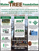
Maine TREE (Timber Research & Environmental Education)
Jonathan LaBonte, Maine TREE Foundation
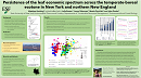
Persistence of the leaf economic spectrum across the temperate-boreal ecotone in New York and northern New England
Matthew Hecking, SUNY ESF
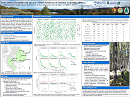
Sixty years of coastal red spruce: Stand dynamics and climate sensitivity at historic inventory sites
Camilla E. Seirup, University of Maine Orono: School of Ecology and Environmental Science, National Park Service: Northeast Temperate Network Inventory and Monitoring Division
Shawn Fraver, University of Maine Orono: School of Forest Resources
Jay W. Wason, University of Maine Orono: School of Forest Resources
Anthony W. D'Amato, University of Vermont: Rubenstein School of Environment and Natural Resources
Kate M. Miller, National Park Service: Northeast Temperate Network Inventory and Monitoring Division
Aaron S. Weed, National Park Service: Northeast Temperate Network Inventory and Monitoring Division
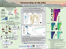
The Vermont Atlas of Life: Discovering and Sharing Biodiversity Knowledge
Kent McFarland
Jason Loomis
Mike Hallworth
Nathaniel Sharp
Spencer Hardy
Julia Pupko