FEMC has expanded the scope of its work through partnerships with other states in the region, partnering successfully with agencies and researchers in New York, New Hampshire, Massachusetts, and Maine to produce a variety of regional and state specific data driven tools. These tools provide valuable information to decision makers and land managers into problems identified in the region as lacking information, synthesize disparate information in innovative and useful ways, or provide methodology and information that encourages more uniform data collection across the region.
You can browse tools below or Search by various criteria to identify the tools of most interest to you.

Browse: Regional Assessment and It's Impacts on Forest Vegetation
Product Location:
Tool Type:
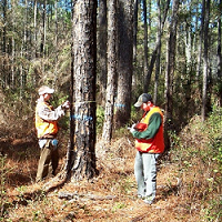
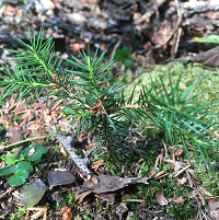
Building on FEMC's work on the Northeast Forest Regeneration Data Network, this project identified methods and protocols being used across the region to measure deer browse and field tested them. The final report provides a comparison of the methods with information about the feasibility, cost and and effort required to use them. This information will allow decision makers to easily find information about standard protocols in use and make informed choices about deer browse assessment methods.
... Read MoreTags:
Comparison of Continuous Forest Inventory Monitoring Programs
Product Location:
Tool Type:
FEMC is working with partners across the region to assemble and compare continuous forest inventory (CFI) monitoring and assessment programs. The goal is to identify commonalities and differences in the various datasets, document the ways in which they can be compared, and enable broad-scale analyses across states. FEMC will make available protocols, data samples, access instructions and data downloads when possible in an online data portal. With funding provided by the USDA AFRI program, we are collaborating with researchers from UVM and UMaine to combine these data in meaningful and statistically robust ways so that we can answer relevant and timely questions concerning the status of regeneration in the region.
Read the final report for the first phase of this project.
The program comparison tool was released in June 2020. Work on further data integration is ongoing.
... Read MoreTags:
DEN: The DendroEcological Network
Product Location:
Tool Type:
The study of tree rings (dendrochronology) provides a powerful tool to understand tree growth and the response of trees to a range of environmental influences. Although useful, collecting and analyzing tree rings can be time consuming and involve the use of highly specialized equipment. To increase the ease and cost-effectiveness of using tree ring information, we created the DendroEcological Network (DEN) to provide an online repository for dendroecological and associated forest ecology data and a cyberinfrastructure for the discovery, exploration, and sharing of those data. The DEN portal is publicly available and anyone with access to the internet can use it.
FEMC built the DEN infrastructure and is currently bringing in data from experts around the region to populate this resource. Data can be access at https:www.uvm.edufemcdendro and work is underway on a user-interface for data upload.
The DEN was first launched in October, 2018.
... Read MoreTags:
Exploring the Connection Between Forest Cover and Water Quality in the Northeast
Product Location:
Tool Type:
The connections between forest cover and water quality are complex and depend on the particular aspects of water quality being considered. FEMC staff worked with experts to determine key factors in understanding connections between forests and water. From this input, FEMC developed an inventory of key forest and water spatial datasets for the northeastern region to provide improved access to analytical information by integrating 30 datasets into a common spatial framework. The Forest Cover and Water Quality story map highlights some of these datsets by providing summaries in the trends of long-term datasets by watershed.
This work not only improves access to information and integrated data but also gives added capacity of professionals to communicate the importance of forest cover in supporting good water quality. Visit the project page to learn more about the project and access the report.
This project was completed in September 2020.
... Read MoreTags:
FragNet: The Northeast Forest Fragmentation Information Network
Product Location:
Tool Type:
The Northeast Fragmentation Information Network (FragNet) is a clearinghouse containing a wealth of various resources about forest fragmentation - the breaking up of continuous forest cover. These resources have been collected from throughout the northeastern US to make it easier for policy makers, planners, advocates and researchers to access information on forest fragmentation. Using FragNet, you can explore resources such as journal articles, technical reports, brochures and legislation.
This tool was first released in October, 2018, and is updated with new resources annually.
... Read MoreTags:
Impacts of Recreation on Forest Ecosystems
Product Location:
Tool Type:
The use of forested lands for recreation has changed significantly in the Northeast over the past decade. Improved infrastructure and resource allocation have created more opportunities for outdoor recreation and increased accessibility to natural lands, however, the implications of increased recreation for forest health have not been systematically explored from a monitoring lens. The purpose of this project is to identify potential options for monitoring connections between recreation and forest health by assessing aspects of forest health that may interact with recreational use of forests, and what type of monitoring efforts are being conducted that could capture these interactions across the region. This project is exploratory in nature and will build a strong foundation to give structure to additional research or tool development.
... Read More
Tags:

Monitoring Northeastern Forest Indicators for Signs of Climate-Driven Change
Product Location:
Tool Type:
This project uses key ecosystem “indicator” metrics to create an online tool that provides recommended methods and sources of data for tracking and monitoring how climate change is impacting forested ecosystems in the Northeast. Experts and stakeholders across the region contributed to selecting the indicator metrics to include in the tool. Users can explore where climate indicators are being monitored, where efforts are needed, and easily access replicable protocols that can be used to fill monitoring gaps across the region.
... Read MoreTags:
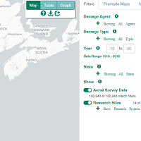
Monitoring and Communicating Changes in Forest Disturbance Regimes
Product Location:
Tool Type:
The extent, severity, and frequency of disturbance regimes occurring in forested ecosystems in the Northeast can be explored using this tool. The tool provides users with information and datasets about where disturbance regime changes are being studied across the region. Several metrics are included as disturbance drivers: drought, extreme weather, pests and pathogens, and fire. Ecosystem responses to disturbance are also captured in stream macroinvertebrate, cold water fisheries, and invasive plants datasets.
... Read MoreTags:
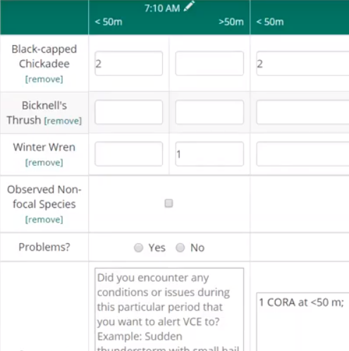
Mountain Birdwatch
Product Location:
Tool Type:
The Mountain Birdwatch Program utilizes citizen scientists to monitor montane birds throughout the Northeast. To make data submission clear, easy, and intuitive, FEMC partnered with Vermont Center for Ecostudies to create the Mountain Birdwatch Data Entry Portal (MBWEP). The newly created MBWEP allows citizen scientists to submit data from the comfort of their homes through a simple interface. Users are able to quickly access their routes for the season and submit data as they complete their routes.
Learn more about the portal at https://www.uvm.edu/femc/mbw.
... Read MoreTags:
NEFHA: Northeastern Forest Health Atlas
Product Location:
Tool Type:
The Northeastern Forest Health Atlas (NEFHA) is a web portal for forest health data that provides information on short- and long-term changes in forest health and disturbance for researchers, managers, policy makers, and the public. The mapping platform brings together research and monitoring data on forest damage and disturbance in the Northeast. The user-interface allows for easy searching of biotic and abiotic damage agents, by state, or year, and can be viewed as a map of detections, or in a graph or table format.
This tool was first released in September, 2018.
Want to learn more about the Northeastern Forest Health Atlas? Click here to view a webinar from September 2018 on how NEFHA works.
... Read MoreTags:
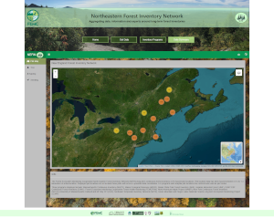
NEFIN: The Northeastern Forest Inventory Network
Product Location:
Tool Type:
The Northeastern Forest Inventory Network is designed to connect people, data and information related to forest inventory programs across the Northeast. This project aggregates data from a diverse and disconnected network of sources that can be used for novel synthesis and analysis of factors influencing forest structure, productivity and health. The research conducted with these data will provide new insights on how forests are growing and changing across the region, improve our understanding of forest demography and biometry, and inform forest management.
... Read MoreTags:
Northeast Forest Regeneration Data Network
Product Location:
Tool Type:
The Forest Ecosystem Monitoring Cooperative created the Northeast Forest Regeneration Data Network for users to access and compare projects related to tree regeneration, including studies on browse impacts, seed production, and forest management.
Through the interactive website, projects can be filtered by selecting which metrics a user is most interested in (like seedling species data), along with other project parameters, like location, timeframe, and number of repeat inventories. Users can then browse and explore individual projects, access structured metadata, download methods, view or download data (when available) and view the relative suitability of each project for a range of analyses.
Visit the project page to learn more about the project and access the report.
This tool was launched in July, 2020.
... Read MoreTags:
Oak Resiliency Assessment Tool
Product Location:
Tool Type:
The Oak Resiliency Assessment Tool allows you to consider how resilient oak-dominated forest stands on your property or a property you manage are to climate change and various stressors. The tool will generate a report with the forest's vulnerability and more information regarding the major forest stressors and potential management actions. You can use this report to inform your management decisions and include it in the property's forest management plan. The assessment is designed to be used at a stand level and may work for a small property or parcel.
... Read MoreTags:
Potential Economic Impacts of Invasive Forest Pests and Diseases in Urban Areas
Product Location:
Tool Type:
FEMC staff made use of existing data collections in the Northeast and developed a synthesis of the possible economic impacts of invasive pests and pathogens (e.g., emerald ash borer) on urban forests. Urban forest inventories using the USDA Forest Service's i-Tree program infrastructure have been conducted in each state, and were used to give a snapshot of the potential losses due to invasive pests.
An online map was created allowing visual exploration of the data and provides informational factsheets for municipalities which summarize the potential economic losses of host trees to four invasive pests and pathogens.
This work increases the availability of data and provides additional resources for managers and technical specialists who advocate for action to address these threats. Visit the project page to learn more about the project and access the full report.
This project was completed in June, 2020.
... Read MoreTags:
Vermont Forest Indicators Dashboard
Product Location:
Tool Type:
The Vermont Forest Indicators Dashboard is a data-driven, ecological monitoring tool that quantifies the condition of Vermont's forested ecosystems in simple terms that offers a more holistic view of the structure, function, and services the forests provide. Current conditions and long-term trends can be compared to threshold or baseline values to help inform management and decision making to sustain this critical resource. The dashboard currently summarizes information about 34 different long-term datasets, from timber production to crown condition to regeneration trends to forest bird diversity.
Each indicator is given:
- an annual score
- a comparison to long-term trends
- a chart with trend line
- a contributing weight towards the overall score of the category
Want to learn more about the Vermont Indicators Dashboard? Click here to view a webinar from August 2018 on how the Dashboard works.
This tool was released in August, 2018, and each indicator is examined annually for new datasets that are released
... Read MoreTags:
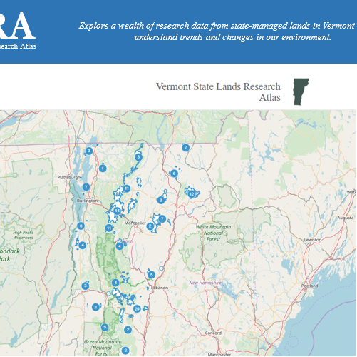
Vermont State Lands Research Atlas
Product Location:
Tool Type:
The Vermont State Lands Research Atlas is a system for capturing and displaying the outputs of research conducted on state lands and was designed to make it easier for planners, land managers and researchers to access information related to scientific research in the state. Researchers interested in utilizing state lands must apply for permits, which require the eventual delivery of reports and products back to the Agency of Natural Resources (ANR), but the ability to capture and archive the underlying data has been limited. FEMC worked with staff in the ANR to develop a system to track when new research permits are being issued, connect the investigators doing the research to the FEMC, and ensure that permit deliverables such as reports and datasets are made available through the FEMC Data Archive. ANR staff can assess compliance with this mandate, and the public can explore the research conducted on state lands through a searchable online map interface.
... Read More