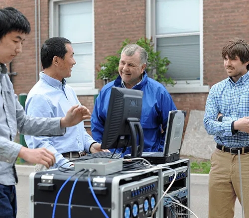
On a recent Wednesday afternoon, CEMS Professor Dryver Huston offers a tour of his laboratory on the UVM campus where he is producing sophisticated sensor systems for the cities of Burlington, Winooski and beyond. A valuable project that Huston has undertaken with Professor Tian Xia and other UVM researchers is to help planners manage and use urban underground utility infrastructure as part of the nonprofit US Ignite Global Cities Team Challenge. It’s a “smart cities” approach that uses remote sensing and information technology to detect and monitor water pipes, gas lines and much more by leveraging the extensive research experience of the CEMS community.
The EAGER project, as it is known, is a new strategy for mapping places once invisible to city planners, and one designed to prevent failures and disruptions after emergencies and disasters, saving money and allowing urban areas to operate more efficiently. Having started in September 2016, this innovative project will continue until next August.
“We’re exploring microwave sensing technology to image the underground utility and structural conditions,” explains Xia. “The microwave signal can penetrate through barriers.” For example, a cell phone signal can penetrate through the wall, so cell phones can be used in a building. In Ground Penetrating Radar (GPR) sensing, they control the microwave signal’s radiation toward the ground and penetrate through the ground surface. “The reflection signal from the underground utility can be received by a highly sensitive antenna and the electronic circuit,” he says. “By analyzing the reflection signal with sophisticated signal processing methods, we produce an underground image.”
Back in the Votey lab, Huston points out some of the machines they’ve built to find pipes in utility systems; one of the radar rigs has a brand-new gimbal mount for a smartphone while the other resembles a giant boom box on wheels. Nearby, a graduate student Robert Farrellis collects data, looking like a large kid in a large sandbox as he has intentionally hidden pipes in a rectangular container of sand.
“This is pretty exciting,” says Huston as he looks at a computer screen that to the untrained eye seems to be a picture of grey. Not that many people would find such a blurry image exciting, but not that many people are like Huston and his team, able to see the blips that represent buried pipes. It’s a significant moment of progress for the EAGER project, which dates back to 1994, when Huston was working with the Vermont Agency of Transportation to use GPR on detecting early corrosion in bridge decks. But it wasn’t until about two years ago that he and the team realized that the timing was right to use similar techniques for cities’ underground infrastructure. As Burlington is one of US Ignite’s “Smart Gigabit Communities” (and the only one in New England), it was well positioned to complement its high-speed telecommunications network with the ability to sense and collect data on underground infrastructure in a state-of-the-art way. (Indeed, Huston explains that a parallel project, which started in January 2017 in partnership with the city of Chattanooga, Tennessee, and continues for three years, brings the two together.)
The biggest hurdles for Huston, Xia and the handful of graduate students involved in the EAGER project range from the funny (having to answer questions from curious onlookers as they push what seems to be an oversized metal detector through the streets) to the formidable. “The subsurface utility infrastructure is very complicated,” says Xia. ‘The citywide survey scope is huge. How to leverage survey efficiency and accuracy is challenging.”
The rewards, however, are receiving positive responses from local planners, knowing that some experimentation may pay off in exponential ways for cities.
“Our R & D efforts are inspired by the community partners based on their needs, their feedback and their encouragement,” says Xia, who adds that next up is exploring new GPR application potential, such as antenna array design and artificial intelligence. “We will continue to engage in research that is meaningful to society.”
"Managing, maintaining and growing underground infrastructure is an expensive and challenging problem for virtually all cities,” says Huston. "As with most smart cities technologies, the research and development path of our techniques will hopefully lead to scalable and open-source solutions that are used by cities in the U.S. and worldwide. We are presently working with three cities in Vermont and Tennessee and are in active discussions with other cities in the Midwest and on the West Coast.”
Below is a selection of scholarly publications by Huston, and Xia.
Ahmed A, Zhang Y, Burns D, Huston D, Xia T. (2016) “Design of UWB Antenna for Air-Coupled Impulse Ground-Penetrating Radar.” IEEE Geoscience and Remote Sensing Letters, Vol. 13, Issue 1, pp 92 – 96, DOI: 10.1109/LGRS.2015.2498404
Barrios C, Motai Y, Huston D. (2015) “Trajectory Estimations using Smartphones.” IEEE Transactions on Industrial Informatics, IEEE Transactions on Industrial Electronics, 62 , 12, 7901-7910, DOI:10.1109/TIE.2015.2478415
Venkatachalam AS, Xu X, Huston D, Xia T. (2013) “Development of a New High Speed Dual-Channel Impulse Ground Penetrating Radar.” IEEE Journal of Selected Topics in Applied Earth Observations and Remote Sensing Vol. 7, No. 3, 753-760 DOI:10.1109/JSTARS.2013.2280995
Huston D, Xia T, Burns D, Orfeo D, Zhang Y, Ou C. (2017) “Mapping, Assessing and Monitoring Urban Underground Infrastructure.” Proceedings of the 11th International Workshop on Structural Health Monitoring 2017, Stanford, CA
Huston D, Xia T, Zhang Y, Fan T, Orfeo D, Razinger J. (2017) “Urban Underground Infrastructure Mapping and Assessment.” SPIE 10168, Sensors and Smart Structures Technologies for Civil, Mechanical, and Aerospace Systems 2017, 101680M, doi:10.1117/12.2263530
Zhang Y, Huston D, Xia T. (2017) “Rough Ground Surface Clutter Removal in Air-Coupled Ground Penetrating Radar Data using Low-Rank and Sparse Representation.” SPIE Smart Structures and NDE Conference as Paper No. 10169-3, Portland, OR, doi:10.1117/12.2261355
Zhang Y, Orfeo D, Burns D, Miller J, Huston D, Xia T. (2017) “Buried Nonmetallic Object Detection using Bistatic Ground Penetrating Radar with Variable Antenna Elevation Angle and Height.” SPIE 10169, Nondestructive Characterization and Monitoring of Advanced Materials, Aerospace, and Civil Infrastructure 2017, 1016908, doi:10.1117/12.2260055