Greensboro Bend
Hydrology
Healthy rivers support healthy people and the places they live. To live in a riparian area and a valley bottom means that human actions have an immediate effect on the local river: the Lamoille. Horse Pond, Greensboro, is the literal headwaters of the Lamoille River. The Lamoille River Watershed is divided into three sections: the Upper, Middle, and Lower Lamoille River. Greensboro Bend is within the Upper Lamoille River, or “headwaters” zone. The Lower Lamoille River drains into Lake Champlain in Milton. At 85 miles in length, the Lamoille is a major river of the Lake Champlain Basin. The plants, wildlife, and people of this 706 square-mile basin, spanning 34 towns, share a common interest in the current and future health of the Lamoille River.
Note: The terms “watershed,” “sub-basin,” and “basin” are interchangeably used in resources to describe a hierarchy in size. In this document, the Lamoille River or Black River Watershed describes a smaller area and the Lake Champlain or Lake Memphremagog Basin describes a larger area.
Note: The northeast portion of Greensboro is part of the Black River Watershed and drains north into the Lake Memphremagog Basin. Source: The Lake Memphremagog Watershed Association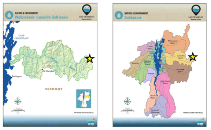
Riparian Buffers
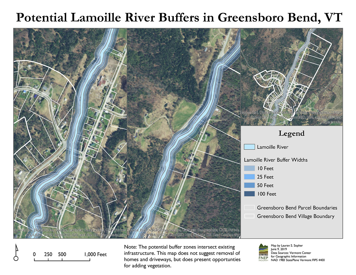
Potential Lamoille River BuffersFlood protection, fish and wildlife habitat, clean water, and river bank stability are made possible by riparian buffers—vegetated areas that border rivers, lakes, and wetlands. Intact riparian areas help prepare us for severe storms and summer droughts, which are predicted to become more frequent and severe as a result of climate change [1]. Community planting projects, whether for street beautification or riparian buffers, present an opportunity for folks to work together on common goals.
The Greensboro Bend community has the opportunity to sustain and enhance vegetated riparian buffers, ideally 100 feet wide, on either side of the Lamoille River. Please see the Greensboro Bend PLACE Program Conservation Recommendations in the 2019 Greensboro Town Plan for more information on this topic.
Wetlands
Greensboro Bend is home to many Class II Wetlands, designated by the Vermont Significant Wetland Inventory (VSWI), which are protected by the Vermont Wetland Rules (PDF). These wetlands range from Seepage Swamps and Seepage Forests to a Northern Conifer Floodplain Forest and an Alluvial Shrub Swamp (please refer to the Natural Communities section for a map). These wetlands provide critical habitat and food sources for fish and wildlife, filter sediments, nutrients, and pollutants, control flooding, stabilize banks, prevent erosion, protect groundwater and drinking water, and provide recreational opportunities. Many of these wetlands are disturbed, indicated by historic and current land use practices and the number of non-native or invasive species observed during fieldwork. The disturbance prohibits the wetlands from fulfilling critical ecosystem functions. The wetlands also present opportunity: if they are left alone or restored, they could improve in condition over time.
The Vermont Wetland Rules point to the importance of a 50-foot buffer zone around Class II Wetlands. Many of Greensboro Bend’s wetlands fall within the floodplain of the Lamoille River. These wetlands have the ability to store large volumes of water during floods, substantial rainfall, or rapid snowmelt. They slow floodwaters and help in downstream flood peaks and bank erosion. This is of particular importance in the geographic context of Greensboro Bend, as East Hardwick, Hardwick, and Wolcott are immediately downstream and designated as Flood Hazard Areas by the Federal Emergency Management Agency (FEMA).