Dataset Overview
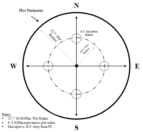
Nested plot location information including latitude and longitude of both fuzzed and unfuzzed locations. Note: not all plots have true plot locations, as not all plots are publically available. For all unfuzzed plot locations, please submit a request to FEMC.
- Purpose
This data provides geospatial plot location information.
- Data Collection Status
-
Data collection for this dataset is ongoing
- Start date
2019-08-13
- Contents
117 records with 6 fields
- Data Availability
-
Available for download
- Data License

- Preferred Citation
Forest Ecosystem Monitoring Cooperative (2023) Nested Plot Locations. FEMC. Available online at: https://www.uvm.edu/femc/data/archive/project/regional-forest-health-monitoring/dataset/nested-plot-locations
- Update Frequency
Annually
- Maintenance Plan
Data is actively maintained and updated when available
- Links
-
No links available for this dataset
- Related Datasets
- Determining Dataset Similarity
- Previous Versions
-
- Version 1 - 2023 Nested plot locations (created 2023-06-07 by Soren Donisvitch)