Mission
Our Mission
We believe that cutting-edge geospatial technology can be used to help people make better decisions for a better world. In our close relationships with the private sector, and Federal and State agencies, we provide a broad range of advanced services for commercial projects including GIS mapping, remote sensing, Unmanned Aircraft System (UAS) services, and data analytics. We’re also developing the workforce of tomorrow, providing UVM undergraduate students with opportunities to work on advanced projects while providing professional mentoring to supplement their academic courses. We take pride in the fact that all of our undergraduate students are paid for their work and receive real-world experience at the SAL.
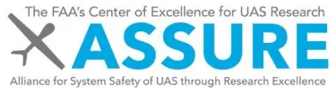
UVM is a core-university in the FAA's Alliance for System Safety of UAS through Research Excellence (ASSURE). With over 100 industry and government partners, ASSURE provides research and field tested protocols and regulations to ensure safe integration of UAS into the airspace.
Leadership Team

Director, Spatial Analysis Laboratory • Research Assistant Professor • Affiliate, Gund Institute for Environment
pbrochu@uvm.edu (802) 656-3324Environmental health, GIS, tree canopy assessment, climate resilience, spatial analysis

Associate Director, Spatial Analysis Laboratory
nina.safavi@uvm.eduStakeholder engagement, urban forestry, parks and open space planning, landscape design, spatial analysis, GIS and data visualization.

Assistant Director for UAS, Spatial Analysis Laboratory
adam.zylka@uvm.edu (802) 560-5067Unoccupied Aircraft Systems (UAS) or 'drones,' geospatial technology, remote sensing, disaster response and emergency management.