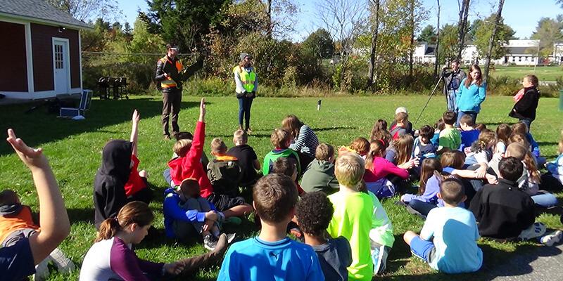
Nearly 200 young students scream and shout as a drone lands at a school field in St. Albans, VT last week. Flown by the University of Vermont’s Unmanned Aircraft Systems (UAS) Team, the drone is small, weighing less than two pounds, but extremely high-tech, loaded with cameras, GPS receivers, and wind sensors.
By the next morning, the children at the St. Albans City School scan through the imagery on computers to map the natural resources on their school grounds using a web-mapping application developed by the UVM Spatial Analysis Lab (SAL) in the Rubenstein School of Environment and Natural Resources. The students can then compare the new imagery to past maps to view changes in land use in their communities.
"The kids were fascinated with the drone that UVM's Spatial Analysis Lab brought up,” said Grace Borst, St. Albans City School Innovation Specialist and STEM Educator. “After they sent us the images the drone took, students really began to understand the importance of satellite images. We are so grateful that our students were able to have this experience, and now we have a beautiful image of our school's property and all of our land projects."
Later in the week, the UAS Team traveled to Fairfax, VT to put on another demonstration for school children at BFA Fairfax (Bellows Free Academy) while they collected overhead imagery in collaboration with SE Group, a Vermont-based planning and design firm. SE Group is working on a redesign plan for the town and engaging school children to help envision what the design would be like. The drone imagery is proving to be a valuable tool in the design process, providing imagery that is not only up to date, but also 15 times more detailed than any previous imagery.
“It was wonderful to see students learn how to incorporate technology into problem solving of community issues," said Amber Soter, Zoning Administrator for the town of Fairfax and parent of one of the students. "We were able to engage many children about the importance of community planning."
The learning opportunity aligns well with the action plan of the Franklin West Supervisory Union which includes BFA Fairfax. The action plan calls for staff and students to engage in real-life learning opportunities with local, state, and global partners to make a difference in their community and beyond.
"The team did an outstanding job with describing the project using 'kid friendly' language," said Rhonda Siemons, Technology Integration Specialist at BFA Fairfax. "Our students loved having the opportunity to weigh in with their ideas on how they can improve the town they live in and travel through every day."
The work was all part of Earth Observation Day, a nationwide activity led by the AmericaView consortium that is dedicated to raising awareness of the importance of satellite and aerial mapping.
“Drones are a great way to get Vermont children excited about technology and the environment,” said Jarlath O’Neil-Dunne, director of the SAL. “It is even more of a bonus that planners will use our data to help revitalize our communities. We are grateful to AmericaView for funding these efforts."