Details and Metadata
Printer-friendly version View XML version Download Ecological Metadata Language file
Methods
The methods followed in the creation of the dataset, including description of field, laboratory and processing steps, and quality control procedures
No methods recorded for this dataset
Dataset Fields
Detailed documentation of the fields comprising the dataset, including the type of measurement, units where applicable, and any controlled vocabularies or code lists present in the data
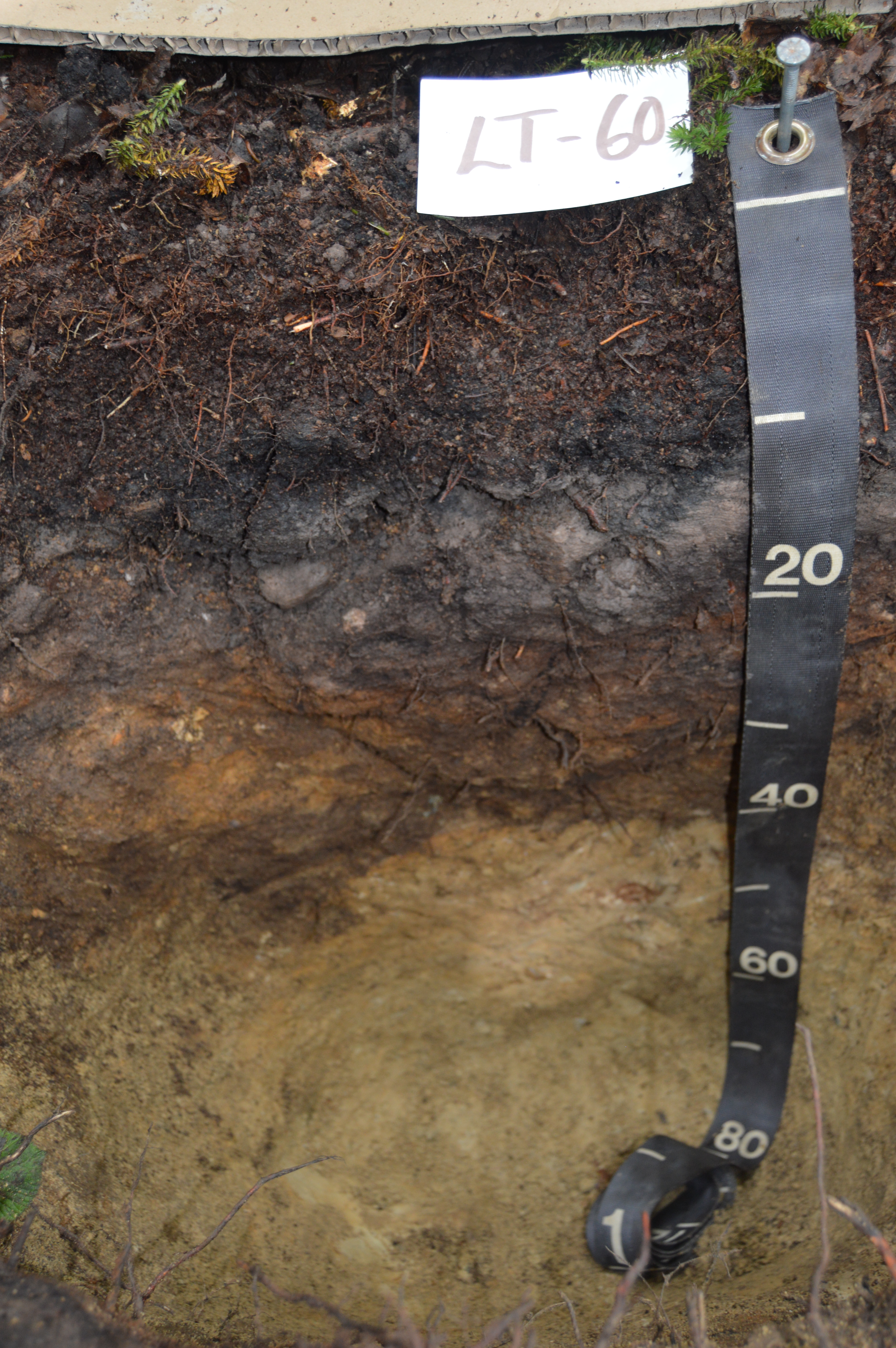
| Field Name | Caption | Description | Additional Information |
|---|---|---|---|
| BedrockReached | Bedrock Reached | BedrockReached field was added in 2017 to account for situations where bedrock was not reached during the soil examination. This was flagged in excel through records showing + next to the bottom depth. 1 for yes bedrock assumed reached. 0 for no bedrock was not reached. | Nominal |
| BottomDepth | Bottom Depth | Bottom depth of sample relative to soil-air interface. A value of -999 indicates that there was either a mistake and the depth was never recorded or bedrock was never reached. | Ratio Unit: centimeter Precision: 0.1 |
| Boundary | Boundary | Boundary at the bottom of the horizon | Nominal |
| Describer | Describer | Nominal | |
| Consistence | Consistence | Resistence of soil peds to rupture in moist conditions | Nominal |
| FeatureColor1 | FeatureColor1 | Munsell color of the most common feature | Nominal |
| FeatureColor2 | FeatureColor2 | Munsell color of the second most common feature | Nominal |
| FeatureColor3 | FeatureColor3 | Munsell color of the third most common color | Nominal |
| FeatureDescription1 | FeatureDescription1 | Description of the most common feature | Nominal |
| FeatureDescription2 | FeatureDescription2 | Description of the second most common feature | Nominal |
| FeatureDescription3 | FeatureDescription3 | Description of the third most common feature | Nominal |
| FieldHorizon | Field Horizon | Field-designated horizon | Nominal |
| fkSampleID | fkSampleID | Sample ID | Nominal |
| LabHorizon | Lab Horizon | Lab-designated horizon | Nominal |
| MatrixColor | MatrixColor | Munsell color - dominant color of the horizon | Nominal |
| Notes | Notes | Notes on this horizon | Nominal |
| RockFragments | Rock Fragments | Visual estimate of the percent soil in certain size | Interval Unit: percent Precision: 1 |
| Roots | Roots | Percentage of fine to very fine roots | Nominal Unit: percent |
| Structure | Structure | Shape and prevalence of soil aggregates | Nominal |
| Texture | Texture | Texture of the soil according to USDA classification | Nominal |
| TopDepth | Top Depth | Top depth of sample relative to soil-air interface | Ratio Unit: centimeter Precision: 0.1 |
Sampling Equipment
Equipment and software used to collect data, including how that equipment was used.
No sampling equipment recorded for this dataset
Site Characteristics
The spatial extent of the dataset site coverage, and descriptions of the spatial extent and context for the data collection
No site characteristics recorded for this dataset