
Details and Metadata
Printer-friendly version View XML version Download Ecological Metadata Language file
Methods
The methods followed in the creation of the dataset, including description of field, laboratory and processing steps, and quality control procedures
Current Methods
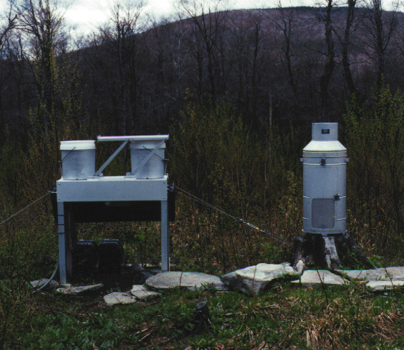
Precipitation samples
Started: 1994-04-06Weekly collection of precipation for chemical analysis is performed at two different sites. Precipitation amount, pH and conductivity analysis is performed at the sites. The sample is shipped to the NADP Central Analytical Lab in Illinois for analysis of pH, conductivity, Ca, Mg, K, Na, NH4, NO3, Cl, SO4.
Ozone and deposition
Started: 1994-01-01Seasonal continuous ozone (May through September), averaged hourly. Deposition (kg/ha) was calculated for chemicals reporting concentration in mg/l for annual, seasonal and montly time steps.
Meteorological data
Started: 1994-01-01Continuous meteorology averaged hourly includes ambient temperature at 2 and 10 m height, relative humidity, surface wetness, precipitation, wind speed and direction, solar radiation.
Past Methods (No longer in use)
- Sample analysis
Started: 1995-07-04
Ended: 1999-02-02Accumulated weekly samples; analysis includes SO2, HNO3, pH, conductivity, acidity and major ions.
Dataset Fields
Detailed documentation of the fields comprising the dataset, including the type of measurement, units where applicable, and any controlled vocabularies or code lists present in the data
Field Name Caption Description Additional Information SiteID Site Identification Unique site identifier
Nominal labno Lab Number Number assigned to sample by analytical laboratory
Nominal StartTime Start Time Time sampling started
DateTime Date/Time Format: YYYY-MM-DDThh:mm:ss EndTime End Time Time sample was collected
DateTime Date/Time Format: YYYY-MM-DDThh:mm:ss Amount Amount of Precipitation Amount of precipitation
Ratio
Unit: inch
Precision: 0.01Type Type of Precipitation Precipitation type
NominalPrecipitation Type Code
+ showAppears in data as Meaning of code r rain m mix s snow Sampling Equipment
Equipment and software used to collect data, including how that equipment was used.
No sampling equipment recorded for this dataset
Site Characteristics
The spatial extent of the dataset site coverage, and descriptions of the spatial extent and context for the data collection
- Site Description
Green Mountain National Forest, Stratton, just south of the Lye Brook Wilderness Area boundary. Summit of hill with southwest airflow.