Dataset Overview
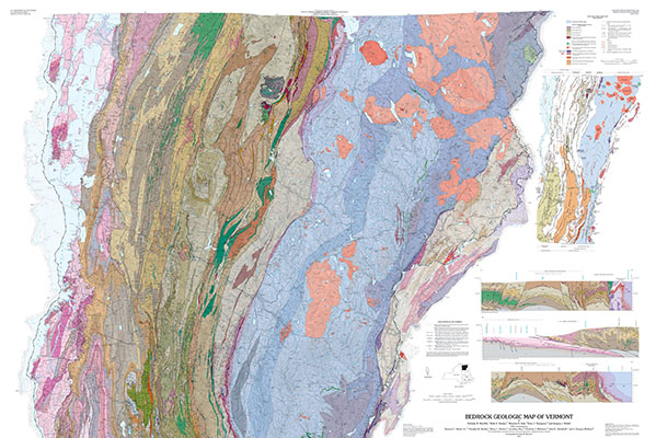
A bedrock map generally includes rock descriptions, age relationships (stratigraphic sequence), and major and minor structural data used to portray a three-dimensional model of the rock on a two-dimensional topographic base map. The bedrock geologic map of Vermont can be downloaded through the Vermont Open Geodata Portal, USGS, or the Vermont ANR Atlas (links included).
- Purpose
Map the bedrock of Vermont by town, quadrangle and watershed.
- Data Collection Status
-
Data collection for this dataset has been completed
- Start date
1993-06-01
- End date
2011-12-31
- Data Availability
-
This dataset is available to download from another website
- Data License
Linked - Third party determines data license
- Preferred Citation
Reference: Ratcliffe, NM, Stanley, RS, Gale, MH, Thompson, PJ, and Walsh, GJ, 2011, Bedrock Geologic Map of Vermont: USGS Scientific Investigations Series Map 3184, 3 sheets, scale 1:100,000. Can be found at: https://www.uvm.edu/femc/data/archive/project/bedrock-survey-mapping/dataset/bedrock-geologic-map-vermont
- Update Frequency
Not planned
- Maintenance Plan
Not planned
- Links
-
- Vermont Open Geodata Portal (Bedrock Geologic Map of Vermont)
- U.S. Geological Survey (Bedrock Geologic Map of Vermont)
- Vermont ANR Atlas (Bedrock Geologic Map of Vermont)
- Related Datasets
- Determining Dataset Similarity