Agenda
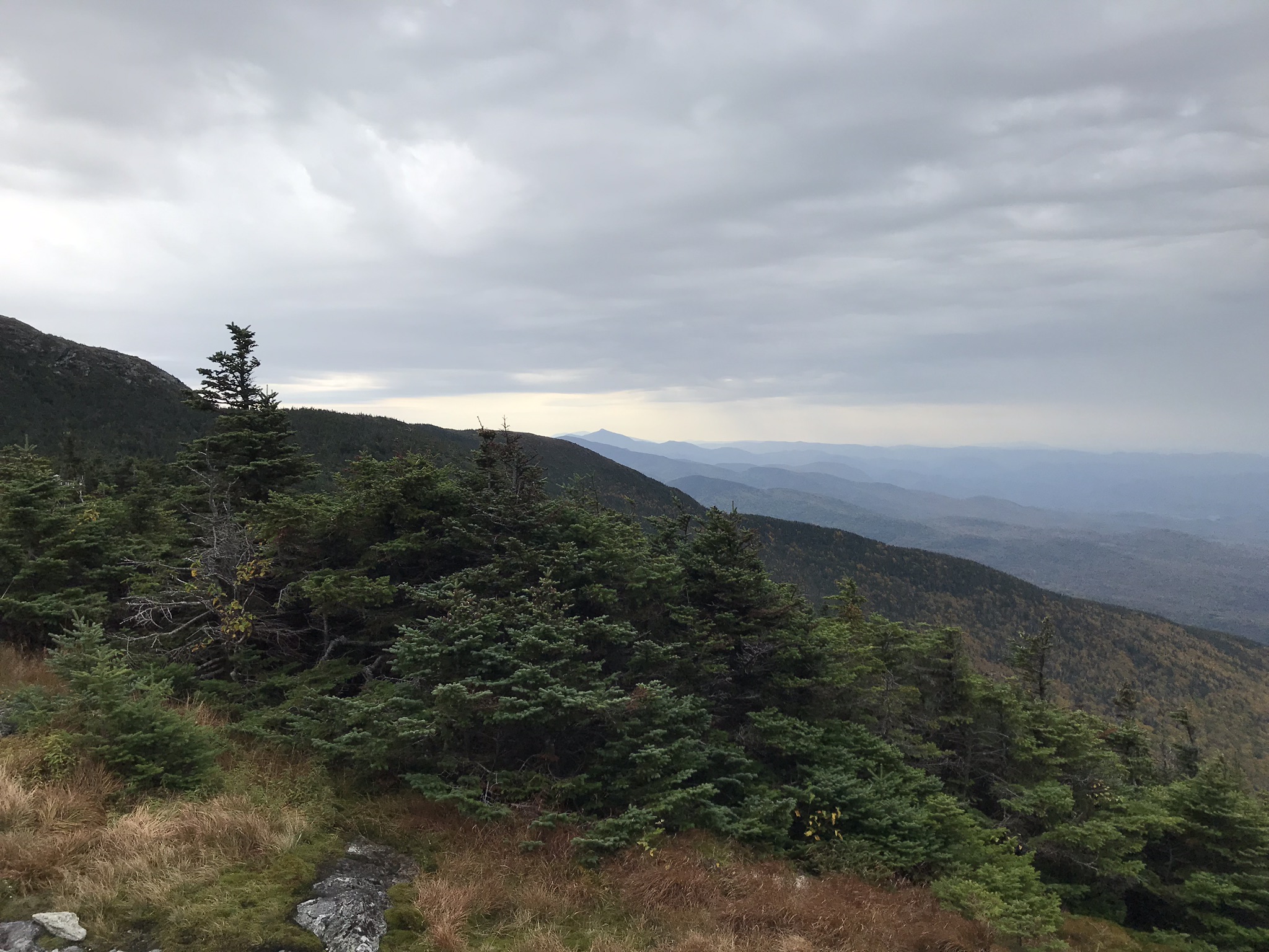
The Monitoring Cooperative is celebrating its 30th anniversary this year! The Annual Conference will be held as a virtual meeting. While this may be a change of venue, it is still being planned as an exciting opportunity to engage with community members from across the network about monitoring initiatives, gain insight into the changes being observed in northeastern ecosystems, and share innovative methods and tools to advance the science.
This program has been approved for 4 Category 1 Continuing Forestry Education credits by the Society of American Foresters
December 17 – Day 1
Parallel tracks of 20-minute presentations contributed by cooperators on various forest ecosystem research, monitoring and outreach activities
| Time | Forest Pests & Diseases Moderator: FEMC | Disturbance & Stressors Moderator: FEMC | Tools & Technology Moderator: FEMC |
||
|---|---|---|---|---|---|
| 10:30 to 10:50 | This talk was canceled | Red Pine Decline in Vermont Savannah L Ferreira + ABSTRACT | Modeling Moose Habitat Suitability by Age, Sex, and Season in Vermont, USA based on GPS Radio-collar Data and Lidar Imagery Joshua Blouin + ABSTRACT | ||
This talk was canceled Presenter: , | |||||
Red Pine Decline in Vermont Savannah Ferreira, State of Vermont Presenter: Savannah L Ferreira, State of Vermont Red pine (Pinus resinosa) has been in a noticeable state of decline across Vermont for the past several years. Previously, foliar shoot blight pathogens such as Diplodia sapinea, Sirococcus conigenus, and Pestalotiopsis spp. have been found to contribute to this decline in central Vermont in 2019. To try and determine if this declining pattern and fungal complex are homogenous across the state, 12 red pine health monitoring sites were established in 2020 to annually observe crown health and tree decline. Monitoring sites were divided evenly among 4 geographical regions: Northeast (NE), Northwest (NW), Central (C), and Southern (S) Vermont. At each of the 12 monitoring sites, 4 permanent plots were established, each with a fixed radius of 35ft. All red pine within the plots were tagged and azimuth, location, diameter at breast height (DBH), and crown position were all measured and recorded. Crown metrics including live crown ratio, crown density, dead shoots and location, crown transparency, needle discoloration, and resinosis and location were observed and recorded for each tree. This year, 10 out of the 12 total plots were destructively sampled to assess foliar pathogens and insect stressors. Crown metrics as described above were observed on the sampled tree before felling. Standard red pine health metrics for an asymptomatic, open-grown red pine were established as having a crown density of 50%, dead shoots of 10%, crown transparency of 30%, and discoloration of 10%. Average crown density for the destructively felled and sampled trees were 45%, 5% less than standard; average dead shoots were 17%, 7% higher than standard; average crown transparency was 34%, 4% higher than standard; and average discoloration was 17%, 7% higher than standard. Felled red pine trees were micro-sampled on the main bole at DBH and symptomatic branches in the canopy with a sterile bone marrow biopsy tool, and symptomatic needles and cones were also harvested from the canopy. Needles and bark plugs were surface disinfested with a 1:9 commercial bleach: water solution (bark plugs for 14 minutes, needles for 3 minutes), and plated on potato dextrose agar with antibiotics. Fungal isolates were identified and subcultured as they appeared. Fungal isolates were identified based on morphology, and a representative subset has been sent out for PCR to confirm morphology identification. Across all sites, Diplodia sapinea was observed in both needle and branch tissue. Insect pests observed included signs of pine weevil gall (Podapion gallicola, 9/10 plots), pine needle scale (Chionaspis pinifoliae, 9/10 plots), and sawflies (9/10 plots). To determine how these insect stressors and pathogens have impacted growth over the past few years, cross-sections were taken at the base of live crown (BLC) and diameter at breast height (DBH) from the 10 sampled trees. This winter, FPR staff will be conducting tree-ring analysis to quantify any growth reductions these complexes may have caused. | |||||
Modeling Moose Habitat Suitability by Age, Sex, and Season in Vermont, USA based on GPS Radio-collar Data and Lidar Imagery Joshua Blouin, Vermont Cooperative Fish and Wildlife Research Unit, Rubenstein School of Environment and Natural Resources, University of Vermont Presenter: Joshua Blouin, Vermont Cooperative Fish and Wildlife Research Unit, Rubenstein School of Environment and Natural Resources, University of Vermont The moose (Alces alces) population has experienced unprecedented declines along the southern periphery of its range, attributed in part to winter tick (Dermacentor albipictus) epizootics. Direct management through hunter harvests has been suggested to reduce moose density and the number of ticks on the landscape, while indirect habitat management may be used to improve the status of the population and health of individuals. We combined more than 41,000 moose locations collected from radio-collared individuals (n = 74), recent land cover data, and high resolution, 3-dimensional lidar data to develop Resource Utilization Functions that link home range use to habitat conditions by age (mature and young adult), season (dormant and growth), and sex. Across analyses by sex, season, and age, the top resource utilization function models included both composition (as measured through the National Land Cover Database) and structure variables (as measured through lidar), and significantly outperformed models that excluded lidar variables. Generally speaking, female moose actively used areas with proportionally more regenerating forest (i.e., forage < 3.0m) and canopy structure (>6.0m), while males actively used more high elevation, mixed forest types. The resultant maps of habitat suitability provide a means of informing management activities (e.g., the restoration or alteration of habitats to benefit moose) and policies around land use that can contribute to population recovery. | |||||
| 10:55 to 11:15 | Trait variation and long-term population dynamics of the invasive Alliaria petiolata (garlic mustard) across three forest microhabitats Laura M. S. Hancock + ABSTRACT | Extreme Weather Changes and Implications for Forest Health Jason Shafer + ABSTRACT | Plots to Pixels to Policy: The Intrepid Journey of a Wall-to-Wall Forest Carbon Monitoring and Assessment System Chris Williams + ABSTRACT | ||
Trait variation and long-term population dynamics of the invasive Alliaria petiolata (garlic mustard) across three forest microhabitats Kristina Stinson, University of Massachusetts Amherst Presenter: Laura M. S. Hancock, University of Massachusetts Amherst Long-term population dynamics across heterogenous environments can be a major factor in determining species' ability to expand their ranges and persist in novel environments. Whether and how the relative performance of populations in different microsites over time impacts invasion into new microsites is poorly understood. Though largely restricted to disturbed semi-shaded microhabitats in its home range, the invasive herb garlic mustard (Alliaria petiolata) successfully invades intact forest understories in its introduced range, where it is known to impact above and below ground community composition. We conducted long term field surveys to evaluate trait variation, biomass allocation, and long-term population demographics of A. petiolata growing at the forest edge, within the intact forest understory, and in the intermediate transition zone between the two. Our results show that adult plants in the edge were taller and branchier, produced more fruits, and had higher total and reproductive biomass than plants in the intermediate and forest microhabitats. Over time, seedling density remained highest in the edge microhabitat compared to the forest and intermediate microhabitats, which had similar densities. Reproductive adult densities were similar among all microhabitats at the beginning of the study, but a decade later, all microhabitats exhibited a decline in the number of adult plants they supported. Populations in the intermediate microhabitat displayed the steepest decline in reproductive adults but supported more adult plants than the forest microhabitat. Populations in all microhabitats were predicted to grow (λ>1) at the onset of the study, and a decade later declines in population size were only predicted in the forest understory (λ<1). The edge and intermediate populations were still growing (λ>1) at the conclusion of the study. Since edge and intermediate patches had higher densities of adult plants which produced the most fruit and had larger reproductive biomass, it appears that the edge populations, and possibly the intermediate populations, have sustained the low-density forest populations through source-sink dynamics at our study sites. Eradication of garlic mustard populations in edge microhabitat could thus be an effective management strategy for reducing populations in the forest microhabitat. | |||||
Extreme Weather Changes and Implications for Forest Health Jason Shafer, Northern Vermont University Presenter: Jason Shafer, Northern Vermont University This presentation will highlight results from a long-term examination of extreme weather trends across Vermont and their possible impacts on forests. Extreme weather such as ice, wind, and snow storms and their yearly, decadal, and long-term trends will be described. This work is being conducted with support from electric utilities to understand how climate change affects long-term planning for the electric grid. Dynamical downscaling of two climate simulations through 2050 examining the frequency and intensity of extreme storms (wet snow, ice, and wind) will be described. This work has direct application to forests as weather-caused power outages are predominantly caused by tree conflicts in right of ways. Speculation on the implications for long-term forest health and resilience to catastrophic storms will be shared. | |||||
Plots to Pixels to Policy: The Intrepid Journey of a Wall-to-Wall Forest Carbon Monitoring and Assessment System Presenter: Chris Williams, Graduate School of Geography, Clark University, Worcester, Massachusetts, USA Forests are recognized as a key component in nature-based solutions for mitigating climate change, with co-benefits across a portfolio of ecosystem services. Thus, U.S. state and regional land managers and policymakers seek actionable information to aid in the design, implementation and evaluation of plans to put these carbon management opportunities into play. This presentation introduces a national-scale forest carbon monitoring and assessment system (NFCMS) that serves as a baseline inventory for greenhouse gas reporting and as a tool for assessing local to regional climate change mitigation opportunities in the forest sector. The method synthesizes FIA yield curves, remote sensing of biomass and disturbances, and a carbon cycle model to quantify baseline drivers and trends in forest carbon stocks, emissions and uptake at a wall-to-wall 30 m resolution. We highlight state-level carbon stock and flux trends, expected future carbon sequestration, and the role of harvest removals across New England plus New York. We also assess the potential climate benefits of avoided deforestation, reforestation, and sustained forest growth and utilization across the region. Concluding discussion examines challenges that remain in preparing the scientific basis for informed decision making about the global climate benefits achievable in the forest sector. | |||||
| 11:20 to 11:40 | Impacts of Emerald Ash Borer Management on Northern Hardwood Forest Dynamics in New England Hanusia Higgins + ABSTRACT | And now for something completely different...Climate change effects on forest fire hazards in the wildland-urban-interface of Bhutan William S. Keeton + ABSTRACT | Using electrical circuit analysis to map landscape connectivity for wildlife in Vermont: Implications for transportation planning and mitigation Caitlin Drasher + ABSTRACT | ||
Impacts of Emerald Ash Borer Management on Northern Hardwood Forest Dynamics in New England Hanusia Higgins, University of Vermont Presenter: Hanusia Higgins, University of Vermont As non-native forest pests disperse across the United States, the emerald ash borer, Agrilus planipennis (EAB), has emerged as one of the most costly and destructive invaders. In response to EAB, forest management practices including pre-salvage logging, "phloem reduction" (large ash removal), and strategies to improve future ash regeneration have been implemented to meet economic, ecological, cultural, and safety objectives. Although many studies have quantified EAB's destruction of ash trees (Fraxinus sp.), less is known about the effects of the management response to this pest. In summer 2020, we measured forest structure and composition at sites across New England that represent a variety of approaches to mitigating EAB's destruction. We present preliminary findings on the range of ash removal treatments and consequences for regeneration and forest composition. This work will highlight effects of the response to EAB to guide management decisions and understand the broader impacts of this invasive pest. | |||||
And now for something completely different...Climate change effects on forest fire hazards in the wildland-urban-interface of Bhutan William Keeton, Rubenstein School of Environment and Natural Resources, University of Vermont, Burlington, Vermont, USA Presenter: William S. Keeton, Rubenstein School of Environment and Natural Resources, University of Vermont; and Gund Institute of Environment With the United States coming out of one of the worst fire seasons in history, there is increasing urgency around adaptation through fire restoration and fuels treatment, particularly within the Wildland-Urban-Interface (WUI) where human lives and infrastructure are most at risk. Understanding climate vulnerabilities are central to this response, and it is informative for forest managers to compare with similar efforts abroad. In the Himalayan Mountains of Bhutan, for example, fires play a formative role in blue pine (Pinus wallichiana) ecosystems but are also changing with shifting land-use patterns. Our research has investigated the climatic, social, and ecological drivers of fire behavior and risk. The most recent study examined fire hazards in the WUI, focusing on two valleys in Bhutan (Thimphu and Jakar) where expanding human settlements and infrastructure, including cultural sites of global significance, are surrounded by blue pine forests. Data characterizing fuel profile and other risk factors were collected from 102 field inventory plots. We then applied FlamMap, a spatially-explicit wildfire simulation model, to simulate forest fire behavior under four climate scenarios. Climate scenarios were based on climate change projections for the Himalayas (symbolizing scenarios of monsoon failures and warmer temperatures) and built with extreme values of temperature and relative humidity from the years 1996 to 2017. The FlamMap output indicators used for assessing fire behavior were flame length, rate of spread, crown fire activity, burn probability, and fire size. After integrating FlamMap output into a common fire hazard index, we created a fire hazard map showing the areas most susceptible to forest fires. FlamMap predicts a likely two-fold increase in fire hazards in the WUI for both study areas due to climate change. The capital city of Thimphu has greater fire hazards than Jakar; fire hazards are spatially variable over both study areas. Our results highlight parallels between increasing forest fire hazards in the Himalayan Mountains and those unfolding in western North America. Results can be used to better plan suburban development to minimize fire risks in the WUI, plan fire restoration treatments, allocate firefighting resources, and otherwise adapt forest management efforts in the face of climate change. Certainly the methodological approach is also relevant to predicting climate-fire vulnerabilities in parts of the Northeast, such as oak-pine forest types in southern New England. | |||||
Using electrical circuit analysis to map landscape connectivity for wildlife in Vermont: Implications for transportation planning and mitigation Caitlin Drasher, University of Vermont Presenter: Caitlin Drasher, University of Vermont Landscape connectivity is important for the persistence of wildlife populations, allowing for genetic exchange and access to resources needed for population growth. The natural landscape is becoming progressively fragmented by human development, impeding the ability of species to move between habitats. Understanding how wildlife move throughout the landscape in response to land cover and human development variables is critical for mitigating the negative impacts of fragmentation on populations. We are using electrical circuit theory to model and map the movement of terrestrial mammals throughout Vermont. This approach treats the movement of wildlife as the flow of electricity through a circuit, while incorporating wildlife occurrence and species-specific landscape resistance data to determine probable movement paths. Resulting maps indicate areas where wildlife movement is being concentrated, and these areas may be targeted for conservation and mitigation efforts to improve landscape connectivity. Our analysis specifically seeks to mitigate the impact of roads on wildlife populations by determining which transportation structures are located in critical connectivity areas for wildlife. This information will be incorporated into a broader Terrestrial Organism Passage Screening Tool, used by transportation managers to make decisions on improving structures to promote wildlife use. We will discuss the use of circuit theory modeling to identify important connectivity areas in the landscape, and how this information can be used to improve transportation infrastructure to increase permeability across road networks. This project is in collaboration with the Vermont Agency of Transportation, The Nature Conservancy in Vermont, Vermont Fish and Wildlife Department, and University of Vermont. | |||||
| 11:45 to 12:05 | Hits, Misses and Incoming: A review of Federal and state pests of concern Judy Rosovsky + ABSTRACT | Spruce DRIED: Density Reduction and Imposed Extreme Drought Kelly French + ABSTRACT | Monitoring Stream Connectivity with Trail Cameras Melissa Czarnowski + ABSTRACT | ||
Hits, Misses and Incoming: A review of Federal and state pests of concern Judy Rosovsky, VAAFM Presenter: Judy Rosovsky, VT Agency of Agriculture, Food and Markets This talk will provide a quick review and update on pests, including diseases, of national import that came through or near VT this past year, and one or two that may be coming our way. There is recent new information about spotted lanternfly biology and how will affect VT; Emerald ash borer potential deregulation and biocontrol release; elongate hemlock scale in northern VT and Asian Giant Hornets, aka 'murder hornets' are on the brink of establishment in WA. COVID may be affecting some regulatory processes and we have had several diseases narrowly miss VT, for now. And how will climate change affect these, if at all? | |||||
Spruce DRIED: Density Reduction and Imposed Extreme Drought Kelly French, University of Maine Presenter: Kelly French, University of Maine, School of Forest Resources Climate change is expected to drive increased temperature, vapor pressure deficit (VPD), and frequency of drought, even in the mesic forests of the northeastern United States. Importantly, many northeastern trees are not tolerant of warmer temperatures or drought, potentially increasing their vulnerability to even minor changes in climate. Thinning forests reduces competition for water and can reduce drought effects. However, thinning may also have negative impacts as it can increase canopy temperature and exposure of residual trees. The goal of this study was to test how thinning and extreme drought influence the water relations of red spruce (Picea rubens), to better inform management of this species with climate change. We created a factorially designed novel experiment to manipulate competition (by thinning) and water availability (by severing sapwood) for eight suppressed spruce trees (breast-height diameters 16-26 cm). We monitored tree water use, water potential, relative water content, leaf photochemistry, stomatal conductance, and microclimate from June through November 2020. We found limited impacts of thinning on tree water use. However, thinning increased light availability (+70% canopy openness), daily maximum temperature (+2.46°C), and daily maximum VPD (+0.64 kPa) compared to non-thinned controls. These environmental changes lead to more negative mid-day leaf water potential for 3 weeks, and the transition to high-light conditions lowered the photosynthetic efficiency of leaves by 5-17% for the rest of the growing season. The experimentally imposed drought led to rapid reductions in sap flow that were proportional to the amount of sapwood severed. Trees experiencing an extreme drought (100% reduction in sap flow), surprisingly showed no clear signs of water stress for 12 weeks. However, these trees had significantly reduced stomatal conductance, lower mid-day leaf water potential, and lower trunk-wood relative water content compared to the controls, suggesting reduced photosynthesis to favor water conservation. This research suggests that although thinning did not influence whole-tree water use, the rapid transition from low- to high-light conditions negatively impacted photosynthesis and carbon relations. Red spruce appears to be relatively resistant to the extreme drought with a very conservative water use strategy. Also, trees that experienced 60-73% reductions in sap flow due to partial sapwood severing did not show signs of water stress for the duration of the experiment, suggesting even a small area of intact sapwood is sufficient to support the species' water transport needs. Importantly, this conservative water-use strategy likely comes with a major opportunity cost for carbon gain, as the tightly closed stomata limit photosynthesis. These novel findings advance our understanding of potential climate change impacts on red spruce, and how silvicultural practices may mitigate or exacerbate the effects of future climates. | |||||
Monitoring Stream Connectivity with Trail Cameras Christopher Bellucci, CT DEEP Presenter: Melissa Czarnowski, Connecticut Department of Energy & Environmental Protection Stream connectivity is important for the ecological health of the stream and downstream waters. In this study, we use the term stream connectivity to mean hydrologically connected pools and riffles that link stream habitat along a longitudinal continuum (upstream to downstream), while also recognizing the lateral dimension (connection to flood plain) and vertical connection to groundwater. There are thousands of man-made structures (i.e. dams, culverts, surface and groundwater withdrawal locations) in Connecticut which negatively impact stream connectivity and can result in aquatic habitat fragmentation. Cost-effective techniques are needed to assess human alteration to streams in order to prioritize management actions to restore stream connectivity. We developed a method to characterize stream connectivity using commercially available trail cameras that cost less than approximately $500 per deployment. We developed a six-category system to describe the variations in stream connectivity observed using the trail camera images. We then used the categorical data to calculate metrics that quantify stream connectivity. To pilot this approach, we evaluated reference locations with minimal anthropogenic influence on stream connectivity in comparison with stream reaches likely to be impacted by nearby groundwater wells.We found that metrics derived from trail camera images were useful to quantify stream connectivity. We anticipate that the methods outlined herein is a useful stream connectivity assessment tool that can be effectively communicated to scientists and non-scientists. All source code and data for this project are freely available and open source at: link https://github.com/marybecker/streamconnectivitymetrics. | |||||
FEMC Listening Session: Help shape the future of the Cooperative
Open to All
The Forest Ecosystem Monitoring Cooperative turns five next year, and 2021 represents 30 years since the founding of the Vermont Monitoring Cooperative. With the FEMC set to expand again in its work and complexity, we invite all collaborators, from founding members to the newly interested, to join a listening session to share their hopes for the Cooperative and help shape its future in the years ahead. Through a series of guided breakouts and group discussions, this session will focus on what the environmental monitoring and assessment agenda of the Cooperative should include going forward, how best to leverage FEMC for the support of monitoring efforts in the region, and identifying the current and pressing needs in long-term monitoring of change of our large and diverse community. The outcomes of this session will be used to directly inform the FEMC's 5-year strategic planning session that begins in January, 2021, so please join us at this important moment in the evolution of your Cooperative!
Organizer: James Duncan, Forest Ecosystem Monitoring Cooperative
December 18 – Day 2

Facilitated flash talks and Q+A with poster presenters
2020 FOREST ECOSYSTEM MONITORING COOPERATIVE REGIONAL PROJECTS
Presenter: Pia Ruisi-Besares, Project Manager, FEMC, RSENR, UVM
Adaptation strategies for reducing susceptibility of northeastern pitch pine barrens to southern pine beetle impacts
Presenter: Elizabeth Jamison, Rubenstein School of Environment and Natural Resources, University of Vermont
Adaptive Silviculture on the Exurban Landscape
Presenter: Amanda Bunce, University of Connecticut, Department of Natural Resources and the Environment
Assessing temporal dynamics of disturbance interactions as a driver of a novel forest mortality event
Presenter: Danielle Tanzer, University of Connecticut
Northeastern States Research Cooperative 2.0
Presenter: Breck-Bowden,
Simulated drought reveals structural and physiological differences in drought tolerance strategies of northeastern forest trees
Presenter: Ruth A. van Kampen, University of Maine, School of Forest Resources
Parallel tracks of 20-minute presentations contributed by cooperators on various forest ecosystem research, monitoring and outreach activities
| Time | Wildlife Moderator: FEMC | Long-Term Monitoring Moderator: FEMC | Forest Ecosystems Moderator: FEMC |
||
|---|---|---|---|---|---|
| 10:30 to 10:50 | Moose Habitat Selection and Fitness Consequences During Two Critical Winter Tick (Dermacentor albipictus) Life Stages in Vermont, USA Joshua Blouin + ABSTRACT | The applications and utility of a unified continuous forest inventory network in Northeastern United States. Soren Donisvitch + ABSTRACT | Forests to Faucets 2.0 (pt 1) Rebecca Lilja + ABSTRACT | ||
Moose Habitat Selection and Fitness Consequences During Two Critical Winter Tick (Dermacentor albipictus) Life Stages in Vermont, USA Joshua Blouin, Vermont Cooperative Fish and Wildlife Research Unit, Rubenstein School of Environment and Natural Resources, University of Vermont Presenter: Joshua Blouin, Vermont Cooperative Fish and Wildlife Research Unit, Rubenstein School of Environment and Natural Resources, University of Vermont Moose (Alces Alces) are a charismatic species that has been in decline across much of their southern range. In New England, USA, the reduction has been attributed, in part, to winter tick (Dermacentor albipictus) infestations. Winter ticks tend to be fairly immobile throughout all life stages, and therefore their distribution patterns at any given time are shaped largely by the occurrence of moose across the landscape during the peak of two critical time periods; fall questing (when ticks latch onto a moose, which coincides with the rut) and spring drop-off (when engorged female ticks detach from moose and lay their eggs in leaf litter). We used recent land cover and lidar data within a dynamic occupancy modeling framework to estimate first-order habitat selection (use vs non-use) of female moose (n = 74) during the questing and drop-off periods. Patch (1 km2) extinction and colonization rates during spring drop-off periods were strongly influenced by habitat and elevation, but these effects were diminished during the questing period when moose were more active across the landscape. In the spring drop-off period, patches where colonization was high and extinction low (highest probability of female moose occupancy) had higher proportions of young (shrub/forage) mixed forest at greater elevations. We evaluated the fitness consequences of individual-based habitat selection (second-order habitat selection during the tick questing period) by comparing Resource Selection Functions (RSF) for 5 females that successfully reared a calf with 5 females whose calf perished. Second-order habitat selection analyses showed adult female moose whose offspring perished selected patches during the questing period that matched the first-order selection during the spring drop-off period. In contrast, adult female moose whose offspring survived selected areas with proportions of young deciduous habitats, as well as higher proportions of mature (canopy) evergreen forests and wetlands at lower elevations, i.e., their second-order habitat selection patterns deviated from the overall patterns illuminated by the multi-season occupancy analysis. Our model coefficients and mapped results define "hotspots" that are likely encouraging the deleterious effects of the tick-moose cycle. Knowledge about the composition and structure of these hotspots may influence more direct (i.e. hunter harvest) and indirect (i.e. conservation, modification, or formation of habitats) management decisions. | |||||
The applications and utility of a unified continuous forest inventory network in Northeastern United States. Soren Donisvitch, University of Vermont Presenter: Soren Donisvitch, Masters Student at the University of Vermont There are numerous continuous forest inventories (CFI) that have recorded forest conditions across the Northeastern United States for the past several decades. Although these efforts have often been focused on a limited geographic domain or set of forest conditions, integration of multiple, long-term inventories provides a unique opportunity to inform regional forest management and scientific applications. The NEFIN project was developed as a collaborative effort led by the FEMC to create a truly unified and application-driven database. This presentation will provide an overview of the infrastructure and preliminary results of standardization across a subset of programs and demonstrate the potential utility of this new network for research on the region's forests. From regional forest stand dynamics to localized growth and yield curves, this comprehensive data resource will provide forest land managers and researchers an instrumental tool in furthering the study and monitoring of forests in the Northeast. | |||||
Forests to Faucets 2.0 (pt 1) Rebecca Lilja, USDA Forest Service Presenter: Rebecca Lilja, USDA Forest Service Forests to Faucets 2.0 builds upon the national Forests to Faucets (2011,
https://www.fs.fed.us/ecosystemservices/FS_Efforts/forests2faucets.shtml) by updating base data and adding new threats including wildfire, invasive pests, and future stresses such as climate-induced changes in land use and water quantity. The project assesses subwatersheds across the US to identify those important to downstream surface drinking water supplies as well as evaluate a subwatersheds natural ability to produce clean water based on its biophysical characteristics: percent natural cover, percent agricultural land, percent impervious, percent riparian natural cover, and mean annual water yield. | |||||
| 10:55 to 11:15 | Community trends in forest bird abundance within northeastern National Parks Aaron Weed + ABSTRACT | Variability in forest conversion rates and drivers across a diverse socio-ecological landscape: a Vermont Regional Planning Commission case study Jennifer Pontius + ABSTRACT | Forests to Faucets 2.0 (pt 2) Rebecca Lilja + ABSTRACT | ||
Community trends in forest bird abundance within northeastern National Parks Jeffrey Doser, Department of Forestry, Michigan State University, East Lansing, MI, 48824 Presenter: Aaron Weed, Northeast Temperate Inventory and Monitoring Program, National Park Service Since 2006 the Northeast Temperate Inventory and Monitoring Network (NETN) of the National Park Service, with the assistance of local partners and a large volunteer base, has conducted annual monitoring of forest birds in nine national parks located from Maine to New Jersey. In this study, we estimated trends in bird abundance and the effects of local forest structure on their abundance from this monitoring program using a novel hierarchical model that accounts for imperfect detection. A multi-species, multi-region removal sampling model was developed that shares information across species and parks to enable inference on rare species and in sparsely sampled parks. The model indicated that trends in bird abundance over time varied widely across parks, but species and guilds showed similar trends within the same park. The analysis indicated significant declines in bird abundance at three parks (Acadia National Park and Marsh-Billings-Rockefeller and Morristown National Historic Parks (NHP)) and significant increases at three others (Saratoga NHP and Roosevelt-Vanderbilt and Weir-Farm National Historic Sites). Unfortunately, the fastest declines over time in bird abundance occurred in the bird communities reflective of higher ecological integrity (i.e. parks with more forest specialists). Bird abundance was most strongly associated with local forest cover (% forest within 1km around sites) but was also related to basal area and regeneration. The consistency we observed in trends within a park suggests that local forest condition may have a broad and consistent effect on the entire bird community and further analyses are needed to determine the driver(s) of these trends. | |||||
Variability in forest conversion rates and drivers across a diverse socio-ecological landscape: a Vermont Regional Planning Commission case study Jennifer Pontius, UVM, RSENR Presenter: Jennifer Pontius, UVM, USFS Much work has been done to understand the pressures that development places on the forested landscape, but most studies cover broad geographic regions heavily weighted towards urban expansion patterns. We set out to understand how the drivers and rates of forest conversion differ across the landscape by examining historical changes in forest cover across 13 smaller Planning Commission Regions across the state of Vermont. Our objectives were to: (1) quantify and map historical changes in forest cover, (2) identify spatial correlates associated with forest conversion to development and (3) examine how rates and drivers of forest loss differ across the landscape. Historical analysis shows a pattern of decreasing forest area and increasing fragmentation metrics across the region, although rates of change vary spatially and temporally. The most highly ranked drivers of forest conversion were related to proximity to roads, but the class of road differs across planning regions. Other population and topographic variables were important in different regions, indicating the differential nature of development pressures across heterogeneous socio-ecological landscapes. This study highlights the importance of using smaller scale models to understand the drivers of forest conversion in order to best inform local planning and sustainably manage important forest resources. | |||||
Forests to Faucets 2.0 (pt 2) Rebecca Lilja, USDA Forest Service Presenter: Rebecca Lilja, USDA Forest Service Forests to Faucets 2.0 builds upon the national Forests to Faucets (2011,
https://www.fs.fed.us/ecosystemservices/FS_Efforts/forests2faucets.shtml) by updating base data and adding new threats including wildfire, invasive pests, and future stresses such as climate-induced changes in land use and water quantity. The project assesses subwatersheds across the US to identify those important to downstream surface drinking water supplies as well as evaluate a subwatersheds natural ability to produce clean water based on its biophysical characteristics: percent natural cover, percent agricultural land, percent impervious, percent riparian natural cover, and mean annual water yield. | |||||
| 11:20 to 11:40 | Lady Beetles of Vermont: Invasions, Extirpations, and Recent Discoveries from Community Scientists Julia Pupko + ABSTRACT | Completing the Life Cycle of Trees: Northern Forest Dead Wood and Tree Regeneration in the Context of Forest Resource Assessments Christopher Woodall + ABSTRACT | The FEMC Sampler: New releases of regional data and tools from the Cooperative in 2020 James Duncan + ABSTRACT | ||
Lady Beetles of Vermont: Invasions, Extirpations, and Recent Discoveries from Community Scientists Julia Pupko, Vermont Center for Ecostudies/ ECO AmeriCorps Presenter: Julia Pupko, Vermont Center for Ecostudies/ ECO AmeriCorps Many studies in North America have reported that lady beetle (Coccinellidae) species assemblages have undergone dramatic changes over the past 50 years, likely due to the introduction of exotic lady beetle species. Some native lady beetles may now be extirpated from parts of their range. Despite these alarming trends, lady beetles have been little studied in Vermont following the publication of a checklist and county record project that was completed in 1976. We digitized historic and modern lady beetle records from literature, museum collections, and crowd-sourced databases to assess the current status of lady beetles in Vermont. Of Vermont's 33 native species, ten have not been recorded since the completion of the 1976 checklist. In 2015, three of the species that remain missing from Vermont were designated as "species of greatest conservation need" in New York: Two-spotted Lady Beetle (Adalia bipunctata), Nine-spotted Lady Beetle (Coccinella novemnotata), and Transverse Lady Beetle (C. transversoguttata). The Nine-spotted Lady Beetle was recently declared "Endangered" in Canada. These designations emphasize the urgency for mapping Vermont's lady beetle species. In 2020 we piloted the Vermont Lady Beetle Atlas, which will be expanded throughout the state in 2021. This project is modeled after other successful projects with the Vermont Atlas of Life as well as the Lost Ladybug Project at Cornell University, which successfully found two species of lady beetle previously thought to be extinct in New York. Using a citizen science framework will allow for a greater chance of discovering more missing lady beetles while engaging Vermonters of all ages in science and natural history. We have already had great success with volunteer data: volunteer community scientists have recently rediscovered three species that had previously been lost for over 40 years. Additionally, volunteers have discovered three new species for the state. While understudied and difficult to find, several species of lady beetle are vital to Vermont's forest health. Due to the critical pest control role played by lady beetles in Vermont's ecosystems, it is important to understand how these species are faring in Vermont so conservation measures can be implemented if needed before it is too late. | |||||
Completing the Life Cycle of Trees: Northern Forest Dead Wood and Tree Regeneration in the Context of Forest Resource Assessments Christopher Woodall, USDA Forest Service Presenter: Christopher Woodall, USDA Forest Service Strategic scale assessments of forest resources are often focused primarily on live tree (sapling to sawtimber populations) attributes such as diameter distributions and species composition. Missing from these assessments are the "tails" of the tree life cycle including regeneration (i.e., birth) and dead wood (i.e., death). Comprehensive assessments of such tails of the tree life cycle may refine our understanding of the future forest (i.e., tree seedlings) and carbon/structural/habitat implications (i.e., standing and down dead wood). Starting in ~2012, the Forest Inventory and Analysis program of the USDA Forest Service, began a northern region wide inventory of tree seedlings and downed dead wood as a compliment to the standing tree inventory which now enables evaluation of live tree dynamics in the context of these tails of their life cycle. The initial results of these "cradle to grave" inventories in the context of a comprehensive assessment of northern forests will be presented. | |||||
The FEMC Sampler: New releases of regional data and tools from the Cooperative in 2020 James Duncan, Forest Ecosystem Monitoring Cooperative Presenter: James Duncan, Forest Ecosystem Monitoring Cooperative Did you miss the launch of an FEMC tool, or always mean to go back and catch that webinar to learn more about what we're up to? Get the digest version by attending our 2020 retrospective on some of the big regional tools and data releases from the year past in bit-sized servings. We will touch on resources for tracking forest regeneration, the economic threats to urban forests from pests, new spatial data compilations connecting forest cover and water quality, and data rescued and in need of rescuing, as well as some of our state projects around clearcut tracking, forest health monitoring and trailhead invasion risk. We promise no more than 15 slides and at least one good joke, so take this chance to find out a little about a lot, and get connected to quick links and resources to learn more after the session. | |||||