Brian Voigt (PhD-NR ’10) became a research assistant professor in RSENR and the Gund Institute for Ecological Economics in December 2012. A longtime member of the School community, Brian conducted his dissertation research with advisor Associate Professor Austin Troy, director of UVM’s Transportation Research Center, and developed an integrated land use and transportation computer model for Chittenden County, Vermont. The model can be used in decision-making and long-range planning efforts by town and regional planning commissions. After completing his dissertation, Brian spent two years as a postdoctoral research associate in the Gund Institute.
His current research projects use a computer model platform called ARIES (Artificial Intelligence for Ecosystem Services). Brian is a lead developer of the platform along with principal developer Ferdinando Villa, formerly of the Gund Institute and now with Basque Centre for Climate Change in Spain; Ken Bagstad (PhD-NR ’09) of the U.S. Geological Survey in Colorado; and UVM College of Engineering and Mathematical Sciences PhD student Gary Johnson.
In collaboration with other researchers, Brian uses ARIES to model, identify, and assess benefits that nature provides to people, analyze trade-offs among stakeholders, and develop information that can be applied to planning, management, and ecosystem restoration decisions, reducing exposure to natural hazards, such as flooding, and addressing resource use and equity of distribution. Brian applies ARIES to a number of different research projects.
Continuing his postdoctoral work with Professor and RSENR Interim Dean Jon Erickson, Brian models freshwater ecosystem services and the spread of zoonotic disease in Tanzania. In Tanzania’s semi-arid grasslands, livestock production is extremely vulnerable to climate change due to changing water and pasture resources as well as altered disease dynamics. These stressors impact livestock survival and marketability and threaten animal health and household livelihoods. In the biologically diverse and economically important Ruaha region, livestock production is a valuable, yet threatened, source of income as communities and livestock producers face increasing water scarcity and disease losses.
“To address the adaptability of livestock systems to these stressors, we established an on-going multi-disciplinary collaboration to model the effects of climate change on livestock health and human livelihoods in the Ruaha region using the ARIES modeling platform,” explains Brian. “We adapted the existing ARIES freshwater ecosystem service model to the contextual setting of the Ruaha region and are extending this approach to include an infectious disease risk model and an agent-based model of pastoralist choice and well-being.”
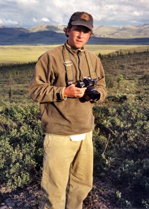
Brian and Jon traveled to Tanzania in May 2011 to present an initial model framework during a participatory workshop that included a range of stakeholders from research, public, and private entities. Their long-term goal is to develop an integrated model of dynamic interactions among economic actors, resource availability, human and animal health, and climate change to provide an important decision support tool that can evaluate adaptive water policy and management strategies for reducing adverse impacts on health and livelihoods.
Brian is also the team leader for the integrated assessment model (IAM) of an EPSCoR (Experimental Program to Stimulate Competitive Research) project to look at long-term the effects of climate change in the Lake Champlain Basin. Brian’s role is to use ARIES to develop a model of the basin that integrates input from hydrology, lake, and land use teams to analyze climate change scenarios.
With the Bureau of Land Management (BLM) and the U.S. Geological Survey (USGS), Brian is working on the second phase of a pilot project to assess the feasibility of incorporating ecosystem services valuation into BLM’s planning and decision-making frameworks in the Moab, Utah region. The Moab region supports a large and diverse tourist economy that draws visitors from around the globe. The number, location, and scale of energy and mineral development sites are a primary concern in the region because inappropriate development may lead to visual impacts that have adverse effects on recreational resources and the industries they support.
Taking diverse stakeholders into consideration, ranging from ATV & OHV operators to mountain bikers, climbers and hikers, Brian uses ARIES to conduct simulation modeling and scenario analysis, coupled with spatial analysis to evaluate management alternatives and identify minimally intrusive resource development sites through the Master Leasing Plan process which guides long-term mineral development in the region.
Brian teaches the graduate-level NR 343 Fundamentals of Geographic Information Systems. He and his partner, Kira, live in a 220-year-old farmhouse in Waitsfield, Vermont. The house and barn originate from two different farms and were moved to their current location in the 1970s. “That makes me comfortable in the Gund since that building’s been moved around a couple of times, too!” Brian points out.
In his free time, Brian gardens, hikes, and backpacks and can be found snowshoeing, skiing, and backcountry sledding around Lincoln Gap in the winter. A member of the Waitsfield Planning Commission since 2009, Brian is active on a committee tasked with identifying a location and design for a new Waitsfield town hall.