
Details and Metadata
Printer-friendly version View XML version Download Ecological Metadata Language file
Methods
The methods followed in the creation of the dataset, including description of field, laboratory and processing steps, and quality control procedures
Current Methods
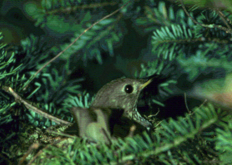
Bird counts
Started: 1991-06-01Counts began shortly aftern dawn on days where weather conditions were unlikely to reduce count numbers (i.e., calm winds and very light or no rain).
Point count intervals
Started: 1991-06-01Observers recorded all birds seen and heard during a 10-min sampling period, which was divided into 3 time intervals: 3, 2 and 5 minutes. Observers noted in which time interval each bird was first encountered, and placed birds into one of 2 distance categories (within or beyond 50 m).
Elevation-dependent sampling
Started: 1999-05-01The number of surveys at each site was dependent on elevation; montane fir-spruce sites were sampled once, LBWA and Underhill were sampled twice during the breeding season.
Dataset Fields
Detailed documentation of the fields comprising the dataset, including the type of measurement, units where applicable, and any controlled vocabularies or code lists present in the data
Field Name Caption Description Additional Information SITENAME Site Name Name of site where data was collected
Nominal SITEDATE Site Date Date when data was collected
DateTime Date/Time Format: other SITESTATION Site Station Sampling stations or point counts within the site
Nominal SURVEYID Survey Identification Identification number given to data count
Ordinal SERIES Series Orders first and second data collection within sample month
OrdinalSeries Codes
+ showAppears in data as Meaning of code 1 First Collection 2 Second Collection SPECIES Species Bird species
NominalForest Bird Monitoring Species Codes
+ showAppears in data as Meaning of code AMGO American Goldfinch AMRE American Redstart AMRO American Robin BAWW Black and White Warbler BCCH Black-capped Chickadee BLJA Blue Jay BLPW Blackpoll Warbler BRCR Brown Creeper BTBW Black-throated Blue Warbler BTNW Black-throated Green Warbler CAWA Canada Warbler CEDW Cedar Waxwing CORA Common Raven EVGR Evening Grosbeak GCTH Gray-cheeked Thrush HAWO Hooded Warbler HETH Hermit Thrush LISP Lincoln's Sparrow MAWA Magnolia Warbler MYWA Myrtle Warbler NAWA Nashville Warbler OVEN Ovenbird PISI Pine Siskin PIWO Pileated Woodpecker PUFI Purple Finch RBGR Rose-breasted Grosbeak RBNU Red-breasted Nuthatch RCKI Ruby-crowned Kinglet REVI Red-eyed Vireo SCJU Slate-colored Junco SOVI Solitary Vireo SWTH Swaison's Thrush VEER Veery WIWR Winter Wren WOTH Wood Thrush WTSP White-throated Sparrow YBFL Yellow-bellied Flycatcher YBSA Yellow-bellied Sapsucker YSFL Yellow-shafted Flicker AMCR American Crow BLBW Blackburnian Warbler CAGO Canada Goose CERW Cerulean Warbler CHIP Chipmunk DEJU Dark-eyed Junco GRSQ Ground Squirrels RESQ Red Squirrel RUGR Ruffled Grouse WBNU White-breasted Nuthatch RAWCOUNT Raw Count Number of birds seen during data collection
Ratio
Unit: number
Precision: 1TIMEINTERVAL Time Interval Time interval within ten minute sampling period
NominalTime Interval Code
+ showAppears in data as Meaning of code A First time interval B Second time interval C Third time interval D Fourth time interval DIST_EST Estimated Distance Estimated distance of bird
Ratio Units:
Distance Codes
+ showAppears in data as Meaning of code 1 Distance estimated at less than 50 meters 2 Distance estimated at greater than 50 meters OBSERVATION_TYPE Observation Type Observation Method
NominalObservation Type Code
+ showAppears in data as Meaning of code C Calling I Individual S Singing STARTTIME Start Time Start time of data collection
DateTime Date/Time Format: hh:mm:ss OBS Observer Initials of observer/ data collector
Nominal Sampling Equipment
Equipment and software used to collect data, including how that equipment was used.
No sampling equipment recorded for this dataset
Site Characteristics
The spatial extent of the dataset site coverage, and descriptions of the spatial extent and context for the data collection
- Site Description
An additional transect established in 1995 in Ranch Valley at 3300 ft.
- Site Description
Two transects established in 1991 on Mount Mansfield: One in Browns River Headwaters in mature northern hardwoods and one at summit in spruce-fir ridgeline forest.
- Site Description
Transects at Lye Brook established in 1999 in northeast area at 680 m elevation in northern hardwood forest.