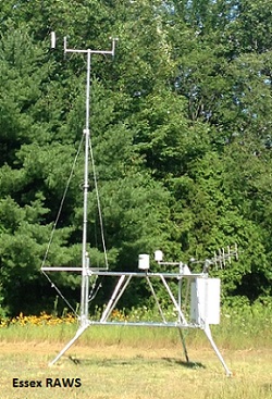
Dataset Overview
Measurements of wind, temperature, relative humidity, dew point, solar radiation and precipitation to predict fire danger.
- Purpose
To predict danger of wildfire in VT; to expand spatial coverage of meteorological observations in VT.
- Data Collection Status
-
Data collection for this dataset is ongoing
- Start date
1999-05-21
- Contents
6598 records with 26 fields
- Data Availability
-
This dataset is available for download from the FEMC. The FEMC data may be a duplicate, subset, or copy of the original from a particular point in time. The original dataset is also available for download from the third party that controls the data license.
- Data License
Linked - Third party determines data license
- Preferred Citation
Dept. of Forests, Parks and Recreation Agency of Natural Resources, Division of Forests Project Lead: Tess Greaves
- Update Frequency
Daily
- Maintenance Plan
VT FPR maintains and calibrates station
- Links
-
No links available for this dataset
- Related Datasets
- Determining Dataset Similarity
- Previous Versions
-
- Version 3 - EssexRAWS (created 2017-06-29 by Miriam Pendleton)
- Version 2 - Essex RAWS data (created 2017-06-23 by Miriam Pendleton)
- Version 1 - Essex Jct RAWS (created 2017-05-19 by Miriam Pendleton)