 -Projects-
-Members-
-Meetings-
-Resources-
-Projects-
-Members-
-Meetings-
-Resources-
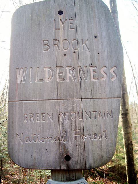
Lye Brook Wilderness Area is unique in that it is the only Class I Wilderness Area in Vermont, and includes a rich archive of existing monitoring and research data. The Lye Brook Subcommittee of the Vermont Monitoring Cooperative connects researchers and land managers interested in Lye Brook. While interest remains high, the activity of the subcommittee has varied over the decades. Reconstituted at the 2013 Vermont Monitoring Cooperative Annual Conference, the Subcommittee regularly convenes meetings of key partners in an ongoing collaboration to identify priority areas for research and monitoring, and maintain a list of activities (past, present and planned) at the intensive monitoring site.
Key Lye Brook Projects from the FEMC Archive
- Biological and Chemical Surveys of Selected Surface Waters in Lye Brook Wilderness Area1993-04-01 to 1997-01-01
Inventory and monitor hydrogeochemcial and biological characteristics of principal water bodies in and around Lye Brook Wilderness Area to determine and document current and future changes to air quality related values (AQRV). - Clean Air Status and Trend Network (CASTNET)1988-01-01 to Ongoing
CASTNET is a national monitoring network established to assess trends in pollutant concentrations, atmospheric deposition, and ecological effects due to changes in air pollutant emissions. Regional CASTNET dry deposition chemistry data from New York and northern New England are archived here. - Cross-site Study of Soil Nitrification and Stream Nitrate Export2001-09-01 to 2002-12-01
Examine the link between soil nitrification and stream nitrate export. - Effects of Acidic Deposition on Terrestrial and Aquatic Ecosystems of Class I Wilderness Areas1994-05-01 to 1996-10-18
Determine the distribution of areas sensitive to deposition of sulfur and nitrogen; determine the current status of sensitive areas utilizing atmospheric deposition of nitrogen; determine the degree of base cation leaching and aluminum mobilization (use soil, vegetation, land use history assocations to identify impacts); verify deposition thresholds; and assess impacts to terrestrial and aquatic ecosystems if under the PSD process. - Federal Forest Inventory and Analysis Data for Vermont1983-01-01 to Ongoing
A summary of the latest USDA Forest Inventory and Analysis data for the state of Vermont. The network of randomly distributed inventory plots are designed to capture broad temporal changes in the condition of the nation’s forest resource. Spatial coverages of species distribution, extent of forest cover and biomass compliment the yearly data summaries to capture an unbiased estimated of the state of Vermont's forests. - Fine Particle Monitoring: Interagency Monitoring of Protected Visual Environments (IMPROVE)1988-09-01 to Ongoing
Furtherance of a national goal that calls for “the prevention of any future, and the remedying of any existing, impairment of visibility in mandatory Class I federal areas which impairment results from manmade air pollution.” The Regional Haze Rule (RHR) expanded this mandate by requiring monitoring in locations representative of the 156 visibility-protected federal Class I areas. IMPROVE was designated as the visibility monitoring network to be used to carry out this responsibility. - Forest Health Monitoring: North American Maple Project1988-06-01 to Ongoing
Annual measurement of sugar maple forest stands to determine tree condition, trends and possible causes of sugar maple decline. Assess the variation in within-season timing of measurements, using same plot design as in the National Forest Health Monitoring Program (NFHM). Initially part of a cooperative monitoring program with other states and Canada, since 2002 Vermont has measured these plots independently for internal use. NAMP is primarily an overstory/forest health monitoring program but they have collected regeneration data beginning in 1998. - Forest Inventory of Lye Brook Wilderness Area1994-01-01 to 1994-12-31
Conduct a SILVEX forest inventory of the Lye Brook Wilderness Area. - Green Mountain National Forests Long-term Ecosystem Monitoring Project (LEMP)2008-08-29 to Ongoing
This project is a 50-year monitoring effort to examine the long-term effects of broad-scale environmental changes--particularly changes in climate, air quality, soil health, and vegetation, in the Green Mountain National Forests. - Incidence of Ozone and Its Effects on Vegetation in Lye Brook Wilderness Area: Monitoring ozone concentrations1989-05-30 to 1994-09-01
To monitor ozone concentrations near and within Lye Brook Wilderness (LBW) and relate these concentrations to the degree of injury to vegetation within LBW. - Incidence of Ozone and Its Effects on Vegetation in Lye Brook Wilderness Area: Ozone effects on Vegetation in the Lye Brook Wilderness Area1988-04-01 to 1995-08-30
To monitor ozone concentrations near and within Lye Brook Wilderness (LBW) and relate these concentrations to the degree of injury to vegetation within LBW. - Land Use History of the Lye Brook Wilderness Area1993-01-01 to 1993-12-31
Document historical ownership, land use, and natural history of the Lye Brook Wilderness Area through oral histories. - Lichens and Air Quality in the Lye Brook Wilderness Area1993-07-01 to 1993-08-30
Collect lichens for a lichen species list; collect lichens for elemental analysis; study the health and distributions of species most sensitive to air pollution; and assess the effects of air quality on lichens. - Long-term Monitoring of Acid Sensitive Lakes1982-03-01 to Ongoing
Long term monitoring of chemistry in acid lakes in the Lye Brook Wilderness. In addition, limited baseline sampling of Lye Brook Meadows, Little Mud Pond, Bourn Brook, Lye Brook, Branch Pond Brook and Winhall River for water chemistry was undertaken in the 1990s. The goal is to determine the present biological and chemical characteristics of principal water bodies in and around Lye Brook Wilderness Area so that changes to air quality related values (AQRV) can be documented. - Lye Brook - Wildlife1995-01-01 to 1995-12-31
Quantify wildlife habitat type and extent. - Lye Brook Area Ecological Land Type Classification1993-02-26 to 1995-12-31
This project performed extensive sampling in the Lye Brook Wilderness are to classify ecological communities based on an integration of soils, vegetation & physiographic data. These communities were then mapped. - Ozone Bioindicator Plant Monitoring1994-06-01 to Ongoing
Detect ozone injury on sensitive native plants, record first occurence data for each species, and evaluate the maximum severity of the damage. - Sentinel Stream Monitoring2000-01-01 to Ongoing
Monitoring the long-term effects of climate change on macroinvertebrate communities in pristine reference streams. - Soil Climate Analysis Network (SCAN)2000-09-13 to Ongoing
The Soil Climate Analysis Network (SCAN) is a comprehensive, nationwide soil moisture and climate information system designed to provide data to support natural resource assessments and conservation activities. Administered by the United States Department of Agriculture Natural Resources Conservation Service (NRCS) through the National Water and Climate Center (NWCC), in cooperation with the NRCS National Soil Survey Center, the system focuses on agricultural areas of the U.S. monitoring soil temperature and soil moisture content at several depths, soil water level, air temperature, relative humidity, solar radiation, wind, precipitation, barometric pressure, and more. - Vermont Forest Health Monitoring1991-06-01 to 2021-12-31
The Forest Health Monitoring Program was established in 1991 as a joint effort between the Vermont Department of Forests, Parks and Recreation (FPR) and the Vermont Monitoring Cooperative (VMC) (as of March 2017 renamed to Forest Ecosystem Monitoring Cooperative (FEMC)) to monitor the condition of a range of tree species in Vermont. Plot design follows the structure set by the National Forest Health Monitoring Program with additional metrics added to reflect improvements in monitoring technologies and additions to monitoring objectives. - Vermont Long-Term Soil Monitoring Program2002-01-01 to Ongoing
Long-term monitoring of forest soils is necessary to understand the effects of continued environmental change, including climate change, atmospheric deposition of metals, and recovery from acidic precipitation. A monitoring program was initiated in 2002 at five protected forest sites in Vermont, three in Mt. Mansfield State Forest and two in the Lye Brook Wilderness Area. Every 5 years at each site, ten soil pits are dug and sampled from subplots in a 50 × 50-m plot. - Vermont Statewide Aerial Sketchmapping of Tree Defoliation, Mortality and other Damages1980-01-01 to Ongoing
Aerial sketch mapping of defoliation, mortality, or other symptoms is a statewide survey conducted to detect tree damage, to determine its cause, and to maintain maps showing the location and extent of damage.
Members
- Diane Burbank , Green Mountain National Forest, USDA Forest Service
- James Duncan Director, Forest Ecosystem Monitoring Cooperative, (FEMC)
- David Hardy , Green Mountain Club
- James Kellogg Aquatic Biologist, Vermont Department of Environmental Conservation, Vermont Agency of Natural Resources
- Heather Pembrook , Vermont Agency of Natural Resources
- Miriam Pendleton Site Operator and Outreach Coordinator, Forest Ecosystem Monitoring Cooperative, (FEMC)
- Ralph Perron Air Quality Specialist, USDA Forest Service
- Angelica Quintana Soil Scientist, Green Mountain and Finger Lakes National Forests
- Judy Rosovsky State Entomologist,
- Thomas Villars , Natural Resources Conservation Service, USDA
Committee Meetings
- 2017-03-21 2017 March Lye Brook Wilderness Area Subcommittee Meeting
- 2016-11-17 2016 November Lye Brook Wilderness Area Subcommittee Meeting
- 2016-08-16 2016 August Field Trip to Lye Brook Wilderness Area
- 2016-02-02 2016 February Lye Brook Wilderness Area Subcommittee Meeting
- 2015-11-04 2015 November Lye Brook Wilderness Area Subcommittee Meeting
- 2015-08-21 2015 August Field Trip to Lye Brook Wilderness Area
- 2015-02-18 2015 February Lye Brook Wilderness Area Subcommittee Meeting
Key resources
- Constructing Wilderness - The Development, Perception, and Promotion of Lye Brook Wilderness Area, Manchester, Vermont (this looks like an undergrad thesis, might not be what you’re looking for)
- Regional haze in the Lye Brook Wilderness
- Lye Brook Wilderness Area Receptor
- Lye Brook Wilderness – Forest Service Air Resource Management
- Lye Brook Wilderness Description
- Green Mountain National Forest Land and Resource Management Plan
- Forest Service National Visitor Use Monitoring - Green Mountain National Forest
- FEMC Lye Brook Intensive Study Site