Are You Prepared If We Have Spring Flooding?
April showers (and snowmelt) can bring May flowers and spring flooding. Let's learn about the factors that can cause spring flooding in the Lake Champlain Basin, and how you can prepare!
In the winter, much of the precipitation we receive is stored as snow and ice in higher elevations of the basin. This year’s mid-March snowstorms pushed our snow levels above average as recorded by the National Weather Service at the top of Mount Mansfield. As winter turns to spring, much of this snow and ice stored high up in the mountains will melt and drain into Lake Champlain.
Lake Champlain usually reaches its peak water level in May, when it absorbs the last of winter’s snowmelt and spring rains. The lake’s average water level is 95.5 feet—any water level higher than 100 feet is considered to be in flood stage. Lake Champlain’s water level is measured by the USGS. Check out today's levels. 
But the risk of spring flooding exists beyond the lake. Flooding events actually occur more often in rivers and streams as water moves through narrow river valleys towards the lake.
Flooding events in rivers and streams are intensified by springtime temperatures that fluctuate well above and below freezing. This can speed up or stop flow as ice, snow, and water interact. Snow-covered ground acts like a speedy runway for rainwater entering rivers and streams, giving them added power. Chunks of ice can pile up in rivers, forming ice jams that divert, slow, or stop water flow.
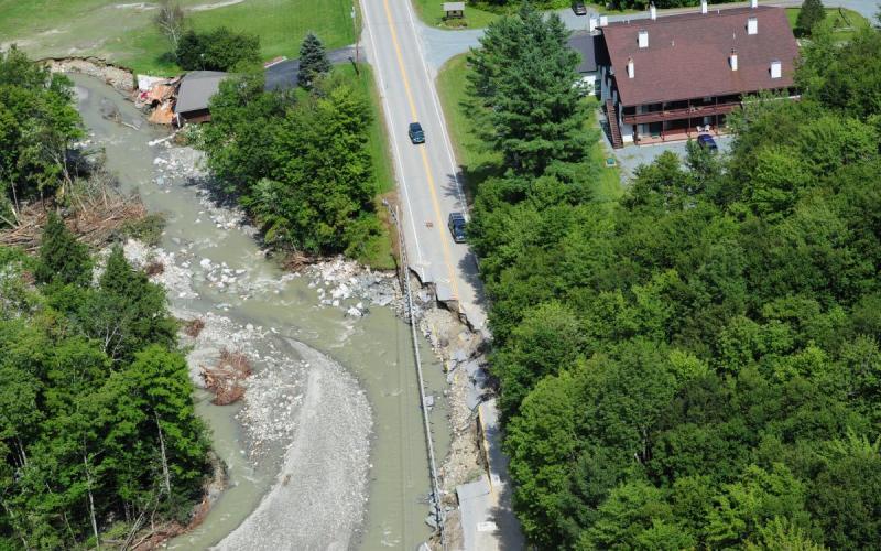
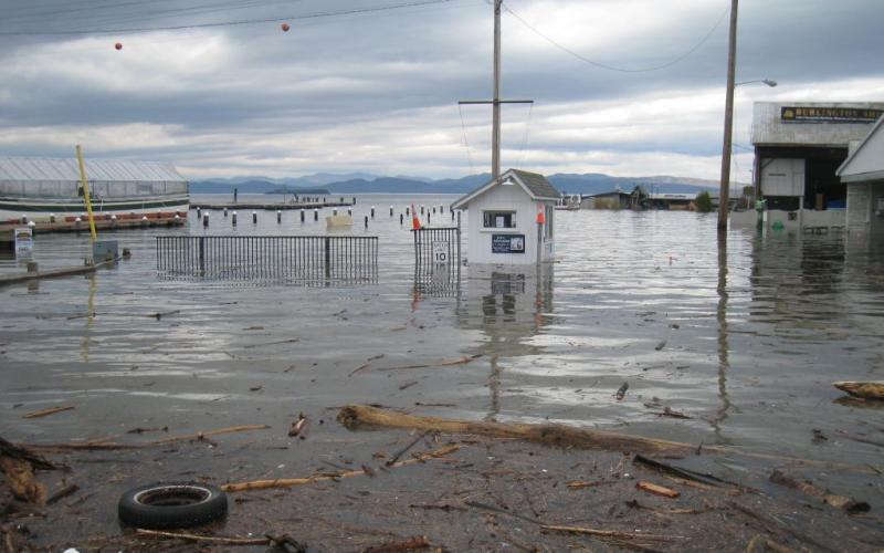
Two main types of hazards occur as a result of snowmelt, heavy spring rain, and fluctuating temperatures. The first is the flooding or inundation itself caused by rising levels of lake or river water. Picture water covering areas of land that are normally dry. This can damage homes and buildings and be dangerous to drive or walk through. The second hazard is fluvial erosion, which occurs when fast moving water carries away material from stream beds and banks. This can make roads, buildings, and utility lines unsafe by undercutting them or even carrying them away.
Flooding is a natural function of water moving throughout different elevations in our mountainous watershed, but it can cause serious destruction to homes and infrastructure in flood-prone areas. This destruction is predicted to increase as climate change brings more intense storms to the Lake Champlain basin at a higher frequency. The restoration of our waterway's natural buffers—shorelines and wetlands—will help to minimize flood damage and give our lakes, rivers, and streams the room they need to move into their natural floodplains.

To prepare your home for flooding, contact your insurance agent to discuss your flood insurance coverage. Elevate basement utilities and materials to minimize potential damage. Develop a Family Emergency Kit and a Family Communication Plan. Visit VT Emergency Management’s Community Preparedness website for more detailed information on how to prepare and respond to a flood.
Want to take a deep dive into flood resilience on the community and individual levels? Take a look at Lake Champlain Sea Grant’s webinar, “How to Avoid Damage from Flooding” and the State of Vermont’s Flood Ready website.