Kelsey Gleason, UVM Larner College of Medicine Assistant Professor teaching in the Public Health program, has brought her expertise in environmental epidemiology and humanitarian disaster resilience and relief around the world and back again, with the aim of teaching communities how to take public health into their own hands.
“I’ve always been drawn to issues in marginalized communities. Communities that have healthcare needs require correct resources and a dedication to fixing them,” she explains.
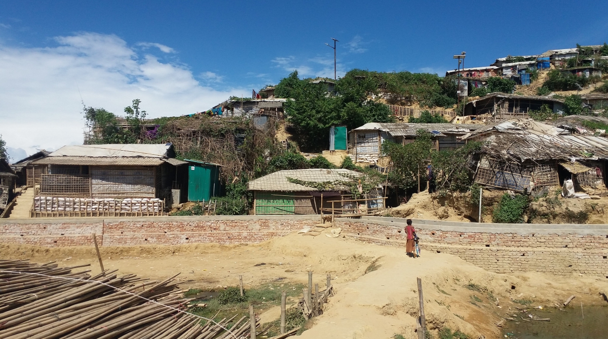
Having previously conducted research on public health issues in Myanmar, Bangladesh, Kenya, Haiti, Ethiopia, and East Timor, Gleason has recently received pilot funding from UVM’s Translational Global Infectious Diseases Research Center (TGIR) to turn her attention to Cox’s Bazar, Bangladesh, where approximately 865,000 people live in the world’s largest network of refugee camps.
Refugee camps, Gleason explains, often experience high levels of infectious disease and mortality, with diarrhea contributing to a disproportionate number of serious illnesses and deaths. Diarrhea, in fact, is the second leading cause of death for children under 5 worldwide.
In her upcoming pilot project, Gleason will be looking for environmental drivers of diarrheal disease among vulnerable refugee populations, using Geographic Information Systems or GIS to study how the natural environment impacts the spread of diarrheal disease in camp settings.
“Diarrhea is closely tied to the natural environment,” Gleason explains, adding that refugee camps like Cox’s Bazaar are often constructed on undesirable land. “Good land will often already be occupied, so camps are built on the steep or muddy land that’s left over.”
The land’s characteristics can have a profound impact on refugee health. If land is particularly vulnerable to flooding, for instance, sanitation problems can quickly spiral as latrines overflow and contaminate well water.
A narrow focus with widespread implications
Gleason is using GIS maps and spatial techniques to understand the specific impact of deforestation and cyclones. It’s possible, for example, to analyze changes in tree cover over time and compare tree coverage against publicly available UNHCR disease and death rate data for the camp. UNHCR data can also be compared against historical weather data; what is the relationship between a category 1 cyclone on camp mortality versus a category 5 cyclone, for example.
“This study is narrow because it focuses on cyclones and deforestation,” Gleason explains. “But this approach has never been done before. This is really a proof-of-concept study, demonstrating that beyond refugee camp settings, we can use spatial technologies to understand the impact of the environment on human health. This can be applied anywhere, and to any disease.”
Gleason’s hope is that if the research is able to show a relationship between environmental factors and refugee health, camp administrators, humanitarian responders, NGO’s and host governments can better plan for weather events and take land characteristics into account when planning a humanitarian response.
It’s exactly the kind of real-world impact that Gleason is passionate about bringing to her public health courses at UVM. “I hope to involve students in data analysis for this research, making it a cross-campus collaborative effort,” Gleason says, driving home the point that students can apply themselves to global public health issues no matter where they live or work.