Dummerston
Surficial Geology
Like the rest of Vermont, the surficial geology of Dummerston has a distinctive glacial flavor to it – meaning that the surficial materials which can be found throughout town are largely the by-products of the last ice age. As recently as 20,000 years ago, southeastern Vermont was covered by a continental ice sheet that extended from the arctic reaches of northern Canada and was as much as a mile thick in places. This massive frozen behemoth greatly changed the topography of the landscape, depressing the earth’s crust, softening pointed peaks and rounding tight valleys, and scraping up every remnant of life, soil, and even much of the bedrock, as it flowed over the surface.
Like a giant conveyor belt, the ice picked up tons of sediment of all sizes as it chugged along, carrying boulders, cobbles, gravels, sand, silt, and clay in its frozen depths. Then, about 6,000 years later, with the warming of the earth’s climate, the great glacier began to recede from southern Vermont. In their retreat, the glaciers released all of the fragments of rock that had been picked up along the way. Where rocks dropped directly out of the ice without the sorting action of water, a random jumble of all different sediment sizes – glacial till – was the result. Till is the dominant surficial material throughout Dummerston and all of Vermont (See surficial geology map). In other places, sediments were deposited by glacial meltwater according to their size and the energy of the water that transported them: the largest, heaviest cobbles and gravels were deposited first, followed by finer grains of sand and silt, and ultimately clay. Together, the water-sorted sediments and chaotic till deposits characterize a surficial geology that is highly varied.
Glacial till
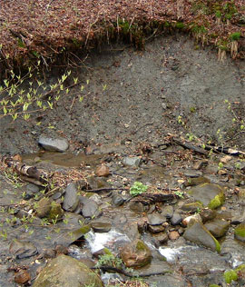
Hillside farmers in Dummerston know till well. Every spring when the ground thaws a fresh batch of stones erupts at the surface, part of the glacier’s legacy. Early settlers used this bounty of stones for the foundations of their houses and barns. However, the rocks also make the soil difficult to cultivate, and accordingly were removed by farmers and assembled into miles of stone walls as boundaries for crop and hay fields. Today, a walk in most any wooded area in the state, such as Prospect Hill in the center of town – will reveal remnants of these walls that once zig-zagged all across the Vermont landscape.
While the upland hills of Dummerston are blanketed in till, the lower elevations are characterized by different surficial features. It turns out the Connecticut River valley was once inundated by a colossal glacial lake. Having formed from the blockage of drainage outlets by sediment accumulation farther south in Connecticut, Lake Hitchcock swelled into the valley, extending north to Lyme, New Hampshire, and flooding many tributaries like the West River to a level several hundred feet above their present elevation. Where upland streams emptied into the margins of this still water they lost their momentum and dropped broad deltas of sand and gravel. In the calm depths settled minor quantities of clay. Eventually the dam failed and the floodwaters flowed out, leaving behind numerous sediments that had accumulated over several thousand years. With the lake gone, the Connecticut and West Rivers and other powerful streams were now free to carve new valleys into the soft sands and muds. They eroded glacial sediments in some places and piled them up in others, creating new landforms like terraces and floodplains.
Many of these terraces are intimately linked to colonial and modern times. Due to their ease of digging and the ability to drain well, sandy terraces like those along the West River in West Dummerston were favorite spots for early cemeteries. More recently, abundant sand and gravel pits have been excavated out of these same riverside sediments. A look at a topographic map of town shows at least seven pits located on the east side of Dummerston along the banks of the Connecticut River. It turns out that the road bed of I-91 and most of the other Interstates in the region were fashioned out of these stable materials! The finer particles have had their utilitarian glory as well. Thick layers of ancient clay that once sat beneath Lake Hitchcock’s frigid waters became the source material for brickyards in the region, like the one on Brickyard Lane near the northern border with the town of Putney.
Finally, though the majority of the surficial sediments in town have roots dating back to glacial times, streams and rivers in the valley lands continue to annually deposit fresh loads of sediment, called alluvium. Historically and today these nutrient-rich residues provide the fertile endowment that sustain Dummerston’s agricultural base. Together the stone walls, cemeteries, sand pits, brickyards, and farmsteads in town give witness to the important legacy of surficial sediments in determining how people carve their lives from the land.