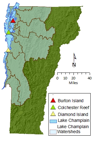
Atmospheric deposition and water quality affect the watersheds hosting Vermont's forested ecosystem. The Lake Champlain watershed contains the Mount Mansfield forested study area and the lake itself lies to the west, or predominantly upwind, of most of Vermont's forested lands. This allows measurements of atmospheric trends and deposition at the lake to complement, and serve as indicators for, deposition in the larger forested watershed. These data are also closely coordinated with forest-based VMC atmospheric monitoring stations on Mount Mansfield and at Lye Brook.
VMC maintains and operates three atmospheric monitoring stations on Lake Champlain: one at Colchester Reef (est. 1996) one at Diamond Island (est. 2004) and the other at Burton Island (est. 2010). Data from these stations are helpful not only to long term forested watershed research, but also to the Lake Champlain research community, the National Weather Service, recreation and tourism interests, and many others.
Colchester Reef
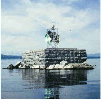
Colchester Reef meteorological station on Lake Champlain: VMC file photo.
Diamond Island
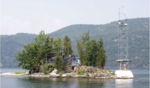
Diamond Island meteorological station on Lake Champlain: VMC file photo.