"I’ll be in the obnoxious purple kit.”
These were our instructions as we headed towards Stowe Mountain Resort to meet with one of their snow reporters. Straight to the point, no exaggerations, and no frills, just like how Stowe’s Snow and Weather Report is written.
Andre Blais, decked in purple as promised, was easy to identify as we skied over to the base of Mount Mansfield. Blais, one of three snow reporters at Stowe, has been working there for over a decade and is a seasoned veteran when it comes to the mountain, especially when it comes to its renowned weather and snow.
His counterparts, Matt Testa and Scott Braaten, joined us, albeit in less-loud colors, as we took our places on the gondola and began the reason for our visit: to talk snow.
While UVM’s Water Resources Institute (WRI) team does not get the similar pleasure of skiing for work every day, snow still plays a large role in our day-to-day work.
Vermont’s highest peak has long been a site for research and monitoring. By leveraging multi-decadal records of snow depth and runoff, researchers are able to uncover long-term trends in the northeastern snowpack.
The WRI manages 15 weather and snow monitoring stations on and around Mount Mansfield, primarily focused on snowpack dynamics. These stations measure snow depth, snow water equivalent, short wave and long wave radiation, and temperature and relative humidity, providing researchers with high-end real-time weather and snow data. These features have the potential to support resort operations, making the lives of snow reporters like Andre, Matt, and Scott just a bit easier.
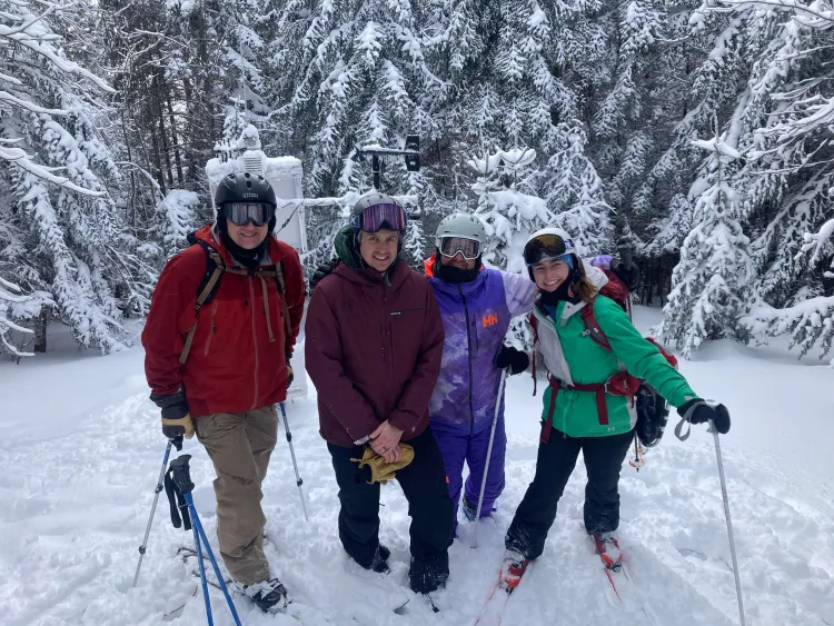
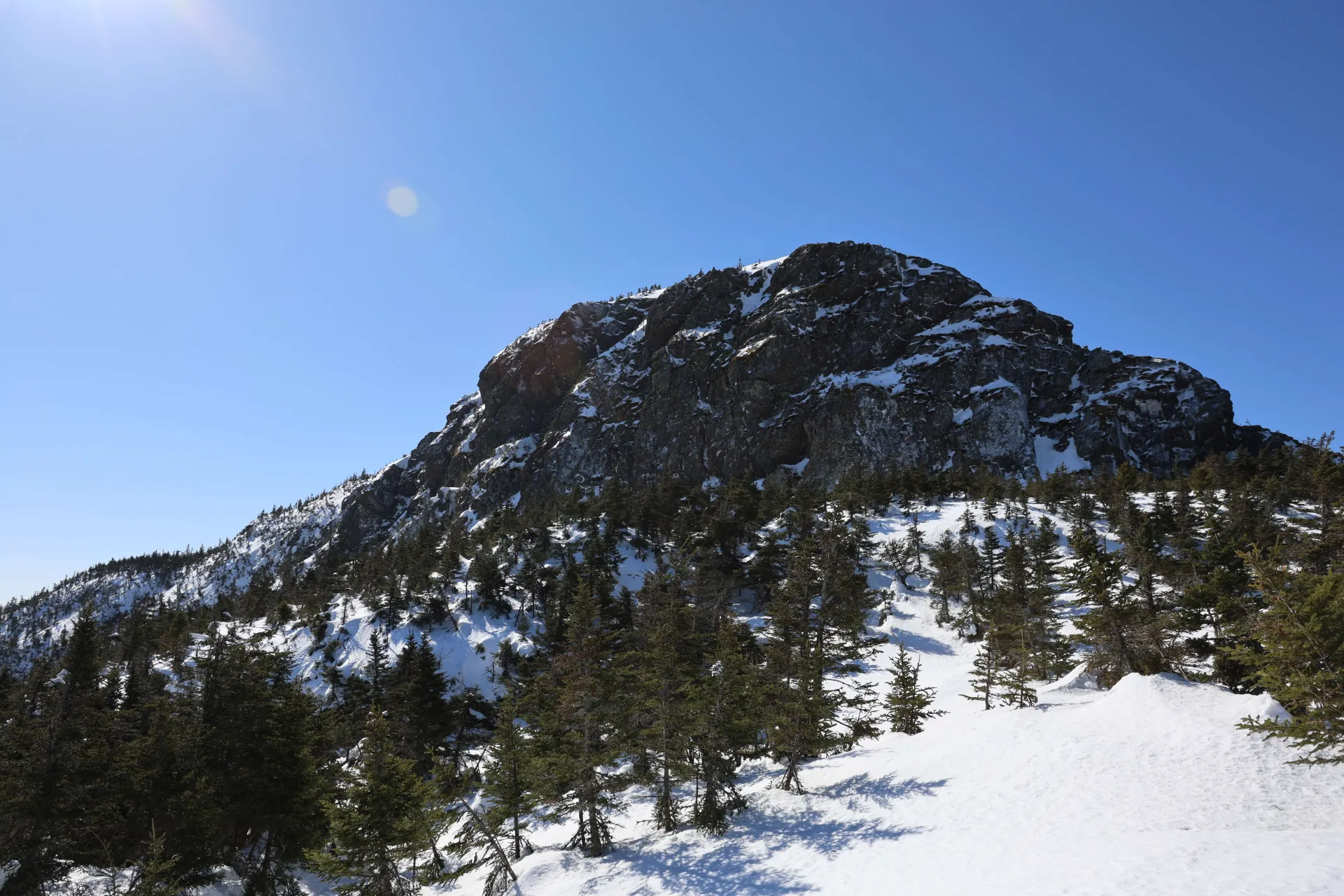
Dismounting the gondola, we followed the resort’s snow reporters to their own monitoring system – a pair of 2 different stakes, one which measures accumulation over 24 hours, and one which measures the depth over the whole season. Right at 3000 feet, these stakes are situated at an upper mountain area with little wind and soft accumulation – allowing the team to avoid over-inflating their snow data– which they pride themselves on.
To inform skiers of snow depths at various elevations, this structure complements other monitoring sites like one by the Barnes Camp at the base of the mountain (1,550 feet) and the iconic 12-foot-high, two-by-four known as the Mount Mansfield snow stake situated at 3,900 feet of elevation.
Matt, Scott, and Andre described how they utilize this arrangement to form their snow reports. Each morning, bright and early, they head to each marker and grab measurements to keep all resort-goers informed via the Stowe Mountain Resort snow phone and on Stowe’s weather and snow report page.
They provide a detailed daily weather forecast that includes how much snow has fallen in the last 24 hours, snow conditions, forecasted temperatures, wind speeds for the day, and what trails have been groomed.
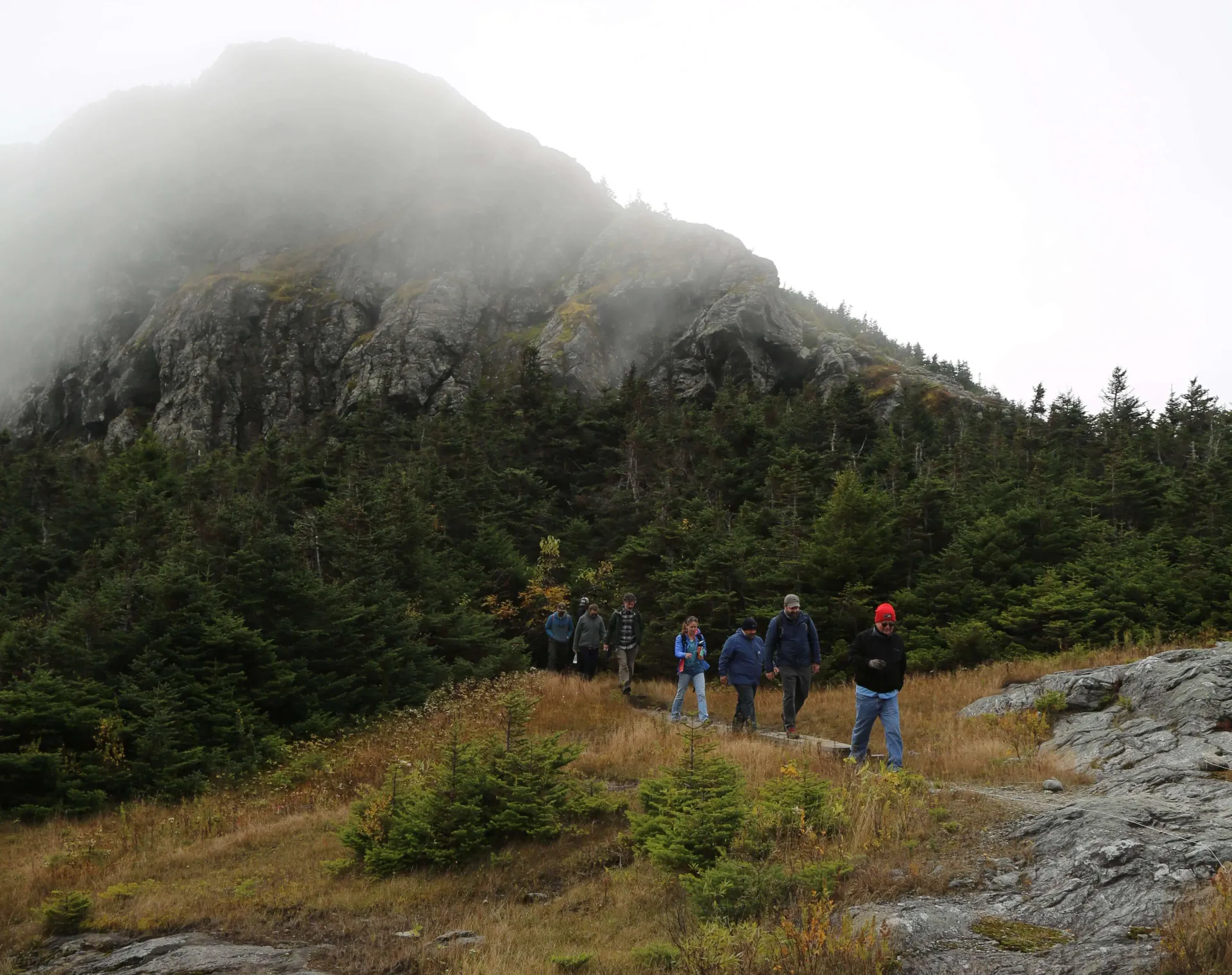
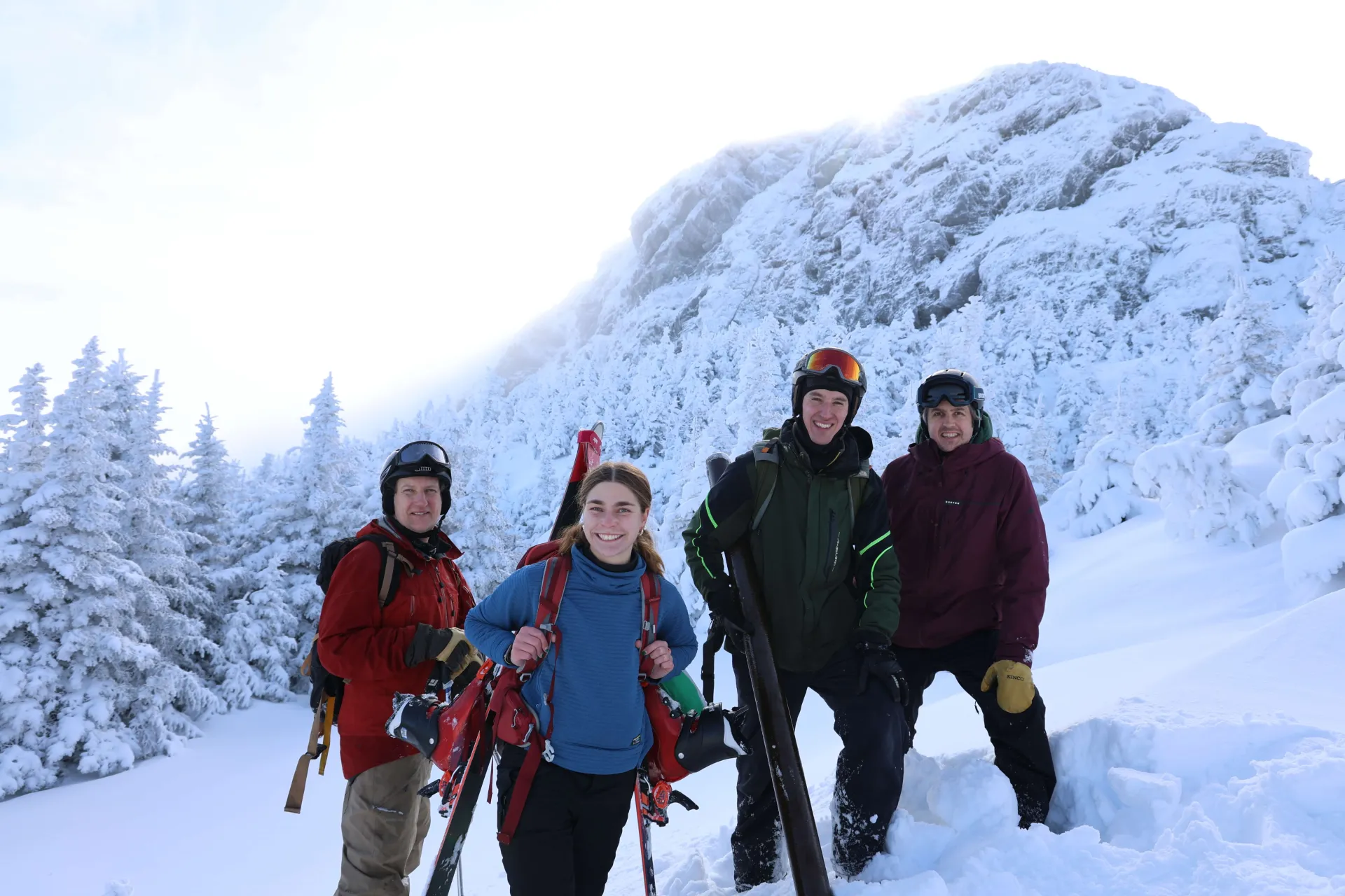
The reporters admitted that having real-time transmissible data would greatly benefit them, and we took this as our opportunity to segue into UVM’s own infrastructure tour. We traversed down the slopes, went back up the Four-runner Quad, and prepped ourselves for the climb to the summit: taking off our skis, strapping on skins or snowshoes, and shedding layers as we headed into the sun.
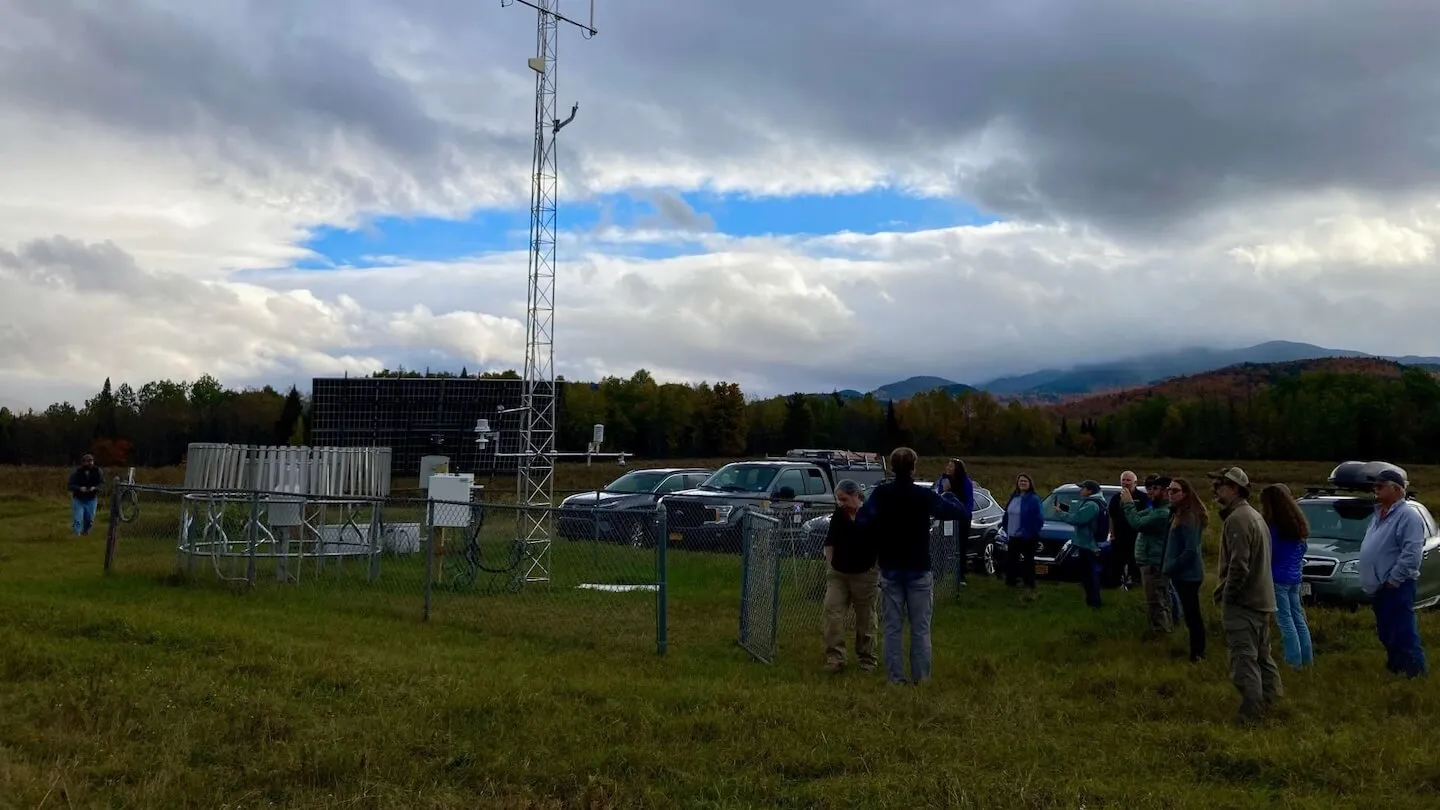
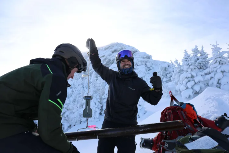
20 minutes and a climb through a winter wonderland later, the group gathered at UVM’s summit site. Speaking to the depth this season, the solar panel standing 8 feet tall was barely visible, and the rest of the station remained buried under a mass of snow.

This station, part of the Summit to Shore (S2S) Environmental Observation Network, originally funded by the US Army Corps of Engineers Cold Regions Research and Engineering Laboratory (CRREL), provides key snow and meteorological instrumentation where the most rain and snowfall occur.
Dr. Arne Bomblies, the principal investigator of the S2S project and professor at UVM’s College of Engineering and Mathematical Sciences, shared just how the station works, and how it helps him better understand snowpack characteristics. Bomblies and his team are working to improve monitoring and modeling of snow at multiple elevations, aspects, and canopy conditions in Vermont.
The S2S Network has 22 weather and snow monitoring stations along an elevational gradient spanning from Lake Champlain, up to Mount Mansfield, and across to the Northeast Kingdom, providing key snow and meteorological instrumentation. These stations have also been incorporated into the new statewide mesonet – a network of advanced weather stations that will enhance real-time monitoring along Vermont’s mountainous terrain that will be essential for the state's meteorological, river forecasting, and flood warning capabilities.
These stations will also measure key variables, including precipitation, temperature, wind speed and direction, relative humidity, soil moisture, and snow depth every five minutes.
However, these stations also hold potential to improve resort operations, including snowmaking, grooming, and lift functions.
This automated weather and snow data can provide historic measurements to plan investments, enhance the guest experience by providing real-time data publicly, and make energy and water usage more efficient and cost effective, enabling guests and staff to better plan experiences that impart real understanding of the natural environment and its weather. Most notably, Matt, Scott, and Andre would be able to get more data in a more efficient way – improving Stowe’s snow reports for all skiers and snowboarders alike.
Join the WRI to learn more about this mountain infrastructure and data at our Talks and Walks event on February 7th. Our Director of Research, Keith Jennings, will lead the talk, Monitoring Rain and Snowmelt for a Resilient Community, at Topnotch Resort at 1 pm. Afterwards, our Director, Beverley Wemple, will lead attendees from the Stowe XC Center to our Ranch Brook monitoring site, highlighting the 25 years of alpine water research occurring on Mount Mansfield. You can register here.