To bolster community resilience against extreme weather, the University of Vermont (UVM) is launching an initiative to establish a statewide weather monitoring network, or Mesonet. The UVM Water Resources Institute (WRI) and the Forest Ecosystem Monitoring Cooperative (FEMC) have secured initial funding from the Leahy Institute for Rural Partnerships to seed this project. In key collaborations, Vermont State University’s (VTSU) Atmospheric Sciences Program will contribute expertise, laying the groundwork for a future UVM/VTSU partnership to fully develop the Mesonet. In addition, the UVM Climate Measurements Center of Excellence (CMeC) will provide insight into how the mesonet can best help communities understand and plan for climate impacts through the development of standardized methods and metrics. Overall, the startup grant empowers communities to better prepare for and respond to weather emergencies.
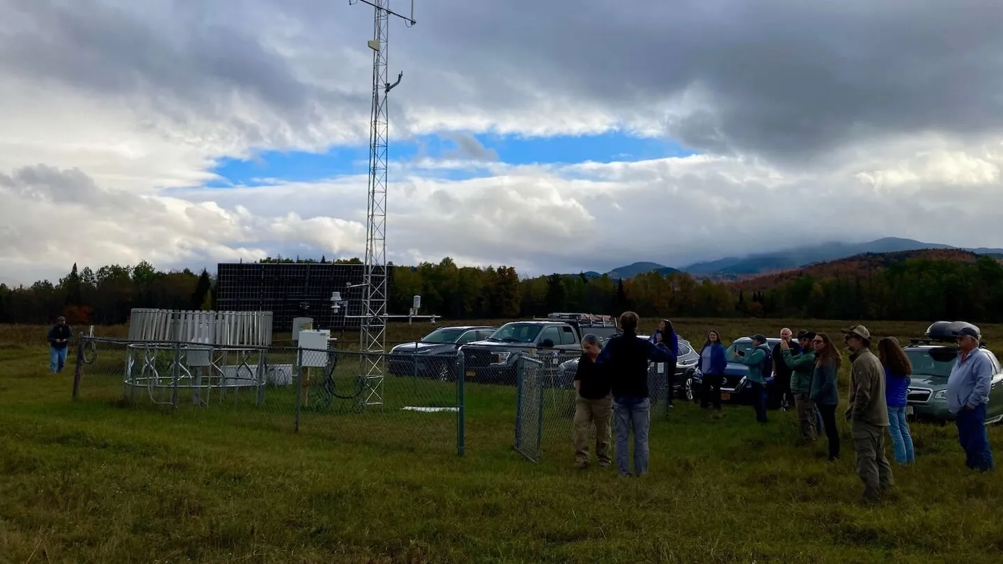
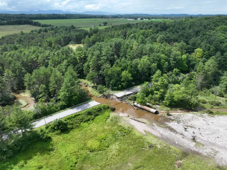
Funding from this grant will develop a new high-end prototype mesonet station that will complement UVM’s existing Summit to Shore weather and snow data network, which is currently focused on observations along elevational gradients. This award comes at a critical time for Vermont, as the state is experiencing more extreme weather due to the effects of climate change. Rural communities, often located in flood-prone regions, do not have the same level of access to reliable, real-time weather data compared to more populated areas, resulting in less accurate forecasts. Creating a more high-quality monitoring infrastructure is crucial for emergency management in these area communities, as well as the agriculture, energy sector, tourism, and outdoor recreation sectors.
A new full-time technician has been hired to manage the network. Starting later this spring, Samantha Koehler, who is completing a graduate degree program in Atmospheric and Oceanic Sciences from the University of Maryland, will take on the role as Senior Technician on the project. Koehler has prior experience setting up a Mesonet in Maryland through her graduate studies and also worked as a technician for the New York State Mesonet (NYSM). A technician from the New York State Mesonet, Scott McKim, will also be involved as a consultant on the project. McKim will provide expertise on instrument selection and site selection. He will also identify opportunities that the Vermont Mesonet should consider in maximizing compatibility with NYSM. Koehler and Joshua Beneš, the WRI’s Associate Director of Facilities and Networks, will work in collaboration with UVM’s state and federal stakeholders to explore statewide needs, gaps, and funding opportunities for automated weather monitoring across Vermont. Through the project and engagement with undergraduate student interns, Beneš and Koehler will identify potential sighting locations for the initial prototype station and future stations.
Bridging the Data Gap in Vermont
Mesonets, or networks of automated weather stations typically managed by universities, aid communities by establishing greater resiliency to extreme weather events. Stations collect real-time meteorological data that helps forecasters predict weather and emergency managers respond to catastrophic floods.
The Vermont Mesonet will leverage existing monitoring infrastructure, as well as establish additional sites in key high-elevation areas, to create a comprehensive, real-time weather network across the state. The project will identify areas across the state in need of automated weather monitoring, through the engagement of state and federal partners that use this data to respond to extreme weather emergencies. These partners include but are not limited to the Vermont Department of Environmental Conservation (DEC), Vermont Emergency Management, the Vermont Agency of Transportation, the USDA Natural Resource Conservation Service, and the National Weather Service.
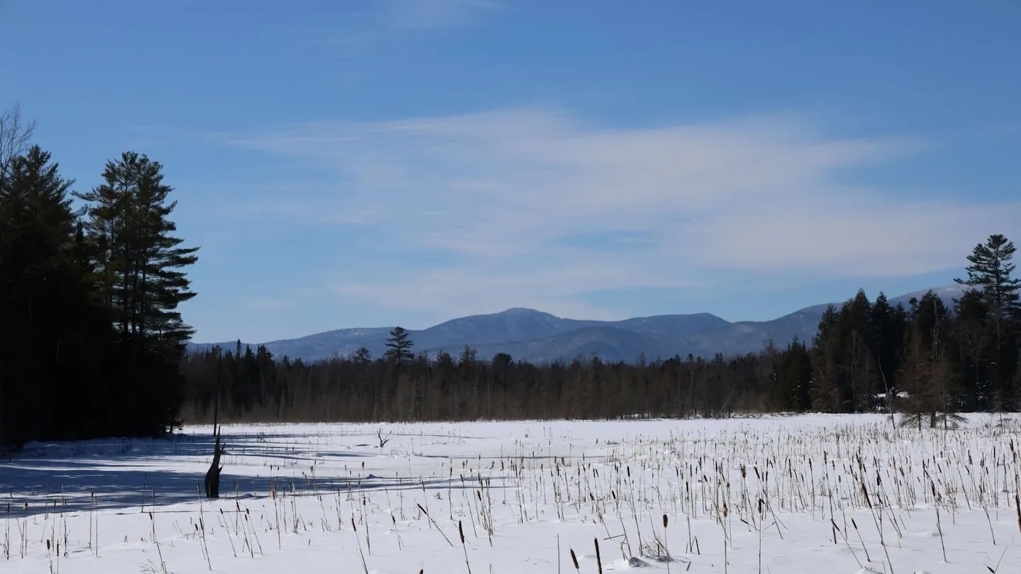
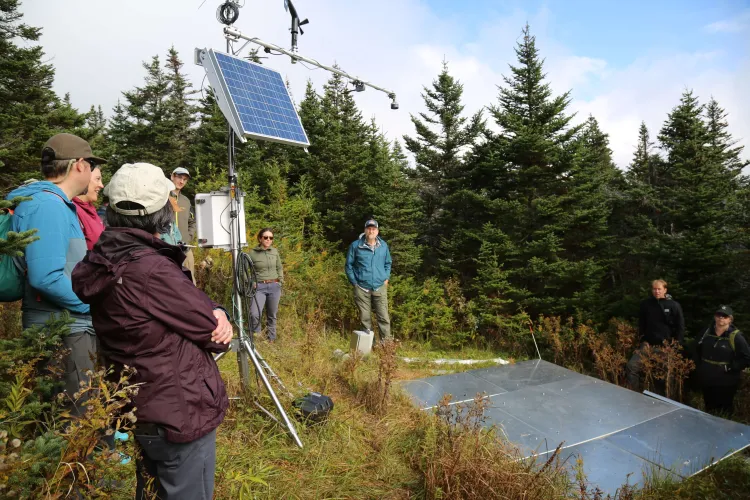
The mesonet will utilize different types of weather stations, each serving a specific function, tailored to varying elevational changes and watershed dynamics. UVM’s Summit to Shore (S2S) Environmental Observation Network will be integrated into this statewide effort. Funded through the Cold Regions Research and Engineering Laboratory (CRREL), S2S has installed 22 weather and snow monitoring stations along an elevational gradient spanning from Lake Champlain, up to Mount Mansfield, and across to the Northeast Kingdom, providing key snow and meteorological instrumentation where the most rain and snowfall occurs, that have the potential to lead to flooding events downstream.
UVM has also been collaborating regionally to develop the Northeast Snow Survey (NESS) Feasibility Study, which has been identifying opportunities to extend the Natural Resource Conservation Service’s automated weather and snow monitoring network to the Northeast. Additionally, UVM is currently managing an Environmental Protection Agency (EPA) funded project which will standardize and integrate regional mountain weather data communications in collaboration with the Whiteface Mountain Observatory in New York and the Mount Washington Observatory in New Hampshire. The Vermont Mesonet will work to establish synergies between these regional initiatives to maximize future opportunities.
The Mesonet also aims to standardize monitoring along elevational gradients to an international methodology. The Unified High Elevation Observing Platform (UHOP), proposed by Beneš and international collaborators, will work to develop a consistent gradient-based climate and environmental measurement model, allowing researchers to effectively report, understand, and predict changes to extreme weather events in mountainous environments around the world.
Impacting Communities Across Vermont
The grant will fund the creation of a prototype monitoring station in a current gap of automated weather which is prone to flooding and downstream snowmelt. This site will serve as a practical resource to a rural Vermont community. The station will provide real-time weather data that will benefit emergency responders, local schools, farmers, and public transportation agencies.
Additionally, the protype will act as an educational tool, providing UVM faculty, staff, and students with a hands-on learning opportunity on automated weather monitoring and data analysis.
For rural communities, the Vermont Mesonet offers greater preparedness and resilience to future extreme weather events. With future funding and a fully established network, municipalities will be able to better predict and respond to storms, floods, and other extreme weather events. With better access to reliable weather information, local farmers can plan their planting and harvest schedules more accurately, schools can make timely decisions about closures, and electric utility providers can make decisions regarding the repair of power lines.
Paving the Way for a Statewide Network
UVM and the VTSU Atmospheric Sciences Program are well poised to collaborate and coordinate efforts to develop a Vermont Mesonet to serve rural communities across Vermont. With the inclusion of CMeC expertise, the network will utilize standardized methods to understand and plan for climate impacts. The Partnership Grant funded by the Leahy Institute for Rural Partnerships will lay the foundation for securing new funds to develop a statewide network. By identifying key areas for new instrumentation, utilizing the protype monitoring station to engage with lawmakers and donors about the need for a Vermont Mesonet, and supporting WRI staff time to prepare grants and secure funds, the award represents a critical step towards meeting the needs of Vermont’s rural communities and building long-term resilience.