Maeve and I trudged through 3 feet of fresh snow—taking turns as we shlepped a 60-pound car battery through the snowy Mansfield woods.
To me, there is nothing more magical than Vermont on a snowy winter day. I fell in love with backcountry skiing when I realized the vastness of beautiful woods and trails that ski touring unveils during the winter months. I have been fortunate to experience several snowy winters while attending UVM, but the changes in Northeast winters have been unmistakable during my lifetime.
In Vermont, snow matters. Our snowpack has far reaching effects on our economy, ecosystem health, groundwater recharge, and flood management. The Northeast is seeing the most rapid warming of any region in the continental U.S., threatening both our winters and our water resources.
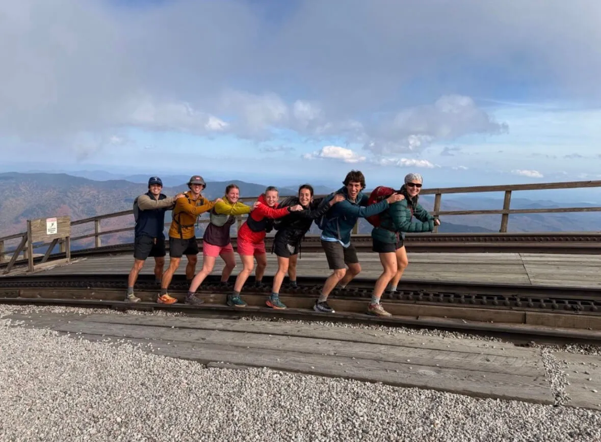
I am a senior Environmental Engineering student and an intern with the UVM’s Water Resources Institute (WRI). I have had the profound privilege of combining my love for the Green Mountains with my engineering studies by helping with UVM’s Summit to Shore project.
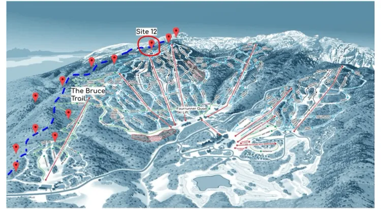
This project is an initiative through the WRI and UVM’s research faculty aiming to monitor snowpack characteristics and meteorological variables across Vermont’s elevation gradients. UVM manages 22 monitoring stations from an elevation of 45 m to 1170 m on the peak of Mount Mansfield. The goal of the project is to support computational snowpack models to better understand the under-studied Vermont mountain environments.
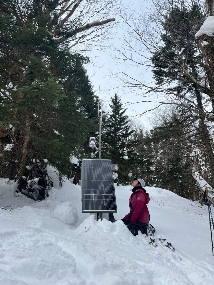
Managing these stations is an endless task. Each station is equipped with state-of-the-art instrumentation to measure air temperature, wind speed, snow depth, and soil moisture and temperature. However, as you can imagine, these stations experience the harshness of Mount Mansfield’s weather, which only exacerbates the challenge of their upkeep.
In the winter months, the stations are only accessible via skis or snowshoes. Scattered across the Mount Mansfield backcountry, just reaching each station is an adventure. Our team uses snowshoes and climbing skins: strips of fabric that attach to the base of the skis that allow for uphill traction. With these skins, we can go uphill skiing to each site. The equipment needed for the stations’ upkeep and repair is then strapped to a sled and manually pulled behind us.
On that bluebird Friday in the snowy Mansfield woods, Maeve and I were skinning with a mission. Site 12’s station battery was dead. Maintaining continuous data records is essential, so despite it being a sub-freezing winter day, fieldwork was necessary. Since the batteries are too heavy to carry by hand, they can only be replaced in winter when they can be sledded up to the stations.
Maeve skied in front with a harness attached to the sled, and I pulled it from behind. The station’s new battery was carefully strapped inside. We headed to Station 12, which is on the east side of Stowe, tucked 300 yards into the woods. Skinning to the site, we arrived at a station buried under a few feet of fresh snow.
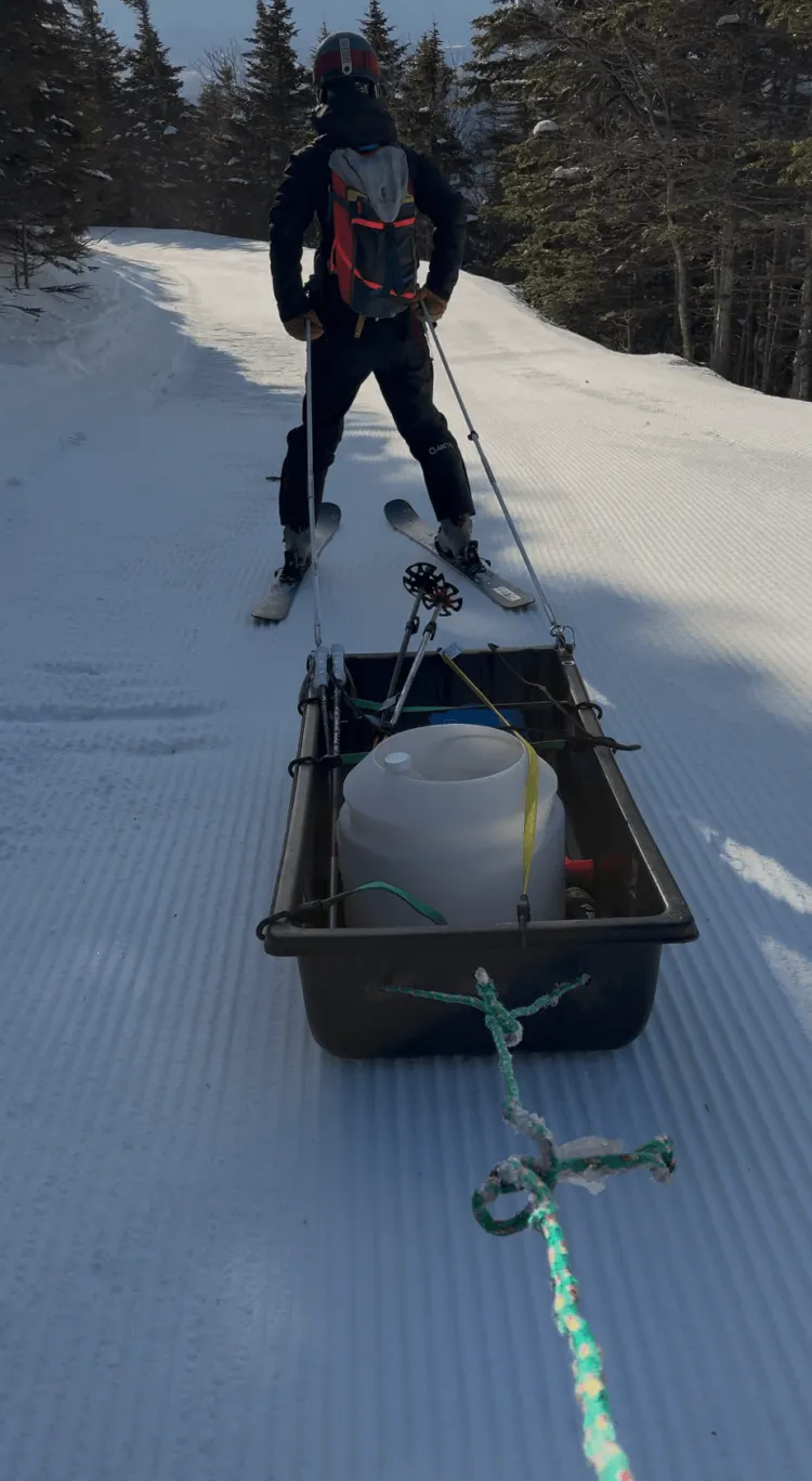
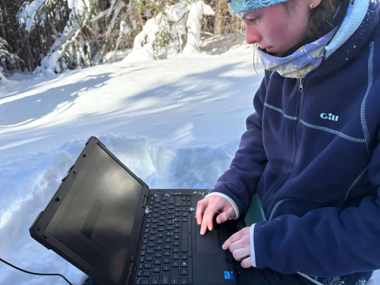
Our first task was to dig through the snow until we reached the old battery. Once it was exposed, we dug the battery out completely, and using all our strength, we hoisted it onto the sled. Next, we rewired the new battery and attached it to the station. The final step of our visit was to hook up the field computer and ensure that everything was recording properly. To do this, we used a hefty Dell laptop—resembling a suitcase—that is built to handle snow and mud.
After confirming that the system was functioning correctly, we ripped our skins off skis, remounted our sled-pulling mechanism, and skied the old battery back down to the base of Mount Mansfield.
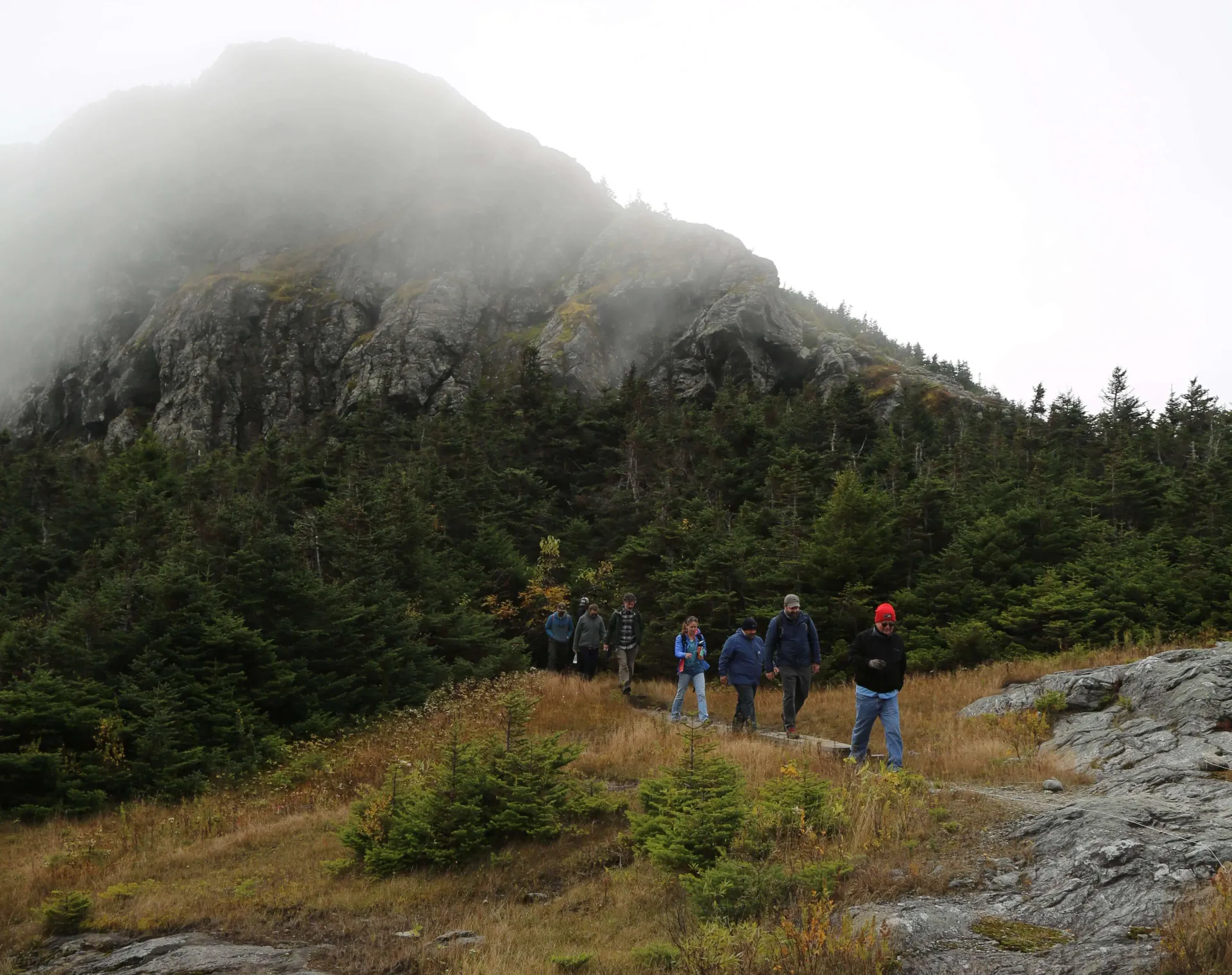
My favorite sites are perched along the elevation gradient of the Bruce Trail, a historic backcountry route famous for being the first purpose-cut ski trail in Vermont. Established in 1934 by the Civilian Conservation Corps, the steep trail drops 2,000 vertical feet from the top of Stowe Mountain Resort to the Cross-Country Ski Center. After replacing the battery, Maeve and I still had work to do. We took the Forerunner Quad to the top of Stowe Mountain Resort before dropping into the Bruce Trail.
Reaching these stations feels like a scavenger hunt. Using a Gaia map with pinned locations, we searched for each station—all of which are tucked into the woods just off the trail. At every stop, we popped off our skis and ran through a routine check: brush snow from the solar panels, inspect the instrumentation, and plug in the field computer to collect data. Between stops, we’re rewarded with a riveting ski down the bobsled-like track of the trail.
These automated weather stations are essential. They collect data that builds an understanding of elevation-based warming, changing mountain snowfall and runoff, mountain ecology, flood and avalanche danger, backcountry recreation, and tourism. Although the iconic Mansfield snow stake has been recording snow depth since 1954, snow depth alone doesn’t provide the full story.
These stations can provide researchers with snow-water equivalent, or SWE, which represents the total water content stored in snow and can vary depending on snow density. SWE allows us to see how much water can run off the mountain during melting events. Snowmelt delivers carbon and nutrients to waterways in Vermont, and with rapidly changing winters, we are seeing more mid-winter rainfall and icing events that implicate the snowpack and runoff characteristics.
***
Back on campus, Joshua Benes, the Associate Director at the WRI, and I are eager to parse through the Mount Mansfield historical datasets. We are interested in using these datasets to investigate Elevation Dependent Warming (EDW) here in Vermont. EDW is a phenomenon where higher altitudes can experience faster temperature increases compared to lower elevations. This can severely impact mountain ecosystems and hydrological cycles. Luckily for us, we have excellent long-term monitoring data from Mount Mansfield and down at the Burlington International Airport.
After graphing the historical data from the two locations, the results were surprising: Across every season, Burlington is experiencing more rapid warming than Mount Mansfield. Analyzing the seasons separately is essential to understanding long-term changes in weather and climate, especially in Vermont where we are seeing the most drastic changes in the summer and winter months.
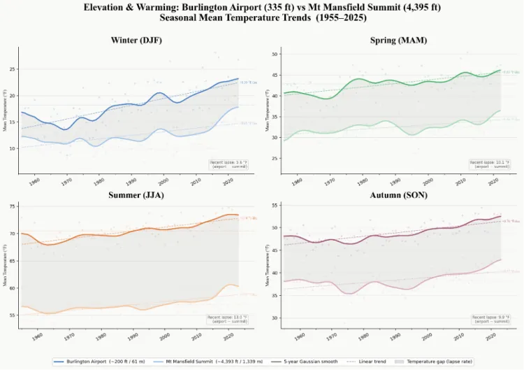
Vermont winters are seeing drastic and rapid warming. The warming climate in the low elevation valley where Burlington lies may be due to increased cloud coverage induced by a warmer atmosphere. This is no secret to anyone who has lived in Burlington over the past decade, as they have likely watched as the snowy winter days are being replaced with cloudy and rainy ones.
Seeing how rapidly our winters are changing here in Vermont is jarring. We are lucky enough to live in a state so connected to our natural environment and the cyclical nature of our seasons. Research, like the Summit to Shore initiative, will continue to help us better understand meteorological elements and climate change here in the Northeast, and how we can best be prepared for such changes.
As for now, I am so grateful for every day spent frolicking through the snowy Vermont woods and the opportunity to engage in science with a side of skiing.