Williston
Surficial Geology
Picture Williston as a lake shore and Brownell Mountain as an island. If you are having trouble with this, take a look at the lake level modeling map below. Can you find your road? What was happening at Taft Corners approximately 13,500 years ago? According to estimates based on lake shore features left by the lakes that formed as the glaciers receded out of the Champlain Valley, Lake Vermont occurred in stages (showed in shades of blue on the map) and reached an elevation of 580 to 660 feet.
So what does the lake level modeling have to do with the surficial geology in Williston? The surficial geology (which describes the loose sediments and their origins that overlay the bedrock) can be split into two dramatically different soil forming actions in Williston. The first being that the glaciers scraped over the bedrock and left behind the dense, rocky till. The second is the post glacial lake and sea history of the landscape. As you can see in the map image,these two actions divide the town into lake covered areas north of the interstate and glacially derived substrate south of the interstate.
The water derived soils are deeper and are found at lower elevations near the rivers and in the old lake bed. Shorelines left behind sandy beach-like features, and the rivers that emptied into the lake left sandy deltas at their mouths. At higher elevations, the soils are mainly glacial till derived.
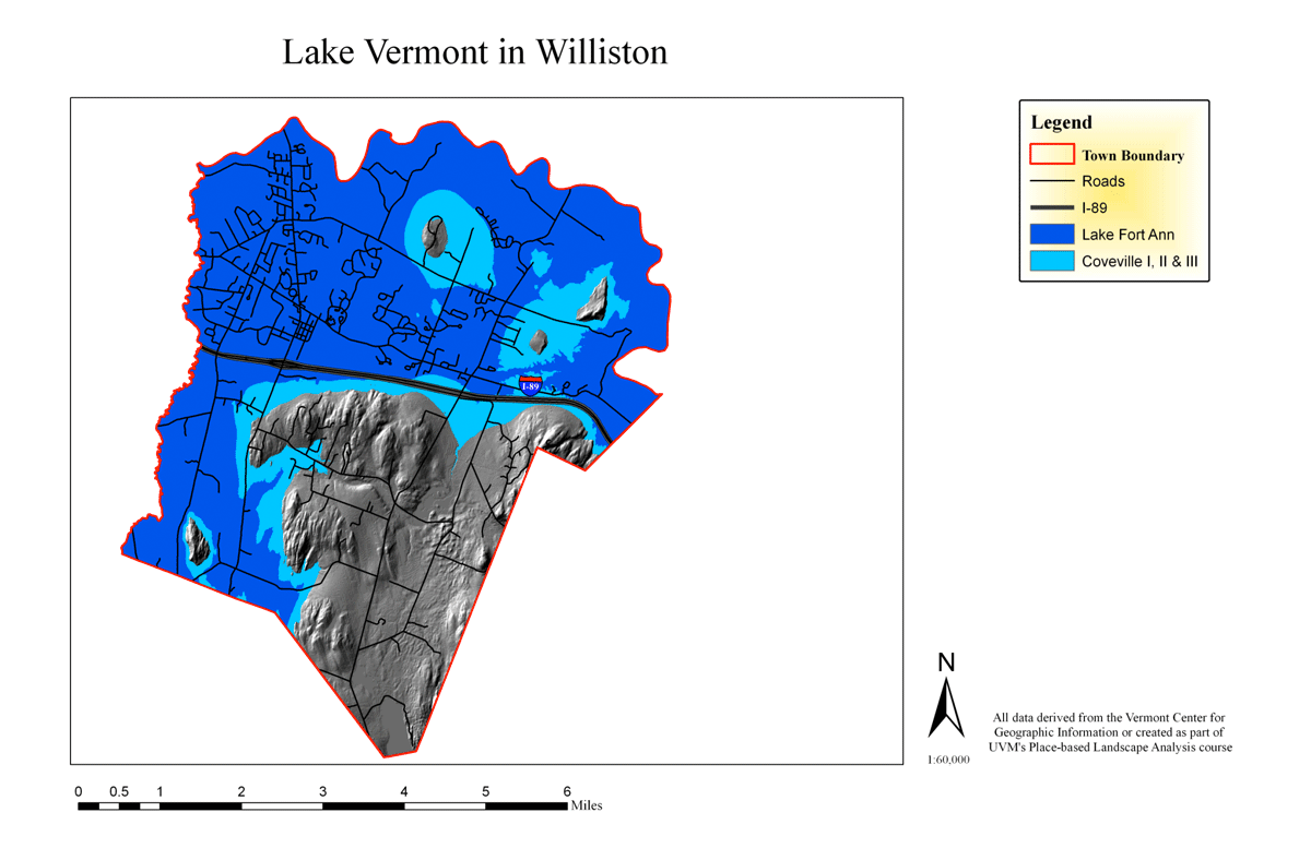
Area of Lake Vermont, over 13,000 years ago
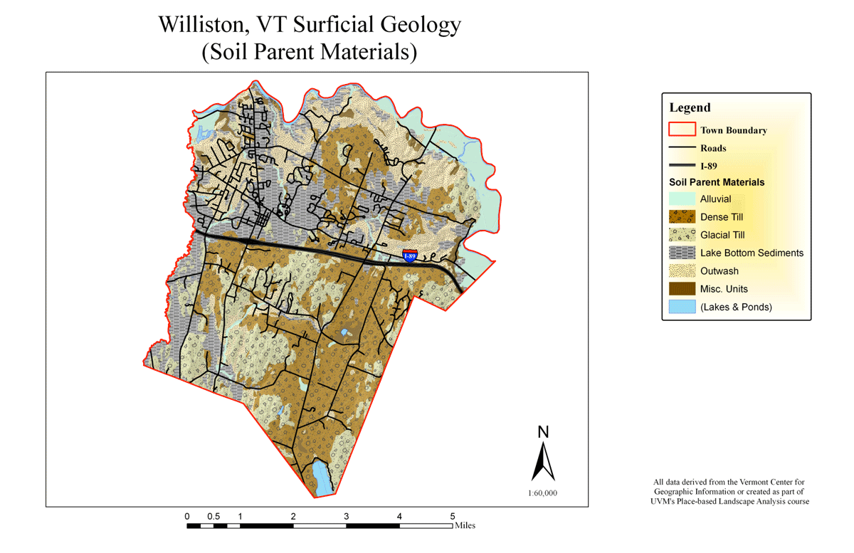
Surface geology map for comparison
These rocky, shallow soils are punctuated by water derived deposits or exposed bedrock, but are generally characterized by having a randomly distributed array of differently sized stones and particles suspended in the soil mixture. While these higher elevations were initially farmed as occurred elsewhere in Vermont, these locales were later abandoned in favor of richer and less rocky farm sites in valley bottoms, and along the Winooski River floodplain.