Analyze Your Town’s Cultural Landscape


View from Mt. Philo, 1955
The cultural landscape of Vermont is a rich text waiting to be read. It has deep layers of meaning and many stories to tell, but most people need to be taught how to read it. If you want to understand the human side of the Vermont landscape, the first thing you’ll have to do is to learn to look at it in a different way. You’ll need to learn to stop and really see all the human features in the landscape, even the most ordinary and easily overlooked objects, whether it’s a telephone pole or woods road or an old brick house, and the one-of-a-kind features, whether it’s a Native American pictograph or a grand hotel or a three-story round barn. All of these human structures and objects are there for a reason. Reading the cultural landscape means having a clear vision of the human features that are really there and understanding why they are there.

A typical Vermont town has human features on the landscape today that are remnants from many previous eras. The cultural landscape can be thought of as being created in layers during the distinct eras of human prehistory and history in Vermont. In learning to read the landscape, you’ll need to learn to see the layers. Here’s an example of how you might approach a common rural Vermont landscape, research it step by step, and learn how to read it and its layers of meaning.

Say you have found an old stone wall in the forested hillside near you. The first thing you need to do is to try to date the stone wall. You might do some research at the town clerk’s office and discover the wall was mentioned in an 1850 deed. You may not know exactly when it was built, but you know it is at least a mid-nineteenth-century feature. The next thing to do would be to look for other human features that could be the same age. You might follow the stone wall and find a cellar hole, and a small stone-lined hole in the ground, and a lilac bush. Human features tend to cluster in certain time periods, and the clusters can help you reconstruct what happened there. The cellar hole you find corresponds to a farmhouse site shown on a map from 1857 and on one from 1869. The small stone-lined hole uses the same building technique as the wall (no mortar, dry-stone), and you surmise it is a well for the farmhouse. The lilac bush is on the side of the cellar hole that faces an old road. It must have been planted there before it was forest, and probably long before. So, you associate all these elements from one era together, erase in your mind’s eye the recent additions to the landscape, and try to picture the mid-nineteenth-century farmhouse along the road, with a dooryard lilac and well, and open fields beyond fenced in stone.

If that stone wall now runs through the woods, you may also be able to research and see in your mind’s eye the farm failure, the abandonment of the farmhouse and farmland, and the natural forest succession of the twentieth century. You’ve started with one human feature on the landscape and learned to read what you see in greater depth.

Human use of the Vermont landscape reaches back 11,000 years, and each of the layers of human use can be looked at one at a time. To understand the prehistoric human layers of the landscape, you need to look mostly underground, and look at archeological excavations to see how early humans used the landscape. (If you’re interested in prehistoric landscapes, see the section that follows.) Most of the human features in the Vermont today, however, are from the landscapes created in historic times by the European settlers of the last 200 years.

If you’re interested in historic landscapes, see the European Settlement section that follows the prehistoric landscape section below, as well as the separate sub-sections on village and city landscapes, and rural, and industrial landscapes.

In the end, the everyday features around us teach us that our social biography gets woven into the physical fabric of our surroundings. If we choose to, we can learn to look beneath the surface of the landscape we travel through and see the evolution of our cultural and natural history. The stories that people have written into the landscape are amazing and revealing, and waiting to be read and understood.

» Prehistory

Humans first came to Vermont about 11,000 years ago, and the prehistoric eras in Vermont cover the story of the earliest human use of the landscape up to about 400 years ago, when the first Europeans came. Our understanding of these eras comes primarily from archeological work.

Paleoindian period

11,000 - 9,000 BP
The first evidence we have of people in Vermont were of those that came following the migrations of big game animals, such as woolly mammoths and caribou, that lived in the tundra environment of post-glacial Vermont. These people are called Paleo-Indians by archeologists, and they are thought to have lived a nomadic life in small, dispersed bands. A few stone tools, mostly spear heads, that date from 11,000 to 9,000 years ago have been found in Vermont. Some Paleo-Indian sites have been found along the former shorelines of the Champlain Sea.

Archaic period

9,000 - 3,000 BP
Over the next several thousand years, as the climate warmed and the forests returned, the human evidence changes, too. Native Americans living here developed a culture that was based on groups of hunters and gatherers moving between seasonal food resources in different environmental zones. These people were called Archaic Indians by archeologists. Food remains at archeological sites can be used to help interpret the distribution of prehistoric environments, i.e. an Archaic campsite with bear bones could indicate the proximity of good bear habitat during that time. Many stone tools, spear heads, and other artifacts of this era have been found in Vermont dating from 9,000 to 3,000 years ago.

Woodland period

3,000 - 400 BP
The human culture and use of the environment evolved again starting about 3,000 years ago into what is called the Woodland Indian era. People still hunted and gathered and moved around seasonally following food resources. But they became more river oriented, and began to create larger settlements near the mouths of major rivers and smaller sites along smaller tributaries and inland ponds. Agriculture came in with the planting of corn about 700 years ago in some areas. Many artifacts have been found that date from 3,000 to 400 years ago, including pottery and arrowheads, both of which were first made during this era.

Contact period

400 BP - present
The Contact period in Native American history (after the Europeans came in 1609) is not well documented by archeological evidence in Vermont. The spread of serious European diseases is know to have depopulated areas of North America, which probably included Vermont. As more archeology is done in Vermont, more evidence may come to light about the human use of the landscape in this era.

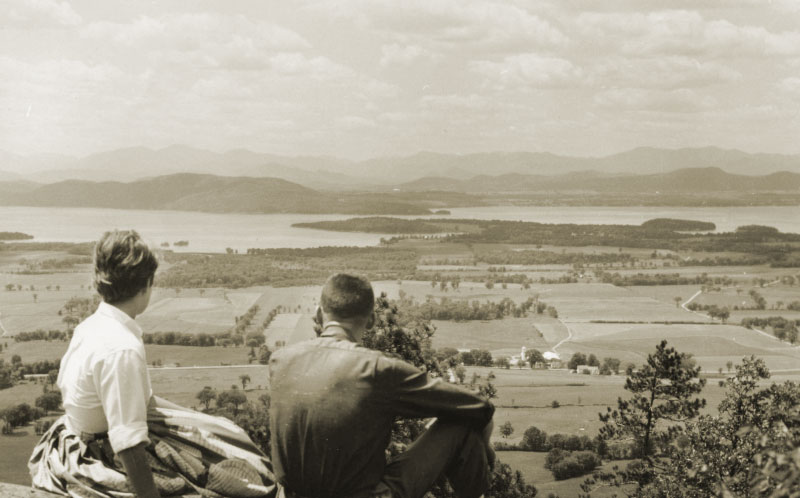
Even though there are almost no human features visible above the ground that date back to prehistoric times, knowing how prehistoric Native Americans used the landscape may change the way you see the physical landscape today. For example, a recent archeological excavation on a south-facing terrace above the Winooski River found evidence of an extensively used Woodland era camp site with many deer bones and stone tools for processing deer hides. By looking at the soils types and landforms nearby, archeologists determined that an area just below the site was probably winter deer yard habitat during that time. The quantity of deer related pieces increased dramatically near the upper layers of the excavation, and led archeologists to wonder about whether this site was used into the early Contact era, and the deer were being harvested, the hides dressed, and then sold to Europeans. That river terrace was later farmed, and now has a cluster of family homes on it, but after the archeological dig, it will never look the same to those who know how it was used in the past. It shows us very clearly how different human cultures can use the same landscape very differently.

Archeological sites are scattered unevenly across the state, and some of the sites are sensitive. To find out more about archeological evidence in your town, contact the State Archeologist’s Office in the Department of Housing and Community Affairs, the Vermont Archaeological Society, or the UVM Consulting Archeology Program.

Prehistoric Landscapes Example

At the Ewing archeological site near Shelburne Pond, more than 75,000 artifacts have been excavated. They date from the Early Archaic period, about 8,000 years ago, through the Woodland period, and into the Early Contact period up until about 300 years before the present. From analyzing these artifacts, we know that Native Americans used this site repeatedly for thousands of years, probably as a seasonal camp.

dugout canoe
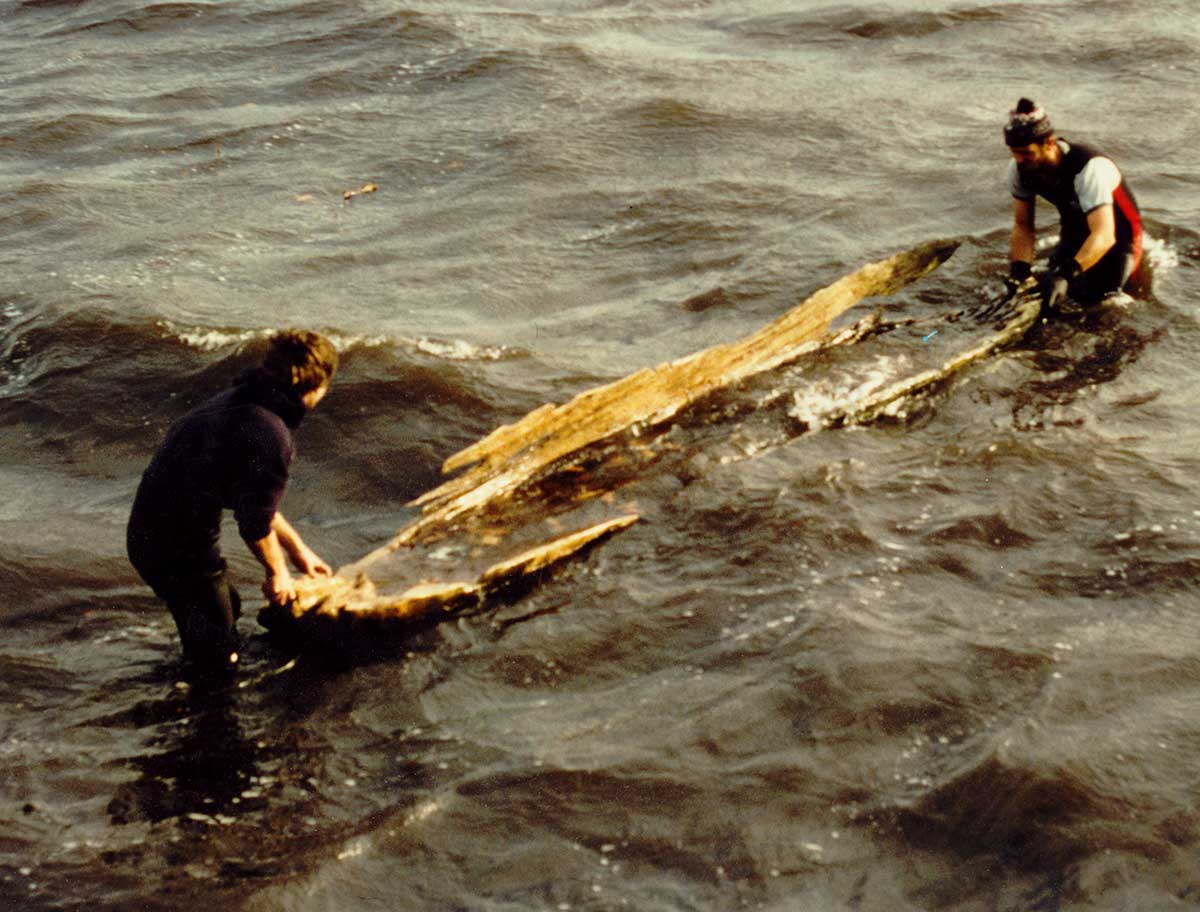
Dugout Canoe Found Dating to Circa 550 BP
Click to see larger image

They erected buildings, hunted, fished, gathered plant foods, cooked food, and made baskets, pottery, stone tools, and canoes here. From the evidence of the food remains found, the environment around Shelburne Pond was rich and varied (no doubt due to the carbonate-rich soils of the area).

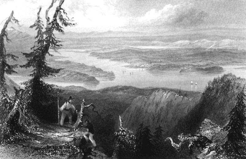
Since the Woodland-era Native Americans here were a riverine people, it is also useful to look at the Shelburne Pond site in the context of the regional watershed. Notice that Shelburne Pond’s outlet is Muddy Brook, flowing north into the Winooski River. The Winooski was known to have been extensively used by Native Americans and provided a connection to Lake Champlain and beyond. So, the Shelburne Pond site was accessible by canoe from other known Native American use areas and was probably part of a network of seasonal camps.

Resources

» European Settlement


Drawing, 1700s,
Lake Memphremagog
Most of the cultural landscape features you see today in Vermont are from the historic era. Europeans arrived in Vermont in 1609, and some early French settlement occurred along Lake Champlain. But the major impact of the Europeans came with the English settlers from the south in the late 1700s. When the Europeans arrived, they came to an almost entirely forested landscape, and systematically transformed it, over several generations, to an almost entirely cleared farming landscape with occasional small villages. This enormous landscape change is the underlying framework of most of the cultural landscape we see today. The landscape continued to evolve and is still evolving today, and we have remnants in the landscape of all the eras in European use of the land.

Settlements
As the initial clearing of the forested landscape progressed, the nineteenth-century Vermont farming landscape evolved into thousands of farmsteads dispersed over almost the entire state (below about 2000’ elevation). Each farmstead eventually consisted of a farmhouse and cluster of farm buildings surrounded by farm fields, hay meadows, pastures, and woodlots. In the higher elevations above 2000’, logging cut over virtually all of the land at one time or another.

Over the last 100 years, the landscape has evolved back into a mostly forested landscape again. The farming landscape is greatly reduced in extent and is now concentrated along the flatter and lower elevations lands, and the mid and high elevation hills are largely grown back to forest again. Cities and suburbs have developed, and the landscape has seen a repopulation of rural areas with residential housing.

Villages also developed very early in European settlement history. The first villages were centered around the waterpower sites, or near the geographical center of town. Many villages of today have retained their 150 year old core and grown only at the edges, and others have evolved into cities. If you are interested in more detail about village and city landscapes, see the following section.

Vermont also has a history of small resource-based industries, such as marble quarries, that have developed outside the boundaries of villages and cities where other industry has traditionally been based. A short section on these special cases can be found below.

The landscape patterns we see today are a mix of pieces left from all the previous eras in settlement history. Sometimes a feature retains its original use, such as an old schoolhouse still in use. Sometimes old features are updated but still serve essentially the same purpose, such as a modern tarmac road along the trace of a 250 year old military road, Sometimes features are altered and used for different things, such as a 100 year old hotel made over into apartments. But with the assistance of research tools, you can learn to decipher even the most complex of human landscapes, and tease out the original layers of the human use of the landscape.

Historic Landscapes: European Settlement in Shelburne:

aerial view of Shelburne covered in snow
Abstract lot lines become visible from the air

The colonial governor of New Hampshire, Benning Wentworth, established Shelburne’s town lines in 1763, and, soon thereafter, lines were drawn on the town map dividing the entire town into large rectangular lots. Lots were sold to farm families mostly from southern New England, and settlers came and began to clear the land. As they established their fields, pastures, and fence lines, the abstract lot lines drawn on the eighteenth-century paper plan became tangible and visible on the landscape. Many of those original lot lines persist on the land today, and give the landscape much of its underlying geometry.

» Ira Allen's 1775 Map of Lots in Shelburne

Resources

» European Settlement: Rural Landscape

The rural landscape of Vermont covers the vast majority of the state, and includes the farming landscape and the forested landscape. From the earliest subsistence farms in the late 1700s to the most modern dairy farms, Vermont’s rural landscape has been dramatically shaped by farming. As farming has evolved, the landscape has evolved with it. It’s not unusual to see a cluster of old apple trees in a 75 year old forest, or to see a modern free-stall barn next to a 120 year old bank barn. To understand the rural landscape you see today, you need to understand the earlier farming and logging patterns, from which it evolved.


Vermont in the 1700s
Farming in Vermont began with the Europeans, especially the English settlers from the south in the late 1700s. Towns were divided into rectangular lots and sold to farm families. So, from the very first, the landscape was one of dispersed farmsteads spread across Vermont. The settlers arrived to a mostly forested landscape and began to clear the forest by hand. The first generation was largely subsistence farmers, clearing small acreages, and eking out a living for their family. The pattern was one of small clearings of a few acres dotted throughout a mostly forested landscape. Few farm buildings remain from this time, although sometimes the original farmhouse remains as an ell on a more modern addition.


Vermont in the 1800s
For most farmers, the first conversion of their land into market-oriented farming came with the sheep boom of the 1820s. Hillside after hillside in Vermont was cleared for sheep pasture as Vermont farmers raised wool for the very profitable world wool market of the time. Small 30’ X 40’ English-style barns were built during this time, and some have survived to this day. Many Vermont farmhouses, or a section of them, date to this time.

About 1850, the long run of dairy farming started in Vermont as the bottom dropped out of the sheep market. Although there had been dairy cows before 1850, they became the center of the farming economy after 1850. Barn designs changed and barn sizes increased. Hay and grain fields were expanded for cows (and the horses needed to run the machinery that made these farms profitable). Farms produced primarily cheese and butter, which were much less perishable than fluid milk. Houses were enlarged as farm families accumulated wealth. The rural Vermont landscape reached its most cleared extent during the second half of the nineteenth century.


Vermont in the 1900s
Around 1900, dairy farming shifted over to fluid milk production as improvements in refrigeration and processing occurred. Small cheese factories and creameries became common in villages. Barbed wire became cheap, and new fencing was done more often with wire instead of stone walls. As the national economy changed in the early twentieth century, hill farming became much less viable here, and farming in large areas in the hilly parts of Vermont was abandoned. Much farmland was reclaimed by natural forest growth, and some small softwood plantations were put in on old farm fields. Successful farms were left along river bottomland and the flatter valley areas of Vermont. The twentieth century barns we have in the state are concentrated there and are uncommon in the higher hill sections. Field sizes increased on the working farms during this era, and old hedgerows and fence lines were removed to accommodate larger machinery.

At higher elevations in Vermont, where the growing season was too short to successfully farm, logging was carried out throughout the latter nineteenth century and into the twentieth century. Although the forests have largely grown back and there are very few human artifacts from logging left up high, the forest age and composition is related to the human use of the landscape.

Barn styles

Bank barn from latter 19th Century

The style of barns used on Vermont farms changed through time as scientific research suggested improvements in barn design and as the type of agriculture evolved through two centuries. Each distinct era of agriculture had a distinct barn type, and one can learn to quickly guess at a barn’s age and past use just by its style. This is especially easy to do with what are probably the two most common barn styles in Vermont: the bank barn and the gambrel-roof barn.

The bank barn is a very common feature in Vermont, and typically dates to the second half of the nineteenth century.

Gambrel-roof barn from early 20th century

If you see a bank barn, you can guess that it was part of an active dairy farm of that era, and the bigger the barn, the larger the herd. The gambrel-roof barn is another common barn, and typically dates to the first half of the twentieth century. If you see a gambrel-roof barn, you can guess that this was an active dairy farm into the twentieth century.

Shelburne has more gambrel-roof barns than many of the more mountainous towns in Vermont, because dairy farming was much more viable in Shelburne well into the 20th century. The relative abundance of this type of barn is testimony to the richer limy soils, the relatively flat land, and the warmer climate of Shelburne, compared to many regions of Vermont.

Resources:

» European Settlement: Village Landscape

Almost every one of Vermont’s 251 towns has at least one village, and often several. Villages played an important role in the European settlement of the land by serving the predominantly farming population with civic and commercial functions. There was usually one established near the geographical center of town at the earliest stages of settlement for the site of the town hall and church. Other villages grew up around particular resources in town. The character of the village depends on its origins.

Villages were often centered around the best mill sites in town. Every town in Vermont had a sawmill and probably every town had a grist mill, too.

Grist mill workers standing outside mill

Grist mill workers, late 1800s

The life the early settlers came to create required both a sawmill to make lumber for the type of buildings they favored, and grist mills to grind the grains upon which their economy was based. Many town charters made special mention of waterfalls for mill sites since they were key components to a successful farming community. Small businesses catering to farmers became associated with these mills, too, such as tanneries, blacksmiths, and small general stores.

Later on in the nineteenth-century, the best waterpower sites also supported small industries that marketed their goods outside of the immediate farming communities, often via railroad to urban areas. As electricity became available in the early twentieth century, some mill villages were abandoned and some evolved into residential areas or other uses.

Villages were also established around transportation hubs. In the late eighteenth and early nineteenth centuries, turnpikes and stage routes had periodic stopping places to feed, water, and rest passengers and horses. Some villages grew up around these stagecoach stops. Later in the nineteenth-century, railroads were built and the area around the new depots often developed into villages.

Cities in Vermont grew from villages that had some unusually good feature that attracted growth. The landscape patterns of cities are actually very similar to those of villages, just on a much larger scale.

The location of Vermont villages is no accident, and to understand the village landscape, you need to understand the village’s origins and how its functions changed through time.

Shelburne Village

village maps of Shelburne

Maps of the two villages in the 1850s and the two villages grown together in the 1980s.

Shelburne village as it is known today actually began as two very distinct villages with two different functions, and only grew together to be one large village in the late twentieth century. Vestiges of the original villages can still be seen today.

The village of Shelburne Falls began around 1785 at the large waterfall on the LaPlatte River in the southeastern part of town. It was a mill village, with a sawmill and a grist mill running on the water power. (These two types of mills were critical to the early development of virtually every town in Vermont.). Other types of mills operated at the falls later on, but the two core mills remained into the twentieth century, primarily supporting the farming community of Shelburne and environs.

Shelburne village (northwest of Shelburne Falls) started in the 1790s as a stagecoach stop on the road from Middlebury to Burlington. An inn (which is still there), a store, blacksmith shop, distillery, and other businesses related to stage travel were established. Later, this village became the civic center, and the town hall, churches, and a merchant’s row were built. The railroad was routed through this village in 1849, further cementing the village’s central role in town life.

During the second half of the twentieth century, the population in Shelburne increased almost seven-fold, and the villages grew together. The core areas of both original villages have eighteenth and nineteenth century buildings, and the housing that filled in between the villages is mostly ranch-style of the late twentieth-century.

Resources

Look at your local library or historical society for:

  • Walton’s Vermont Register and Almanac from 1818 on
  • Sanborn Fire Insurance maps from the 1880s to 1940s
  • Birdseye view lithographs from the late 1800s
  • Local newspapers, town histories
  • Henry F. Walling’s maps from the 1850s
  • F.W. Beers’ atlases from the 1860s and 70s
  • Hamilton Child’s Gazetteers from the 1880s
  • Electrification maps from the early 1900s
  • Old photo and postcard collections, aerial photos from the 1927 flood
  • Diaries or account books from local business people
» European Settlement: Industrial Landscape


Winooski woolen mill, 1890
Industrial landscapes develop around specific industrial sites. Many industrial sites are in villages or cities in Vermont. But there are industrial sites that are in neither, especially ones that are based around a natural resource, such as stone quarrying. Utilitarian industrial buildings, quarry holes, small collection of caretakers houses, and the like, may be clustered together, but distinct from a surrounding farming landscape or from a village or city, and have an entirely different character. Especially if the site is from the eighteenth or nineteenth-century, look for the natural resource it is based on. Twentieth century sites may be unconnected to the natural resources, but owe their location to some other human factor.

Shelburne’s Industrial Landscape


Hand-made bricks; Brick house, Shelburne

Shelburne has a number of brick houses dating from the early nineteenth century. During that time in Vermont, virtually all brick was manufactured locally from local materials using simple hand techniques. There is considerable evidence that the brick for the houses was made in Shelburne.

An old town history mentions a brick kiln site in the northern part of town in the 1840s, and an oral tradition still exists in town about the kiln’s location. Investigating the site showed a large, squarish pit in the ground (possibly where clay would have been kneaded), and a myriad of broken bits of old brick all through the adjacent corn field.

Extensive clay soil, an essential raw material, extends all throughout the eastern half of Shelburne, and ran directly through the historic brick kiln site. (The clay soils were deposited on the bottom of a glacial lake at the edge of the melting continental glacier about 12,000 years ago.)

There are at least ten brick houses nearby that date to the same time that the brick kiln is reported to have been operating. At one of those brick houses, the owners had recently repaired an original brick wall and had found handprints and other obvious signs on the bricks that they had been hand made.

The nineteenth-century brick houses were built as farm houses and villages houses, but for us they are a legacy of a time when even bricks were made by hand with materials immediately at hand.

Resources

Look at your local library or historical society for:

  • Industrial census information
  • Henry F. Walling’s maps from the 1850s
  • F.W. Beers’ atlases from the 1860s and 70s
  • Hamilton Child’s Gazetteers from the 1880s
  • Walton’s Vermont Register and Almanac starting in 1818
  • Town histories
  • Old postcard and photograph collections