|
|||||||||||||||||||||
|
Town Analyses > Hinesburg > Owl's Knoll
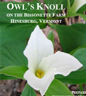
A Local Educator's Field Guide to Owl's Knoll![]() Prepared by Kristen Sharpless, University of Vermont, Field Naturalist Program. Downloads:Full field guide [PDF] (109mb)Maps [PDFs]:1. Regional Map (9.1mb)2. LaPlatte River Watershed (1.1mb) 3. Educational Hotspots (588kb) 4. Soils (684kb) 5. Stands (3.7mb) 6. Natural Communities (524kb) 7. Featured Wildlife Habitats (3.5mb) Pond Brook Dam and Waterfall
Zoom in on this photo, or view the photo page. Hinesburg in the early 1900's
Zoom in on this photo, or view the photo page. 1869 F.W. Beers Map of Hinesburg
Zoom in on this photo, or view the photo page. Farm Relics in the Hinesburg Town Forest
Zoom in on this photo, or view the photo page. Mills of Mechanicsville
Zoom in on this photo, or view the photo page. Cultural sites in the Hinesburg Town Forest
Zoom in on this photo, or view the photo page. Historic map of the Hinesburg Town Forest
Zoom in on this photo, or view the photo page. Stonewalls in the Hinesburg Town Forest
Zoom in on this photo, or view the photo page. Bisonette Sugar Shack
Zoom in on this photo, or view the photo page. Beers Atlas Map of Mechanicsville
Zoom in on this photo, or view the photo page. The Old Mill today
Zoom in on this photo, or view the photo page. History on Lincoln Hill
Zoom in on this photo, or view the photo page. |
||||||||||||||||||||
| |||||||||||||||||||||