Predicting floods, specifically in mountainous terrain, has long been a major challenge. Now, University of Vermont (UVM) scientists have demonstrated how artificial intelligence can significantly improve streamflow prediction in these complex environments.
Research published today in the Journal of the American Water Resources Association reveals that one of the federal government's newer forecasting systems—the National Water Model—can be significantly enhanced with AI and real-time data. The UVM team has developed a new model that implements these developments, providing more reliable predictions of peak streamflow and timing, particularly in mountainous regions where current forecasts frequently fall short.
"Our machine learning framework can be used as an advanced error-correction tool for the National Water Model (NWM),” says Mirce Morales-Velazquez, the study’s lead author. “While we initially tested it on past NWM simulations in mountainous watersheds, it is adaptable and can be used to improve future forecasts. It holds significant potential for enhancing performance across a wide range of catchments throughout the contiguous United States.”
Most of the world’s river systems originate in mountainous settings, where they play a critical role in determining water quality, quantity, flooding, and nutrient movement.
Yet, despite their importance, these headwater streams are often inaccurately represented in forecasts across the United States, creating serious gaps in high flow and flood prediction.
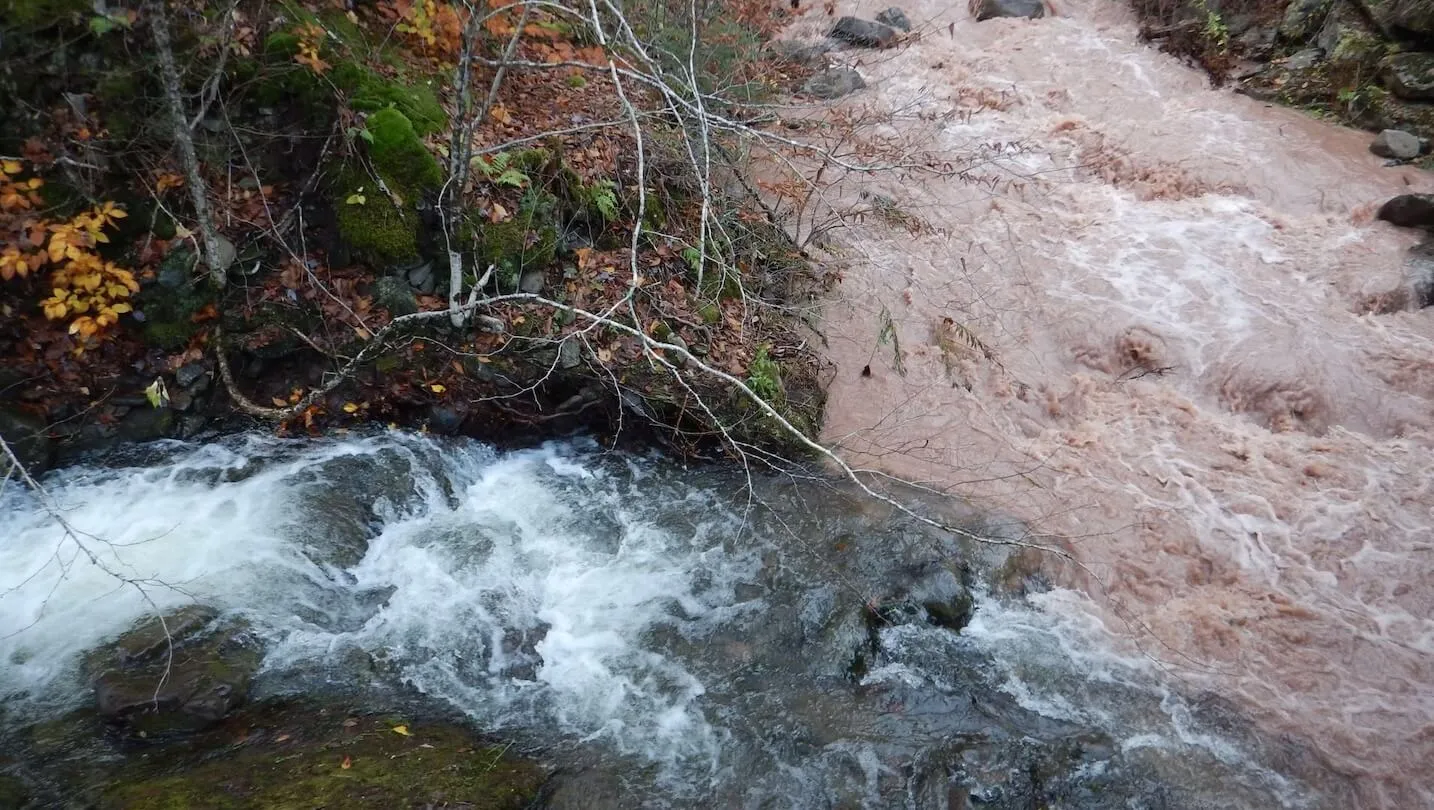
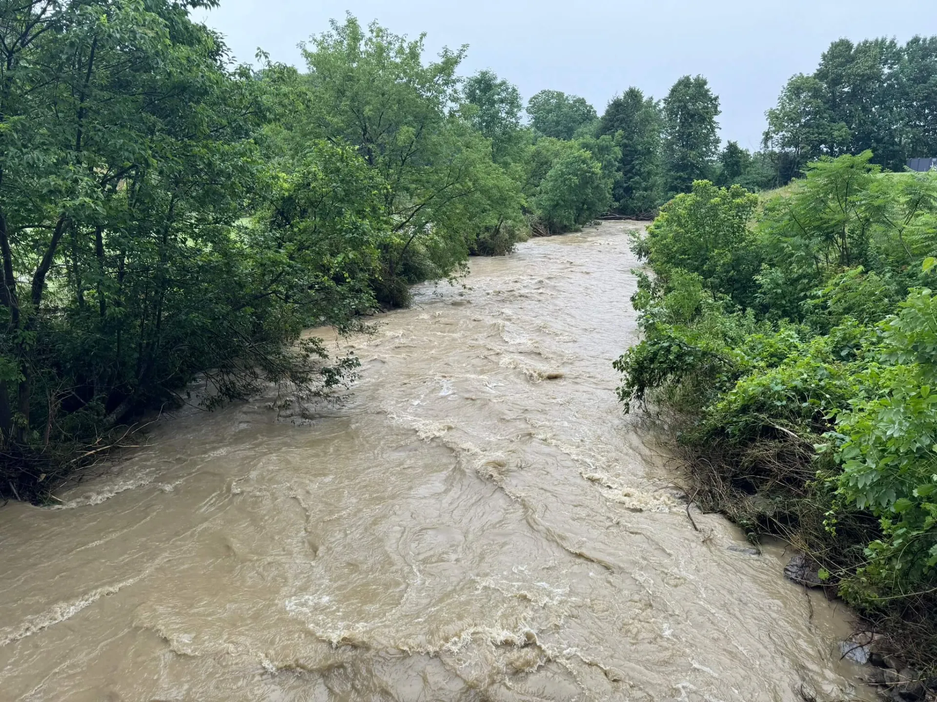
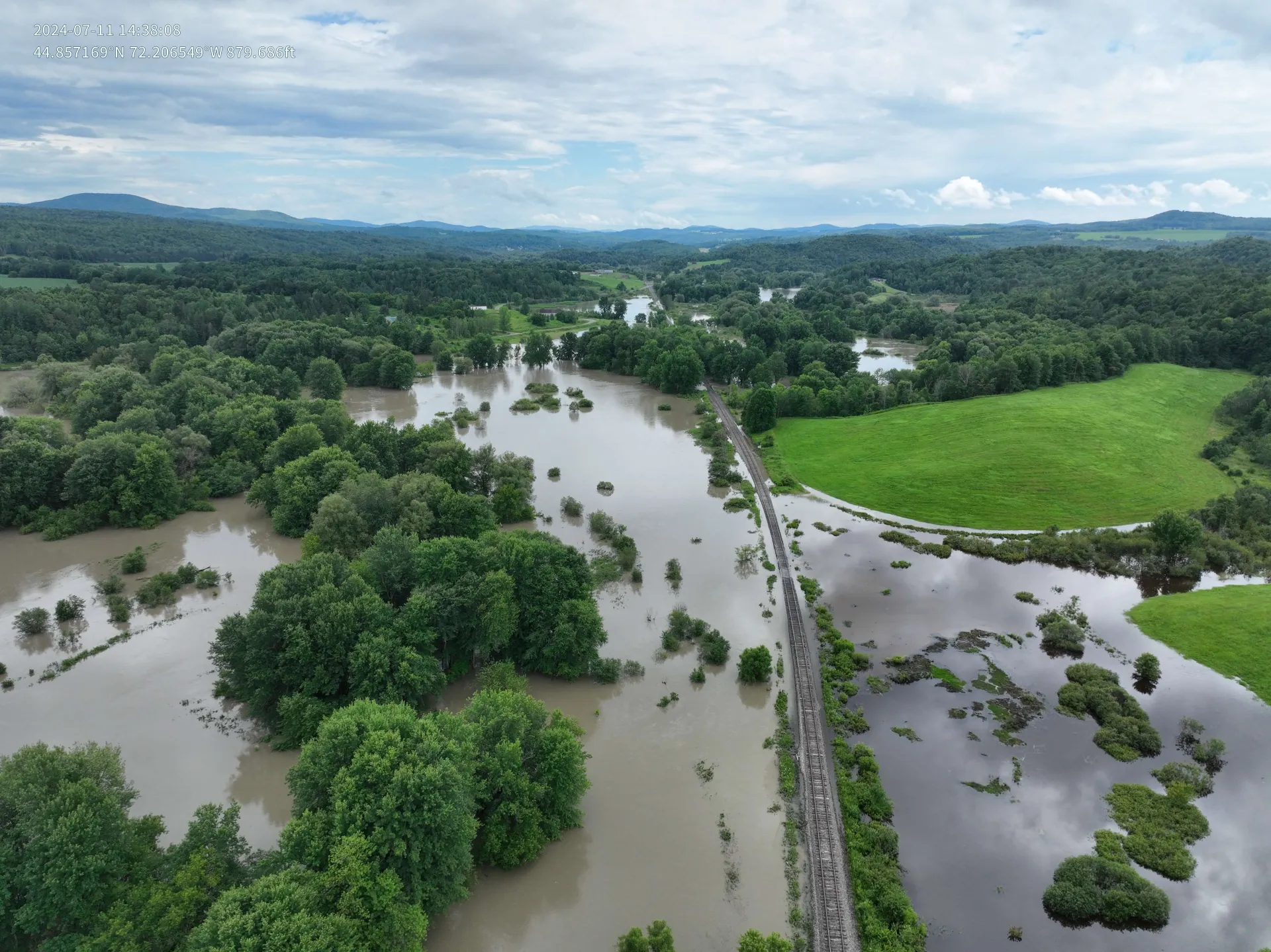
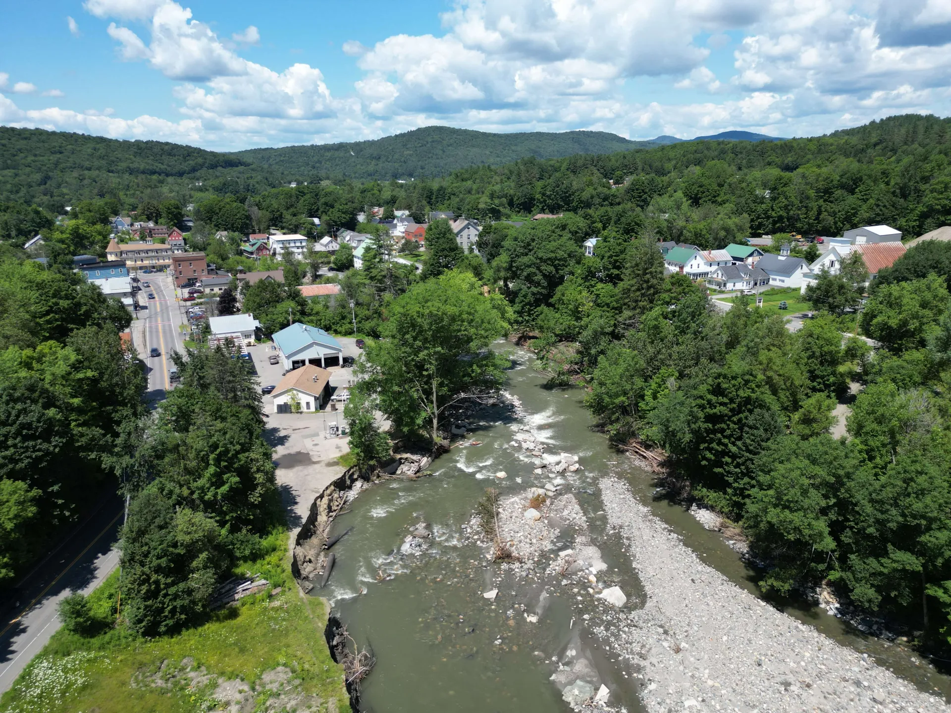
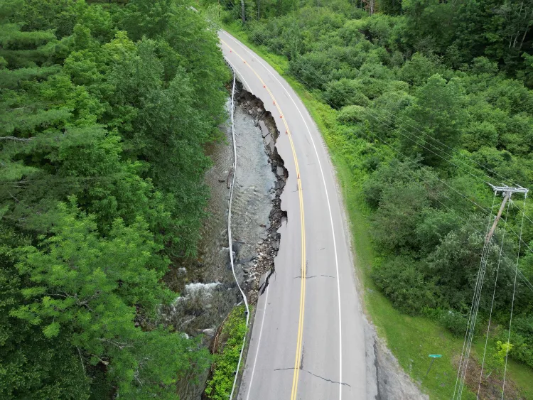
These imprecisions have real-world consequences. Mountain communities are especially vulnerable to flash floods and extensive erosion damage. In July 2023 and again in July 2024, catastrophic flooding in Vermont caused over $2.2 billion in damage, destroying property, washing out roads and bridges, and triggering landslides and mudslides.
“Given the increasing frequency and severity of floods, accurate forecasting is extremely important,” explains Morales-Velazquez, a post-doctoral scholar at UVM’s Water Resources Institute and the Department of Geography and Geosciences. Not only do these predictions guide emergency warnings, but they shape community planning, infrastructure decisions, and response efforts.
The newly published research, led by UVM researchers Dr. Mirce Morales-Velazquez, Dr. Andrew Schroth, and Dr. Beverley Wemple, in collaboration with U.S. Geological Survey scientist, Dr. James Shanley, found that the National Water Model (NWM) consistently underestimates streamflow in complex watersheds, particularly during snowmelt, spring runoff, and high flow events.
To address these shortcomings, the researchers developed a new AI model that leverages real-time data – including rainfall, snowpack, and stream water levels – with NWM predictions. The model resulted in a dramatic improvement in hourly streamflow accuracy, better predicting both the magnitude and timing of high flow, which triggers floods.
“There's often a significant lag between research advancements and their full implementation in operational models,” says Andrew Schroth, Associate Professor of Geosciences at UVM and Principal Investigator of the project funding this study. “A post-processing tool like this offers a flexible, relatively quicker way to bridge that gap and deliver immediate, actionable improvements to forecasts. Asmodel development evolves over time, this tool can relatively seamlessly become incorporated in new models. This is particularly important in the case of the National Water Model, as it is constantly evolving and improving through federal, private and academic collaborations, many of which are facilitated by the Cooperative Institute of Research to Operations in Hydrology, of which UVM is a key partner institution.”
The model benefits from low-cost water level sensors, collecting data from streams at frequent intervals. These relatively inexpensive instruments help fill gaps in the nation’s stream gage network and help improve model performance, specifically in small, steep watersheds that often trigger floods in settings like those of the mountains of Vermont, but are rarely monitored.
This work provides a template for empowering local communities to improve the performance and inherent utility of the National Water Model for their watershed of concern.
The team evaluated NWM performance in 19 mountainous watersheds across the Northeast and tested the AI correction model on five areas across Vermont. In all locations, the newly developed AI model outperformed the NWM. It reduced streamflow errors by more than 60% and more accurately improved peak timing predictions by several hours.
This method is scalable, offering a roadmap for boosting flood resilience in complex terrain. With many local meteorological and water level sensors already in place across the United States, this AI-enhanced model can be deployed widely, and affordably.
The team’s approach can transform the National Water Model into a far more valuable tool for predicting flow, especially for communities in flood-prone mountainous terrain that dominate so much of the interior eastern U.S. from Georgia to Maine. This tool has potential to both improve resilience and save lives.
The study was supported by NOAA's Cooperative Institute for Research to Operations in Hydrology, which aims to advance the capacity for operational hydrologic forecasting of streamflow, floods, droughts, and water quality.