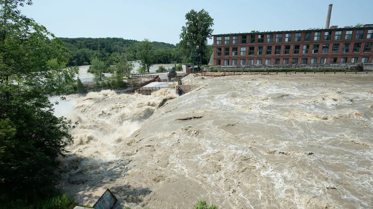
The flood of 1927. Tropical Storm Irene in 2011. Historic flooding in 2023 and 2024. Vermonters are no strangers to extreme weather and the ways climate change exacerbates the impacts of natural disasters. But when the worst happens, Vermonters don’t see strangers—only neighbors who need help.
As Vermont’s land-grant university, the University of Vermont, too, aims to serve the people of the Green Mountain State. From agriculture to zoology, the research that happens here helps keep Vermont’s woods and waters clean, Vermont farms productive, and communities safer and healthier.
This month, we’re sharing research from UVM’s Gund Institute for Environment and Water Resources Institute that improves lives and livelihoods in Vermont every day. Today, we’re highlighting four flood-related research projects that are helping residents of the Green Mountain State.
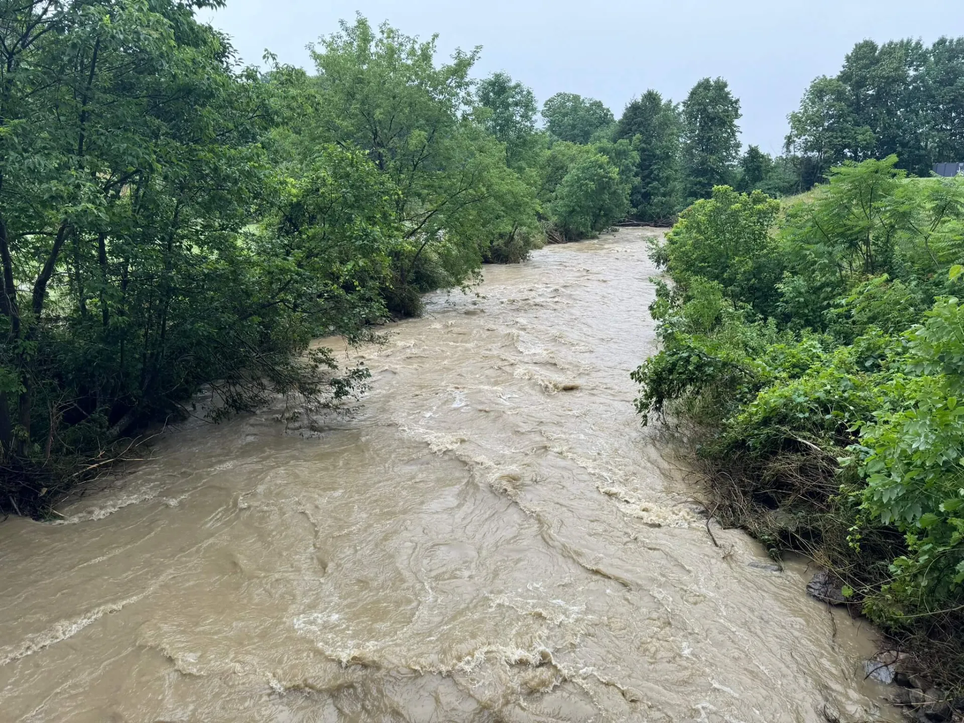
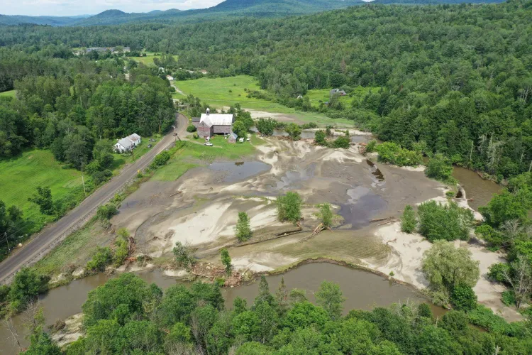
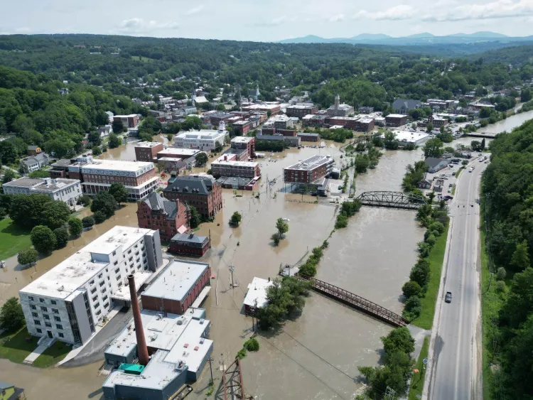
Recent flooding has caused severe damage throughout the state of Vermont, with the July 2023 floods alone resulting in two fatalities and more than $1 billion in damages. Flooding is rapidly becoming one of the most widely experienced and costly natural disasters here.
How do UVM researchers even begin to address this issue?
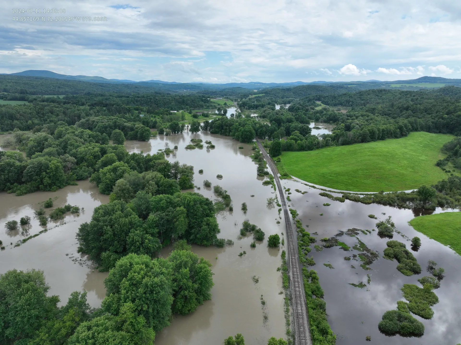
Understanding floodplains to build flood resilient communities
Rebecca Diehl and Kristen Underwood, research associate professors at UVM, are starting by mapping the state’s floodplains and rivers.
Floodplains—low-lying areas adjacent to rivers and streams—can play a crucial role in reducing flood impacts, as they influence how water moves across the landscape. They act as a natural buffer, temporarily storing floodwater, in a phenomenon called attenuation.
However, not all floodplains are created equally.
While these natural landscapes have the potential to reduce downstream flooding, the researchers say it’s important to understand which floodplain characteristics are most effective in creating flood resiliency.
Underwood and Diehl are developing computer models that simulate floods in those rivers and their tributaries, allowing them to explore alternatives for floodplain and river restoration.
For example, along the Great Brook in Plainfield and a separate Great Brook in Middlesex, communities are grappling with flooding impacts. In these communities, the UVM team is collaborating with the Agency of Natural Resources, SLR Corporation, and Norwich University to better understand the magnitude of past events and design infrastructure to withstand future storms.
They are mapping high watermarks to calculate the maximum streamflow that coursed through the riverbed during the peak of the floods.
“If we're able to identify the floodplains that are most effective at attenuating flows, we can then help direct Vermont’s very limited resources toward those more effective projects,” Underwood explains. “In the process, we can also reduce the flood peaks and the flood power to downstream communities and reduce the impacts of future floods.”
This project, which is federally funded, is expected to come online in Fall 2025.
Utilizing nature-based solutions
Urban development also influences how flooding impacts local communities.
As warmer temperatures fuel heavier rain and cities replace natural landscapes, stormwater systems become overwhelmed and runoff increases, putting more people and properties at risk.
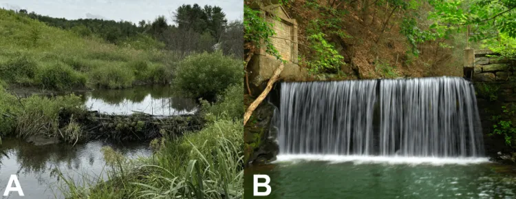
Nature-based solutions, such as restoring wetlands and reconnecting floodplains, offer effective ways to reduce flood risk.
These landscapes absorb and slow floodwaters, while providing added benefits such as cleaner air, carbon storage, biodiversity, and recreational space—advantages that traditional “grey” infrastructure, such as dams and levees, typically do not offer.
Despite their benefits, nature-based solutions are underused. Dr. Jessica Balerna, a post-doctoral scholar with the Climate Measurements Center for Excellence, rolled out a nationally representative study to better understand public preferences, knowledge, and support for nature-based solutions compared to traditional flood infrastructure.
The study, which is expected to be published soon, revealed that while many people recognize the value of engineered structures, interest is growing in natural alternatives, specifically when their additional benefits are realized.
However, public understanding is limited. Only about half of the respondents knew that wetlands reduce flood risk, and many couldn’t define key flood terms.
When asked about how municipalities should use public funds to mitigate floods, most respondents preferred a balanced approach, with a 50/50 investment between natural and engineered solutions. Balerna said that shows people are not necessarily opposed to natural solutions, but they are more comfortable when they are paired with traditional infrastructure.
Brendan Fisher, professor in the Rubenstein School and co-lead on the project, said “there is not much work comparing the full costs and benefits of nature-based solutions and hard infrastructure approaches to flood mitigation. There are going to be places in the landscape where one option is going to make much more sense than the other. Natural solutions offer a suite of co-benefits to people and biodiversity when preferred, but our work here shows that the average citizen isn’t that familiar with just how, and how much, natural solutions can benefit them."
Public education and community-based planning are key to the public becoming more informed about flood mitigation measures, reshaping management strategies for a safer, more resilient future.
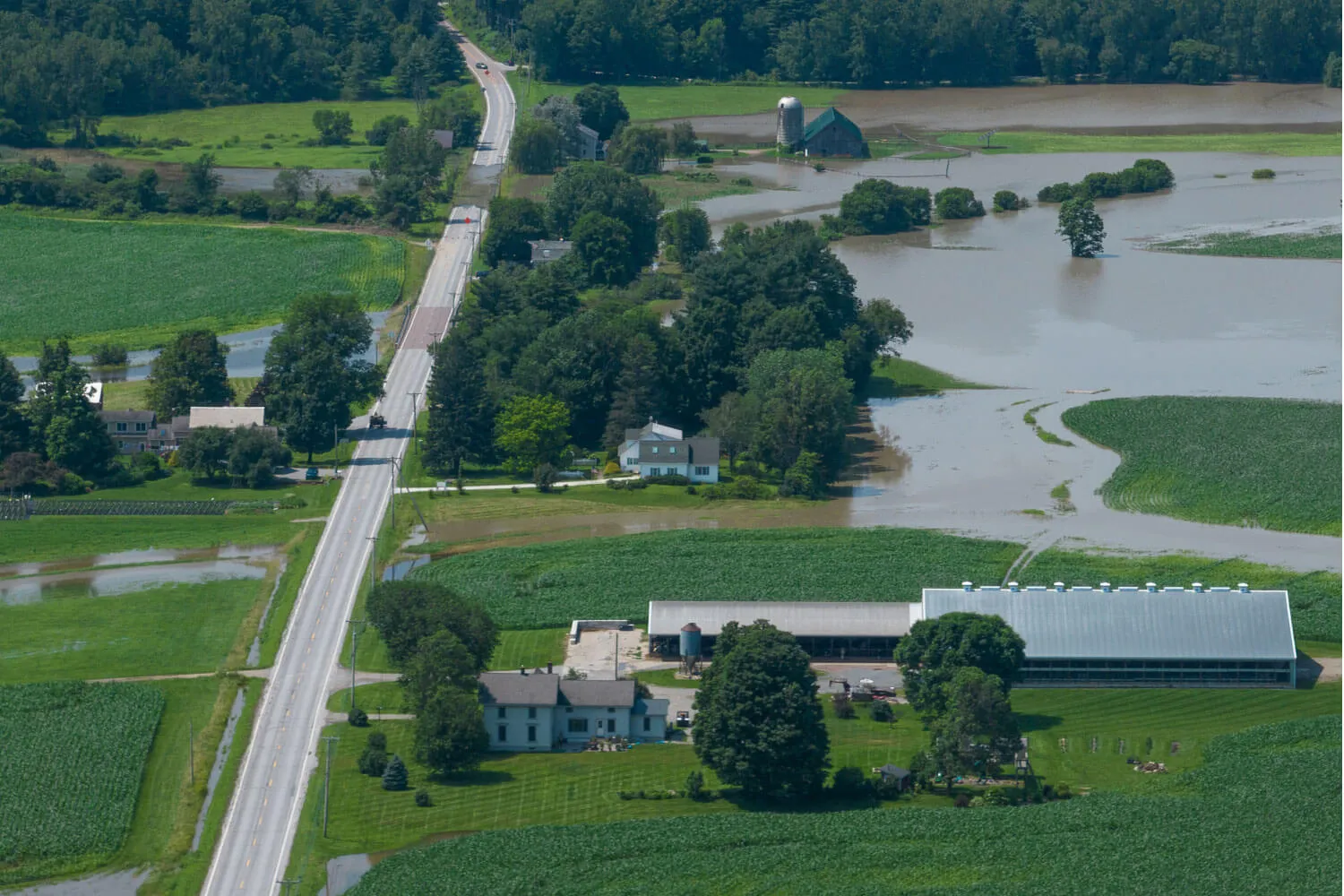
Disentangling varying flooding impacts
Flooding isn’t a one-size-fits-all disaster; in fact, there are a variety of flood types.
"In July 2023, we saw lots of rising water, causing inundation flooding, as we saw in Montpelier,” Underwood said. “In July 2024, more of the damage was sustained when fast-moving water came out of the hills, and eroded the stream channels and undermined infrastructure, homes, bridges and roads.”
Understanding what areas of Vermont are more prone to inundation flooding versus areas that are more prone to erosion flooding is critical for making informed emergency plans and effective decisions about infrastructure. Currently, there is limited hazard mapping for floodplains, and when it exists, it tends to be focused in developed communities, rather than outlying rural areas. Diehl and Underwood are working to address this gap
Through a federal grant, the researchers, who are Gund and Water Resources Institute affiliates, hope to expand mapping to areas of the state that are currently underserved—which are also at the greatest risk of both erosion and inundation flooding.
Underwood expects the maps to serve as a guide in future local planning and zoning around the state, in order to avoid future flood hazards, impacts, and losses.
“The maps that we produce from this project will be available statewide and will be helpful for communities to plan either in the mid-term or the long-term for their growth areas,” she said.
The maps are expected to be available to the public within a year and a half.
Improving how flood warnings are communicated
Another crucial piece of flood preparedness is warning the public ahead of time. The National Weather Service (NWS) produces watches and warnings for severe weather events, including floods.
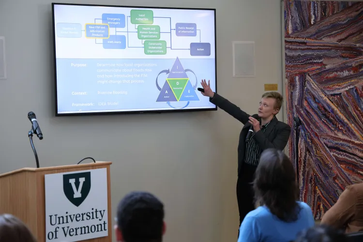
And while emergency managers might get an early morning phone call prompting them to take action, it’s less well understood how community groups receive, perceive, and share flood warnings. Anne Jefferson, a professor in the Rubenstein School, and Elizabeth Doran, a professor in the College of Engineering and Mathematical Sciences, are working to address this question.
Jefferson and Doran, their team at UVM, and their partners at RTI International are working with six communities across the United States, ranging from Rutland County, VT to Dallas-Fort Worth, TX. The team is using a combination of focus groups, interviews, and survey research to understand how local authorities, health and human service organizations, and community interest organizations receive, modify, and share flood warning information.
Jefferson said this work is “getting a snapshot of who's talking to whom, and providing an understanding of how this type of information moves.”
The team has found that channels like emails and phone calls are the most widely used in pre-flood disaster communication, especially from organizations like the NWS and local authorities. Participants expressed that these agencies are highly trusted sources, delivering understandable information that is generally consistent with other information they are receiving.
However, they reported that communication breakdowns are a major barrier to sharing information in a timely manner. The research team discovered health and human service organizations, such as hospitals, shelters, school districts, and community interest organizations may not always collaborate or talk with one another.
Participants also mentioned flood warning communication would be more effective if the information they received was more location specific and impact driven. In fact, many of the organizations said that they modify the messages they receive to include more granular information based on their local, institutional knowledge before sharing those messages with their own audiences.
The researchers are sharing the study’s findings with the NWS, the communities they studied, and other audiences, so that organizations can implement the project findings and recommendations in their own actions and policies.