Focal Places in Burlington
The South End: Geological History
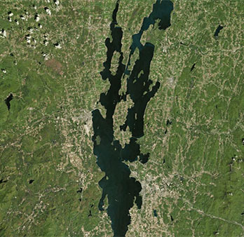
The Champlain Valley
In much more recent history, the south end was radically transformed by an ice age. In the most recent advance, glaciers filled the Champlain Valley with ice a mile thick, leaving deposits of glacial till we can still find in our soils, today. As the glacier retreated 14,000-15,000 years ago, the melt water filled the Champlain Valley, forming Lake Vermont. As the glacier retreated even further north, ocean water from the St. Lawrence Seaway flooded the basin approximately 13,000 years ago. This introduction of salt water created the Champlain Sea, a home for beluga whales and other salt water aquatic inhabitants. Around 11,000 years ago, this great body of water became isolated from its saltwater source resulting in a transformation that led to the lake we know today as Lake Champlain — though the lake was called by the name, “Petoubouqu,” or “The Waters That Lie Between” (between the Adirondacks and the ‘Green’ Mountains), by the Abnaki, long before that. If you sample the soils and examine the geology of Burlington’s south end, you’ll find evidence of these geologic eras in the bedrock and in the surficial sediments.
UVM Geologist, Stephen Wright, also points to evidence of another story found in the shallow layers of South End soils in the following video. He describes that, above the wetland sands and silts found in the South End’s Barge Canal area, soil explorers and geologists will also find layers of sawdust and wood shavings. This is evidence of the (geologically-speaking) very recent history. This area served as a hub for Burlington’s booming lumber industry. The copious waste from the mills and wood yards was used as landfill to extend the city’s shoreline and expand lumber storage areas. The video on the left, Stephen gives an overview:
In addition to what we know about the geologic history of the South End, there are remaining geologic mysteries in the topography as well: Burlington is a city on a hill. And while some might take for granted the familiar tiers in the landscape, others question what causes may have formed these flat terraces, which lie at varying elevations. Stephen Wright shares his hypothesis for how these tiers may have been formed in this clip on the right.