Focal Places in Burlington
The Intervale : Cultural Context
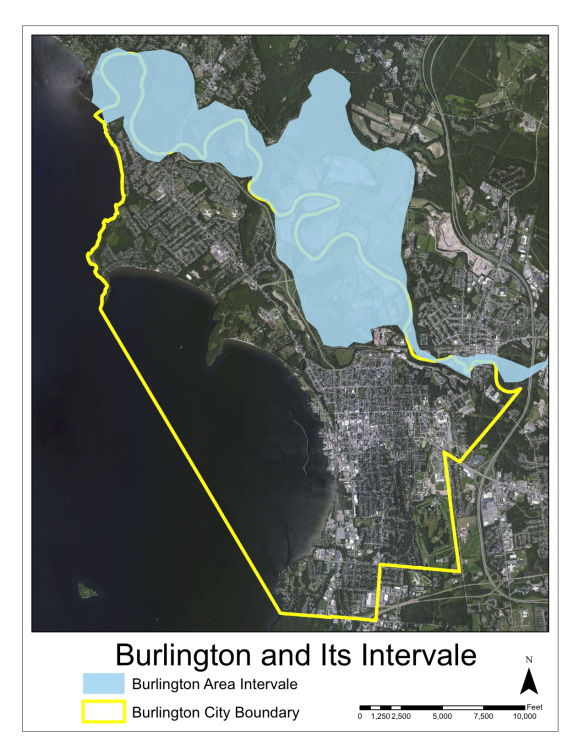
Over the past 20 years, the Intervale Center in Burlington, VT has created a nationally recognized incubator model for supporting local food systems. However, Burlington’s Intervale has supported sustainable food systems for thousands of years. The Intervale as we know it today is an 870-acre floodplain on the Burlington side of the Winooski River, where it flows through the cities of Burlington, Winooski, and Colchester. It remains home to a rich diversity of species, including moose, bear, migratory birds, and economically and culturally valuable plants, and its riparian forests provide a important habitat corridor traveled by many animals. It’s also home to a dozen established and incubator farms, city parkland, radio towers, and a wood-fired power generating plant.
Frequent floods renew the land’s fertility, and have also embedded a record of human history over thousands of years. Abenaki Indians have been using the Burlington Intervale nearly continuously over that time , and buried in the Intervale’s agricultural soils are burial sites, stone hearths, tools, ceramics, and plant remains that show periods of use stretching back to 3000 BC, and reveal seasonal hunting, fishing, and food growing and gathering patterns. Corn agriculture dates back over 600 years; when European settlers arrived in the late 18th century, several hundred acres in Burlington’s Intervale was cleared for agriculture, much of it cornfields planted by Abenaki farmers.
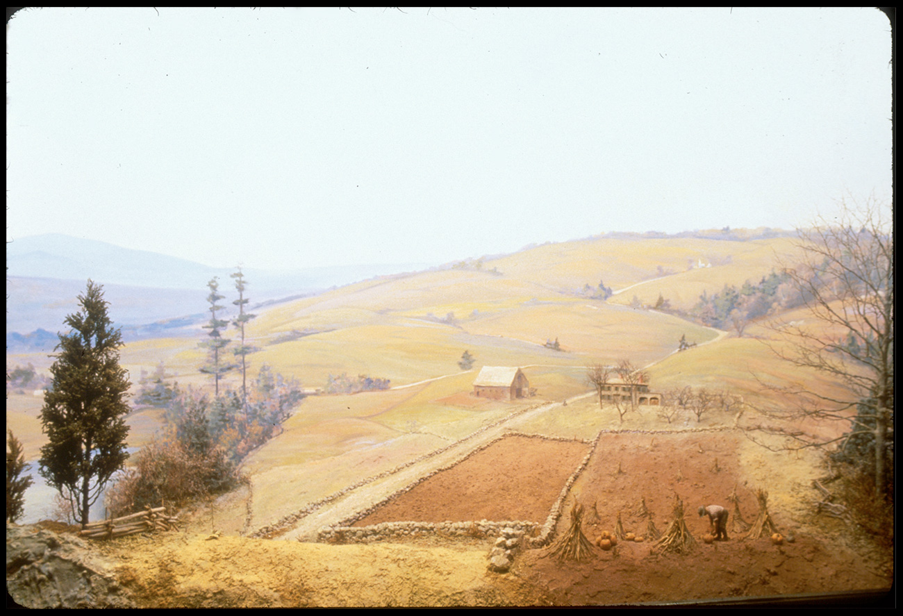
Human use of the Intervale intensified after European colonization. In the 1770s, Europeans settled there and began cultivating it. For a few generations after the American Revolution, the Burlington Intervale was known as one of the granaries of New England, producing rye and winter wheat, as well as flax, barley, butter and pork. With the construction of the railroad (which still passes through the Intervale and services the McNeil Power Plant), grain markets shifted west, and Intervale farmers turned to dairy. In the 1800s, much of the land was owned by absentee landowners, and worked by tenant farmers.
At this time, Dr. John Pomeroy, a founder of the University of Vermont medical school, owned a sizeable chunk of land in the Intervale; his son was a lawyer and debt collector who ran a poorhouse in the Intervale.
Upstream land use patterns in 19th century Vermont also had a major impact on the Winooski River and the Burlington Intervale. As the watershed’s hills were cleared for sheep pasture, surface runoff and flooding increased, and sediment traveled downstream to the lower Winooski. As a result, the course of the Winooski through the Intervale shifted dramatically—600-1000’—over only 80 years. Click through this slideshow to watch the Winooski River change its course throughout the 19th century.
In the early 20th century, the Calkins family bought land in the Intervale. Rena Calkins was born and grew up dairying in the Intervale, and lived in the brick farmhouse which now serves as the Intervale Center office. The Calkins dairy closed in 1992, when Rena was in her 80s. The Intervale housed other agricultural operations in the mid-20th century, including a pig farm and slaughterhouse (Gardener’s Supply is in the old slaughterhouse building), a commercial gladiola nursery, and cornfields. It also housed the city dump, squatter’s camps, and hundreds of junked cars. Alongside the Anglo-American industrial and agricultural history, French-Canadian-Abenaki families (many of whom lived in the Old North End) continued to use the Intervale for agriculture, hunting, gathering, and seasonal festivals and gatherings.
Organic farming returned to the Intervale in the late 1980s, supported by Will Raap, who founded Gardener’s Supply in 1986, and the Intervale Foundation (now the Intervale Center) 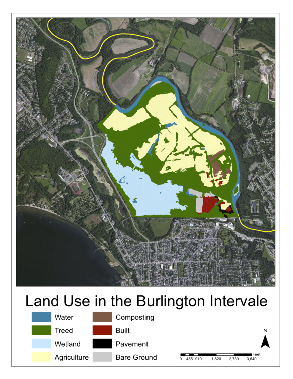 shortly thereafter. Now, the Burlington Intervale houses the Intervale Center and its programs, including vegetable farms and CSAs, infrastructure and equipment, the Intervale Conservation Nursery, and New Farms for New Americans, as well as public recreational land administered by the Winooski Valley and Burlington Park Districts, extensive wetlands, and the McNeil Generating Plant.
In 2011, the Intervale experienced two severe flooding events, in late April and after Irene in late August. After Irene, crops and fields were damaged and destroyed, but they were also possibly contaminated from the effects of upstream floodwaters, and under federal regulations, farmers weren’t able to sell these crops, a huge loss. As the impacts of climate change unfold, which will likely hold more frequent and more severe storm events and floods, what is the future of the agriculture in floodplains like the Intervale? Will it be that the floods of 2011 are now the new normal? How much risk can small farmers absorb? How can we best manage these lands, as well as the land upstream in the watershed?
To hear audio stories of the Intervale - click on this map link and zoom to Burlington in order to listen to the stories embedded in the map