Focal Places in Burlington
Rockpoint : Natural History & Ecology
Rock Point woodsThe nearly 200 acres of private and public land that make up the Rock Point Area are an exemplary model of an “Urban Wild" within the city limits of Burlington. This term applies to lands that “provide habitat for rare and endangered plant and animal communities, wetlands and other riparian systems, floodplain, unique geological and hydrological features, important wildlife habitat and travel corridors, areas important for scientific research and education, scenic vistas, trails, passive recreation, sustainable forest communities, and cultural features” (Meals, Don, and Wayne Gross. Burlington Conservation Board Memorandum – January 30, 2002). Moreover, you will find that the historic land use of the property directly ties in to the plants and animals that are found here today. Its conservation as an urban wild into the future will make this a key spot for providing needed habitat within the Burlington city matrix.
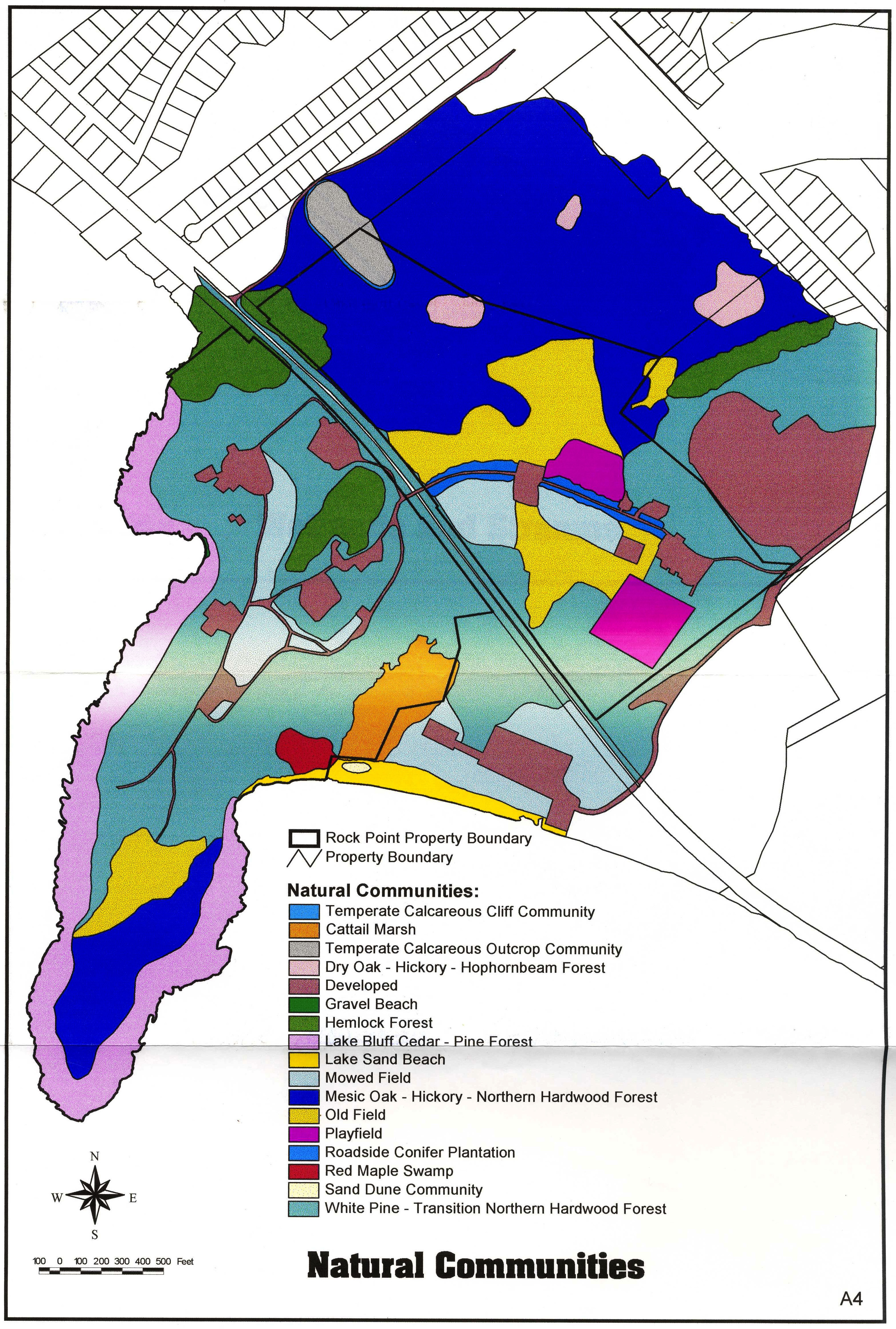
What makes the Rock Point Area so special ecologically? Some of the features are natural communities, rare & endangered plant species, and wildlife that are found nowhere else in the Burlington city limits (for instance, did you know there have been moose sightings in Burlington at Rock Point?). The map below shows the various natural communities of Rock Point. By exploring each of these natural communities and understanding how they differ, you will be able to understand what lives where and why, and it will help you when you are looking for that particular bird, wildflower, or tree that interests you.
The concept of a natural community is simple but elegant. In Vermont, the book Wetland, Woodland, Wildland is the foremost authority on our natural communities, and it is the basis for the following descriptions. As defined by WWW, natural communities are "interacting assemblage of organisms, their physical environment, and the natural processes that affect them." Essentially, natural communities recognize that there is a pattern to how plants, animals, and other organisms are found, and it is due to a number of factors, including water, soils, and climate. Some associations are more rare than others, and knowing where these are can aid in identifying and monitoring the rare, threatened, and endangered species within them.
Mesic Maple-Ash-Hickory-Oak Forest
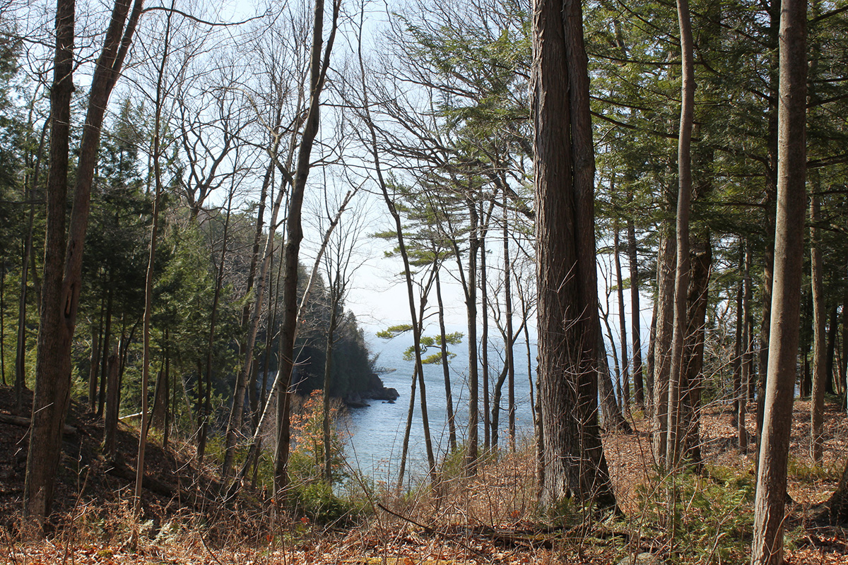
Most of the forests in the Rock Point Area consist of Mesic Maple-Ash-Hickory-Oak Forest- show in dark blue in the above map, labeled as “Mesic Oak-Hickory Northern Hardwood.” This community is quite uncommon in in Vermont, and is found mostly in the Champlain Valley and along the Connecticut River. It is similar to our common Northern Hardwood Forest, but contains many more species that are found more commonly in the central and southern Appalachian Mountains; the term "mesic" refers to the warmer climate and intermediate wetness of the site.
The dominant tree species in the forest are sugar maple, red maple, white oak, red oak, white ash, and shagbark hickory. Due to the abundance of these mast-producing trees, the forests are very important for wildlife ranging in size from squirrel to moose. The shagbark hickory (Carya ovata), is crucial habitat for the tiny endangered Indiana bat (Myotis sodalis). The bats roost under the flaking, peeling bark of older trees. A few particularly beautiful large shagbarks exist on the eastern edge of the Arms Grant Property, just south of the Alliance Church.
Wild turkeys have been heard and seen throughout this forest type due to the high quantity of mast-producing trees like oak and hickory. A suite of forest-dwelling songbirds like Eastern Wood-pewee*, Red-eyed Vireo, Black-throated Blue Warbler*, and Scarlet Tanager* can also be found - look for most of these birds starting in early May. White-tailed deer, mice, chipmunks, and squirrels are also very common. (*These birds are a part of "The Birder’s Dozen [PDF]” that represents twelve of the 39 Responsibility Birds that the Audubon Vermont Forest Bird Initiative is working to protect. These birds use different forested natural communities in a variety of ways for feeding and breeding.)
The understory of these forests is not as abundant as the Transition Hardwood Forest, with its enriched soils. Red oaks, white oaks, and hickories produce acorns and nuts in abundance. A rare hickory for Vermont found here includes pignut hickory (Carya glabra). Uncommon herbaceous plants that can be found here are tick trefoil (Desmodium) and large-flowered trillium (Trilluim grandifolium), which will begin flowering in late-April to early-May. In the particularly wet areas on the Arms Grant property, there are some excellent places to see skunk cabbage (Symplcarpus foetidu) and false hellebore (Veratrum viride).
White Pine - Transition Hardwood Forest
The White Pine-Transition Hardwood ForestThe White Pine-Transition Hardwood Forest is the other common forest type at Rock Point. Human influence of this forest plays heavily into its current composition. It is a variant of the Mesic Maple-Ash-Hickory-Oak Forest described above, and is described in WWW as the “Transition Hardwoods Limestone Forest.” It is similar to a Rich Northern Hardwood forest, but with a far greater proportion of red oaks in the overstory. You will see much sugar maple, beech and ash alongside the red oak. Due to land use history on Rock Point, white pines are far more prominent than would have occurred without the influence of intensive logging.
Laurel Broughton quoted John Hopkins, Jr. (the son of Bishop Hopkins who purchased the much of the Rock Point property in 1841) as saying “we had found that the choppers… had felled all the timber on the southern exposure of a hill near the Lake.” Currently there are scattered large white pine trees up to only 150 years old, synchronous with Hopkins’ account and one particularly large white oak at the boundary of the diocese and the Arms Grant parcel that is over 200 years old, and likely marks the property line. Most of the trees were clearcut by the mid-1800s, after which the land was used for agriculture into the early 1900s. Since these woods are now in a relatively young stage, the white pines still make-up a large part of the forest composition.
These forests are great communities for bird watching, as the same species described in the Mesic Maple-Ash-Hickory-Oak Forest can also be found here. The common early spring migrants – Eastern Phoebe, House Finch, American Goldfinch, and Tufted Titmouse – can be easily viewed at the feeders 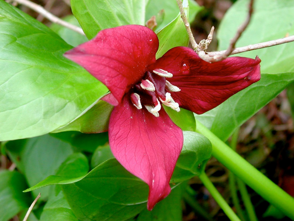
Red Trillium (Trillium_erectum)around the Rock Point Conference Center buildings. Look to the edges of openings with the old fields and marshes for viewing other common early migrants like the Song Sparrow and the Red-winged Blackbird, respectively.
White Pine-Transition Hardwood forests are a great place to learn many of the common spring ephemeral wildflowers of Vermont. These include some of the most conspicuous early flowering plants like trout lily (Erythronium americanum), blood root (Sanguinaria Canadensis), anemone (Anemone riparia), Canada mayflower (Maianthemum canadense), and red trillium/wakerobin (Trillium erectum).
Limestone-Enriched Communities: Limestone Bluff Cedar-Pine Forest and Temperate Calcareous Outcrop Community
One of the most unique features of Rock Point's natural communities is the calcium-enriched bedrock upon which they are founded - see more on the Champlain Thrust Fault to understand how this rock formation came about. The 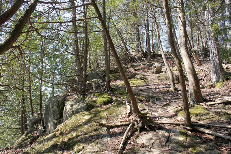
limestone and dolostone rock just at the surface supplies ample amounts of calcium to the soils above, that in turn allows for a unique set of plants to take root. Along the edge of the Rock Point peninsula, the Limestone Bluff Cedar-Pine Forest is the dominant community, with northern white-cedar (Thuja occidentalis) being the most common tree, along with white and red pines. Botanists come from throughout New England to view this unusual and beautiful community, the approximate location of which is shown on the map.
The cool air from the lakeside creates a moist microclimate in which some rare herbaceous plants grow, such as walking fern (Asplenium rhizophyllum) and purple clematis (Clematis occidentalis). Within the Temperate Calcareous Outcrop Community scattered throughout the Arms Grant Property you will find rare and beautiful plants like the yellow lady slipper (Cypripedium calceolus var. pubescens) and square goldenrod (Solidago squarrosa). Additionally, there are several plants that anyone working in the woods should know – these plants are indicators that the soils below are rich in calcium, an essential nutrient for plant health. If you are working in your sugarbush, for instance, you will want to look for these plants to indicate a potentially highly productive forest. Rich site indicator plants that can be found on Rock Point include the very handsome maidenhair fern (Adiantum pedatum), the basswood tree (Tilia americana), and herbaceous plants like Dutchman’s breeches (Dicentra cucullaria), large-flowered trillium (Trillium grandiflorum), hepatica (Hepatica acutiloba), wild ginger (Asarum canadense), and meadow rue (Thalictrum diocicum).
Wetlands
Most of the natural landscape of the Rock Point Area is characterized by its warm, dry microclimate along the windswept shores of Lake Champlain and its sandy soils that drain water thoroughly. However, there are a few places where changes in the soil size and texture create a variety of wetland types ranging from wet fields and seeps to swamps and marshes. These areas where there are poorly drained silts and clays are where most of the wetlands in the Rock Point Area occur - these areas are noted in the map below.
This first map notes areas where the poorly-drained, silty-clay soils are most prominent:
View Poorly Drained Soils at Rock Point in a larger map
This second map shows the various wetlands occurring on the Rock Point property - red maple swamps, cattail marshes, vernal pools and seeps. Note the correlation between many of these areas and the prominence of silty-clay soils in the above map:
View Wetlands of the Rock Point Area in a larger map
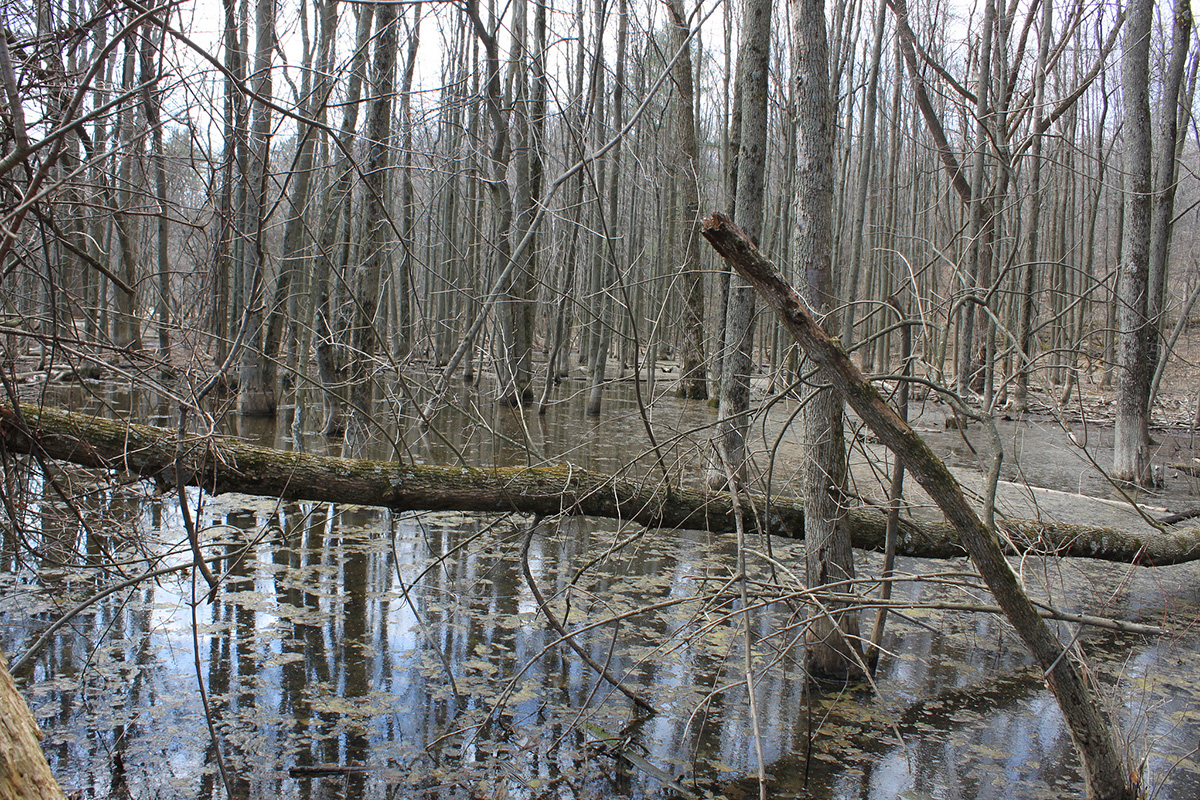
Red Maple Swamp
The Red Maple Swamp (outlined in red in the above map) occurs along the shores of Lake Champlain, just at the end of North Beach. You can see how the height of the water varies throughout the year by looking at the waterline at the base of the red maple, black ash, and green ash trees. This is good habitat for amphibians and fish (one can often see minnows swimming at all times of the spring, summer, and fall), but there is also a high degree of trash blowing in from the beach.
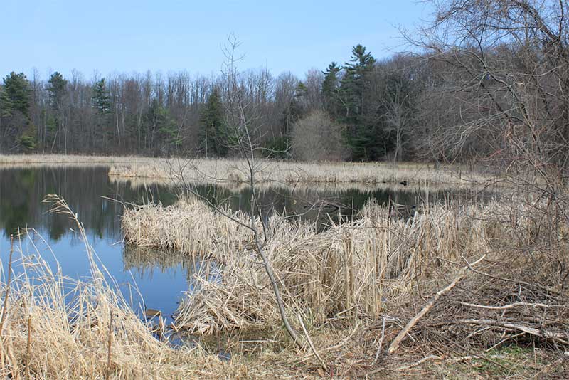
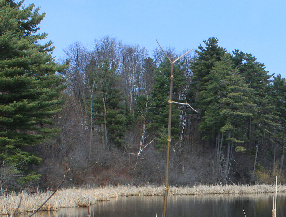
Cattail Marsh
The Cattail Marsh (outlined in green) is located adjacent to the Red Maple Swamp to the north of North Beach, just beyond a sand berm vegetated with the rare and unique Champlain Beach Grass (Ammophila breviligulata subspecies champlainensis). A pair of beavers live here in a den that has changed location over the years, but is currently along the eastern edge of the marsh, not too far off from the pedestrian trail. This marsh is also an excellent space from which to view wood ducks, beavers, muskrat, and mink.
Wet Fields, Seeps, and Vernal Pools
Vernal pools The several wet old fields (light blue shading, dark blue outline) at the end of Rock Point and adjacent to the parking area by the Diocese office are in the early stages of eventually becoming a forested wetland. The silt-clay soils here keep these areas wet throughout most of the year. Their being adjacent to forest also makes them an excellent place for viewing the American Woodcock (a species of concern identified by Vermont Audubon) as the males need an expansive open area to perform their elaborate mating dance.
There are a few seeps - areas where groundwater pools at the surface (dark blue shading with dark blue outline) and potential vernal pools - temporary spring ponds (outlined in yellow) within the Arms Grant Property near the Alliance Church on North Ave. These are very important areas for amphibians, as frogs and salamanders will lay their eggs in these pools before hatching and beginning their amphibious or terrestrial lives.