Focal Places in Burlington
The Intervale : Natural History & Ecology
In addition to the land that is being actively farmed, Burlington’s intervale contains several different types of natural areas. Each one contains different plants, provides homes for different animals, and serves a different role in the overall ecosystem. The intervale provides a unique opportunity to explore several types of natural areas within a relatively small distance. In order to facilitate place-based education, below are identified examples of four natural areas within a short walk from one another; these are identified by purple dots on the map below.
Mature Floodplain Forest
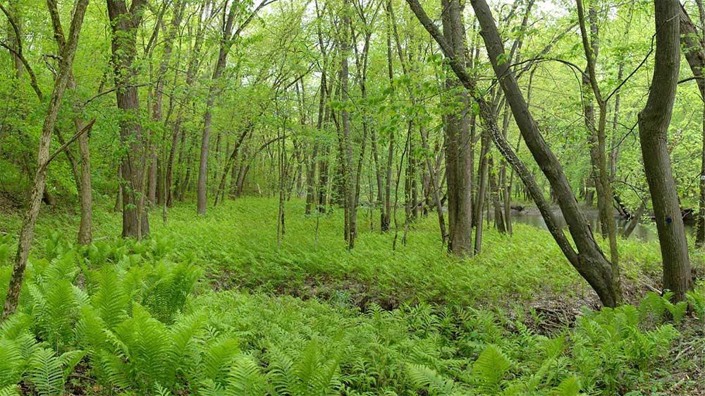
Silver maple floodplain forest
The Mature Floodplain Forest is dominated by silver maple trees, which are able to survive periodic flooding. These large trees fill the canopy and shade the ground below, limiting the presence of shrubby undergrowth. One plant that thrives in these moist, shady conditions is the ostrich fern, which has strong bulb-like roots so the plants can withstand the force of floodwaters. Another common sight in floodplain forests is invasive plants, which take advantage of the bare, nutrient-rich soil to colonize. Examples on this site include Japanese knotweed and goutweed.
This type of forest used to be common on riverbanks throughout Vermont, but many have been removed for agriculture. When left in place as a riparian buffer, these forests prevent erosion and reduce flood damage, as well as filtering out excess nutrients from fertilizers and manure washed downstream. Their shade keeps water cooler so cold-water fish like brook trout and landlocked Atlantic salmon can survive. On land, riparian forests provide habitat for water-loving mammals such as river otters and mink. Larger mammals use riparian forests as corridors for traveling and numerous migratory birds use this forest type for breeding.
Early Succession Floodplain Forest
The Early Succession Floodplain Forest is situated between the mature forest and the cleared fields. Here fast-growing boxelders (also known as ashleaf maple) and cottonwoods form the majority of canopy trees. With sun penetrating the canopy in numerous gaps and openings, Jerusalem artichoke patches are common and riverbank grape vines hang from trees throughout. If the neighboring farm fields were abandoned, they would grow back into Early Succession Floodplain Forest over the course of 10-20 years. In the absence of logging or other major disturbance, this area will likely develop over the next century into a Mature Floodplain Forest.
River Shore Meadow
On the other side of the Mature Floodplain Forest, jutting out into the river, is a sandy River Shore Meadow. As the river flows around a sharp bend, it drops sand on the inside of the curve, forming a beach. Over time, this beach widens as the river continues to meander, and succession has brought new plant communities. The ground is covered with cockleburs, stinging nettle, and numerous grasses. A few stands of sandbar willow are scattered throughout the meadow – and it’s clear that they and other young trees have been nibbled on by moose. Here again, you’ll find Japanese knotweed taking advantage of bare ground. This River Shore Meadow community is another example of early succession, emerging from newly deposited riverine silt and sand, and helping to stabilize and hold that new soil in place. In time, this landscape will likely succeed into an Early Succession Riparian Forest, although flooding and beaver impacts may delay the arrival of forest cover for many years.
Riverbank Farm Field
Finally, further upstream is a hay field that runs all the way to the riverbank, with no forested buffer zone. At this Riverbank Farm Field site, the bank is steep, providing good nesting territory for a belted kingfisher. Willow and cottonwood trees have been planted here by people to limit bank erosion; although they are only saplings, several have already been chewed by beavers.