A Need for Flood Resilience
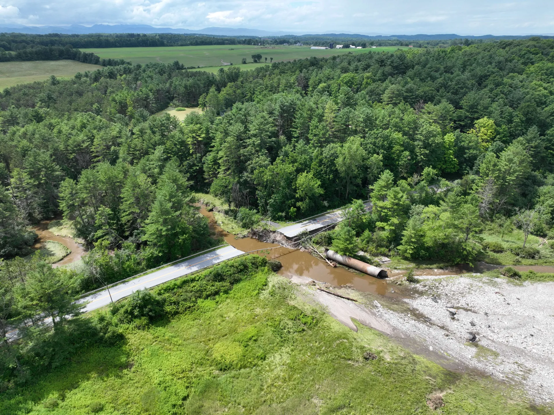
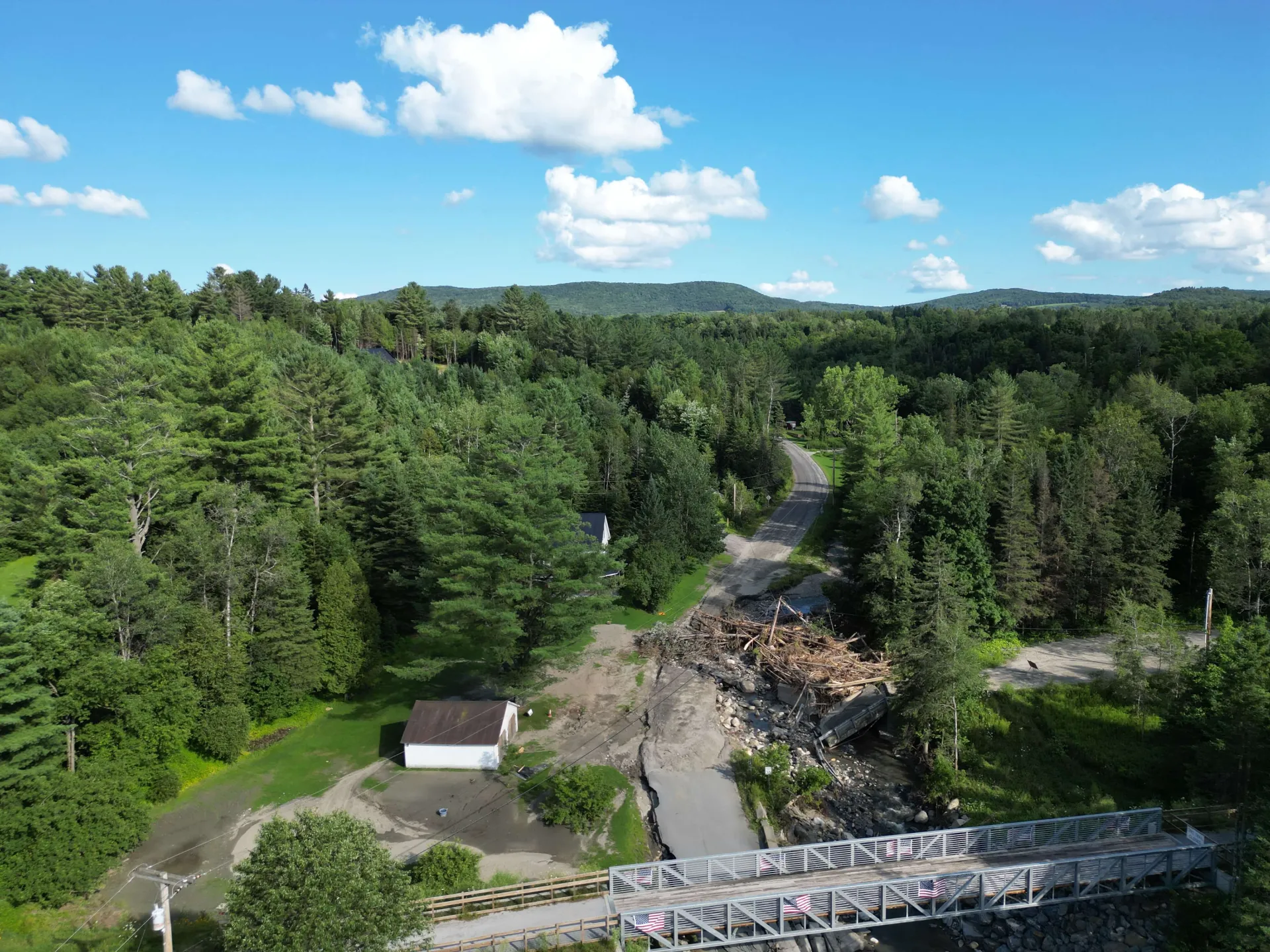
Flooding is rapidly becoming one of the most widely experienced, deadliest, and costly natural disasters threatening our economy, well-being and security. More attention needs to be on forecasting floods and their impacts in steep, mountainous terrain.
Collaborative Research: SAFER Apps
This NSF grant supports community-driven research partnerships on Earth system hazards to develop actionable solutions that reduce risk and increase social and ecological resilience. In this project, we seek to bring more attention to forecasting floods and their impacts in steep, mountainous terrain and the opportunities that nature-based solutions (NBS) afford for improving flood resiliency.
Considerable effort has gone into improving operational flood forecasting and approaches are emerging to predict and map flood inundation hazard zones. Despite considerable progress in flood risk prediction, little attention has focused on the challenge of forecasting floods generated in mountainous terrain and the associated erosional flood hazards that cascade through mountain settings. Further, the rich knowledge of affected communities has largely been left untapped in research.
Our Goal:
Develop capacity for the integration of flood risk prediction science and NBS deployment that is responsive to community needs and builds resilience for highly vulnerable, rural communities of mountain regions, using the Appalachians as a model mountain system.
Our Goal:
Develop capacity for the integration of flood risk prediction science and NBS deployment that is responsive to community needs and builds resilience for highly vulnerable, rural communities of mountain regions, using the Appalachians as a model mountain system.
The Challenge
- Mountains play a disproportionately large role in providing freshwater ecosystem services compared to lower lying regions, as Earth’s so-called “water towers” and the headwaters of river systems.
- Mountains are key biodiversity hotspots, under severe threat by climate change.
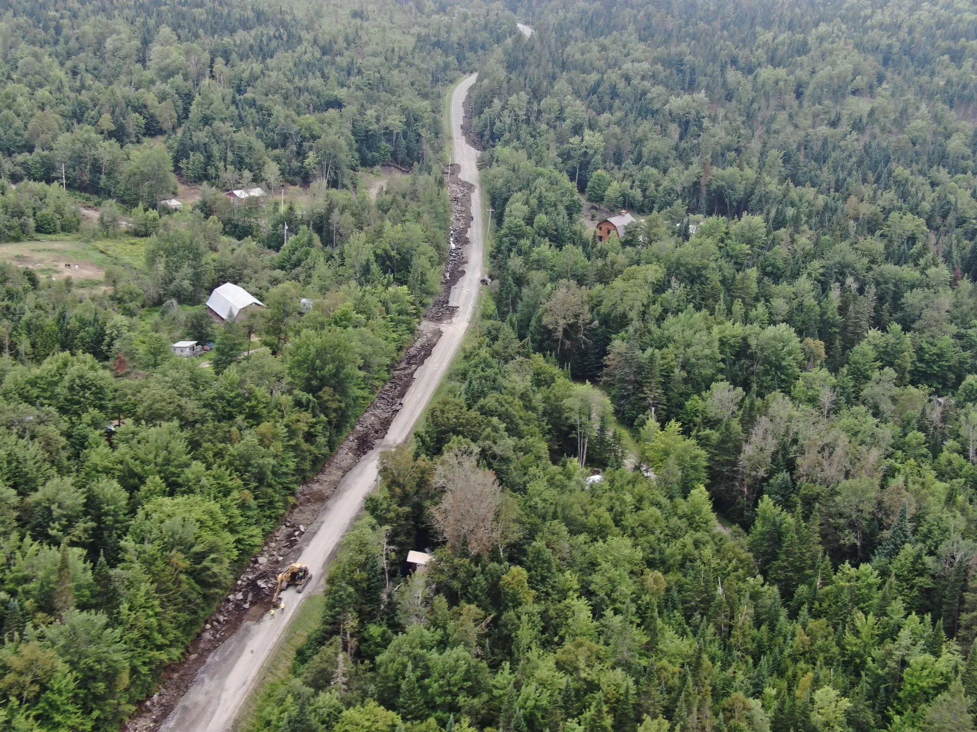
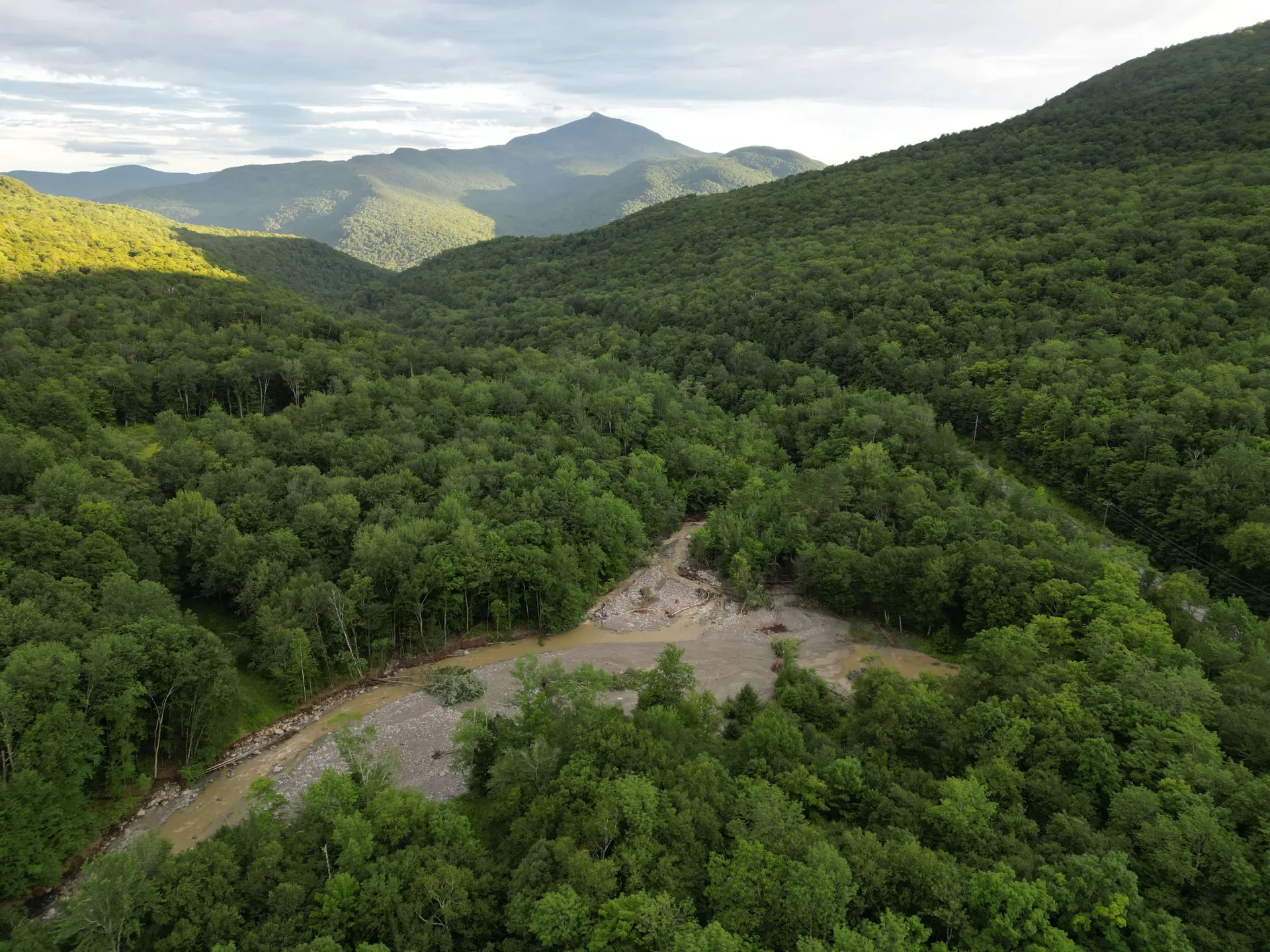
- Flooding in mountainous terrain can be especially destructive, as it initiates dynamics that generate impacts to downstream communities, biodiversity, and other ecosystem services.
- Managing flood risks in mountain environments is challenged by uncertainty in how disturbances interact with climate change, which in itself is driven by the lack of basic data and robust forecasting models in headwater systems.
Project Approach, Participation, and Partnerships
This project brings together University of Vermont, Penn State University, and West Virgina University to build on momentum in these states and across institutions to accelerate the integration of river science, prediction tools, and nature-based solutions deployment. We focus on two types of work: convening activities and compilation of relevant flood damage data.
Our approach involves learning, partnership development, relationship building, co-production of research questions, and the ideation of appropriate models, tools, and solutions to build resilience to flooding, using three states (PA, VT, WV) in the Appalachian Mountains as the testbed.
This project aims to build partnerships across academia, NGOs, and governance and planning entities.
Why the Appalachians?
The Appalachian Mountains provide water to tens of millions of people in the eastern and mid-western US, including the Boston, New York, Washington DC, Pittsburgh, Louisville, and Atlanta metro areas.
Small towns, gateway cities, and rural communities throughout the Appalachians have endured extreme climate-related disruption. Many Appalachian communities struggle to prepare for future climate risks.
We aim to use the Appalachian mountain chain as a model system to understand the risks experienced by freshwater ecosystems and human communities in mountain settings.
Join Us: We invite interested conservation organizations, community members and leaders, emergency management personnel and others to join us in this effort.
Virtual Roundtables
Kicking off in January 2025. An opportunity to learn and contribute ideas on needs to advance resilience to flood hazards, conducted via online webinars and discussions.
Field Trips
Planned for summer (in Vermont) and fall (in West Virginia) 2025. Engage with communities and decision makers on flood experiences in mountain settings.
West Virginia Field Trip Itinerary
Pennsylvania Field Trip Itinerary
Workshop
Contribute to the development of plans to integrate river science, flood prediction tools, and nature-based solutions deployment in mountain settings. Check back for agendas of workshops in participating states.
Learn More
Click the button to learn more about the Science to Advance Freshwater Ecosystem and Community Resilience in the Appalachians (SAFER Apps) project.
SAFER Apps FlyerVirtual Roundtables
Principal Investigators and Project Leads
Principal Investigators and Project Leads
This project is supported by the National’s Science Foundation’s new program: Confronting Hazards, Impacts, and Risks for a Resilient Planet.
Images provided by UVM's Spatial Analysis Lab.