You may have heard that Vermont has a housing problem. But building our way out is complicated.
Knowing where and what to construct requires understanding the scope of the shortage in a community as well as zoning restrictions, flood risks, and whether the wastewater system can accommodate growth. This information is often hard to find or difficult to parse. That is why University of Vermont scholars built one place—the Vermont Data Collaborative—for municipalities to find the data they need to tackle issues from housing and conservation to community health and wellbeing—and in formats they can actually use.
The tool is a collaboration between UVM entities including the Vermont Research Open-Source Program Office (VERSO), Leahy institute for Rural Partnerships, Center for Rural Studies, and the Vermont State Data Center, to host, translate, and package data in user-friendly reports. The Vermont Data Collaborative’s pilot platform is now live and accepting feedback from partners across Vermont.
“This is UVM showing up for towns and regional planning commissions in a really concrete way,” says Patricia Coates, director of the Leahy Institute which funded development of some of the early dashboards. “I want Vermonters to see UVM as their first go-to resource to get the data they need to make policy.”
The Vermont Data Collaborative (VDC) is designed to serve as a single source for Vermonters to harness insights about their communities. The Center for Rural Studies is a natural partner in this effort because it already works with state and local stakeholders to produce original surveys and interpret Census data.
The VDC will merge datasets that have never been together in the same space, explains Michael Moser, who leads research operations at the center.
Understanding local capacity
Think of all the dispersed places one would need to go to gather federal, state, and local data about food security measures, community health outcomes, demographic information, education, housing, employment levels, and parcel level data about flood risk and zoning restrictions. Then picture the various formats one would need to convert information from PDFs, Word documents, and Excel spreadsheets. The VDC will not only house data in one place but make it relevant and readable to the user.
“In some ways, that could put me out of business,” Moser says.
The platform was largely built using research and design work by UVM students eager to put their learning into practice.
For instance, in 2024, VERSO staff and students built the Vermont Zoning Atlas, a compilation of zoning regulations across all 255 Vermont towns and a catalog of the known wastewater and stormwater infrastructure across the state. Another tool, the Vermont Livability Map, overlays these datasets with flood risk to identify where development and conservation make sense on the landscape. The VDC is where tools like these can be accessed and communities can initiate other data projects to enable more productive (and potentially less contentious) conversations.
“It's so exciting because people don't have to go get a data science degree to play with it or go on a detective mission,” explains Emma Spett, M.S. ‘20 program coordinator for the Leahy Institute who spearheaded the project. “We're really interested in the pipeline from a community identified need/problem/challenge to a data tool or service.”
She recognized the value of localized data while producing annual economic reports for the state’s regional development corporations and towns through UVM’s Office of Engagement. Spett often heard that information gaps in area wastewater management systems could prevent new homes or businesses from breaking ground. The Leahy Institute helped fund VERSO’s team to build the wastewater mapping tool to better understand local capacity.
While other universities have offices designed to expand open-source research and data sharing, Kendall Fortney, the director of UVM’s program, uses a more applied approach, Spett says. “A lot of the work that he does is building platforms and tools that leverage open-source information to address public challenges. And he does that using students which is very cool.”
For instance, Ian Sargent ’26 came to UVM to study statistics, but wasn’t sure how to apply it until he began interning with Fortney’s team.
“Stats is the quantification of uncertainty,” he explains. “Quantifying that uncertainty is how we move forward and make decisions. … When you are changing a zoning policy, or you are lobbying for more housing development, I think that you need data driven evidence to back it.”
In 2025, Sargent got a fast-tracked education in public policy, reviewing Vermont’s zoning codes, learning about wastewater infrastructure, and reading flood maps while creating the Vermont Livability Map. Afterward, he built the prototype for the Vermont Data Collaborative, which adds Census level data for all towns to help identify trends and determine which groups are underserved. This required interviewing experts to understand economic development and meeting with community planners to learn how they use Census data and which of the 400 variables are truly helpful to their work, Sargent explains. “You need to make sure that this [tool] is actually going to be usable. Because you don’t want to build a very large, very intensive project and have them say we don’t need it.”
Before coming to UVM, Sargent wasn’t thinking about climate resilience and flood mitigation and embedding those datasets into digital tools for the public. Now, he does. And Sargent has an added respect for the people who collect the data in the first place.
“I have a dataset of every manhole in the state,” Sargent says. “It’s very large. People have mapped that and I appreciate their work.”
Creating the space to do good work
Kendall Fortney created the Open Research Community Accelerator (ORCA) at UVM to hire and train students like Sargent to serve as consultants on public data projects from designing and developing software to performing community engagement. In the past two years 42 students have worked over 8,000 hours on two dozen different projects such as creating an emergency alert prototype for the city of Burlington or building a mutual aid portal for water managers to relay flooding information.
Those products reduce work for municipal and state staff who may not have the expertise to build it themselves, Fortney explains. “You give them space to actually do things.”
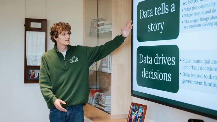
That desire to do something is what motivates many of Fortney’s students—and himself.
He is from Bennington, Vt., and wants to help the state make progress on some of the very real challenges affecting its future. And he has a history of using data for good. Fortney spent over a decade working in tech companies in Burlington before serving as the first data innovation fellow at the Vermont Center for Geographic Information and attending open-source events at the United Nation about producing digital public goods.
While these are valuable tools—they require a lot of work and collaboration that is difficult and time consuming. This is how ORCA emerged. Fortney knew students had an appetite to work on real-world problems and that there was a growing need for it in sectors from housing to healthcare. In an era where it can feel like government agencies are unable to take big swings on big problems, the VDC and other digital public goods could help.
“Let’s try some crazy ideas,” Fortney says. “Take the housing question. How do we actually figure out where to build housing? A ‘Just get it done [attitude]’ doesn’t work if you don’t have wastewater infrastructure that can support density; it doesn’t get it done if you have zoning that prevents it; it doesn’t get it done if you don’t understand how we deal with the market flow. … It is really easy to be flippant in those spaces, like ‘why is it so hard?’ the answer is because it is hard.”
It doesn’t help that many small communities are often under-resourced or operating with volunteer labor.
“We need to think different and I think that’s hard to do that when we are just trying to survive,” Fortney says. “We need to bring perspective to that and show them something different. That is what students are great for. ... We can solve this stuff. I don’t need to create a new Bitcoin, just solve basic bureaucracy.”
For Kevin Chu, executive director of the Vermont Futures Project, understanding data is a key part of advancing policies that make the state more prosperous and affordable. Much of his job involves aggregating, tracking, and interpreting numbers: Migration to and from Vermont. Which demographic groups are leaving the workforce. Who is concerned about housing? What are the hopes and dreams of Vermonters for the state?
“A lot of my work is in what I call the translation space,” Chu says. “… It’s one thing to collect information and data; it’s another thing to actually put it to meaningful use.”
“We need to think different and I think that’s hard to do that when we are just trying to survive. We need to bring perspective to that and show them something different. That is what students are great for." - Kendall Fortney
In 2025, the Futures Project released its economic action plan—the product of two years of data analysis and interviews with over 5,000 Vermonters across all 14 counties—to guide the path forward and quantify the scale of challenges.
“Because this is one of the missing pieces I see in public discussion,” Chu says. “People will say we have a workforce shortage. We are in a housing crisis. But how many times have you heard people say here is how many workers we actually need?”
That is where data can help. The hitch is that data needs to tell a story people can relate to. People not only need to see themselves reflected in the data, but it needs to be communicated in a way that feels less scary, Chu explains.
He envisions using a tool like the VDC before presentations to selectboards and communicating the points that matter most to locals.
Bring too much and it becomes noise, Chu says. “We live in a time where there is a saturation of information without clarity on knowledge.”