
Details and Metadata
Printer-friendly version View XML version Download Ecological Metadata Language file
Methods
The methods followed in the creation of the dataset, including description of field, laboratory and processing steps, and quality control procedures
Past Methods (No longer in use)
- Condition assessment
Started: 1999-01-01
Ended: 2000-12-31A total of twenty-eight seasonal pools were assessed during the years 1999 and 2000. The assessed pools included those representative of reference (minimally disturbed) conditions as well as those representing a range of disturbance. Of those twenty-eight pools, five were assessed in both years in order to evaluate annual variability. Pools were selected to represent most of the biophysical regions of Vermont as well as a range of disturbance type and intensity.
- Assessment of water chemistry and communities
Started: 1999-01-01
Ended: 2000-12-31Biological communities assessed included aquatic macroinvertebrates, algae, vegetation, and amphibians. Water chemistry included earth metals, major anions, color, pH, alkalinity, aluminum, and specific conductance. A number of ecological observations were made at each pool, including: pool size; pool depth; in-pool habitat characteristics; and forest type and condition surrounding each pool.
- Pool visits and data analysis
Started: 1999-01-01
Ended: 2000-12-31All pools were visited a minimum of twice to assess amphibians and aquatic macroinvertebrates (early and late spring), with additional later visits between August and November as necessary to characterize physical and vegetative parameters. Data were analyzed in a variety of ways in an effort to identify ecological indicators of reference condition classification or disturbance gradients.
Started: 1999-01-01
Ended: 2000-12-31See report for full details of methods
Dataset Fields
Detailed documentation of the fields comprising the dataset, including the type of measurement, units where applicable, and any controlled vocabularies or code lists present in the data
| Field Name | Caption | Description | Additional Information |
|---|---|---|---|
| Species | Species Name | Unique species name | Nominal |
| Code | Species Code | 6-letter code to abbreviate species name | Nominal |
| armsgran | Percent Cover at Arms Grant | Percent cover at Arms Grant site | Nominal |
| baldmtnn | Percent Cover at Bald Mountain North | Percent cover at Bald Mountain North site | Nominal |
| baldmtns | Percent Cover at Bald Mountain South | Percent cover at Bald Mountain South site | Nominal |
| ballmtn | Percent Cover at Ball Mountain | Percent cover at Ball Mountain site | Nominal |
| boyer | Percent Cover at Boyer | Percent cover at Boyer site | Nominal |
| carlhill | Percent Cover at Carlton Hill | Percent cover at Carlton Hill site | Nominal |
| danahile | Percent Cover at Dana Hill East | Percent cover at Dana Hill East site | Nominal |
| danahils | Percent Cover at Dana Hill South | Percent cover at Dana Hill South site | Nominal |
| dartmout | Percent Cover at Dartmouth | Percent cover at Dartmouth site | Nominal |
| dorset | Percent Cover at Dorset | Percent cover at Dorset site | Nominal |
| hamphill | Percent Cover at Hampshire Hill | Percent cover at Hampshire Hill site | Nominal |
| hobartsp | Percent Cover at Hobart Spruce | Percent cover at Hobart Spruce site | Nominal |
| hughes | Percent Cover at Hughes | Percent cover at Hughes site | Nominal |
| irishiln | Percent Cover at Irish Hill North | Percent cover at Irish Hill North site | Nominal |
| irishis | Percent Cover at Irish Hill South | Percent cover at Irish Hill Southv | Nominal |
| iroqmapl | Percent Cover at Iroquois Maple | Percent cover at Iroquois Maple site | Nominal |
| iroqtann | Percent Cover at Iroquois Tannic | Percent cover at Iroquois Tannic site | Nominal |
| maidston | Percent Cover at Maidstone | Percent cover at Maidstone site | Nominal |
| mbrlake | Percent Cover at MBR Lake (Pogue) | Percent cover at MBR Lake (Pogue) site | Nominal |
| mbrsadle | Percent Cover at MBR Saddle | Percent cover at MBR Saddle site | Nominal |
| okemo | Percent Cover at Okemo | Percent cover at Okemo site | Nominal |
| pinehill | Percent Cover at Pine Hill | Percent cover at Pine Hill site | Nominal |
| shawmtne | Percent Cover at Shaw Mountain East | Percent cover at Shaw Mountain East site | Nominal |
| shawmtnw | Percent Cover at Shaw Mountain West | Percent cover at Shaw Mountain West site | Nominal |
| sleepriv | Percent Cover at Sleepers River | Percent cover at Sleepers River site | Nominal |
| thistlhl | Percent Cover at Thistle Hill | Percent cover at Thistle Hill site | Nominal |
| whitchmt | Percent Cover at Whitcher Mountain | Percent cover at Whitcher Mountain site | Nominal |
| woodsinn | Percent Cover at Woodstock Inn | Percent cover at Woodstock Inn site | Nominal |
| species frequency | Species Frequency | Number of times a plant is present in a given area | Ratio Unit: number Precision: 10 |
| percent cover | Average Percent Cover | Average amount of ground plants cover | Ratio Unit: percent Precision: 0.0000000001 |
Sampling Equipment
Equipment and software used to collect data, including how that equipment was used.
No sampling equipment recorded for this dataset
Site Characteristics
The spatial extent of the dataset site coverage, and descriptions of the spatial extent and context for the data collection
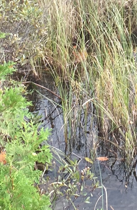
- Site Description
An effort was made to select seasonal pools across a range of geographical locations and elevations within the state. Seasonal pools include pools commonly referred to as vernal, temporary, intermittent, ephemeral, or autumnal. For this study, a seasonal pool was defined by the following criteria: 1) no permanent inlets or outlets, 2) standing water for at least two months of the year, and 3) dries out for some portion of each year with average rainfall.