A
Discussion of Agriculture in Townshend, Vermont
Kaitlin
O'Shea, October 2009
Historic
Preservation Program, University of Vermont
Historical
Narrative
Townshend, Vermont is located in southeastern
Vermont in Windham County in the Connecticut River Valley. On June 20, 1753 the state
of New
Hampshire chartered Townshend to John Hazelton and sixty-three others.[1]
In 1840, Townshend increased by annexing Acton.[2]
At that time, Windham County was part of
Cumberland County, which was not
divided into Windham, Windsor, and Orange counties until February 1871.[3]
Typically, four villages are typically included as a part of Townshend:
West
Townshend, East Townshend (or Townshend Village), Harmonyville, and
Simpsonville. In
early gazetteers
such as that of James H. Phelps, the town is discussed according to its
division of school districts.[4]
This is also
seen on the F.W. Beers Atlas of Windham County, Vermont, 1869.[5]
West River is the main river
running through Townshend with several brooks:
Acton, Fair, Negro, Joy, Mill, Fletcher, Simpson, and Acton. These
water
sources provide fresh water for domestic uses and irrigation if
necessary.[6]
River valleys provide excellent
arable land and the hillside provides grazing
ground.
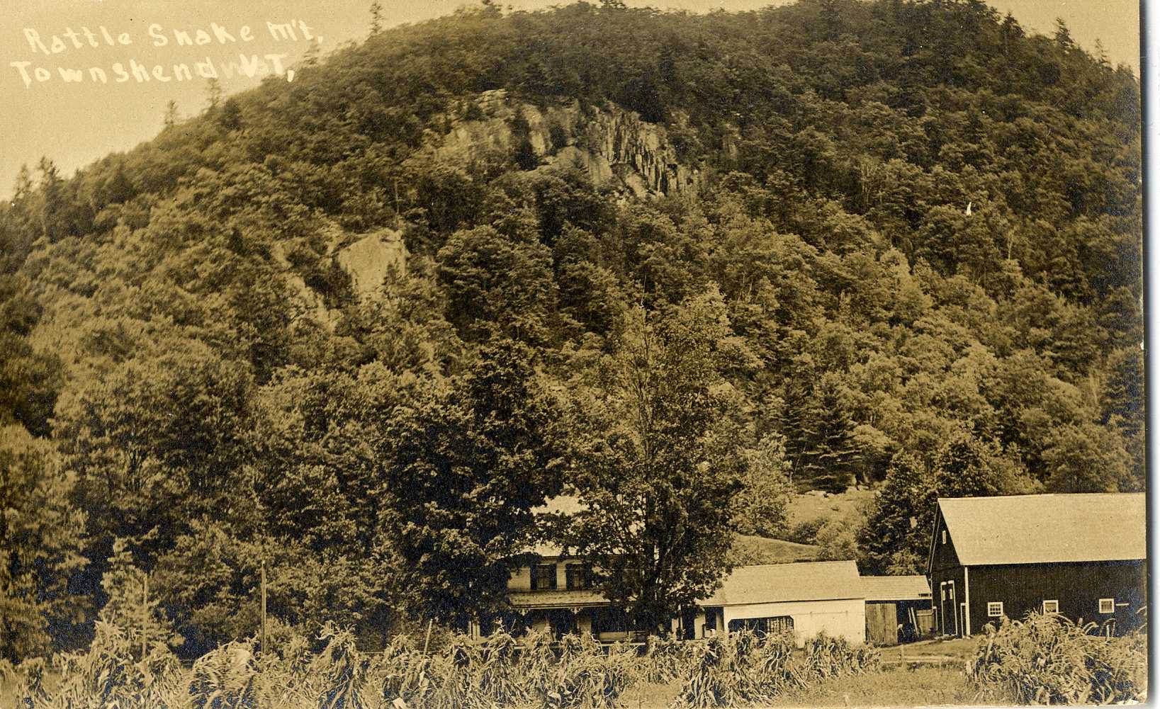
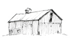
Figure 1: A
farmstead near Rattle Snake
Mountain shows the rugged terrain of Townshend.
Courtesy
of the University of
Vermont Libraries Special Collections.
Early surveyors of Townshend discouraged settlers
due to the rocky terrain and inhospitable farming land;[7]
yet, people moved to Townshend regardless and farming became the
primary
occupation of the residents. Townshend reached its peak population in
1820 with
1,406 people.[8]
Zadock Thompson's A Gazetteer of the
State of the Vermont (1824) discusses the early agricultural
activities of
Townshend, showing that the early farmers found success amongst the
mountains
and valleys.[9]Thompson
writes that industrious farmers are able to have "their barns filled
with hay and flax, their granaries with corn, wheat, rye, oats,
barleys, peas,
and beans and their cellars with the best of cider, potatoes, turnips,
beats,
onions, and other esculent vegetables."[10]
In addition, other notable crops and products included apples, lumber,
butter,
and cheese.[11]
Aside from pure agricultural
activities, Townshend was supported by
agricultural related activities including blacksmiths, gristmills,
furniture
makers, tanners, sawmills, a harness shop, and the usual town
businesses such
as a general store, a hotel, a millinery, a tinsmith, a drug store, and
a
carriage shop.[12]
The first
blacksmith, General Fletcher, began operations ca. 1770.[13]
Mills represented some of the
early businesses, the first one beginning
operations in 1782.[14]
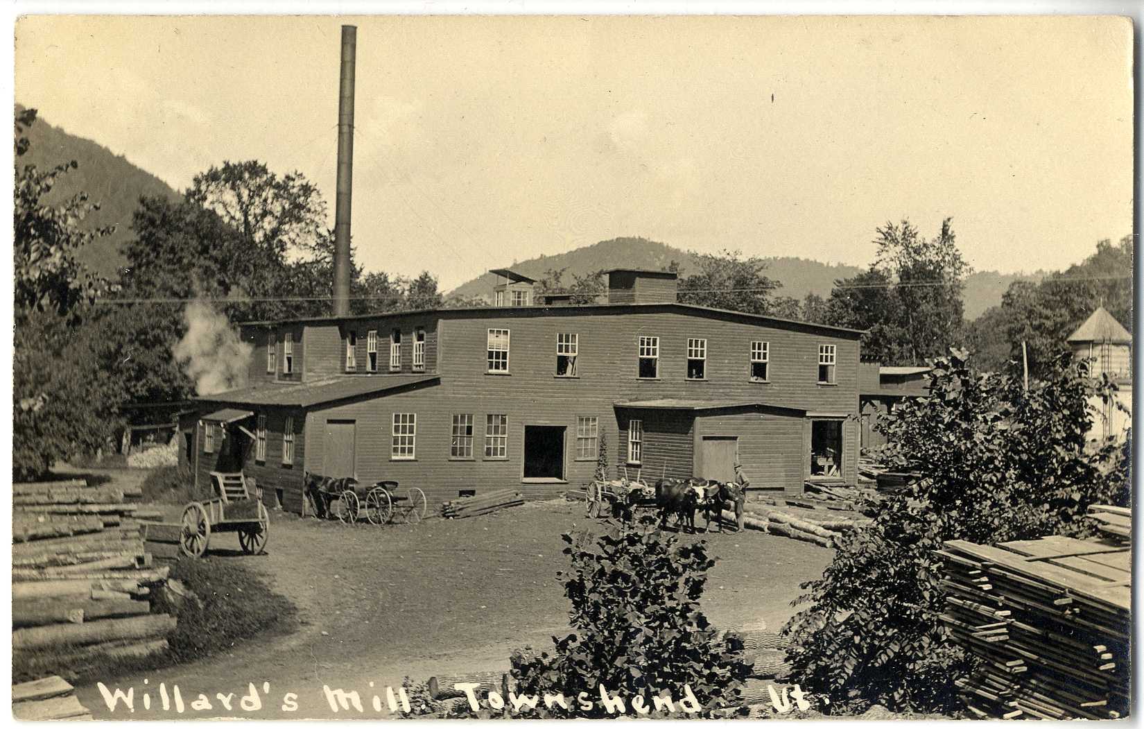
Figure 2: A 1910
postcard of Willard's
Mill.
Courtesy
of the UVM Libraries Special Collections.
Little information of the earliest days (late
1770s) of Townshend farming is available; that information would have
to be
obtained by individually investigating the extant barn structures and
perhaps
deed records. For instance, structures would have to be examined in
order to
determine the methods of construction looking for timber framing, hand
hewn
timbers, and scribe rule markings, which would indicate the late
1700s/early
1800s for building construction.[15]
However, Phelps'
tables of Grand List Statistics for
Townshend (for taxation purposes) address some agricultural
activities and
other statistics from 1802 – 1841.[16]
Summarized, his calculations
demonstrate that with some dips and regeneration, overall, cattle
ownership
reached its height (between those years) in 1833. Sheep continuously
increased,
reaching the greatest number in 1841. Overall, sheep farming in Vermont
reached
its peak in the early 1830s;[17]
thus,
Townshend saw success longer than most parts of the state.
Many products harvested or made on family farms
could be bartered locally, with some of the earliest exports of maple
sugar and
wood. Large sheep farms emerged in the 1820s -1830s as did large-scale
potato
farming.[18]
A few decades later, the 1860 and 1880
U.S. Census of Agriculture reveal that many of the 1820s farming
activities, as
discussed by Zadock, are still in place. Farmers of Townshend supported
themselves and their families primarily from the land, with a few
specialized
crops or products that would help to support their livelihood. Records
of the
1860 and 1880 agricultural census show that the most prevalent crops
were Indian
corn, Irish potatoes, butter, maple sugar, wool, and orchard products.[19]
In both years, farms grew at
least one cereal crop, typically oats, wheat, or
rye. milch cows, sheep, and oxen outnumbered horses and swine. Based on the census records,
productions
appeared steady with few differences. For example, while butter was a
very
popular dairy product in 1860 and 1880, cheese was much more widespread
in
1860.[20]
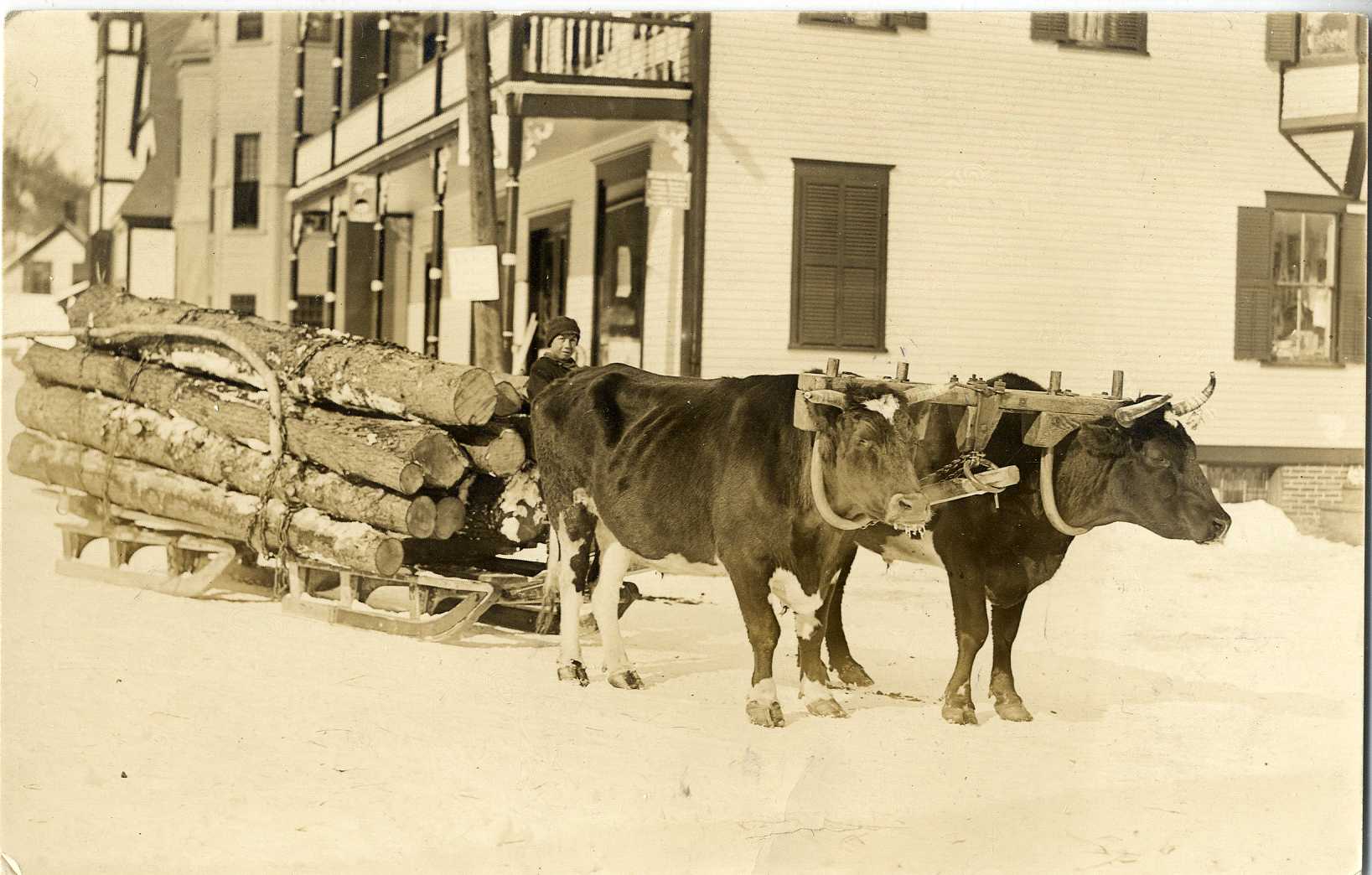
Figure 3: Oxen
pulling felled trees
through the village of Townshend, VT, 1913.
Courtesy
of UVM Libraries Special Collections.
The Hamilton Child's Gazetteer
provides a helpful look at Townshend agriculture in
1884. The largest
concentrations
farms lied along the main roads (today what are VT Routes 30 and 35),
with many
on the western side of town near Acton Brook and the West River. The
most
common farm specifications included sugar orchards, sheep, and dairy.[21]
Sheep and wool production could be found most commonly in the western
half of
town while sugar orchards mainly filled the eastern side of town.[22]
In Hamilton Child's Gazetteer only
a few farmers were listed
as owning apple orchards, yet according to the 1880 census most farms
had apple
trees and produced many bushels of apples that year.[23]
While trends in Vermont represent a decrease in
sheep farming and wool products in the mid 1800s and an increase in
dairy
farming in the mid to late 1800s,[24]
a 1939
Works Progress Administration report analysis found that the number of
cows and
sheep decreased from 1850 onwards; although after 1880, the number of
sheep
diminished drastically and the number of dairy cows saw a slow, steady
decline.[25]
As the market changed, Vermonters focused on a diversity of products
that could
be sold in the urban areas, which was possible due to the expansion of
the
railroad. The Rutland Division of the Central Vermont Railroad opened
in
December 1849 and passed through Windham County, though the railroad
faced many
construction challenges and the branch from Brattleboro to South
Londonderry
did not open until 1880.[26]
Products
and crops included milk, eggs,
potatoes, corn, cereals, and fruits.[27]
Townshend generally follows the overall
agricultural history of Vermont, with some differences. For example,
the 1860
and 1880 censuses do not list tobacco or hops, which both made their
way into
Vermont agriculture.[28]
Overall,
the agricultural production and land in Townshend reached its peak in
1860, but
has since declined. This change can be seen by looking at the number of
farms
in Townshend in 1860 (183), 1880 (157), 1935 (78), and 1945 (69).[29]
Although this decrease in the number of farms can be accounted for by
the fact that
some farms were combined, thereby increasing the acreage, the overall
agricultural activities did decrease[30]
A report on the Agricultural Trends
written for the Works Progress Administration in 1939 includes charts
that plot
the number of farms and livestock in Townshend. Comparing 1850
to 1935, the numbers of milch cows, oxen, other neat stock, horses,
hogs, and
sheep declined, though hens, unrecorded except in 1880 and 1935,
increased from
2,161 to 3,289.[31]
This
indicates that chicken and egg production became an important part of
the
agricultural economy. Beyond the 1940s and 1950s, trends across the
state of
Vermont show a sharp decrease in agriculture, particularly with the
development
of farming as a corporate big business. Family-owned farms, in the
state and
across the nation, could not compete.[32]
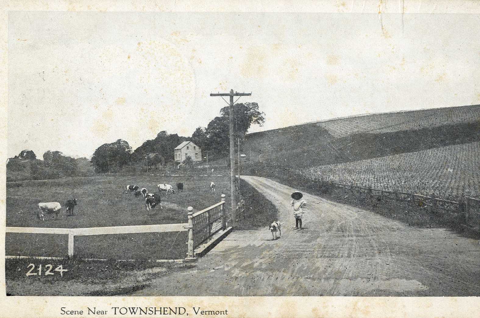
Figure 4: Dairy
cows in the pasture near
Townshend, VT, ca. 1930.
Courtesy
of UVM Libraries Special
Collections.
Modern
Townshend
The modern landscape and built environment of
Townshend certainly indicates that the town has an agricultural past; a
windshield survey conducted in September - October 2009 of Townshend
found approximately
180 properties to have at least one agriculturally related structure,
whether a
large ground stable barn or a small greenhouse. However, not all of
these
structures were historic, and some historic structures may have been
clad in
new siding and meticulously maintained. A windshield survey lacks that
depth. Some
historic activities
remain visible on the landscape, such as dairy farming. Most noticeably
there
are small scale diversified or specialized farming activities in
Townshend. For
instance, farms advertise maple sugar, alpacas, and pumpkins. One farm appeared as a
hobby farm,
raising emus.
Furthermore, while sugar production and growing
potatoes were two of the most common agricultural endeavors, very few
related
structures were seen during the survey. Historic maple sugar houses are
no
longer in use, many are dilapidated. Some buildings may no longer be
standing
due to common fires.[33] Farms
advertise maple sugar,
which indicates that farmers have new structures or other methods for
maple
sugar production.
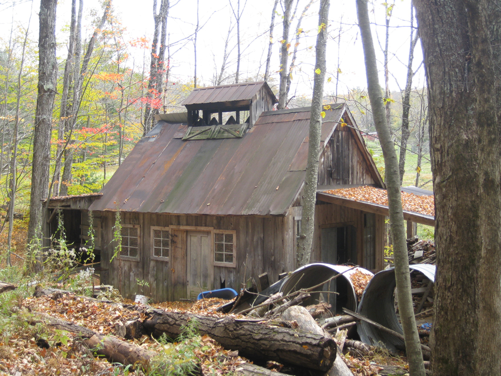
Figure 5: A
dilapidated maple sugar house
at Peak Mountain Farm in Townshend, VT.
Photograph
by author, October
2009.
In the case of potato storage, they may have been
out of sight from the public road. However, for those barns standing,
many
appear to be in use, though often the use is currently for storage of
belongings or vehicles. Barns in the villages have been converted to
antique
stores, garages, and in about five visible cases, barns have been
rehabilitated
into a house or business and office space.
Townshend,
VT remains a primarily rural town as of October 2009 with small
villages,
Townshend being the largest. The southwestern portion is largely
Townshend
State Forest, a Vermont State Park. The southeastern portion reveals
new
development just south of Crane Mountain to the east of Harmonyville. Comparing historic and
modern maps
reveals that this area had not seen development.
A 1958 road map shows an unimproved
road through the area,
though the 2000 map reveals small, short, winding roads.[34]
New construction is still occurring. Overall, the farms do not suggest
high
agricultural activity; there is not evidence for the great quantities
of apple
orchards from the 1880s. A few large stable barns suggest prior using
for sheep
and cattle. However, the extant barns reveal a recent link to
agricultural and
in many cases, residents are maintaining their barns, adapting them for
a
current use and showing their connection to their heritage.
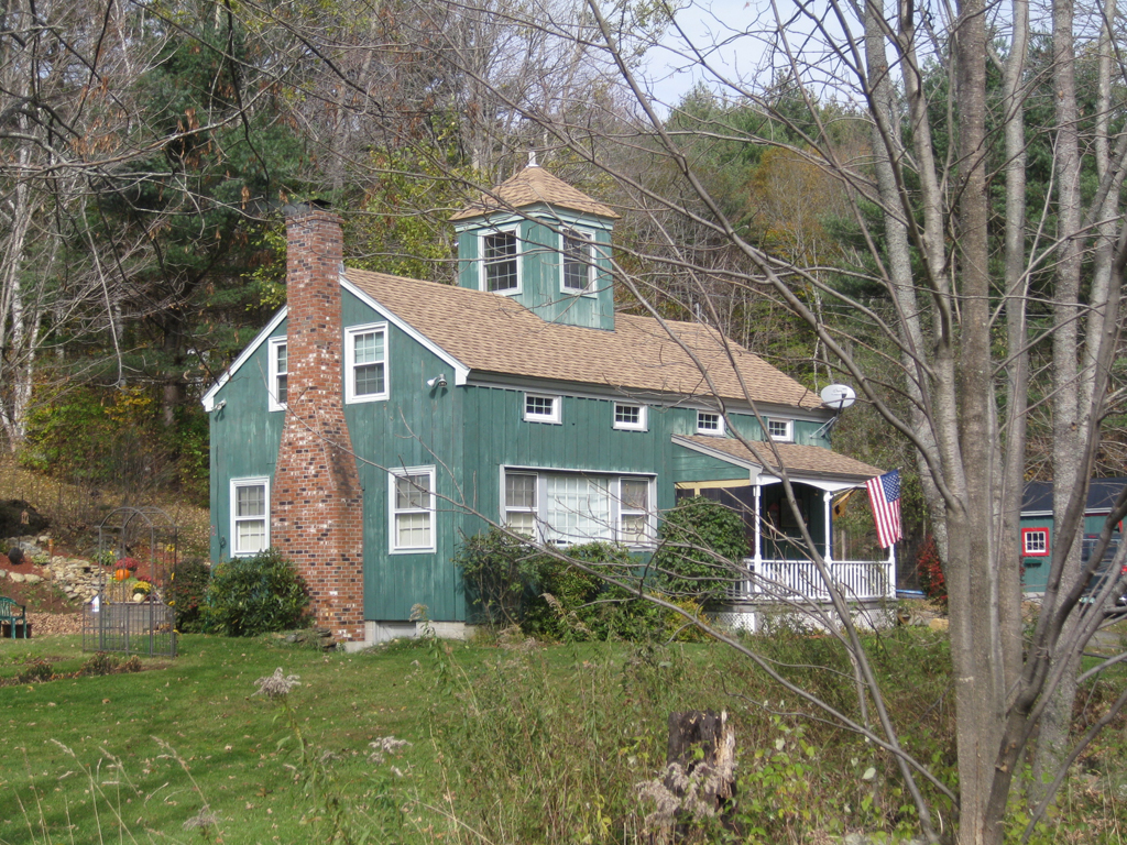
Figure
6: A rehabilitated barn
converted to a dwelling at 2557 Grafton
Road, Townshend, VT.
Photograph
by author (October 2009).
Suggestions
for Further Research
Due to the limitations of this project and the
vast amount of primary sources available, one avenue for research is to
analyze
Phelps' discussion of Townshend residents and their properties
mentioned. As
Phelps writes of construction dates
and alterations to their property, including barns; there is much
information
to be discovered. Unfortunately, individual properties are identified
by occupants
in 1877 and not by the modern construct of addresses.[35]
Phelps discusses these properties in relation to the districts of the
town,
similar to the F.W. Beers Atlas. Seeing as Phelps' Gazetteer was
published in
1877, many of the names discussed correlate to the Beers Atlas of
Windham
County of 1869. Thus,
there is
invaluable information. Complemented by deed research to trace the
property
owners' names and matching them to Phelps and Beers would result in an
understanding of the individual farms. Phelps
even accounts for properties that have been moved or
demolished. This study, given appropriate attention, could accurately
place the
agricultural activities of Townshend.
[1]
Hamilton
Child, Gazetteer
and Business Directory of Windham County, VT, 1724-1884 (Syracuse, New York: Journal
Office, 1884), section 304, 20-21.
[4]
James H.
Phelps, Collections Relating to the History
and
Inhabitants of the Town of Townshend, Vermont, Part
II (Brattleboro, Vermont: Geo. E. Selleck, 1877).
[5] F.W. Beers, Atlas
of Windham County, Vermont (New York: F.W. Beers, A.D. Ellis,
& G.G.
Soule, 1869).
[6]
James H. Phelps, Collections
Relating to the History and Inhabitants of the Town of
Townshend, Vermont, Part II
(Brattleboro,
Vermont: Geo. E. Selleck, 1877), 50.
[7] Hamilton Child, section
304, 23.
[8] Zadock Thompson, Gazetteer of the State of Vermont, Contains
a Brief General View of the State: A Historical and Topographical
Description (Montpelier:
E.R. Walton, 1824), 310.
[13] James H. Phelps, 160.
[15]
Thomas D. Visser, Field
Guide to
New England Barns and Farm Buildings (Hanover, New
Hampshire: University
Press of New England, 1997), 9-19. During
a windshield survey conducted of Townshend in
September-October 2009,
the author found approximately 20 English barns, which would be a good
place to
begin investigations.
[16] James H. Phelps, 240-246.
[17] Agricultural
Resources of Vermont, Multiple Property Documentation Form,
National
Register of Historic Places (Montpelier, Vermont: Vermont Division for
Historic
Places, 1991), E6.
[18] Agricultural
Resources of Vermont, Multiple Property Documentation Form,
E6.
[19] U.S. Bureau of the Census,
Agricultural Census,1860,
1880.
[21] Hamilton Child, 486-495.
Analysis based on the
Town of Townshend section in the Business Directory of Windham County,
in which
individuals are listed with their occupation and address by road. Those
listed
as farmers sometimes have a specific type of farming listing, which was
utilized in this discussion.
[23] Ibid.; U.S. Bureau of the
Census, Agricultural
Census, 1880.
[24] Agricultural
Resources of Vermont, Multiple
Property Documentation Form, E7.
[25] Works Progress
Administration, Agricultural Trends in
Townshend, VT, Official Project No.
665-12-3-56 (Burlington, Vermont:
The
Agricultural Extension Service, University of Vermont and State
Agricultural
College, September 1939), 5.
[26] Hamilton Child, 46-49.
[27] Howard S. Russell, A Long Deep Furrow, with foreword by
Wayne D. Rasmussen (Hanover,
New Hampshire: University Press of New England, 1976), viii.
[28] Agricultural
Resources of Vermont, Multiple
Property Documentation Form, E7.
[29] U.S. Bureau of the Census,
Agricultural Census,1860, 1880; Farm
Census for the Towns in Vermont Based on the Bureau of the Census
Unpublished
Data, Jan. 1, 1945 (Burlington Vermont: University of
Vermont and State
Agricultural College Cooperative Agricultural Extension Service, 1946
1935
figure from WPA report, 1946) available at UVM Libraries Special
Collections.
[30] Works Progress
Administration,
Agricultural Trends in Townshend,
VT, 5.
[32] Agricultural
Resources of Vermont, Multiple Property Documentation Form,
E29.
[33] Thomas D. Visser, 180.
[34] Townshend Road Map with
alterations, 1958 from
the Town Highway Map Archives of the Vermont Agency of Transportation,
http://www.mtbytes.com/vtrans/, accessed 10/25/2009; Road Names in
Townshend,
VT, 2000, provided by the Windham Regional Commission.
[35] This warrants a much more in
depth history of
Townshend properties, in which many properties could be identified
through deed
research and be paired with PhelpsÕ history. It does not discuss the
use of a
building beyond house or barn.