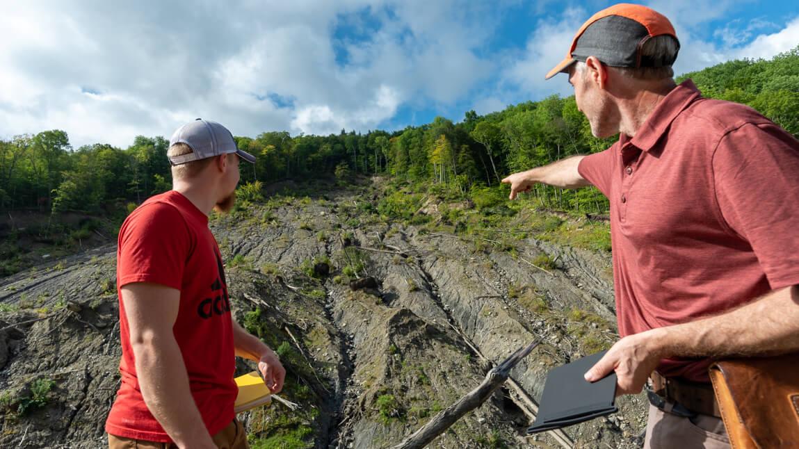
One day at the end of May, in 2019, in the Mount Mansfield State Forest outside of Waterbury, twelve acres of hillside gave way and fell into Cotton Brook. This landslide, three hundred feet high, wiped out the Foster Trail, and dumped tons of silt into the brook. In turn, the silt washed down into Waterbury Reservoir, clogging it with a large muddy delta. Two years later, on a grey August morning, UVM geologist Keith Klepeis stands at the bottom of the still-raw slope amidst a vertiginous web of destroyed trees, bent and snapped into piles like gigantic splinters.
“Landslides happen all the time. But this is a big slip,” he says, probably the largest in Vermont in forty years. And, Klepeis’s research shows, they’re becoming more common and more powerful as the climate changes. “We’re seeing more rainfall and bigger storms,” he says. “We want to know more about how this kind of slide happens; it’s not well understood.” This collapse caught people by surprise and it was only by luck that no hikers went down with the trees.
He’s there with a team including Grant Long ’22, one his undergraduate students; Vermont state geologist Dr. Jonathan Kim; Julia Boyles of the Vermont Geological Survey; Norwich University geologist George Springston; three drone pilots from the state’s Agency of Transportation; and Julie Moore, Secretary of the Agency of Natural Resources. They’d all like to know how likely it is that this slide will slide again—and where else in the state to watch out for rocks, or whole hillsides, that might tumble. To help, the scientists, with funding from FEMA, are studying the complex layers and forces at work—and developing maps and models of how this landslide happened. “We want to measure the exact geometry here, which points toward the mechanisms. And that will help land managers understand the risks. And then we go onto the next place,” Klepeis says, building toward a comprehensive understanding across the state. “What aspects of this event are transferable?” wonders Klepeis a professor for twenty-one years in UVM's Geology Department, soon to join the newly-proposed Department of Geography and Geosciences. He and his colleagues know that part of what happened here was a bit like the top of a tipped-over layer cake sliding on icing underneath. Fourteen thousand years ago, around the time the vast Laurentide ice sheet melted northward, this site was under water, near the shores of Glacial Lake Winooski. It left behind fine-grained lake-bottom silt and clay. On this 28-degree forested slope, this layer under the topsoil creates what the geologists call a “vulnerable slide surface.”
“It might have happened in seconds,” says Klepeis, “you wouldn’t haven’t wanted to be here when it came thundering down.” Which is why he and the rest of the researchers have, cautiously, come back here, collaborating with the State of Vermont, to build the knowledge and advanced tools needed to better predict where the earth will move and when to get out of the way.
