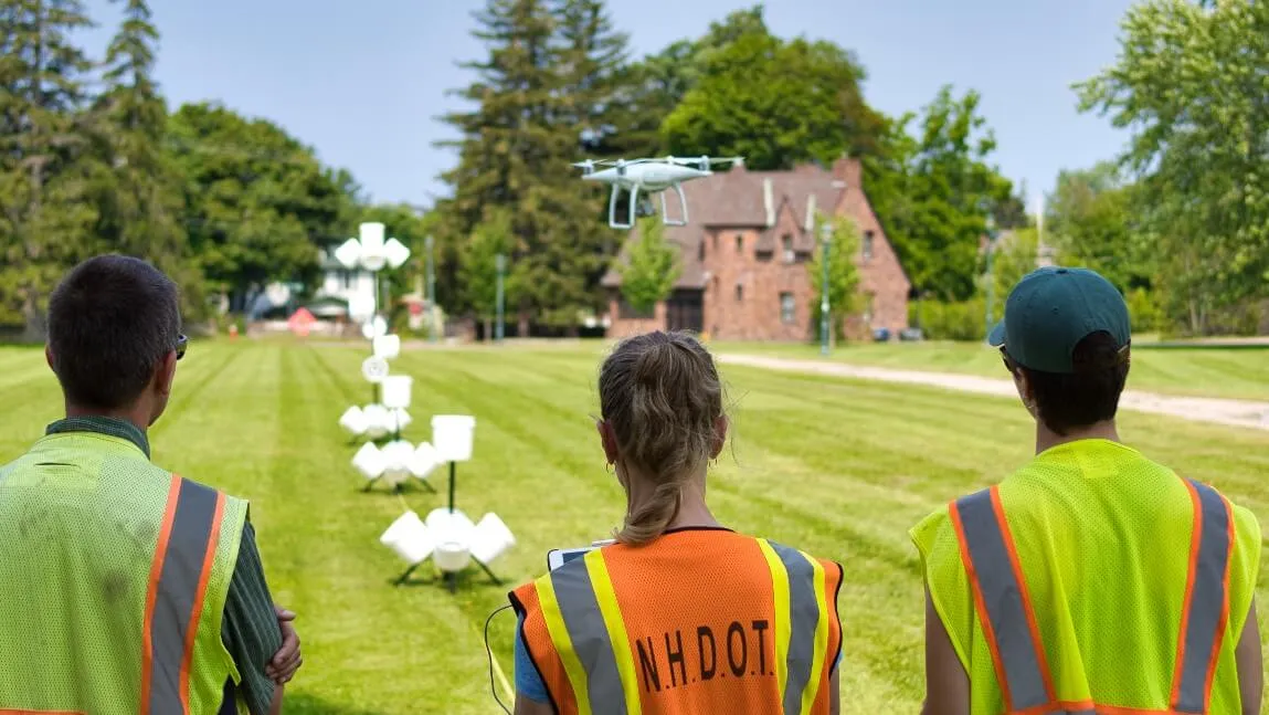
The airspace over Southworth lawn during the first week of August was buzzing with activity as 20 state officials from around Vermont and New England practiced their drone flying skills. The training was part of a five-day workshop hosted by UVM’s Spatial Analysis Lab (SAL).
“It was a great opportunity to share our knowledge with state government and state agencies in the region and build partnerships,” commented SAL director Jarlath O’Neil Dunne.
The training was led by O’Neil-Dunne and Adam Zylka ’14. Zylka has been experimenting with drone technology since his days as a UVM undergraduate in the Rubenstein School of Environment and Natural Resources. He’s now the Unmanned Aircraft Systems (UAS) lead at SAL.
“The idea was to use our expertise and do workshops to train state employees how to use drones safely and effectively, and help them build out drone programs at their various agencies,” Zylka said.
Participants included the Vermont Agency of Natural Resources; transportation officials from Vermont, Massachusetts, Maine and New Hampshire; and state police from Maine and Vermont.
The training included risk assessment—identifying potential dangers to drone flights posed by weather, utility lines and other hazards—and learning the “rules of the air.” Later in the week, the group learned the art of nighttime flying.
The workshop participants learned how to fly drones using handheld remotes, testing their skills on courses designed to sharpen their steering and hovering. They practiced mapping, infrastructure inspections, and 3D modeling using the Redstone water tower as a point of interest.
“One application for drones is the ability to get close to structures and use the camera to zoom in on a specific feature, like a bolt head,” Zylka explained. “It’s one way to quickly assess maintenance needs or potential failures in buildings, bridges or dams.”
The diversity of attendees illustrates the numerous applications that data from drone flights can generate.
A Pioneer in Unmanned Flight
SAL is nationally known for big projects like landcover tree mapping—the lab has completed tree canopy assessments from Los Angeles County, to New York City, to the Chesapeake Bay watershed.
These projects depend on imagery and elevation data collected by satellites or planes. UAS offer a way to perform more focused observations.
“We started our UAS research at UVM in response to the impacts of Irene,” Zylka said. “We were asking ourselves ‘how can we use this kind of new technology for disaster response?’ With UAS we can easily map impacted areas, determine volumes of damaged roadways, or see if it’s safe to cross a storm-damaged bridge."
The SAL has used UAS data for projects including localized disaster response, monitoring aquatic invasive species in Vermont’s waterways, calculating the volume of woodchip piles at Burlington Electric, and monitoring changes at the landfill in Coventry, Vt. WCAX-TV recently interviewed Zylka for a feature on how UAS data have been used to monitor gypsy moth caterpillar impacts in Addison County.
“UAS have a lot of advantages. They are lightweight, maneuverable and pretty easy to operate. The camera technology is always improving. They can go places where traditional aircraft can’t go, and places where it’s unsafe for humans to go.”
Zylka was one of the earliest members of UVM’s UAS team as a student—he graduated in 2014 with a degree in environmental engineering and a minor in geospatial technologies. He became the first American employee for the Swiss drone manufacturer senseFly, serving as a technical manager and trainer for businesses, universities and federal agencies in North America. Now he’s back at SAL, training local and regional clients to use.
“It’s exciting to see the technology grow, and helping people understand the multiple uses. As a land grant university we love sharing our knowledge with community.”
Funding for this workshop was provided by the National Academies of Sciences–Transportation Research Board.