Vermont Barn Census
Chittenden County Student Research Project - 2010
|
Vermont Barn CensusChittenden County Student Research Project - 2010 |
|
University of Vermont Historic Preservation
|
Agricultural History of Jericho and Bolton, Vermont Written and compiled by Kate Ritter, Fall of 2010
The towns of Jericho and Bolton lie within a landscape that is undulating, wild, and serene. Aside from being attracted to the beauty of this setting, it is difficult to imagine what would have drawn pioneers from Connecticut and western Massachusetts to establish their farms and communities amongst such unforgiving conditions. Although misleading, this area indeed boasted (and continues to provide) fertile soil for cultivation and plentiful rivers and streams for water power. It is apparent that throughout the towns’ history, residents have embraced the cool climate and challenging terrain, not only making the best of the land, but also enjoying an existence that is marked by quiet roads and cherished buildings, many of which appear much the same as they did one or even two centuries ago. Jericho began as a township of 23,040 acres, granted to Edward Burling, Thomas Chittenden, “and 64 others, in 72 shares” by Governor Benning Wentworth of New Hampshire. Chartered on June 7, 1763, the hilly land offered numerous streams and springs, which influenced its character as a manufacturing town.1 The first residents, Roderick Messenger, Azariah Rood, and Joseph Brown, journeyed from Connecticut and western Massachusetts with their families. Messenger and Rood began to develop land on the banks of the Winooski River, and Brown took a plot within the flats near Underhill, on the banks of Brown River (later named in his honor). The town was initially difficult to settle, as land struggles with the Native Americans and the British forced the pioneers to withdraw until peace was declared between the States and Great Britain. After the original settlers returned to the land, its population grew steadily.2 In 1791, the community members constructed the town’s first church on four acres of land that was donated by Luther Chapin. Until this point, people had been meeting in private residences and barns, with services conducted by Ebenezer Kingsbury.3 The designated plot became known as “the Green,” and was the spot around which Jericho Centre was developed.4 Jericho Centre was a post-village in the center part of town. It was smaller than Jericho town, but still contained a number of businesses and residences, as well as Jericho Academy, founded in 1825 by Simeon Bicknell. The area around Jericho and Jericho Centre boasted numerous springs and streams that ran through the land, enabling the construction of several mills which produced flour, cider, and cheese, as well as milled lumber.5 The main town of Jericho was considered to be the settlement’s manufacturing hub, and is located west of the Centre. Manufactured and agricultural products were eventually shipped by way of the Central Vermont Railroad, constructed in 1847. The climate and soil yielded conditions that were excellent for growing grains and grasses, and timber of various types was also plentiful. Together, the advancements in transportation and farming encouraged the construction of more mills, so that by 1882, there were seven total in Jericho itself. These included a pump and water tubing manufactory, the Jericho Chair Company, several grist and flouring mills, a butter-tub and cheese-box manufactory, and two sawmills.6 The Agricultural Census indicates that by 1860, there were 13,603 acres of “improved land” within the town, with the most notable populations of animals being those of milking cows (1,316 total) and sheep (2,000 total). Abundant crops included Indian corn (12,512 bushels per year), oats (26,054 bushels per year), Irish potatoes (23,100 bushels per year), wool (8,065 pounds per year), butter (156,215 pounds per year), cheese (106,438 pounds per year), and maple sugar (14,225 pounds per year).7
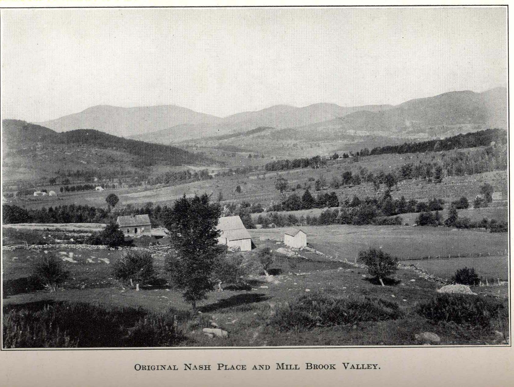
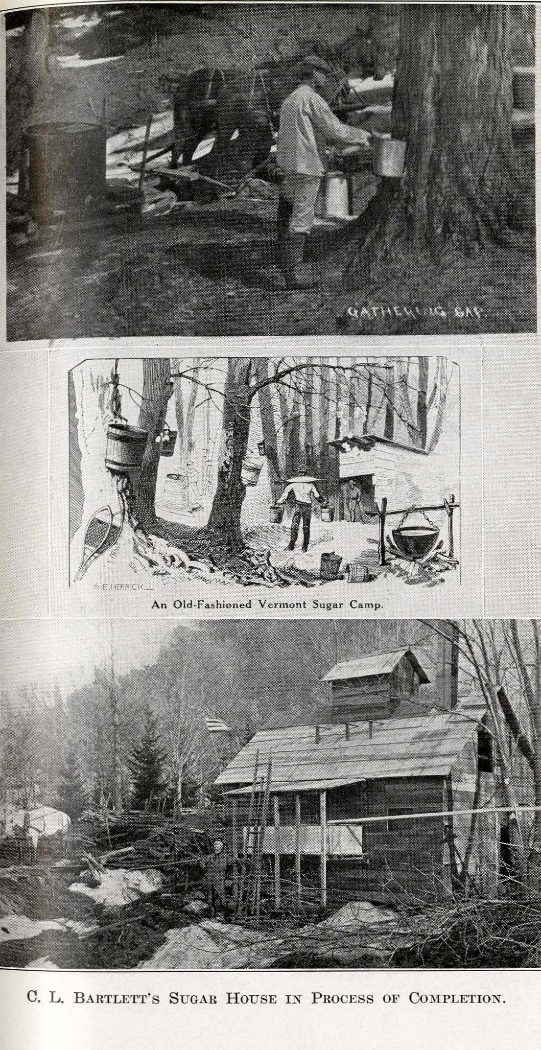
Above left: showing agricultural landscape of Jericho. Photographer: unknown. Source: Lilian Carlisle, Look Around Chittenden County (Chittenden County Historical Society: Burlington, VT, 1976). Above right: showing the process of maple sugaring. Photographer: unknown. Source: Lilian Carlisle, Look Around Chittenden County (Chittenden County Historical Society: Burlington, VT, 1976).
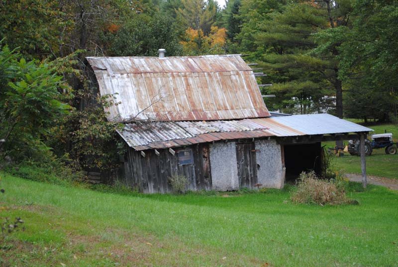
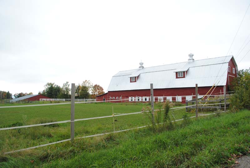
With the rich variety of crops and livestock came construction of a variety of structures, including sugar houses, corn cribs, sheep barns, chicken coops, milking parlors, and other specific buildings that were in addition to the central barn. The central barns were generally of the English type (late-18th century to mid-19th century) and the larger ground stable type (late-19th century to mid-20th century). Several of the town’s original farms are still active, and are housing many of the same livestock and products. Of special note is the earliest standing homestead of the town, built by Joseph Brown in 1788. The property remained in the Brown family until 1971, and its appearance has undergone minimal change. Although only the threshing barn remains from the original group of four, the current owners keep tradition alive by raising chickens, sheep, and growing organic produce.8 The town readily exhibits its agricultural heritage with the rich and interesting variety of barns and outbuildings. These structures display a spectrum of physical states, ranging from sagging and leaning, to preserved and active.
521 Browns Trace Rd (facing north-east) and 4 Nashville Rd (facing west), Jericho. Photos by Kate Ritter, 2010.
Similar to Jericho, Bolton also contains a varied collection of farm buildings. However, major contrasts stem from a geographical location that causes the town to be even more rugged and removed than the neighboring Jericho. Bolton was granted under the same conditions and on the same day as Jericho, to Thomas Darling and “71 associates.” The 23,040 acres were “very broken and mountainous, the rugged, rocky piles, with their steep cliffs and dark gorges, afford(ed) many wild, romantic points of scenery…"9 The settlement’s first church was a 50-foot tall rock, the first quarterly service being held in 1800. “For many years, the church site was situated at the back of a level meadow about one and a half miles from the Jonesville station, and about 40 rods from the railway, and was pointed out to visitors, but its whereabouts is a mystery now.”10 Bolton’s unique geography grows from the valley created by the Winooski River, with mountains abruptly rising on both sides, which creates wind tunneling and cool temperatures. The close proximity of the river has also caused major flooding issues, especially during the years of 1852 and 1927, when the rushing water demolished the main bridge, and many farms and residences. Despite these challenging conditions, Bolton developed as a small lumbering and milling town, with its residents taking advantage of the numerous water sources by constructing several milling facilities. By 1882, three of these mills were located in the “hamlet” of Bolton, next to the river. These included two lumber and shingle manufactories, and a butter tub and cheese box manufactory. The small village of West Bolton also contained a small number of community buildings and residences.11 Bolton’s residents also managed to maintain a small but prosperous number of farms, as the land boasted rich soil that was ideal for cultivation: “The hillsides have a deep soil of marl and clay, while many of the streams have upon either bank a rich interval of sandy loam, second in fertility to none in the country.”12 They kept similar livestock and produced comparable goods as residents in Jericho did. However, two names stand out on the 1860 Agricultural Census as unique because of the unusual crops that they put forth. Joel Davis was the only resident who produced molasses (40 gallons per year). Also notable, and possibly relevant, is the relatively high amount of improved acreage and value of his farm. Another resident, Lyman Chiloh (writing difficult to read) grew hops, a rare crop in Vermont, producing 1500 pounds per year. Chiloh’s name does not appear to be present on the roughly corresponding 1857 Beers Atlas map, and neither of these crops appear to be tallied in the 1880 Agricultural Census. Although Bolton has experienced a small yet hearty group of residents, the population gradually declined throughout the mid-1800’s and into the mid-1900’s, until it rose again as the result of a completely different industry: downhill skiing. Aside from the few small farms that have continued to exist, the town is mainly centered around the Bolton Valley ski resort. Many dwellings are seasonal, and much of the farmland has gone to wild fields or returned to forest, an example of the many establishments where nature, once again, reclaims its ground.
1 Hamilton Childs, Gazetteer and Business Directory of Chittenden County, Vermont for 1882-83 (Syracuse, NY: Hamilton Childs, 1883), 223. 2 Chauncy Hayden, Luther Stevens, and Wilbur LaFayette, The History of Jericho, Vermont (Burlington, VT: The Free Press Printing Co., 1916), 113. 3 Chauncy Hayden, Luther Stevens, and Wilbur LaFayette, The History of Jericho, Vermont (Burlington, VT: The Free Press Printing Co., 1916), 120. 4 Hamilton Childs, Gazetteer and Business Directory of Chittenden County, Vermont for 1882-83 (Syracuse, NY: Hamilton Childs, 1883), 237. 5 Hamilton Childs, Gazetteer and Business Directory of Chittenden County, Vermont for 1882-83 (Syracuse, NY: Hamilton Childs, 1883), 225. 6 Hamilton Childs, Gazetteer and Business Directory of Chittenden County, Vermont for 1882-83 (Syracuse, NY: Hamilton Childs, 1883), 224. 8 Jericho Community Center, Barn and Farm Tour Publication (Jericho, VT: Jericho Community Center, 2005). 9 Hamilton Childs, Gazetteer and Business Directory of Chittenden County, Vermont for 1882-83 (Syracuse, NY: Hamilton Childs, 1883), 88. 10 Chauncy Hayden, Luther Stevens, and Wilbur LaFayette, The History of Jericho, Vermont (Burlington, VT: The Free Press Printing Co., 1916), 278. 11 Hamilton Childs, Gazetteer and Business Directory of Chittenden County, Vermont for 1882-83 (Syracuse, NY: Hamilton Childs, 1883), 90. 12 Hamilton Childs, Gazetteer and Business Directory of Chittenden County, Vermont for 1882-83 (Syracuse, NY: Hamilton Childs, 1883), 89.
Bibliography of Resources
Agricultural Census, Chittenden County, VT: Jericho and Bolton (1850, 1860, 1870, 1880). Albers, Jan. Hands on the Land. Cambridge, MA: The MIT Press, 2000. Beers, F.W. Atlas of Chittenden County, Vermont. New York: F.W. Beers, 1869. Childs, Hamilton. Gazetteer and Business Directory of Chittenden County, Vermont for 1882-83. Syracuse, NY: Hamilton Childs, 1883. Childs, Hamilton. Map of Chittenden County, Vermont. Syracuse, NY: Hamilton Childs, 1882. Hayden, Chauncy, Luther Stevens, and Wilbur LaFayette. The History of Jericho, Vermont. Burlington, VT: The Free Press Printing Co., 1916. Jericho Community Center. Barn and Farm Tour Publication. Jericho, VT: Jericho Community Center, 2005. United States Geological Survey. Enosburg Falls, VT Topographic Map. USGS, 1924. United States Geological Survey. Enosburg Falls, VT Topographic Map. USGS, 1953. Vermont Landscape Change Program, http://www.uvm.edu/landscape/menu.php (search Bolton). Visser, Thomas. Field Guide to New England Barns and Farm Buildings. Lebanon, NH: University Press of New England, 1997. Walling, H.F. Map of Chittenden County, Vermont. New York: Baker & Tilden Co., 1857.
|
||||
Funding support for the Vermont Barn Census project has been provided in part by a Preserve America grant through the National Park Service
to the State of Vermont Division for Historic Preservation.
The content of this site was written and accumulated by Kate Ritter, UVM Graduate Student in Historic Preservation, during Fall of 2010.