 |
||||
Source Data: Vermont Mapping Program (VMP) 1/2m panchromatic digital orthophotographs and National Agricultural Imagery Program (NAIP) 1m true color digital orthophotographs supplemented by numerous ancillary GIS data layers.
Classification Scheme: 14 classes based on Anderson et al. (1976). Click to download a zip file containing ArcGIS layer files with symbology created specifically for the Riparian LULC layers.
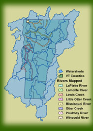
Riparian Buffer: 800 meters on each side of the stream (1600m total). Measured from edge of stream banks where visible on aerial imagery, and from stream center lines when the banks are not discernable.
Minimum Mapping Unit (MMU): 0.1 hectares (~0.25 acres).
Horizontal Accuracy: 1:5,000
Currentness: August, 2003
Downloadable Data
| Download | Metadata |
| Lamoille River (North Branch, Seymour River) | |
| LaPlatte River | |
| Lewis Creek | |
| Little Otter Creek | |
| Missisquoi River (North Branch, Trout River) | |
| Otter Creek (Lemon Fair River, New Haven River) | |
| Poultney River (Castleton River, Hubbardton River) | |
| Winooski |

Click to view full-size version
Download index layer
shapefile format
shapefile format