Vermont Barn Census
Chittenden County Student Research Project - 2010
Home
History
Survey Map
Census
Pictures
VT Barn Census
Resources
Historic Maps
Click on each map for a higher resolution image.
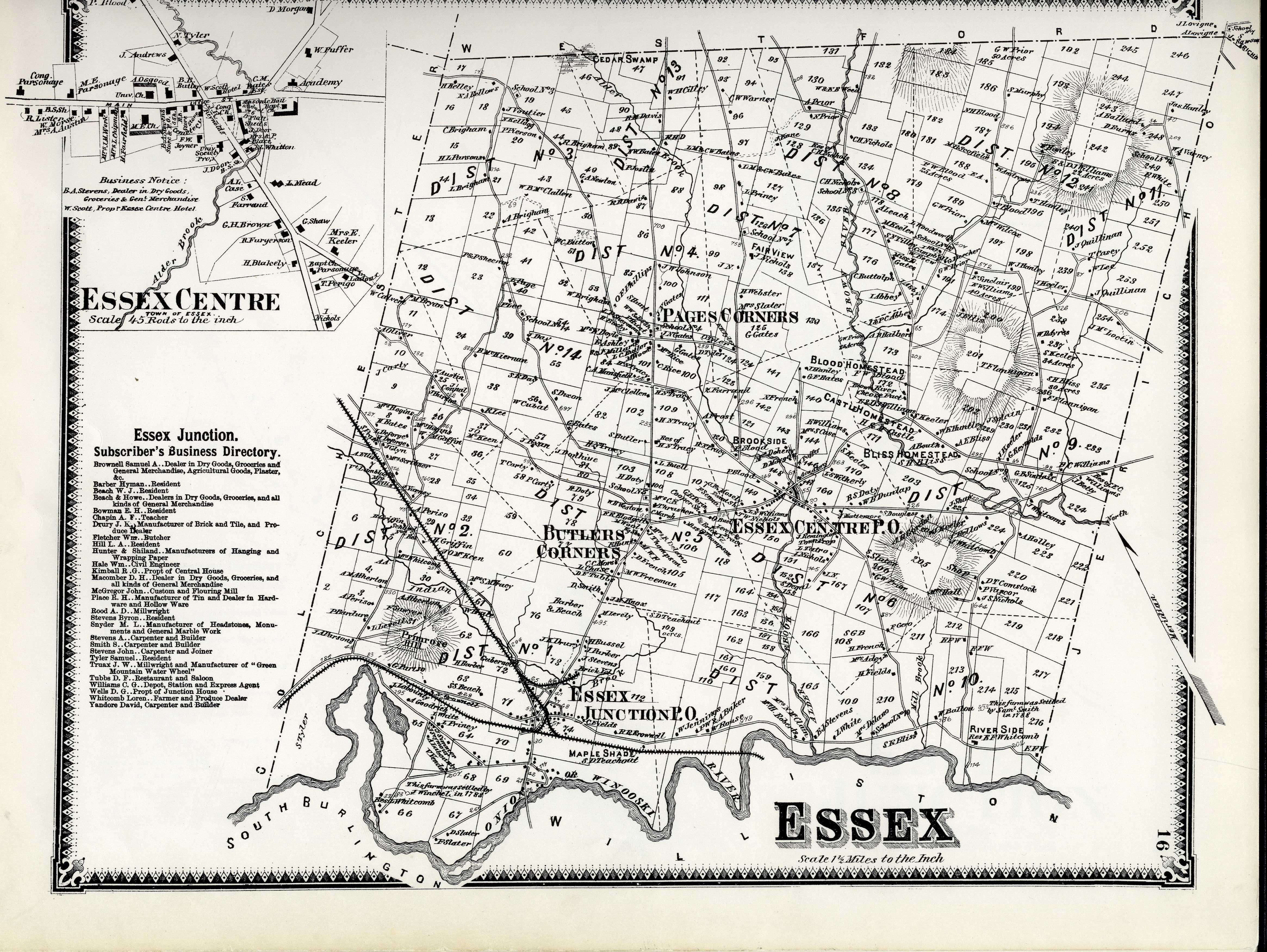
F.W. Beers Map of Essex, 1869
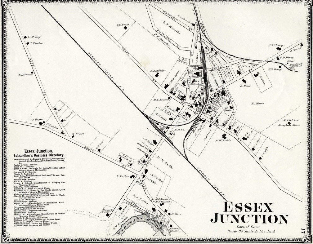
F.W. Beers Map of Essex Junction, 1869
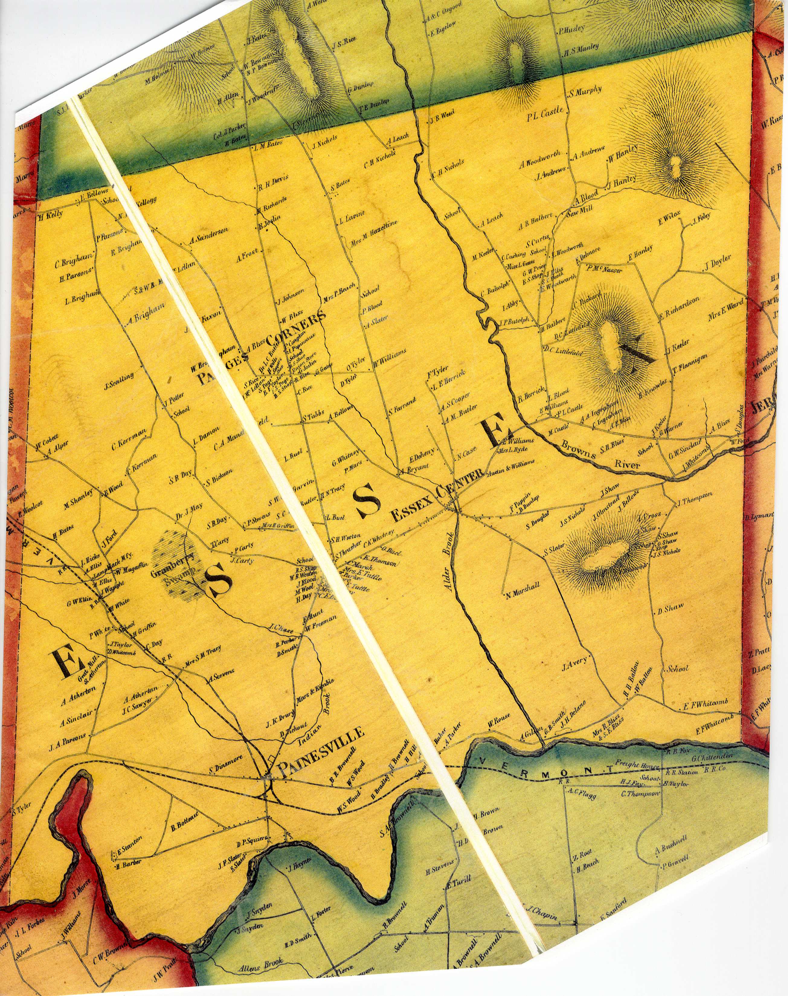
H.F. Walling map of Essex, 1857
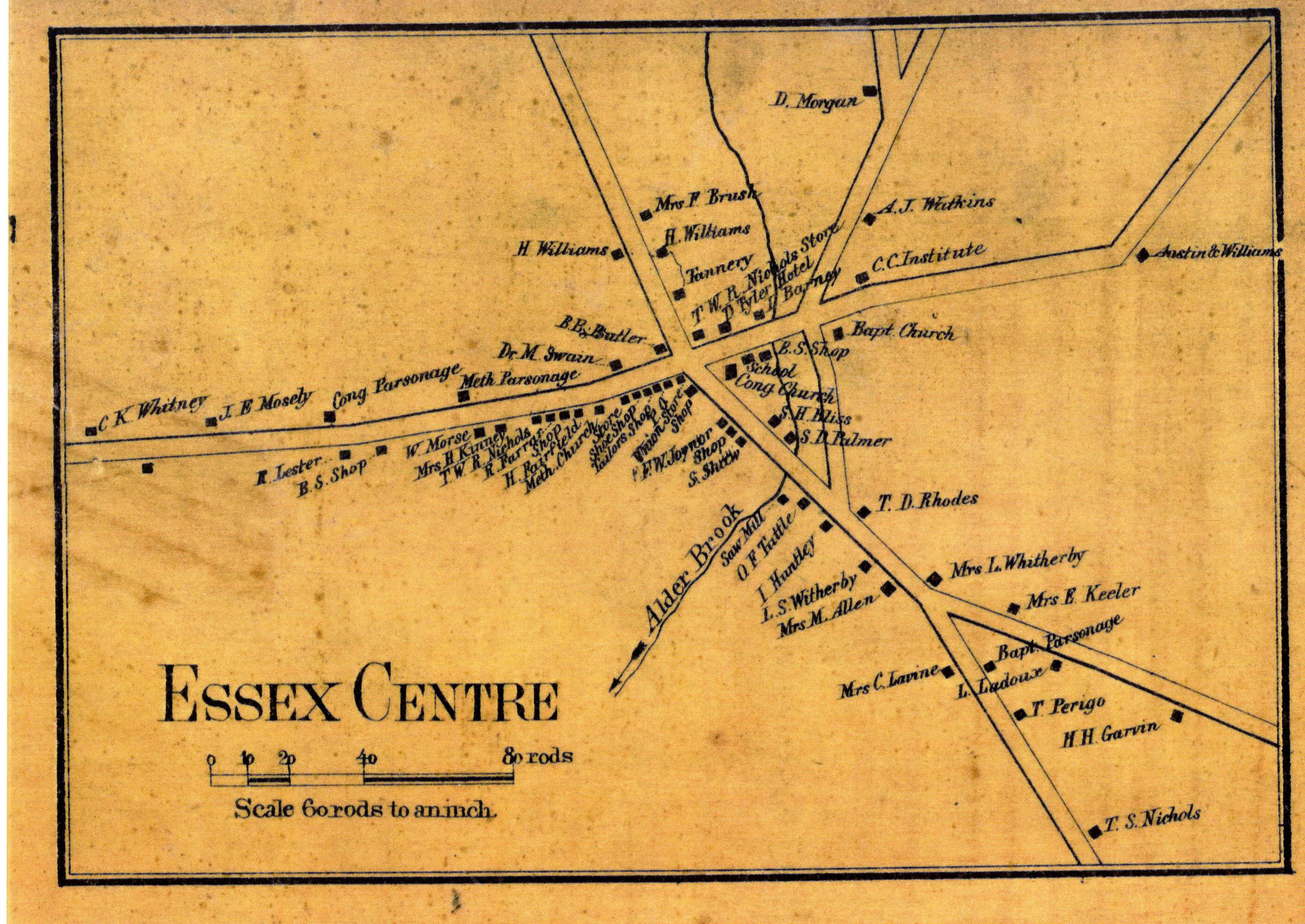
H.F. Walling map of Essex Center, 1857
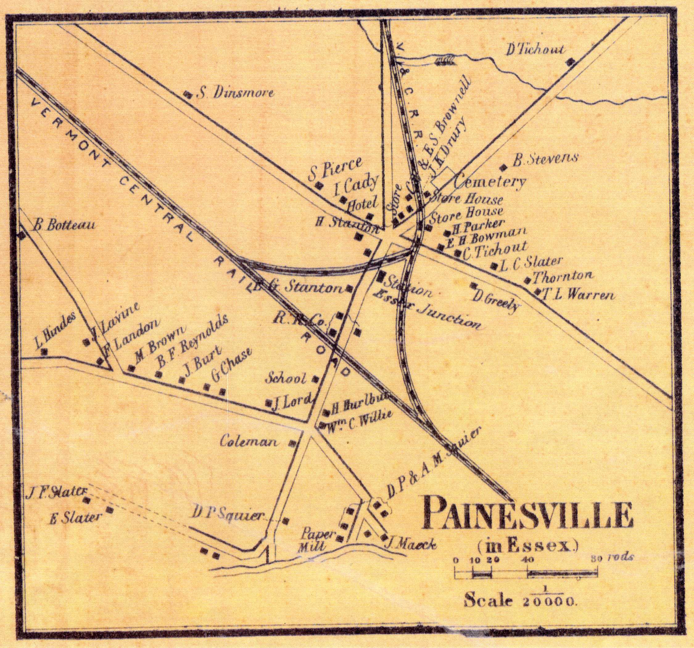
H.F. Walling map of Painesville (Essex Junction), 1857
All map images compliments of the Bailey Howe Library: UVM Special Collections