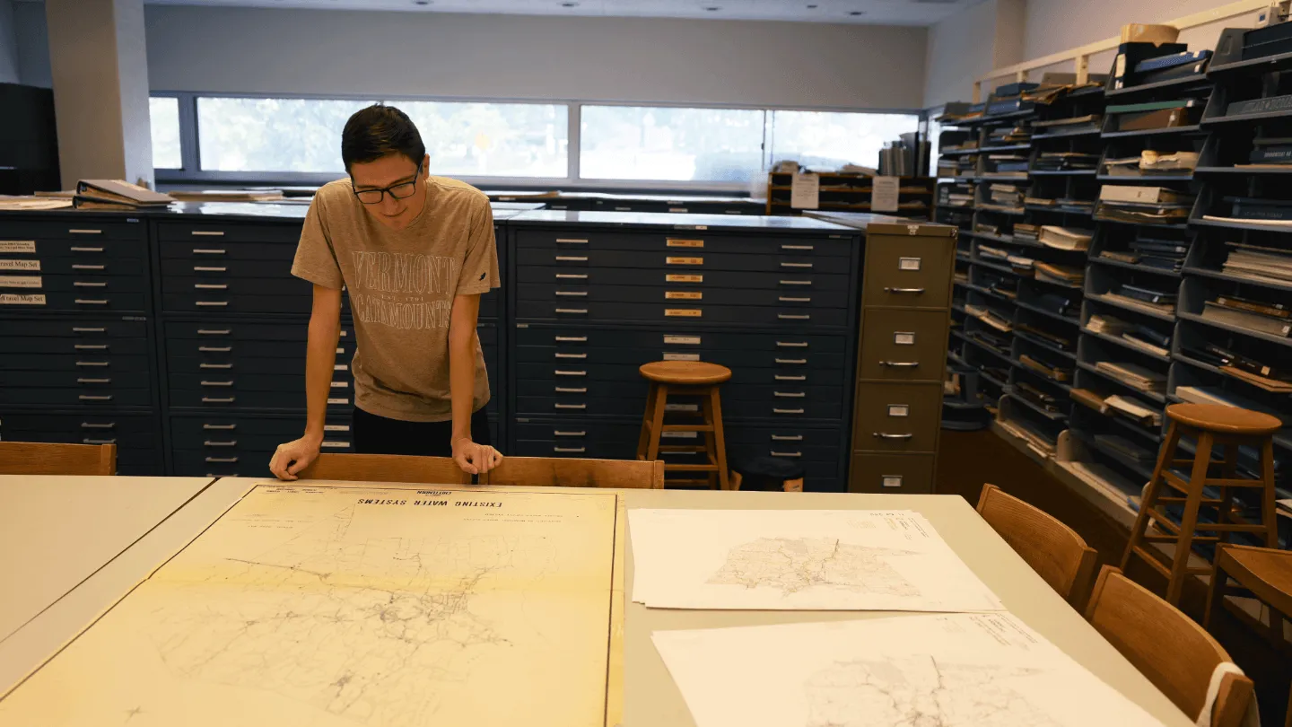
On the ground floor of Howe Library, the Howe Library Map Room houses one of UVM’s most versatile collections—used by students, faculty, and researchers for everything from class projects to community planning. The resources in this largest collection of maps in the state of Vermont show more than directions – they reveal stories, data and even 3D landscapes.
Student projects in the map room
If you’re anything like senior UVM student John Patton, you may have heard of the map room but held off on venturing in until the right project fell in your lap. During the spring semester of 2025, Patton did exactly that.
While enrolled in a capstone course in the Rubenstein School of Environment and Natural Resources, Patton and a group of his peers were paired with a community partner, the Lake Champlain Sea Grant’s (LCSG) BLUE program. BLUE is a residential green stormwater infrastructure incentive program in Burlington. Burlington residents can work with BLUE evaluators to learn more about ways to reduce pollution from stormwater runoff on their property site.
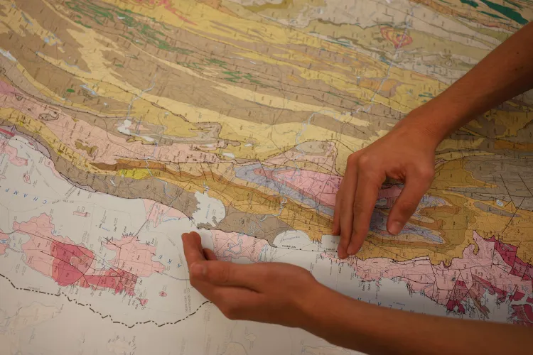
LCSG wanted Patton’s group to learn more about the surficial geology of the Burlington area. Surficial geology studies the loose materials that cover the earth’s surface like soil, sand, gravel, and rocks; it also looks at how that material came to be located there.
“LCSG wanted us to find this information in order to build a resource that homeowners can use when participating in the BLUE program,” said Patton. “Often the geological aspects of a property affect what sort of stormwater solutions can be implemented. If soil is too sandy or has too much clay, for example, you might be able to put in a rain barrel but not an infiltration trench.”
When Patton’s group began to look for information on the surficial geology of Burlington, they realized that online resources such as soil and hydrological surveys only covered agricultural areas and almost entirely omitted Burlington as an urban area.
“My group and I thought that if we looked at older print resources, we would be able to find that missing information,” said Patton. “I had awareness of the map room but I hadn’t worked in the room before. It felt like the perfect place to go for what we were needing.”
Patton and his group began by working with Trina Magi, coordinator of the federal depository library collection and map room at the UVM Libraries, to analyze maps of Chittenden County detailing generalized land use, limitations for development, and more. Patton said that the group was then referred to and worked with librarians in the Silver Special Collections Library to examine maps that had a closer focus on Burlington.
“Trina pulled a bunch of maps related to Chittenden County data for us,” Patton shared. “The entire table we were sitting at was just covered in maps and we spent hours leafing through them.”
The combination of the Howe map room and Special Collections’ map resources proved the perfect supports for Patton’s project, which resulted in a digital guide titled “Burlington’s Missing Soil Mystery.” Their digital guide features maps of Burlington that show exactly where surficial material, bedrock, groundwater, and more exist. The group’s digital guide is now used by LCSG’s BLUE program when working with homeowners to identify how they can reduce pollution from stormwater runoff on their property.
Archaeological projects in the map room
Patton’s project is just one of many purposes served by the map room. Kathleen Kenny, program historian and research supervisor for UVM’s Consulting Archaeology Program (CAP), has worked at UVM since the 1990s and finds the collection integral to her work.
UVM’s CAP program provides archaeological and historic preservation services to businesses and individuals, non-profit groups, local governments, and state and federal agencies. As the program historian and research supervisor, Kenny oversees research investigations done on historic archaeological sites.
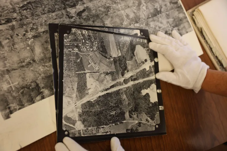
“I’ve been using the map room since I started at UVM,” said Kenny. “The aerial photos in the map room are like a time machine that I can use to look at structure sites or to learn more about disturbances through the years.”
Kenny and the CAP program once worked with a group in Bennington on the improvement of a dangerous intersection. The group dug holes used to investigate subsurface soil conditions called test pits and discovered disturbed soils, or soil that has been physically altered likely due to construction or excavation, as well as areas of concrete.
Upon this discovery, Kenny immediately thought of the map room and headed down to the ground floor of Howe to investigate. The collection helped Kenny and the group discover that the location they were working on had once been occupied by a gas station and tourist cabins.
“We could then direct our investigations away from the disturbed area, saving time and money,” said Kenny. “Not to mention a few sore backs.”
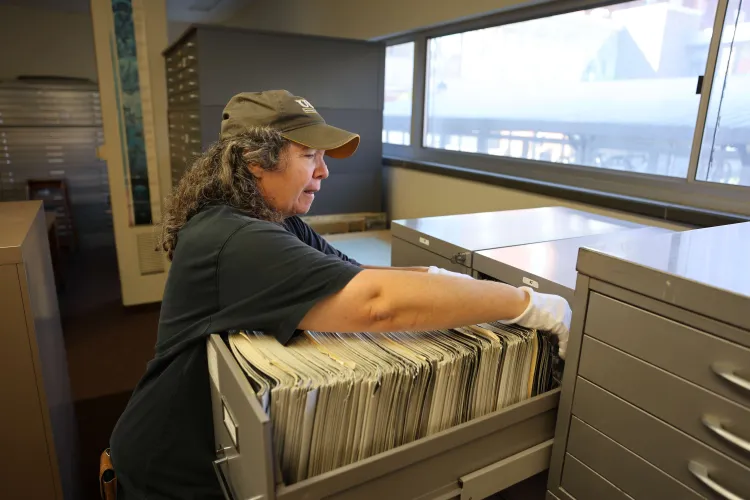
Like Patton, Kenny found value in the use of physical materials in the map room as opposed to online or digital resources. Kenny shared that the details of digital maps become blurry upon zoom. Working with physical maps and magnifying devices like loupes makes it easy to have a thorough understanding of what she is looking at.
“The map room is great and has resources that are likely to be useful for a wide variety of environmental surveys like wetlands, flood studies, forestry, surficial geology and those looking into property history like archaeologists, historic preservationists, surveyors, and more,” said Kenny.
The possibilities in the map room remain endless, and Trina Magi, like most librarians, would love to help the next project.
“I have worked with skiers, hikers, and canoeists planning back-country adventures. We've provided answers for an author of a hiking guide, forestry students researching logging activity, and community members trying to settle property-line disputes,” said Magi. “I’ve also had several groups of students come in just for the sheer pleasure of exploring what’s here.”
You can work with the map room
Consider how you can incorporate maps into your own work. Learn more about the map room and how to make an appointment or send an email to Trina at Trina.Magi@uvm.edu