
trend is
flat
over time
Forest cover is the percent of the state of Vermont with tree cover.

trend is
down
over time
Regeneration of sugar maple seedlings provides information about the future of Vermont's hardwood forests.
trend is
flat
over time
Regeneration of red spruce seedlings provides information about the future of Vermont's softwood forests.

trend is
up
over time
Forests with greater stand complexity have trees in a range of sizes and as a result, may be more productive and resilient to stress.
trend is
flat
over time
Forest patch sizes provides information on the average size of contiguous forest blocks.
trend is
flat
over time
Forest connectivity is a measure of the linkages among Vermont's forests.
trend is
down
over time
With greater diversity in tree species, forests can support more biodiversity, exhibit higher resilience to stress, and store more carbon.
trend is
down
over time
Across the landscape, having a range of forest stand ages provides diversity, varied habitat conditions, and resilience to stressors.
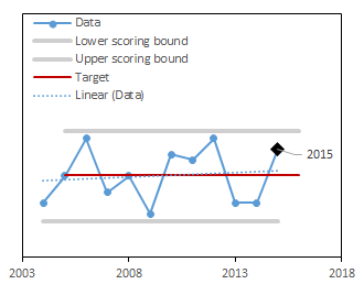
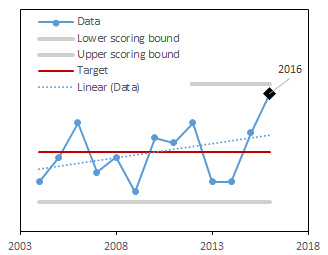
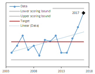
Latest Score:
3/5
in 2023
score trend is flat over time
Forest connectivity is an assessment of how connected large areas of forests are on the landscape. Forest blocks that are separated make it harder for animals and plants to move between patches1. Forests with higher connectivity allow for the exchange of water and nutrients, movement of wildlife, dispersal, genetic interchange between populations, and long distance range shifts of species, such as in response to climate change2,3. Maintaining functional connectivity is critical as forests become more fragmented with urban expansion. Here, forest connectivity is measured using the “Contagion Index” calculated using FragStats software4. A high score means that forest connectivity is not changing from year to year.
The score is calculated using a target value and the historical range of the the entire long-term dataset. The higher the score, the closer this year's value is to the target.
Once the score is computed for each year, the trend in scores over time is calculated. If the trend is significantly positive or negative, the long-term trend is marked as increasing or decreasing respectively.
| Component | Description |
|---|---|
| Scored as | Distance between minimum and target (scaled 1-5) |
| Target value | Long-term mean |
| Directionality of scores | No change from the long-term mean is better |
| Minimum value used in scoring | Data minimum - 10% of the range |
| Maximum value used in scoring | Data maximum + 10% of the range |
Using the National Land Cover Database (NLCD)1 we mapped forest cover (41 Deciduous Forest, 42 Evergreen Forest, 43 Mixed Forest, and 90 Woody Wetlands) at 30 meter resolution. The 2019 reprocessed release of the NLCD begins in 2001. We used FragStats2 to compute forest connectivity. We used the 8 cell neighborhood rule with a ‘no sampling’ strategy. We selected ‘Contagion’ as the Landscape Aggregation metric for computation. We set the target for this dataset to be the long-term mean. The current year is scored for where it falls between target and either the lower scoring bounds (dataset minimum minus 10% of the range) or the upper scoring bounds (dataset maximum plus 10% of the range) and the target when values are above the target, scaled to be between 1 and 5.