Northeastern Forest Inventory Network
Aggregating data, information and experts around long-term forest inventories
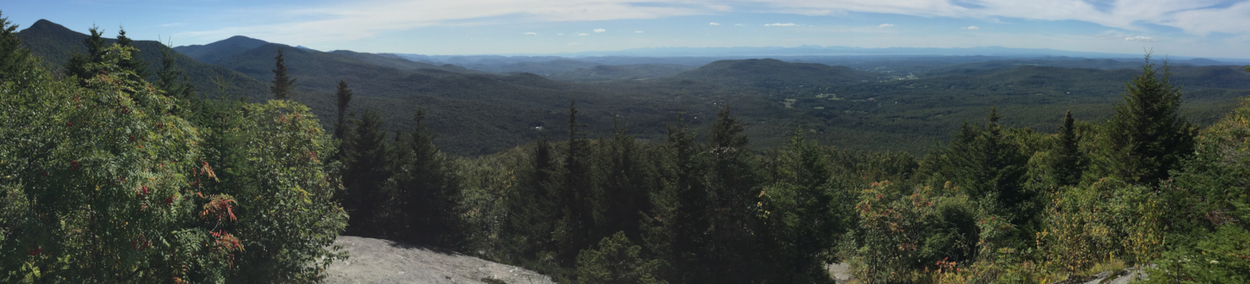
The heterogeneous, temperate forests of the northeastern United States (US) represent a complex history of management, conservation, natural disturbances, and site characteristics that make assessment of trends and patterns of forest metrics a challenge. Because of the spatial and structural complexities across forest stands, forest inventory sampling intensity must be sufficient to capture the variation across the landscape. Further, the drivers of change in these forest systems have been variable across time, space, and scale. The economy of the predominantly forested states of Massachusetts, Maine, New Hampshire, New York, and Vermont (hereafter, the ‘region’) depends heavily on the health and sustainable management of its forest. While the relative contribution of forestlands to the gross domestic product for these states is among the highest in the US (4-5%) (Forest2Market 2016), the forests face increasing pressures from land use and ownership changes, declines in available forest products markets, and greater presence of disturbance agents (e.g., invasive pests, extreme weather events). Developing predictions of the future forests require a solid understanding of the current productivity, composition, structure, and condition across the landscape.
While the USFS FIA program is a robust and useful resource for assessing forest condition, it is limited in spatial resolution (i.e., 1 plot per ~2,000 ha) and temporal scope (i.e., >1999 and re-measured every 5-7 years), and focuses on tree status metrics. Consequently, this project involves enriching FIA data with additional data collection sites, as well as inclusion of stands with previous or active forest management to help elucidate how management and forest change interact. This expanded database of field inventory data will allow us to ask several pressing research questions about forest structure and function over time, and the role that site, climate and disturbance agents play in those patterns.
The goals of this project are to (1) increase the accessibility and usability of forest inventory data from disparate collections in the northeastern US, (2) demonstrate how the research community can utilize this data for investigating trends in and drivers of forest growth and yield over time, and (3) increase connections among practitioners across administrative and disciplinary boundaries to enable greater exchange of information and expand collaborations around analyzing trends in northeastern forests.
This project will create new knowledge and insight about how forests in the region are growing and changing, and what this could mean for the region’s economic and ecological future. In addition to simple aggregation, cross-walking, and standardization of inventory data and methodologies, there are many important research questions that the resulting data resource would allow us to address. Specifically, the abundance of field data aggregated as a part of this project will be used to develop and test novel remote sensing methods to assess forest structure and function on a landscape scale.
- Remote sensing utility: Landscape scale assessments of forest structure and function rely on remote sensing technologies for a synoptic view of the contiguous forest. However, one common limitation of such studies is the lack of sufficient field data for imagery calibration, model validation, or accuracy assessment. We propose to use the resulting broad network of inventory data to develop remote sensing models to quantify forest productivity, stand age, stocking and structural complexity across the landscape based on fused remote sensing image products. This will provide a unique assessment of forest structure and function across a diverse landscape.
- Examine short- and long-term patterns in tree growth, forest productivity, carbon sequestration, and harvest potential. Utilizing the remote sensing products developed as a part of this project will allow us to evaluate spatiotemporal patterns in forest productivity, carbon sequestration and storage, and harvest potential. Spatial regression models will also evaluate environmental correlates with productivity maps. These products will help inform forest management and adaptation strategies and inform estimates of carbon flux necessary for climate change models.
This project will run from January 1, 2020 to December 31, 2021. We propose the following timeline:
- Spring 2020
- Engage stakeholders to identify relevant forest inventory data
- Contact program and data managers to discuss individual dataset details
- Summer 2020
- Develop data infrastructure for ingesting and standardizing target datasets
- Aggregate ancillary datasets
- Fall 2020
- Perform initial data analysis and exploration
- Remote sensing processing and data fusion
- Spring 2020
- Algorithm development and testing
- Summer 2021
- Analysis and synthesis of data in support of research papers
- Fall 2021
- Develop and submit manuscripts
- Presentation of final products at regional and national meetings
- Jennifer Pontius (University of Vermont, Rubenstein School of Environment and Natural Resources)
- Anthony D'Amato (University of Vermont, Rubenstein School of Environment and Natural Resource)
- Aaron Weiskittel (University of Maine, School of Forest Resources)
- Jim Duncan (Forest Ecosystem Monitoring Cooperative, University of Vermont)
- Alexandra Kosiba (State of Vermont, Department of Forests, Parks and Recreation)
- Emma Tait (Forest Ecosystem Monitoring Cooperative, University of Vermont)
- Soren Donisvitch (University of Vermont, Rubenstein School of Environment and Natural Resources)
- Clarke Cooper (Forest Ecosystem Monitoring Cooperative)
This work is supported in part by the Agriculture and Food Research Institute from the USDA National Institute of Food and Agriculture.