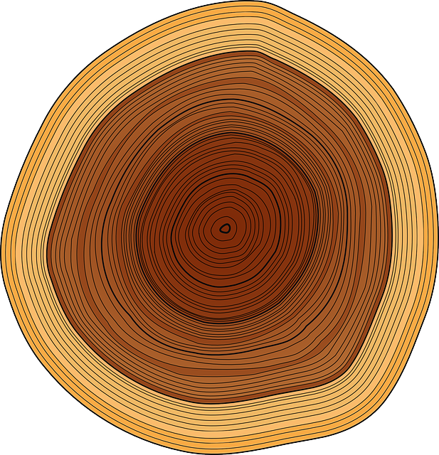
The DendroEcological Network - Providing seamless access to ecological and dendrochronological data
Explore, locate and download dendroecological data
The mission of the DendroEcological Network (DEN) is to provide an online repository for dendrochronological and associated forest ecology data, as well as offer a cyberinfrastructure for the discovery, exploration, and sharing of that data. The data portal is publicly available and anyone with access to the internet can use it and contribute to it. To maintain the rigor of the overall resource, the DEN is currently limited to only accept datasets containing cores that were cross-dated.
Using data you find here? Find out how to cite the data stored here and check out the data use policy.
Comparative growth trends of five Northern hardwood and montane tree species along elevational transects in Mt. Mansfield State Forest
Objectives
We compared growth trends and response to climate and environmental variables among dominant tree species along elevational gradients at Mt. Mansfield, VT: balsam fir, red maple, red spruce, sugar maple, and yellow birch.
Data Contents
Data for 9 Plots, 268 Trees, 479 Cores
Principal Investigator
Alexandra Kosiba, Paul Schaberg, Gary Hawley, Shelly Rayback
Laboratory
Schaberg/Hawley/Rayback Dendrochronology Collaborative
Project Description
We set up elevational transects were set up in three of the four watersheds on Mt. Mansfield (Underhill, VT): Brown’s River, Stevensville Brook, and Ranch Brook Watersheds. Along each of these transects, three plots were selected – one within each of the following elevational zones: low (450-650 m asl), mid (750-850 m) and high (900-1000 m) (n plots = 9), which align with northern hardwoods, transition, and montane spruce-fir ecotones. Plots contained 10-14 dominant or co-dominant trees of each of the target tree species with approximately equal distribution around plot center in attempts to avoid differing competition pressures between trees. We sampled red maple, sugar maple, and red spruce at low elevation; sugar maple, yellow birch, and red spruce at mid elevation; and red spruce and balsam fir at high elevation. Due to differential species densities across the landscape, plots were of variable radius.
Quantifying the legacy of foliar winter injury on woody aboveground carbon sequestration of red spruce trees
Objectives
Red spruce tree cores were collected from 30 plots in VT, NH, and MA to assess the influence of the 2003 winter injury event on long-term growth and C sequestration.
Data Contents
Data for 39 Plots, 380 Trees, 756 Cores
Principal Investigator
Alexandra Kosiba, Paul Schaberg, Gary Hawley
Laboratory
Schaberg/Hawley Lab
Project Description
In 2003, a severe region-wide event damaged over 90% of red spruce in the northeastern US. We assessed the influence of the 2003 winter injury event on long-term growth and C sequestration of red spruce trees by measuring the xylem growth (basal area increment) in forest stands in Vermont, New Hampshire, and Massachusetts where winter injury was quantified in 2003. To do this, we assessed dominant and co-dominant red spruce trees in 30 forest plots (10–15 trees per plot) from 14 locations that had been quantified for winter injury severity (visual assessment of damage to current-year foliage, ranging from 0% to 100%) in 2003 (a sub-set of the 27 locations and 176 plots assessed by Lazarus et al., 2004).
Potential role of soil calcium in recovery of paper birch following ice storm injury in Vermont
Objectives
To more fully understand the potential causes of birch decline, we assessed crown health, radial growth, and available soil cations at 12 paper birch (Betula papyrifera and B. papyrifera var. cordifolia) sites located in the north-central Green Mountains, VT.
Data Contents
Data for 12 Plots, 175 Trees, 350 Cores
Principal Investigator
Joshua Halman, Paul Schaberg, and Gary Hawley
Laboratory
Schaberg/Hawley Lab
Project Description
In 2006, we assessed crown health, radial growth, and available soil cations at 12 paper birch (Betula papyrifera and B. papyrifera var. cordifolia) sites located in the north-central Green Mountains, Vermont, as a preliminary assessment of factors that may be influencing paper birch decline. Selected plot locations overlapped with previous aerial mapping of paper birch decline, and we avoided areas known to have been affected by insect outbreaks in 2004 and 2005. Nine of the sites were located at three different elevations on each of three different mountain-slopes in order to assess tree health and soil nutrition across an elevational gradient. Three plots per site were established within areas known to have experienced moderate ice storm damage in 1998 and 3-4 dominant or co-dominant birch trees closest to plot center were sampled for tree and soil assessments. At higher elevations, sample trees included heart-leafed paper birch. All sites contained dominant and co-dominant paper birch with sugar maple and/or red spruce as companion species. Understory vegetation was highly variable depending on both aspect and elevation, though hobblebush (Viburnum alnifolium) and striped maple (Acer pensylvanicum) were present on most plots. Soils were usually Spodosols with generally well defined Oa, E, and B horizons, except at some upper elevations where soils were either Histosols or Entisols (i.e., no B horizon present).
Differential impacts of calcium and aluminum treatments on sugar maple and American beech growth dynamics
Objectives
We sought to evaluate the impact of changes in soil calcium and aluminum due to acid deposition on the growth and physiology of sugar maple and American beech trees at Hubbard Brook Experimental Forest (Thornton, New Hampshire) following a major ice storm in 1998.
Data Contents
Data for 3 Plots, 180 Trees, 360 Cores
Principal Investigator
Joshua Halman, Paul Schaberg, Gary Hawley, Tim Fahey
Laboratory
Schaberg/Hawley Lab
Project Description
To evaluate the impact of changes in soil calcium and aluminum due to acid deposition, we examined sugar maple and American beech growth and forest composition at Hubbard Brook Experimental Forest (Thornton, New Hampshire) following a major ice storm in 1998. We measured xylem annual increment, foliar cation concentrations, American beech root sprouting, and tree mortality at the experimental nutrient perturbation (NuPert) plots located within HBEF where treatment plots had been amended with calcium or aluminium beginning in 1995.
Forest condition change in northern Vermont: potential causes and implications for landscape-scale analysis
Objectives
The purpose of this research was to study the relationship between radial tree growth and vegetation indices derived from Landsat 5 TM imagery in Vermont and New Hampshire.
Data Contents
Data for 16 Plots, 253 Trees, 492 Cores
Principal Investigator
Aiko Weverka, Jen Pontius
Laboratory
Pointus and Schaberg/Hawley Labs
Project Description
In this study, the following questions were investigated: 1) Is there a relationship between measurements of basal area increment and vegetation indices derived from Landsat 5 TM data the same year 1984-2010? 2) If these relationships exist, are they stronger for certain vegetation indices, species types, or particular locations? 3) Is there some combination of multiple vegetation indices that can be used to model BAI across the landscape? To answer these questions, we analyzed tree growth for dominant species in Northern Vermont and New Hampshire.
Red spruce growth comparison: calcium addition and reference watersheds at Hubbard Brook Experimental Forest, NH
Objectives
To compare the effects of calium-addition on red spruce growth dynamics, we examined the annual growth of dominant and codominant red spruce trees growing in the reference and calcium-addition watersheds at the Hubbard Brook Experimental Forest, NH.
Data Contents
Data for 6 Plots, 60 Trees, 120 Cores
Principal Investigator
Joshua Halman, Paul Schaberg, and Gary Hawley
Laboratory
Schaberg/Hawley Lab
Project Description
In 2006, we examined the annual growth of dominant and codominant red spruce trees growing in the reference watershed (WS6) and calcium-addition watershed (WS1) at Hubbard Brook Experimental Forest (Thorton, NH) to compare the effects of Ca-addition on red spruce growth dynamics.
Balsam fir and red spruce growth trends along elevation on Whiteface Mountain, NY
Objectives
This research involved resampling a series of permanent plots established in the 1980's and collecting tree cores from red spruce and balsam fir at many of these sites to identify shifts in tree growth and demography associated with recent environmental changes.
Data Contents
Data for 31 Plots, 114 Trees, 219 Cores
Principal Investigator
Martin Dovciak, Colin Beier, and Jay Wason
Laboratory
Dovciak Lab
Project Description
This research involved resampling a series of permanent plots established in the 1980's and collecting tree cores from red spruce and balsam fir at many of these sites to identify shifts in tree growth and demography associated with recent environmental changes. To do this, we studied tree species distributions along elevational gradients on 12 mountains in four states of the northeastern United States (New York, Vermont, New Hampshire, and Maine). See Wason et al. (2017) for more information.
Assessing relationships between red spruce radial growth and pollution critical load exceedance values
Objectives
We used results from a 30 m resolution steady-state sulfur and nitrogen critical load exceedance model for New England to better understand the spatial connections between calcium depletion and red spruce productivity.
Data Contents
Data for 12 Plots, 137 Trees, 256 Cores
Principal Investigator
Ben Engel, Paul Schberg, Gary Hawley, Shelly Rayback
Laboratory
Schaberg/Hawley/Rayback Dendrochronology Collaborative
Project Description
In order to maximize the sample size and range of exceedance values assessed, this study utilized a large set of both pre-existing (Weverka, 2012, Kosiba et al., 2013, Kosiba et al., 2014) and newly collected red spruce xylem increment cores from VT and NH, for a total of 441 trees at 37 sites. These sites included 23 plots chosen to reflect a broad range of red spruce forest conditions (Weverka, 2012, Kosiba et al., 2013, Kosiba et al., 2014) and 14 new plots that were selected using a previously established critical load and exceedence model (NEG/ECP) to identify areas where: (1) red spruce were predicted to occur in the forest type module of the NEG/ECP model, (2) located on state and federal lands to streamline the issuance of collection permits, and (3) at locations where modeled exceedance values approach the positive and negative limits for the study area (−2 and +2 keq ha−1 y−1) to extend and balance the range of values assessed.
Effects of multiaged silvicultural systems on reserve tree growth 19 years after establishment across multiple species in the Acadian forest in Maine
Objectives
This study investigated the growth response of mature, isolated reserve trees and their paired analogues from the control in two multiaged silvicultural systems in the Acadian Forest Ecosystem Research Project, ME.
Data Contents
Data for 104 Plots, 718 Trees, 715 Cores
Principal Investigator
David R. Carter, Robert S. Seymour, Shawn Fraver, and Aaron Weitskittel
Laboratory
UMaine Orono
Project Description
This study investigated the growth response of mature, isolated reserve trees (n = 528) and their paired analogues from the control (n=190) in two multiaged silvicultural systems in the Acadian Forest Ecosystem Research Project (AFERP).
Assessment of weather-associated causes of red spruce winter injury and consequences to aboveground carbon sequestration
Objectives
We collected tree cores from red spruce trees at a red spruce plantation in northern NH and 23 forested plots (MA, NH, and VT) to assess the reductions in carbon sequestration that followed a severe winter injury event and explore the possible causes of this event.
Data Contents
Data for 24 Plots, 241 Trees, 483 Cores
Principal Investigator
Paul Schaberg, Gary Hawley, and Brynne Lazarus
Laboratory
Schaberg/Hawley Lab
Project Description
We sought to investigate the environmental factors that may contribute to red spruce foliar winter injury and how much this injury influences tree carbon stores. We used a long-term record of winter injury in a plantation in New Hampshire and at 23 forested plots (in MA, NH, and VT) and conducted stepwise linear regression analyses with local weather and regional pollution data to determine which parameters helped account for observed injury.
Natural disturbance in an old-growth landscape of northern Maine
Objectives
Our general objective was to reconstruct, using methods of dendrochronology, the frequency and severity of natural disturbances that have shaped an old-growth landscape in northern Maine over the past several hundred years.
Data Contents
Data for 37 Plots, 1757 Trees, 1757 Cores
Principal Investigator
Shawn Fraver and Alan White
Laboratory
UMaine Orono
Project Description
We used tree-ring data from 37 plots, randomly located within the TNC’s Big Reed Forest Reserve, to reconstruct the history of natural disturbances in this old-growth landscape.
Drivers of red spruce and balsam fir tree growth in mountains of the Northeastern US
Objectives
To determine how red spruce and balsam fir tree growth is driven by climate and acidic deposition in mountains of the northeastern United States.
Data Contents
Data for 40 Plots, 246 Trees, 246 Cores
Principal Investigator
Jay W. Wason, Colin M. Beier, John J. Battles, Martin Dovciak
Laboratory
SUNY ESF
Project Description
This project integrates with our broader research on montane spruce-fir forest responses to environmental change. In this project, we collected tree cores from red spruce and balsam fir trees along elevation gradients on 10 mountains across the northeastern US. We analyzed the tree rings to determine the extent to which climate and acidic deposition have driven recent tree growth patterns.
Climate response of co-occurring tree species using tree-rings
Objectives
Compare climate response of co-occurring canopy dominate species. Expected outcomes are that the general response between species will be the same but there will be nuanced differences.
Data Contents
Data for 10 Plots, 371 Trees, 669 Cores
Principal Investigator
Justin T. Maxwell, Grant L. Harley, Scott M. Robeson.
Laboratory
Unknown
Project Description
In this project we were interested in comparing the climate response between multiple co-occurring species. While, we found that the general response was to June climate and that soil moisture was the leading driver of growth, we found distinct species-specific differences. The ongoing work aims at determining what drives these differences.
Growth of canopy red oak near its northern range limit: current trends, potential drivers, and implications for the future
Objectives
Our objective for this study was to identify the potential climate and pollution variables that have been best associated with red oak growth in Vermont over the past several decades.
Data Contents
Data for 11 Plots, 214 Trees, 432 Cores
Principal Investigator
Rebecca Stern, Paul Schaberg, Shelly Rayback, Paula Murakami, Christopher Hansen, Gary Hawley
Laboratory
Schaberg/Hawley/Rayback Dendrochronology Collaborative
Project Description
We measured tree rings for 213 dominant and codominant red oak trees at 11 VT sites, and statistically compared growth to tree and stand characteristics and regional climate and pollutant deposition data. Because red oak wood is ring-porous, exhibiting a bimodal distribution of vessels, xylem growth can be easily partitioned into earlywood (EW) and latewood (LW) growth as well as whole-ring widths (WRW). Therefore, we evaluated relationships between WRW, LW and EW growth and environmental factors that may influence growth.
NGCP Red Spruce Biogeochemistry
Objectives
Identify points of vulnerability and recovery to atmospheric deposition of pollutants in northeastern red spruce forests.
Data Contents
Data for 8 Plots, 273 Trees, 508 Cores
Principal Investigator
Kevin T. Smith (NRS), Walter C. Shortle (NRS, retired), Gregory B. Lawrence (USGS)
Laboratory
Unknown
Project Description
At the invitation of the Northern Global Change Program, coordinated sampling and analysis was conducted for soil chemistry, dendrochronology, and dendrochemistry.
Eastern white pine and eastern hemlock growth: possible tradeoffs in response of canopy trees to climate and pollution
Objectives
Our objective for this study was to identify the potential climate and pollution variables that have been best associated with eastern white pine and eastern hemlock growth in Vermont over the past several decades.
Data Contents
Data for 26 Plots, 507 Trees, 1996 Cores
Principal Investigator
Rebecca Stern, Paul Schaberg, Shelly Rayback, Paula Murakami, Christopher Hansen, Gary Hawley
Laboratory
Schaberg/Hawley/Rayback Dendrochronology Collaborative
Project Description
We measured tree rings for 507 dominant and codominant eastern white pine and eastern hemlock trees at 24 VT sites, and statistically compared growth to tree and stand characteristics and regional climate and pollutant deposition data.
Growth trends and environmental drivers of major tree species of the Northern Hardwood Forest
Objectives
Our objective for this study was to identify the potential climate and pollution variables that have been best associated with sugar maple, red maple, yellow birch and American beech growth in Vermont over the past several decades.
Data Contents
Data for 30 Plots, 688 Trees, 4095 Cores
Principal Investigator
Rebecca Stern, Paul Schaberg, Shelly Rayback, Paula Murakami, Christopher Hansen, Gary Hawley
Laboratory
Schaberg Lab
Project Description
We measured tree rings for 688 dominant and codominant sugar maple, red maple, yellow birch and American beech trees at 30 VT sites, and statistically compared growth to tree and stand characteristics and regional climate and pollutant deposition data.
White oak chronologies of the Champlain Valley of Vermont
Objectives
White oak is one of the oldest living tree species found in Vermont, USA. It mainly grows in the Champlain Valley within ecologically significant natural areas such as mesic clay plain forests and dry hemlock-oak forests. This project aims to compile existing white oak chronologies from the Champlain Valley in order to facilitate the sharing of tree ring growth data of this long-lived species. It is our hope to add more Vermont white oak chronologies to this project.
Data Contents
Data for 4 Plots, 53 Trees, 108 Cores
Principal Investigator
Schaberg, P.G., Murakami, P.F., Hansen, C.F., D’Amato, A.W., and Murray, H.F.
Laboratory
Unknown
Project Description
This is a collection of white oak cores collected in the Champlain Valley of Vermont. Two trees in this collection can be dated back to 1662 and 1630 with one individual probably originating before the year 1580.
White oak and red maple tree cores from urban forest patches and reference sites
Objectives
Tree cores were collected to compare growth rates of two important native tree species (white oak (Quercus alba L.) and red maple (Acer rubrum L.)) across urban and reference forest sites of three major cities in the eastern United States (New York, NY (NYC); Philadelphia, PA; and Baltimore, MD).
Data Contents
Data for 18 Plots, 170 Trees, 336 Cores
Principal Investigator
Nancy F. Sonti, Richard A. Hallett, Kevin L. Griffin, and Joe H. Sullivan
Laboratory
Unknown
Project Description
Tree cores were collected to compare growth rates of two important native tree species (white oak (Quercus alba L.) and red maple (Acer rubrum L.)) across urban and reference forest sites of three major cities in the eastern United States (New York, NY (NYC); Philadelphia, PA; and Baltimore, MD). Trees were selected from secondary growth oak-hickory forests found in New York, NY; Philadelphia, PA; and Baltimore, MD, as well as at reference forest sites outside each metropolitan area.
SCBI Forest-GEO Complete Chronologies
Objectives
Trees were cored in 2010, 2011, 2016 and 2017 at the Smithsonian Conservation Biology and Forest GEO large forest site in Front Royal Virginia.
Data Contents
Data for 1 Plot, 726 Trees, 726 Cores
Principal Investigator
Kristina Anderson-Teixeira
Laboratory
Unknown
Project Description
The Smithsonian Conservation Biology Institute (SCBI) large forest dynamics plot is located at the Smithsonian’s National Zoo and Conservation Biology Institute in Front Royal, VA, adjacent to the northern end of Shenandoah National Park. The plot is located at the intersection of three of the major physiographic provinces of the eastern US: the Blue Ridge, Ridge and Valley, and Piedmont provinces. The forest type is typical mature secondary eastern mixed deciduous forest, with a canopy dominated by tulip poplar (Liriodendron tulipifera), oaks (Quercus spp.), and hickories (Carya spp.), and an understory composed mainly of spicebush (Lindera benzoin), paw-paw (Asimina triloba), American hornbeam (Carpinus caroliniana), and witch hazel (Hamamelis virginiana). The SCBI forest plot is 25.6 ha (640 x 400 m), including a 4-ha fenced exclosure where white-tailed deer have been excluded since 1990, as well as three 1-ha Smithsonian Monitoring and Assessment of Biodiversity Program (SI-MAB) sites, with some sites surveyed several times since 1990. In 2010 and 2011, over 500 trees were cored in order to establish a baseline of dendrochronological data and gather background on the forest plot. In 2016 the annual mortality census was amended to include coring any tree marked dead. This practice was continued in 2017 when the current chronologies were created.
Ecology of remnant Betula papyrifera populations in Nebraska, USA
Objectives
The aims of this research are to (i) use dendrochronological techniques to assess the performance of B. papyrifera to intra- and inter-annual microclimatic variability and (ii) determine if satellite imagery can serve as a proxy for assessing tree health by relating vegetation indices such as NDVI to tree-ring characteristics.
Data Contents
Data for 1 Plot, 45 Trees, 155 Cores
Principal Investigator
Tala Awada, Paolo Cherubini
Laboratory
Unknown
Project Description
Remnant populations of Betula papyrifera have persisted in the Great Plains after the Wisconsin Glaciation along the Niobrara River Valley, Nebraska. Population health has declined in recent years, which has been hypothesized to be due to climate change. We used tree rings to assess the response of B. papyrifera to microclimate and the normalized difference vegetation index (NDVI) derived from satellite imagery as a proxy for population health. The study area was located at the Nature Conservancy’s Niobrara Valley Preserve in north-central Nebraska, centered at 42°78′34″N, 100°02′80″W, and encompasses nearly 227 km2. Seven north-facing stands were selected along a 27 km section of the river. Individuals were found only on north-facing slopes and growing from pre-existing root crowns. We selected the largest trees based on healthiest visual appearance and largest diameter measured at breast height. A total of 180 cores, i.e., four cores from each of 45 trees, were sampled at 1.3 m from the base, at 90° around the trunk, representing the north, south, east, and west sides. The oldest ring record dated back to 1894, with the majority of consistent records across trees rings dating back to the early 1950s, thus the time frame selected for this study.
Impacts of long-term calcium and aluminum treatments on sugar maple growth, wound closure and overall health
Objectives
The objective of this study was to explore the relationship between calcium nutrition and stress response physiology in sugar maple trees growing in a long-term, replicated calcium manipulation study.
Data Contents
Data for 12 Plots, 60 Trees, 120 Cores
Principal Investigator
Brett Huggett, Paul Schaberg, Gary Hawley and Christopher Eager
Laboratory
Schaberg Lab
Project Description
In 2004, we measured tree ring growth, branch dieback, crown vigor, foliar nutrition, wound closure and the production of lignin and callose in mostly dominant and codominant sugar maple trees growing on twelve pre-existing plots at the Hubbard Brook Experiment Forest in Thornton, New Hampshire. In total, 60 trees were evaluated. The plots, established in 1995, were equally and randomly divided among three treatments: soil calcium addition, soil aluminum addition and control (no treatment).
Tree health and productivity among LiDAR-derived canopy categories in sugar maple and yellow birch
Objectives
The objective of this study was to determine if LiDAR can be used to quantify structural characteristics that are either the cause (e.g., overcrowding) or the consequence (e.g., greater crown thinning or tree mortality) of tree heath and productivity issues.
Data Contents
Data for 36 Plots, 333 Trees, 652 Cores
Principal Investigator
Christopher Hansen, Paul Schaberg, Allan Strong, Shelly Rayback, Gary Hawley
Laboratory
Schaberg Lab
Project Description
We measured tree ring growth, crown condition and tree mortality for 333 dominant and codominant sugar maple and yellow birch trees at the Hubbard Brook Experiment Forest in Thorton, New Hampshire and compared these health metrics among four LiDAR-derived canopy classes – 1. high crown, high understory closure, 2. high crown, low understory closure, 3. low crown, high understory closure and 4. low crown, low understory closure.
Growth, winter injury and spring phenology of pure American chestnut growing in common garden on the Green Mountain National Forest, VT
Objectives
Trees growing in this provenance planting represent the historical range of American chestnut from North Carolina to Maine. The objective for this study was to determine how genetics and the environment modulate chestnut physiology and growth needed to guide breeding and management efforts in the restoration of American chestnut.
Data Contents
Data for 1 Plot, 109 Trees, 208 Cores
Principal Investigator
Paul Schaberg, Paula Murakami, Kendra Collins, Chris Hansen, Gary Hawley
Laboratory
Schaberg Lab
Project Description
We measured tree rings for 107 open-pollinated American chestnut and compared annual growth with winter shoot injury, spring foliar budbreak and leaf-out, spring foliar frost injury, and climate variables (temperature and moisture).
Environmental drivers of growth for tree species associated with a limestone bluff cedar-pine forest in Vermont
Objectives
Red Rocks Park, located along the eastern shore of Lake Champlain in South Burlington, Vermont is comprised of a rich diversity of forest communities including the state-significant limestone bluff cedar-pine forest. The objective of our study was to determine the impact of historical climate regimes and pollution deposition on the growth of eight tree species (four conifers and four hardwoods) with a particular focus on northern white cedar and eastern red cedar – species that help define the Limestone Bluff Cedar-Pine Forest – a rare upland natural community recognized by that state of Vermont as ecologically significant.
Data Contents
Data for 1 Plot, 63 Trees, 123 Cores
Principal Investigator
Paul Schaberg, Paula Murakami, Christopher Hansen, Rebecca Stern
Laboratory
Schaberg lab
Project Description
We measured tree ring growth of dominant and co-dominant eastern red cedar (collected in 2017), northern white cedar (collected in 2017) and white ash (collected in 2019) in Red Rocks Park in South Burlington, Vermont and combined this data with previous increment core collections of eastern hemlock, white pine, American beech, red oak, and white oak (collected in 2016) at the same site to compare individual species’ growth with climate parameters including air temperature (maximum and minimum) and precipitation (both rain and snow) as well as pollution deposition. Increment core data from the previous core collections at Red Rocks Park are similarly archived on the DEN under the following projects: “Growth trends and environmental drivers of major tree species of the northern hardwood forest”, “Eastern white pine and eastern hemlock growth: possible tradeoffs in response of canopy trees to climate and pollution”, “White oak chronologies of the Champlain Valley of Vermont”, and “Growth of canopy red oak near its northern range limit: current trends, potential drivers, and implications for the future”.
Red spruce core collections from a range-wide provenance study located in New Hampshire
Objectives
To determine annual growth of red spruce in a range-wide provenance study in northern New Hampshire.
Data Contents
Data for 1 Plot, 217 Trees, 410 Cores
Principal Investigator
Paul Schaberg, Gary Hawley, Ali Kosiba, Joshua Halman, Brynne Lazarus, Chris Hansen, Paula Murakami, Catherine Borer, Stephen Keller, Thibaut Capblancq and Brittany Verrico.
Laboratory
Schaberg lab
Project Description
We collected increment cores from dominant and co-dominant trees growing in a range-wide red spruce provenance study in Colebrook, NH in 2004 and 2021. This study was established in 1960 and the trees growing here represent 12 provenance sources from eastern Canada (New Brunswick, Nova Scotia and Quebec) and eastern U.S. (Maine, New Hampshire, Massachusetts, New York, Pennsylvania, West Virginia and North Carolina). In 2004, cores were collected to assess growth following a series of significant winter injury events that damaged current year foliage (see associated DEN project, “Assessment of weather-associated causes of red spruce winter injury and consequences to aboveground carbon sequestration”). In 2021, cores were collected as part of a separate study to assess differences in growth magnitude and patterns for the 12 seed sources and relate these to gene sequences measured by Steve Keller (molecular geneticist in the Plant Biology Department at the University of Vermont). While these two core collections were conducted for different objectives, they are archived together to enable easy access to their raw ring width data for future studies at this site. For specific seed source locations, see: Wilkinson, RC. 1990. Effects of winter injury on basal area and height growth of 30-year-old red spruce from 12 provenances growing in northern New Hampshire. Can J. For. Res. 20:1616-1622.
Restoration of dry oak forests on the Green Mountain National Forest in southern Vermont
Objectives
Tree cores were collected for major species (white oak, red oak, red maple, white pine and red pine) in order to better understand the stand origin, historical development, disturbance dynamics, and successional trajectory of “The Dome" in the Green Mountains National Forest, VT.
Data Contents
Data for 5 Plots, 75 Trees, 150 Cores
Principal Investigator
Paul Schaberg and Diane Burbank
Laboratory
Schaberg lab
Project Description
This project, spearheaded by the USDA Forest Service, seeks to restore and maintain oak and oak-pine forests on the southern and western slopes of a mountain known as “The Dome” by reintroducing fire and the use of timber sales, other mechanical treatments, and herbicides. These particular forests are unique in Vermont as they appear to represent the northern edge of the range for several central Appalachian species like American chestnut and sassafras. Some of the habitat has abundant American beech and red maple in the understory with few oak saplings, suggesting mesophication and future shifts toward a northern hardwood ecosystem.
Annual xylem growth and age estimates of red maple, paper birch and American beech growing in the Bartlett Experimental Forest (NH)
Objectives
The cores archived here were part of a larger study to investigate the seasonal dynamics of stemwood nonstructural carbohydrates in temperate forest trees.
Data Contents
Data for 1 Plot, 38 Trees, 0 Cores
Principal Investigator
Andrew Richardson, Moriah Carbone, Trevor Keenan, Claudia Czimczik, Dave Hollinger, Paula Murakami, Paul Schaberg, and Xiaomei Xu.
Laboratory
Unknown
Project Description
In the larger study, cores were collected from the Howland Forest (ME), Bartlett Experimental Forest (NH) and Harvard Forest (MA) to assess the age of sugars and starch reserves in several temperate forest species including red maple, red spruce, eastern hemlock, paper birch and American beech. An additional subset of increment cores was collected at Bartlett Experimental Forest due to the high rate of mortality among paper birch trees found there. These included 20 paper birch, 10 red maple and 10 American beech trees.
Influence of climate and genetics on green ash growth in a range-wide provenance test near the species’ northern range limit
Objectives
Trees growing in this provenance planting represent the historical range of green ash. The objective of this study was to determine how genetics and the environment influence annual growth. Information gained here may be particularly useful for future restoration efforts of ash species impacted by EAB in the north.
Data Contents
Data for 1 Plot, 44 Trees, 82 Cores
Principal Investigator
Paul Schaberg, Paula Murakami, Christopher Hansen, Gary Hawley
Laboratory
Schaberg lab
Project Description
We measured annual radial xylem growth of 44 green ash trees from a range-wide provenance planting in Burlington, VT and compared growth with local climate metrics (precipitation, snow and temperature). A better understanding of the relative influences of genetics and climate on green ash growth is particularly important as the invasive insect, Emerald Ash Borer (EAB), is greatly diminishing green ash populations throughout its native range. In Vermont, EAB was first detected in 2018. At the time of our core collection, 2019, EAB was not detected in the provenance planting. The timing of this study presented a novel opportunity to document annual growth in living trees before the negative impacts of EAB.
Cedar chronologies from the Limestone Bluff Cedar-Pine Forest of Butternut Hill Natural Area
Objectives
Eastern red cedar and northern white cedar are main components of the rare and ecologically significant Limestone Bluff Cedar-Pine Forest growing along the shores of Lake Champlain. The current and future health of this forest community remains uncertain due to a changing climate, pollution, invasive pests and pathogens, and human disturbance via development. Understanding how past environmental influences, such as climate and pollution, impact annual radial growth may help with future conservation efforts.
Data Contents
Data for 1 Plot, 32 Trees, 63 Cores
Principal Investigator
Shelly Rayback, Paula Murakami, Christopher Hansen
Laboratory
Unknown
Project Description
We extracted tree cores from 16 eastern red cedar and 16 northern white cedar dominant and co-dominant trees at the Butternut Hill Natural Area in the summer of 2018. This natural area, managed by The Nature Conservancy, is located along the shores of Lake Champlain (VT) and is home to a rare and ecologically significant upland community called the Limestone Bluff Cedar-Pine Forest. In Vermont, this forest community is small in size (mostly under 10 acres) and number (97 total patches).
17-year resurvey of 1998 Ice Storm Forest Response Study in Vermont and New Hampshire
Objectives
Tree cores were collected 17 years after the 1998 ice storm to evaluate long-term effects on growth.
Data Contents
Data for 39 Plots, 244 Trees, 483 Cores
Principal Investigator
John L. Campbell, Paul G. Schaberg, Lindsey E. Rustad, Christopher F. Hansen, Charles T. Driscoll.
Laboratory
Unknown
Project Description
After the 1998 ice storm, the USDA Forest Service, Northern Research Station initiated the Ice Storm Forest Response Study to address shortcomings in our understanding of ice storm effects on forest ecosystems. In the first summer after the storm (1998), forest damage was mapped using aerial photographs and ground surveys. In the following summer (1999), forest plots were established, and forest inventory data were collected to quantify damage and track recovery in areas of Vermont and New Hampshire, USA that were affected by the ice storm. Forest inventory data were collected again 17 years after the storm (2015) along with tree cores to evaluate long-term forest responses.
Red spruce increment cores collected in 2017 from three Vermont sites
Objectives
This red spruce increment core collection was conducted in response to research indicating that red spruce have experienced significant increases in growth following decades of decline predisposed by inputs of acid deposition and in response to a warming climate (Kosiba et al. 2018).
Data Contents
Data for 3 Plots, 52 Trees, 104 Cores
Principal Investigator
Paul Schaberg, Paula Murakami, Christopher Hansen, Gary Hawley
Laboratory
Schaberg Lab
Project Description
As a follow-up to findings reported by Kosiba et al. 2018, we collected increment cores from 18 trees growing on Mt. Mansfield, VT – five years following the most recent collection. Eight of these trees overlapped with those previously collected by Kosiba et al. 2017. Red spruce trees were also sampled in Wolcott (15) and Guildhall, VT (19). Estimates of annual basal area increment (BAI) from 2013-2017 indicate that red spruce on Mt. Mansfield continue to maintain a high level of growth (BAI = 28.8 cm2). Annual growth at the other two, lower elevation sites was significantly less (Wolcott BAI = 11.8 cm2; Guildhall BAI = 11.5 cm2). See the following DEN projects for more information regarding previous work: “Comparative growth trends of five northern hardwood and montane tree species along elevational transects in Mt. Mansfield State Forest” and “Quantifying the legacy of foliar winter injury on woody aboveground carbon sequestration of red spruce trees”.
Annual white ash growth of healthy dominant and codominant trees in VT and NH
Objectives
The objective of this study was to determine how climate variables influence annual growth of white ash in the northern part of its historical range and before EAB negatively impacts local ash populations.
Data Contents
Data for 8 Plots, 130 Trees, 263 Cores
Principal Investigator
Christopher Hansen and Paula Murakami
Laboratory
Unknown
Project Description
We measured annual radial xylem growth of 130 dominant and codominant white ash trees from seven sites in VT and one in NH to compare growth with local climate metrics (precipitation, snow, and temperature). A better understanding of the relative influences of climate on white ash growth is particularly important as the invasive insect, Emerald Ash Borer (EAB), is greatly diminishing ash populations throughout its native range. In Vermont, EAB was first detected in 2018. Cores in this study were collected from 2021-2022 and present a novel opportunity to document annual growth in healthy, living trees before the negative impacts of EAB take hold.
Jump to:
Abies balsamea
Comparative growth trends of five Northern hardwood and montane tree species along elevational transects in Mt. Mansfield State Forest
Project Contents
Data for 9 Plots, 268 Trees, 479 Cores
Principal Investigator
Alexandra Kosiba, Paul Schaberg, Gary Hawley, Shelly Rayback
Laboratory
Schaberg/Hawley/Rayback Dendrochronology Collaborative
Project Description
We set up elevational transects were set up in three of the four watersheds on Mt. Mansfield (Underhill, VT): Brown’s River, Stevensville Brook, and Ranch Brook Watersheds. Along each of these transects, three plots were selected – one within each of the following elevational zones: low (450-650 m asl), mid (750-850 m) and high (900-1000 m) (n plots = 9), which align with northern hardwoods, transition, and montane spruce-fir ecotones. Plots contained 10-14 dominant or co-dominant trees of each of the target tree species with approximately equal distribution around plot center in attempts to avoid differing competition pressures between trees. We sampled red maple, sugar maple, and red spruce at low elevation; sugar maple, yellow birch, and red spruce at mid elevation; and red spruce and balsam fir at high elevation. Due to differential species densities across the landscape, plots were of variable radius.
Forest condition change in northern Vermont: potential causes and implications for landscape-scale analysis
Project Contents
Data for 16 Plots, 253 Trees, 492 Cores
Principal Investigator
Aiko Weverka, Jen Pontius
Laboratory
Pointus and Schaberg/Hawley Labs
Project Description
In this study, the following questions were investigated: 1) Is there a relationship between measurements of basal area increment and vegetation indices derived from Landsat 5 TM data the same year 1984-2010? 2) If these relationships exist, are they stronger for certain vegetation indices, species types, or particular locations? 3) Is there some combination of multiple vegetation indices that can be used to model BAI across the landscape? To answer these questions, we analyzed tree growth for dominant species in Northern Vermont and New Hampshire.
Balsam fir and red spruce growth trends along elevation on Whiteface Mountain, NY
Project Contents
Data for 31 Plots, 114 Trees, 219 Cores
Principal Investigator
Martin Dovciak, Colin Beier, and Jay Wason
Laboratory
Dovciak Lab
Project Description
This research involved resampling a series of permanent plots established in the 1980's and collecting tree cores from red spruce and balsam fir at many of these sites to identify shifts in tree growth and demography associated with recent environmental changes. To do this, we studied tree species distributions along elevational gradients on 12 mountains in four states of the northeastern United States (New York, Vermont, New Hampshire, and Maine). See Wason et al. (2017) for more information.
Natural disturbance in an old-growth landscape of northern Maine
Project Contents
Data for 37 Plots, 1757 Trees, 1757 Cores
Principal Investigator
Shawn Fraver and Alan White
Laboratory
UMaine Orono
Project Description
We used tree-ring data from 37 plots, randomly located within the TNC’s Big Reed Forest Reserve, to reconstruct the history of natural disturbances in this old-growth landscape.
Drivers of red spruce and balsam fir tree growth in mountains of the Northeastern US
Project Contents
Data for 40 Plots, 246 Trees, 246 Cores
Principal Investigator
Jay W. Wason, Colin M. Beier, John J. Battles, Martin Dovciak
Laboratory
SUNY ESF
Project Description
This project integrates with our broader research on montane spruce-fir forest responses to environmental change. In this project, we collected tree cores from red spruce and balsam fir trees along elevation gradients on 10 mountains across the northeastern US. We analyzed the tree rings to determine the extent to which climate and acidic deposition have driven recent tree growth patterns.
Back to Top
Acer rubrum
Comparative growth trends of five Northern hardwood and montane tree species along elevational transects in Mt. Mansfield State Forest
Project Contents
Data for 9 Plots, 268 Trees, 479 Cores
Principal Investigator
Alexandra Kosiba, Paul Schaberg, Gary Hawley, Shelly Rayback
Laboratory
Schaberg/Hawley/Rayback Dendrochronology Collaborative
Project Description
We set up elevational transects were set up in three of the four watersheds on Mt. Mansfield (Underhill, VT): Brown’s River, Stevensville Brook, and Ranch Brook Watersheds. Along each of these transects, three plots were selected – one within each of the following elevational zones: low (450-650 m asl), mid (750-850 m) and high (900-1000 m) (n plots = 9), which align with northern hardwoods, transition, and montane spruce-fir ecotones. Plots contained 10-14 dominant or co-dominant trees of each of the target tree species with approximately equal distribution around plot center in attempts to avoid differing competition pressures between trees. We sampled red maple, sugar maple, and red spruce at low elevation; sugar maple, yellow birch, and red spruce at mid elevation; and red spruce and balsam fir at high elevation. Due to differential species densities across the landscape, plots were of variable radius.
Forest condition change in northern Vermont: potential causes and implications for landscape-scale analysis
Project Contents
Data for 16 Plots, 253 Trees, 492 Cores
Principal Investigator
Aiko Weverka, Jen Pontius
Laboratory
Pointus and Schaberg/Hawley Labs
Project Description
In this study, the following questions were investigated: 1) Is there a relationship between measurements of basal area increment and vegetation indices derived from Landsat 5 TM data the same year 1984-2010? 2) If these relationships exist, are they stronger for certain vegetation indices, species types, or particular locations? 3) Is there some combination of multiple vegetation indices that can be used to model BAI across the landscape? To answer these questions, we analyzed tree growth for dominant species in Northern Vermont and New Hampshire.
Effects of multiaged silvicultural systems on reserve tree growth 19 years after establishment across multiple species in the Acadian forest in Maine
Project Contents
Data for 104 Plots, 718 Trees, 715 Cores
Principal Investigator
David R. Carter, Robert S. Seymour, Shawn Fraver, and Aaron Weitskittel
Laboratory
UMaine Orono
Project Description
This study investigated the growth response of mature, isolated reserve trees (n = 528) and their paired analogues from the control (n=190) in two multiaged silvicultural systems in the Acadian Forest Ecosystem Research Project (AFERP).
Growth trends and environmental drivers of major tree species of the Northern Hardwood Forest
Project Contents
Data for 30 Plots, 688 Trees, 4095 Cores
Principal Investigator
Rebecca Stern, Paul Schaberg, Shelly Rayback, Paula Murakami, Christopher Hansen, Gary Hawley
Laboratory
Schaberg Lab
Project Description
We measured tree rings for 688 dominant and codominant sugar maple, red maple, yellow birch and American beech trees at 30 VT sites, and statistically compared growth to tree and stand characteristics and regional climate and pollutant deposition data.
White oak and red maple tree cores from urban forest patches and reference sites
Project Contents
Data for 18 Plots, 170 Trees, 336 Cores
Principal Investigator
Nancy F. Sonti, Richard A. Hallett, Kevin L. Griffin, and Joe H. Sullivan
Laboratory
Unknown
Project Description
Tree cores were collected to compare growth rates of two important native tree species (white oak (Quercus alba L.) and red maple (Acer rubrum L.)) across urban and reference forest sites of three major cities in the eastern United States (New York, NY (NYC); Philadelphia, PA; and Baltimore, MD). Trees were selected from secondary growth oak-hickory forests found in New York, NY; Philadelphia, PA; and Baltimore, MD, as well as at reference forest sites outside each metropolitan area.
Restoration of dry oak forests on the Green Mountain National Forest in southern Vermont
Project Contents
Data for 5 Plots, 75 Trees, 150 Cores
Principal Investigator
Paul Schaberg and Diane Burbank
Laboratory
Schaberg lab
Project Description
This project, spearheaded by the USDA Forest Service, seeks to restore and maintain oak and oak-pine forests on the southern and western slopes of a mountain known as “The Dome” by reintroducing fire and the use of timber sales, other mechanical treatments, and herbicides. These particular forests are unique in Vermont as they appear to represent the northern edge of the range for several central Appalachian species like American chestnut and sassafras. Some of the habitat has abundant American beech and red maple in the understory with few oak saplings, suggesting mesophication and future shifts toward a northern hardwood ecosystem.
Annual xylem growth and age estimates of red maple, paper birch and American beech growing in the Bartlett Experimental Forest (NH)
Project Contents
Data for 1 Plot, 38 Trees, 0 Cores
Principal Investigator
Andrew Richardson, Moriah Carbone, Trevor Keenan, Claudia Czimczik, Dave Hollinger, Paula Murakami, Paul Schaberg, and Xiaomei Xu.
Laboratory
Unknown
Project Description
In the larger study, cores were collected from the Howland Forest (ME), Bartlett Experimental Forest (NH) and Harvard Forest (MA) to assess the age of sugars and starch reserves in several temperate forest species including red maple, red spruce, eastern hemlock, paper birch and American beech. An additional subset of increment cores was collected at Bartlett Experimental Forest due to the high rate of mortality among paper birch trees found there. These included 20 paper birch, 10 red maple and 10 American beech trees.
17-year resurvey of 1998 Ice Storm Forest Response Study in Vermont and New Hampshire
Project Contents
Data for 39 Plots, 244 Trees, 483 Cores
Principal Investigator
John L. Campbell, Paul G. Schaberg, Lindsey E. Rustad, Christopher F. Hansen, Charles T. Driscoll.
Laboratory
Unknown
Project Description
After the 1998 ice storm, the USDA Forest Service, Northern Research Station initiated the Ice Storm Forest Response Study to address shortcomings in our understanding of ice storm effects on forest ecosystems. In the first summer after the storm (1998), forest damage was mapped using aerial photographs and ground surveys. In the following summer (1999), forest plots were established, and forest inventory data were collected to quantify damage and track recovery in areas of Vermont and New Hampshire, USA that were affected by the ice storm. Forest inventory data were collected again 17 years after the storm (2015) along with tree cores to evaluate long-term forest responses.
Back to Top
Acer saccharum
Comparative growth trends of five Northern hardwood and montane tree species along elevational transects in Mt. Mansfield State Forest
Project Contents
Data for 9 Plots, 268 Trees, 479 Cores
Principal Investigator
Alexandra Kosiba, Paul Schaberg, Gary Hawley, Shelly Rayback
Laboratory
Schaberg/Hawley/Rayback Dendrochronology Collaborative
Project Description
We set up elevational transects were set up in three of the four watersheds on Mt. Mansfield (Underhill, VT): Brown’s River, Stevensville Brook, and Ranch Brook Watersheds. Along each of these transects, three plots were selected – one within each of the following elevational zones: low (450-650 m asl), mid (750-850 m) and high (900-1000 m) (n plots = 9), which align with northern hardwoods, transition, and montane spruce-fir ecotones. Plots contained 10-14 dominant or co-dominant trees of each of the target tree species with approximately equal distribution around plot center in attempts to avoid differing competition pressures between trees. We sampled red maple, sugar maple, and red spruce at low elevation; sugar maple, yellow birch, and red spruce at mid elevation; and red spruce and balsam fir at high elevation. Due to differential species densities across the landscape, plots were of variable radius.
Differential impacts of calcium and aluminum treatments on sugar maple and American beech growth dynamics
Project Contents
Data for 3 Plots, 180 Trees, 360 Cores
Principal Investigator
Joshua Halman, Paul Schaberg, Gary Hawley, Tim Fahey
Laboratory
Schaberg/Hawley Lab
Project Description
To evaluate the impact of changes in soil calcium and aluminum due to acid deposition, we examined sugar maple and American beech growth and forest composition at Hubbard Brook Experimental Forest (Thornton, New Hampshire) following a major ice storm in 1998. We measured xylem annual increment, foliar cation concentrations, American beech root sprouting, and tree mortality at the experimental nutrient perturbation (NuPert) plots located within HBEF where treatment plots had been amended with calcium or aluminium beginning in 1995.
Forest condition change in northern Vermont: potential causes and implications for landscape-scale analysis
Project Contents
Data for 16 Plots, 253 Trees, 492 Cores
Principal Investigator
Aiko Weverka, Jen Pontius
Laboratory
Pointus and Schaberg/Hawley Labs
Project Description
In this study, the following questions were investigated: 1) Is there a relationship between measurements of basal area increment and vegetation indices derived from Landsat 5 TM data the same year 1984-2010? 2) If these relationships exist, are they stronger for certain vegetation indices, species types, or particular locations? 3) Is there some combination of multiple vegetation indices that can be used to model BAI across the landscape? To answer these questions, we analyzed tree growth for dominant species in Northern Vermont and New Hampshire.
Natural disturbance in an old-growth landscape of northern Maine
Project Contents
Data for 37 Plots, 1757 Trees, 1757 Cores
Principal Investigator
Shawn Fraver and Alan White
Laboratory
UMaine Orono
Project Description
We used tree-ring data from 37 plots, randomly located within the TNC’s Big Reed Forest Reserve, to reconstruct the history of natural disturbances in this old-growth landscape.
Climate response of co-occurring tree species using tree-rings
Project Contents
Data for 10 Plots, 371 Trees, 669 Cores
Principal Investigator
Justin T. Maxwell, Grant L. Harley, Scott M. Robeson.
Laboratory
Unknown
Project Description
In this project we were interested in comparing the climate response between multiple co-occurring species. While, we found that the general response was to June climate and that soil moisture was the leading driver of growth, we found distinct species-specific differences. The ongoing work aims at determining what drives these differences.
Growth trends and environmental drivers of major tree species of the Northern Hardwood Forest
Project Contents
Data for 30 Plots, 688 Trees, 4095 Cores
Principal Investigator
Rebecca Stern, Paul Schaberg, Shelly Rayback, Paula Murakami, Christopher Hansen, Gary Hawley
Laboratory
Schaberg Lab
Project Description
We measured tree rings for 688 dominant and codominant sugar maple, red maple, yellow birch and American beech trees at 30 VT sites, and statistically compared growth to tree and stand characteristics and regional climate and pollutant deposition data.
Impacts of long-term calcium and aluminum treatments on sugar maple growth, wound closure and overall health
Project Contents
Data for 12 Plots, 60 Trees, 120 Cores
Principal Investigator
Brett Huggett, Paul Schaberg, Gary Hawley and Christopher Eager
Laboratory
Schaberg Lab
Project Description
In 2004, we measured tree ring growth, branch dieback, crown vigor, foliar nutrition, wound closure and the production of lignin and callose in mostly dominant and codominant sugar maple trees growing on twelve pre-existing plots at the Hubbard Brook Experiment Forest in Thornton, New Hampshire. In total, 60 trees were evaluated. The plots, established in 1995, were equally and randomly divided among three treatments: soil calcium addition, soil aluminum addition and control (no treatment).
Tree health and productivity among LiDAR-derived canopy categories in sugar maple and yellow birch
Project Contents
Data for 36 Plots, 333 Trees, 652 Cores
Principal Investigator
Christopher Hansen, Paul Schaberg, Allan Strong, Shelly Rayback, Gary Hawley
Laboratory
Schaberg Lab
Project Description
We measured tree ring growth, crown condition and tree mortality for 333 dominant and codominant sugar maple and yellow birch trees at the Hubbard Brook Experiment Forest in Thorton, New Hampshire and compared these health metrics among four LiDAR-derived canopy classes – 1. high crown, high understory closure, 2. high crown, low understory closure, 3. low crown, high understory closure and 4. low crown, low understory closure.
17-year resurvey of 1998 Ice Storm Forest Response Study in Vermont and New Hampshire
Project Contents
Data for 39 Plots, 244 Trees, 483 Cores
Principal Investigator
John L. Campbell, Paul G. Schaberg, Lindsey E. Rustad, Christopher F. Hansen, Charles T. Driscoll.
Laboratory
Unknown
Project Description
After the 1998 ice storm, the USDA Forest Service, Northern Research Station initiated the Ice Storm Forest Response Study to address shortcomings in our understanding of ice storm effects on forest ecosystems. In the first summer after the storm (1998), forest damage was mapped using aerial photographs and ground surveys. In the following summer (1999), forest plots were established, and forest inventory data were collected to quantify damage and track recovery in areas of Vermont and New Hampshire, USA that were affected by the ice storm. Forest inventory data were collected again 17 years after the storm (2015) along with tree cores to evaluate long-term forest responses.
Back to Top
Betula alleghaniensis
Comparative growth trends of five Northern hardwood and montane tree species along elevational transects in Mt. Mansfield State Forest
Project Contents
Data for 9 Plots, 268 Trees, 479 Cores
Principal Investigator
Alexandra Kosiba, Paul Schaberg, Gary Hawley, Shelly Rayback
Laboratory
Schaberg/Hawley/Rayback Dendrochronology Collaborative
Project Description
We set up elevational transects were set up in three of the four watersheds on Mt. Mansfield (Underhill, VT): Brown’s River, Stevensville Brook, and Ranch Brook Watersheds. Along each of these transects, three plots were selected – one within each of the following elevational zones: low (450-650 m asl), mid (750-850 m) and high (900-1000 m) (n plots = 9), which align with northern hardwoods, transition, and montane spruce-fir ecotones. Plots contained 10-14 dominant or co-dominant trees of each of the target tree species with approximately equal distribution around plot center in attempts to avoid differing competition pressures between trees. We sampled red maple, sugar maple, and red spruce at low elevation; sugar maple, yellow birch, and red spruce at mid elevation; and red spruce and balsam fir at high elevation. Due to differential species densities across the landscape, plots were of variable radius.
Forest condition change in northern Vermont: potential causes and implications for landscape-scale analysis
Project Contents
Data for 16 Plots, 253 Trees, 492 Cores
Principal Investigator
Aiko Weverka, Jen Pontius
Laboratory
Pointus and Schaberg/Hawley Labs
Project Description
In this study, the following questions were investigated: 1) Is there a relationship between measurements of basal area increment and vegetation indices derived from Landsat 5 TM data the same year 1984-2010? 2) If these relationships exist, are they stronger for certain vegetation indices, species types, or particular locations? 3) Is there some combination of multiple vegetation indices that can be used to model BAI across the landscape? To answer these questions, we analyzed tree growth for dominant species in Northern Vermont and New Hampshire.
Natural disturbance in an old-growth landscape of northern Maine
Project Contents
Data for 37 Plots, 1757 Trees, 1757 Cores
Principal Investigator
Shawn Fraver and Alan White
Laboratory
UMaine Orono
Project Description
We used tree-ring data from 37 plots, randomly located within the TNC’s Big Reed Forest Reserve, to reconstruct the history of natural disturbances in this old-growth landscape.
Growth trends and environmental drivers of major tree species of the Northern Hardwood Forest
Project Contents
Data for 30 Plots, 688 Trees, 4095 Cores
Principal Investigator
Rebecca Stern, Paul Schaberg, Shelly Rayback, Paula Murakami, Christopher Hansen, Gary Hawley
Laboratory
Schaberg Lab
Project Description
We measured tree rings for 688 dominant and codominant sugar maple, red maple, yellow birch and American beech trees at 30 VT sites, and statistically compared growth to tree and stand characteristics and regional climate and pollutant deposition data.
Tree health and productivity among LiDAR-derived canopy categories in sugar maple and yellow birch
Project Contents
Data for 36 Plots, 333 Trees, 652 Cores
Principal Investigator
Christopher Hansen, Paul Schaberg, Allan Strong, Shelly Rayback, Gary Hawley
Laboratory
Schaberg Lab
Project Description
We measured tree ring growth, crown condition and tree mortality for 333 dominant and codominant sugar maple and yellow birch trees at the Hubbard Brook Experiment Forest in Thorton, New Hampshire and compared these health metrics among four LiDAR-derived canopy classes – 1. high crown, high understory closure, 2. high crown, low understory closure, 3. low crown, high understory closure and 4. low crown, low understory closure.
17-year resurvey of 1998 Ice Storm Forest Response Study in Vermont and New Hampshire
Project Contents
Data for 39 Plots, 244 Trees, 483 Cores
Principal Investigator
John L. Campbell, Paul G. Schaberg, Lindsey E. Rustad, Christopher F. Hansen, Charles T. Driscoll.
Laboratory
Unknown
Project Description
After the 1998 ice storm, the USDA Forest Service, Northern Research Station initiated the Ice Storm Forest Response Study to address shortcomings in our understanding of ice storm effects on forest ecosystems. In the first summer after the storm (1998), forest damage was mapped using aerial photographs and ground surveys. In the following summer (1999), forest plots were established, and forest inventory data were collected to quantify damage and track recovery in areas of Vermont and New Hampshire, USA that were affected by the ice storm. Forest inventory data were collected again 17 years after the storm (2015) along with tree cores to evaluate long-term forest responses.
Back to Top
Betula papyrifera
Potential role of soil calcium in recovery of paper birch following ice storm injury in Vermont
Project Contents
Data for 12 Plots, 175 Trees, 350 Cores
Principal Investigator
Joshua Halman, Paul Schaberg, and Gary Hawley
Laboratory
Schaberg/Hawley Lab
Project Description
In 2006, we assessed crown health, radial growth, and available soil cations at 12 paper birch (Betula papyrifera and B. papyrifera var. cordifolia) sites located in the north-central Green Mountains, Vermont, as a preliminary assessment of factors that may be influencing paper birch decline. Selected plot locations overlapped with previous aerial mapping of paper birch decline, and we avoided areas known to have been affected by insect outbreaks in 2004 and 2005. Nine of the sites were located at three different elevations on each of three different mountain-slopes in order to assess tree health and soil nutrition across an elevational gradient. Three plots per site were established within areas known to have experienced moderate ice storm damage in 1998 and 3-4 dominant or co-dominant birch trees closest to plot center were sampled for tree and soil assessments. At higher elevations, sample trees included heart-leafed paper birch. All sites contained dominant and co-dominant paper birch with sugar maple and/or red spruce as companion species. Understory vegetation was highly variable depending on both aspect and elevation, though hobblebush (Viburnum alnifolium) and striped maple (Acer pensylvanicum) were present on most plots. Soils were usually Spodosols with generally well defined Oa, E, and B horizons, except at some upper elevations where soils were either Histosols or Entisols (i.e., no B horizon present).
Forest condition change in northern Vermont: potential causes and implications for landscape-scale analysis
Project Contents
Data for 16 Plots, 253 Trees, 492 Cores
Principal Investigator
Aiko Weverka, Jen Pontius
Laboratory
Pointus and Schaberg/Hawley Labs
Project Description
In this study, the following questions were investigated: 1) Is there a relationship between measurements of basal area increment and vegetation indices derived from Landsat 5 TM data the same year 1984-2010? 2) If these relationships exist, are they stronger for certain vegetation indices, species types, or particular locations? 3) Is there some combination of multiple vegetation indices that can be used to model BAI across the landscape? To answer these questions, we analyzed tree growth for dominant species in Northern Vermont and New Hampshire.
Ecology of remnant Betula papyrifera populations in Nebraska, USA
Project Contents
Data for 1 Plot, 45 Trees, 155 Cores
Principal Investigator
Tala Awada, Paolo Cherubini
Laboratory
Unknown
Project Description
Remnant populations of Betula papyrifera have persisted in the Great Plains after the Wisconsin Glaciation along the Niobrara River Valley, Nebraska. Population health has declined in recent years, which has been hypothesized to be due to climate change. We used tree rings to assess the response of B. papyrifera to microclimate and the normalized difference vegetation index (NDVI) derived from satellite imagery as a proxy for population health. The study area was located at the Nature Conservancy’s Niobrara Valley Preserve in north-central Nebraska, centered at 42°78′34″N, 100°02′80″W, and encompasses nearly 227 km2. Seven north-facing stands were selected along a 27 km section of the river. Individuals were found only on north-facing slopes and growing from pre-existing root crowns. We selected the largest trees based on healthiest visual appearance and largest diameter measured at breast height. A total of 180 cores, i.e., four cores from each of 45 trees, were sampled at 1.3 m from the base, at 90° around the trunk, representing the north, south, east, and west sides. The oldest ring record dated back to 1894, with the majority of consistent records across trees rings dating back to the early 1950s, thus the time frame selected for this study.
Annual xylem growth and age estimates of red maple, paper birch and American beech growing in the Bartlett Experimental Forest (NH)
Project Contents
Data for 1 Plot, 38 Trees, 0 Cores
Principal Investigator
Andrew Richardson, Moriah Carbone, Trevor Keenan, Claudia Czimczik, Dave Hollinger, Paula Murakami, Paul Schaberg, and Xiaomei Xu.
Laboratory
Unknown
Project Description
In the larger study, cores were collected from the Howland Forest (ME), Bartlett Experimental Forest (NH) and Harvard Forest (MA) to assess the age of sugars and starch reserves in several temperate forest species including red maple, red spruce, eastern hemlock, paper birch and American beech. An additional subset of increment cores was collected at Bartlett Experimental Forest due to the high rate of mortality among paper birch trees found there. These included 20 paper birch, 10 red maple and 10 American beech trees.
Back to Top
Betula papyrifera var. cordifolia
Potential role of soil calcium in recovery of paper birch following ice storm injury in Vermont
Project Contents
Data for 12 Plots, 175 Trees, 350 Cores
Principal Investigator
Joshua Halman, Paul Schaberg, and Gary Hawley
Laboratory
Schaberg/Hawley Lab
Project Description
In 2006, we assessed crown health, radial growth, and available soil cations at 12 paper birch (Betula papyrifera and B. papyrifera var. cordifolia) sites located in the north-central Green Mountains, Vermont, as a preliminary assessment of factors that may be influencing paper birch decline. Selected plot locations overlapped with previous aerial mapping of paper birch decline, and we avoided areas known to have been affected by insect outbreaks in 2004 and 2005. Nine of the sites were located at three different elevations on each of three different mountain-slopes in order to assess tree health and soil nutrition across an elevational gradient. Three plots per site were established within areas known to have experienced moderate ice storm damage in 1998 and 3-4 dominant or co-dominant birch trees closest to plot center were sampled for tree and soil assessments. At higher elevations, sample trees included heart-leafed paper birch. All sites contained dominant and co-dominant paper birch with sugar maple and/or red spruce as companion species. Understory vegetation was highly variable depending on both aspect and elevation, though hobblebush (Viburnum alnifolium) and striped maple (Acer pensylvanicum) were present on most plots. Soils were usually Spodosols with generally well defined Oa, E, and B horizons, except at some upper elevations where soils were either Histosols or Entisols (i.e., no B horizon present).
Back to Top
Carya cordiformis
SCBI Forest-GEO Complete Chronologies
Project Contents
Data for 1 Plot, 726 Trees, 726 Cores
Principal Investigator
Kristina Anderson-Teixeira
Laboratory
Unknown
Project Description
The Smithsonian Conservation Biology Institute (SCBI) large forest dynamics plot is located at the Smithsonian’s National Zoo and Conservation Biology Institute in Front Royal, VA, adjacent to the northern end of Shenandoah National Park. The plot is located at the intersection of three of the major physiographic provinces of the eastern US: the Blue Ridge, Ridge and Valley, and Piedmont provinces. The forest type is typical mature secondary eastern mixed deciduous forest, with a canopy dominated by tulip poplar (Liriodendron tulipifera), oaks (Quercus spp.), and hickories (Carya spp.), and an understory composed mainly of spicebush (Lindera benzoin), paw-paw (Asimina triloba), American hornbeam (Carpinus caroliniana), and witch hazel (Hamamelis virginiana). The SCBI forest plot is 25.6 ha (640 x 400 m), including a 4-ha fenced exclosure where white-tailed deer have been excluded since 1990, as well as three 1-ha Smithsonian Monitoring and Assessment of Biodiversity Program (SI-MAB) sites, with some sites surveyed several times since 1990. In 2010 and 2011, over 500 trees were cored in order to establish a baseline of dendrochronological data and gather background on the forest plot. In 2016 the annual mortality census was amended to include coring any tree marked dead. This practice was continued in 2017 when the current chronologies were created.
Back to Top
Carya glabra
SCBI Forest-GEO Complete Chronologies
Project Contents
Data for 1 Plot, 726 Trees, 726 Cores
Principal Investigator
Kristina Anderson-Teixeira
Laboratory
Unknown
Project Description
The Smithsonian Conservation Biology Institute (SCBI) large forest dynamics plot is located at the Smithsonian’s National Zoo and Conservation Biology Institute in Front Royal, VA, adjacent to the northern end of Shenandoah National Park. The plot is located at the intersection of three of the major physiographic provinces of the eastern US: the Blue Ridge, Ridge and Valley, and Piedmont provinces. The forest type is typical mature secondary eastern mixed deciduous forest, with a canopy dominated by tulip poplar (Liriodendron tulipifera), oaks (Quercus spp.), and hickories (Carya spp.), and an understory composed mainly of spicebush (Lindera benzoin), paw-paw (Asimina triloba), American hornbeam (Carpinus caroliniana), and witch hazel (Hamamelis virginiana). The SCBI forest plot is 25.6 ha (640 x 400 m), including a 4-ha fenced exclosure where white-tailed deer have been excluded since 1990, as well as three 1-ha Smithsonian Monitoring and Assessment of Biodiversity Program (SI-MAB) sites, with some sites surveyed several times since 1990. In 2010 and 2011, over 500 trees were cored in order to establish a baseline of dendrochronological data and gather background on the forest plot. In 2016 the annual mortality census was amended to include coring any tree marked dead. This practice was continued in 2017 when the current chronologies were created.
Back to Top
Carya ovalis
SCBI Forest-GEO Complete Chronologies
Project Contents
Data for 1 Plot, 726 Trees, 726 Cores
Principal Investigator
Kristina Anderson-Teixeira
Laboratory
Unknown
Project Description
The Smithsonian Conservation Biology Institute (SCBI) large forest dynamics plot is located at the Smithsonian’s National Zoo and Conservation Biology Institute in Front Royal, VA, adjacent to the northern end of Shenandoah National Park. The plot is located at the intersection of three of the major physiographic provinces of the eastern US: the Blue Ridge, Ridge and Valley, and Piedmont provinces. The forest type is typical mature secondary eastern mixed deciduous forest, with a canopy dominated by tulip poplar (Liriodendron tulipifera), oaks (Quercus spp.), and hickories (Carya spp.), and an understory composed mainly of spicebush (Lindera benzoin), paw-paw (Asimina triloba), American hornbeam (Carpinus caroliniana), and witch hazel (Hamamelis virginiana). The SCBI forest plot is 25.6 ha (640 x 400 m), including a 4-ha fenced exclosure where white-tailed deer have been excluded since 1990, as well as three 1-ha Smithsonian Monitoring and Assessment of Biodiversity Program (SI-MAB) sites, with some sites surveyed several times since 1990. In 2010 and 2011, over 500 trees were cored in order to establish a baseline of dendrochronological data and gather background on the forest plot. In 2016 the annual mortality census was amended to include coring any tree marked dead. This practice was continued in 2017 when the current chronologies were created.
Back to Top
Carya ovata
Climate response of co-occurring tree species using tree-rings
Project Contents
Data for 10 Plots, 371 Trees, 669 Cores
Principal Investigator
Justin T. Maxwell, Grant L. Harley, Scott M. Robeson.
Laboratory
Unknown
Project Description
In this project we were interested in comparing the climate response between multiple co-occurring species. While, we found that the general response was to June climate and that soil moisture was the leading driver of growth, we found distinct species-specific differences. The ongoing work aims at determining what drives these differences.
Back to Top
Carya tomentosa
SCBI Forest-GEO Complete Chronologies
Project Contents
Data for 1 Plot, 726 Trees, 726 Cores
Principal Investigator
Kristina Anderson-Teixeira
Laboratory
Unknown
Project Description
The Smithsonian Conservation Biology Institute (SCBI) large forest dynamics plot is located at the Smithsonian’s National Zoo and Conservation Biology Institute in Front Royal, VA, adjacent to the northern end of Shenandoah National Park. The plot is located at the intersection of three of the major physiographic provinces of the eastern US: the Blue Ridge, Ridge and Valley, and Piedmont provinces. The forest type is typical mature secondary eastern mixed deciduous forest, with a canopy dominated by tulip poplar (Liriodendron tulipifera), oaks (Quercus spp.), and hickories (Carya spp.), and an understory composed mainly of spicebush (Lindera benzoin), paw-paw (Asimina triloba), American hornbeam (Carpinus caroliniana), and witch hazel (Hamamelis virginiana). The SCBI forest plot is 25.6 ha (640 x 400 m), including a 4-ha fenced exclosure where white-tailed deer have been excluded since 1990, as well as three 1-ha Smithsonian Monitoring and Assessment of Biodiversity Program (SI-MAB) sites, with some sites surveyed several times since 1990. In 2010 and 2011, over 500 trees were cored in order to establish a baseline of dendrochronological data and gather background on the forest plot. In 2016 the annual mortality census was amended to include coring any tree marked dead. This practice was continued in 2017 when the current chronologies were created.
Back to Top
Castanea dentata
Growth, winter injury and spring phenology of pure American chestnut growing in common garden on the Green Mountain National Forest, VT
Project Contents
Data for 1 Plot, 109 Trees, 208 Cores
Principal Investigator
Paul Schaberg, Paula Murakami, Kendra Collins, Chris Hansen, Gary Hawley
Laboratory
Schaberg Lab
Project Description
We measured tree rings for 107 open-pollinated American chestnut and compared annual growth with winter shoot injury, spring foliar budbreak and leaf-out, spring foliar frost injury, and climate variables (temperature and moisture).
Back to Top
Fagus grandifolia
Differential impacts of calcium and aluminum treatments on sugar maple and American beech growth dynamics
Project Contents
Data for 3 Plots, 180 Trees, 360 Cores
Principal Investigator
Joshua Halman, Paul Schaberg, Gary Hawley, Tim Fahey
Laboratory
Schaberg/Hawley Lab
Project Description
To evaluate the impact of changes in soil calcium and aluminum due to acid deposition, we examined sugar maple and American beech growth and forest composition at Hubbard Brook Experimental Forest (Thornton, New Hampshire) following a major ice storm in 1998. We measured xylem annual increment, foliar cation concentrations, American beech root sprouting, and tree mortality at the experimental nutrient perturbation (NuPert) plots located within HBEF where treatment plots had been amended with calcium or aluminium beginning in 1995.
Forest condition change in northern Vermont: potential causes and implications for landscape-scale analysis
Project Contents
Data for 16 Plots, 253 Trees, 492 Cores
Principal Investigator
Aiko Weverka, Jen Pontius
Laboratory
Pointus and Schaberg/Hawley Labs
Project Description
In this study, the following questions were investigated: 1) Is there a relationship between measurements of basal area increment and vegetation indices derived from Landsat 5 TM data the same year 1984-2010? 2) If these relationships exist, are they stronger for certain vegetation indices, species types, or particular locations? 3) Is there some combination of multiple vegetation indices that can be used to model BAI across the landscape? To answer these questions, we analyzed tree growth for dominant species in Northern Vermont and New Hampshire.
Natural disturbance in an old-growth landscape of northern Maine
Project Contents
Data for 37 Plots, 1757 Trees, 1757 Cores
Principal Investigator
Shawn Fraver and Alan White
Laboratory
UMaine Orono
Project Description
We used tree-ring data from 37 plots, randomly located within the TNC’s Big Reed Forest Reserve, to reconstruct the history of natural disturbances in this old-growth landscape.
Climate response of co-occurring tree species using tree-rings
Project Contents
Data for 10 Plots, 371 Trees, 669 Cores
Principal Investigator
Justin T. Maxwell, Grant L. Harley, Scott M. Robeson.
Laboratory
Unknown
Project Description
In this project we were interested in comparing the climate response between multiple co-occurring species. While, we found that the general response was to June climate and that soil moisture was the leading driver of growth, we found distinct species-specific differences. The ongoing work aims at determining what drives these differences.
Growth trends and environmental drivers of major tree species of the Northern Hardwood Forest
Project Contents
Data for 30 Plots, 688 Trees, 4095 Cores
Principal Investigator
Rebecca Stern, Paul Schaberg, Shelly Rayback, Paula Murakami, Christopher Hansen, Gary Hawley
Laboratory
Schaberg Lab
Project Description
We measured tree rings for 688 dominant and codominant sugar maple, red maple, yellow birch and American beech trees at 30 VT sites, and statistically compared growth to tree and stand characteristics and regional climate and pollutant deposition data.
SCBI Forest-GEO Complete Chronologies
Project Contents
Data for 1 Plot, 726 Trees, 726 Cores
Principal Investigator
Kristina Anderson-Teixeira
Laboratory
Unknown
Project Description
The Smithsonian Conservation Biology Institute (SCBI) large forest dynamics plot is located at the Smithsonian’s National Zoo and Conservation Biology Institute in Front Royal, VA, adjacent to the northern end of Shenandoah National Park. The plot is located at the intersection of three of the major physiographic provinces of the eastern US: the Blue Ridge, Ridge and Valley, and Piedmont provinces. The forest type is typical mature secondary eastern mixed deciduous forest, with a canopy dominated by tulip poplar (Liriodendron tulipifera), oaks (Quercus spp.), and hickories (Carya spp.), and an understory composed mainly of spicebush (Lindera benzoin), paw-paw (Asimina triloba), American hornbeam (Carpinus caroliniana), and witch hazel (Hamamelis virginiana). The SCBI forest plot is 25.6 ha (640 x 400 m), including a 4-ha fenced exclosure where white-tailed deer have been excluded since 1990, as well as three 1-ha Smithsonian Monitoring and Assessment of Biodiversity Program (SI-MAB) sites, with some sites surveyed several times since 1990. In 2010 and 2011, over 500 trees were cored in order to establish a baseline of dendrochronological data and gather background on the forest plot. In 2016 the annual mortality census was amended to include coring any tree marked dead. This practice was continued in 2017 when the current chronologies were created.
Annual xylem growth and age estimates of red maple, paper birch and American beech growing in the Bartlett Experimental Forest (NH)
Project Contents
Data for 1 Plot, 38 Trees, 0 Cores
Principal Investigator
Andrew Richardson, Moriah Carbone, Trevor Keenan, Claudia Czimczik, Dave Hollinger, Paula Murakami, Paul Schaberg, and Xiaomei Xu.
Laboratory
Unknown
Project Description
In the larger study, cores were collected from the Howland Forest (ME), Bartlett Experimental Forest (NH) and Harvard Forest (MA) to assess the age of sugars and starch reserves in several temperate forest species including red maple, red spruce, eastern hemlock, paper birch and American beech. An additional subset of increment cores was collected at Bartlett Experimental Forest due to the high rate of mortality among paper birch trees found there. These included 20 paper birch, 10 red maple and 10 American beech trees.
17-year resurvey of 1998 Ice Storm Forest Response Study in Vermont and New Hampshire
Project Contents
Data for 39 Plots, 244 Trees, 483 Cores
Principal Investigator
John L. Campbell, Paul G. Schaberg, Lindsey E. Rustad, Christopher F. Hansen, Charles T. Driscoll.
Laboratory
Unknown
Project Description
After the 1998 ice storm, the USDA Forest Service, Northern Research Station initiated the Ice Storm Forest Response Study to address shortcomings in our understanding of ice storm effects on forest ecosystems. In the first summer after the storm (1998), forest damage was mapped using aerial photographs and ground surveys. In the following summer (1999), forest plots were established, and forest inventory data were collected to quantify damage and track recovery in areas of Vermont and New Hampshire, USA that were affected by the ice storm. Forest inventory data were collected again 17 years after the storm (2015) along with tree cores to evaluate long-term forest responses.
Back to Top
Fraxinus americana
SCBI Forest-GEO Complete Chronologies
Project Contents
Data for 1 Plot, 726 Trees, 726 Cores
Principal Investigator
Kristina Anderson-Teixeira
Laboratory
Unknown
Project Description
The Smithsonian Conservation Biology Institute (SCBI) large forest dynamics plot is located at the Smithsonian’s National Zoo and Conservation Biology Institute in Front Royal, VA, adjacent to the northern end of Shenandoah National Park. The plot is located at the intersection of three of the major physiographic provinces of the eastern US: the Blue Ridge, Ridge and Valley, and Piedmont provinces. The forest type is typical mature secondary eastern mixed deciduous forest, with a canopy dominated by tulip poplar (Liriodendron tulipifera), oaks (Quercus spp.), and hickories (Carya spp.), and an understory composed mainly of spicebush (Lindera benzoin), paw-paw (Asimina triloba), American hornbeam (Carpinus caroliniana), and witch hazel (Hamamelis virginiana). The SCBI forest plot is 25.6 ha (640 x 400 m), including a 4-ha fenced exclosure where white-tailed deer have been excluded since 1990, as well as three 1-ha Smithsonian Monitoring and Assessment of Biodiversity Program (SI-MAB) sites, with some sites surveyed several times since 1990. In 2010 and 2011, over 500 trees were cored in order to establish a baseline of dendrochronological data and gather background on the forest plot. In 2016 the annual mortality census was amended to include coring any tree marked dead. This practice was continued in 2017 when the current chronologies were created.
Environmental drivers of growth for tree species associated with a limestone bluff cedar-pine forest in Vermont
Project Contents
Data for 1 Plot, 63 Trees, 123 Cores
Principal Investigator
Paul Schaberg, Paula Murakami, Christopher Hansen, Rebecca Stern
Laboratory
Schaberg lab
Project Description
We measured tree ring growth of dominant and co-dominant eastern red cedar (collected in 2017), northern white cedar (collected in 2017) and white ash (collected in 2019) in Red Rocks Park in South Burlington, Vermont and combined this data with previous increment core collections of eastern hemlock, white pine, American beech, red oak, and white oak (collected in 2016) at the same site to compare individual species’ growth with climate parameters including air temperature (maximum and minimum) and precipitation (both rain and snow) as well as pollution deposition. Increment core data from the previous core collections at Red Rocks Park are similarly archived on the DEN under the following projects: “Growth trends and environmental drivers of major tree species of the northern hardwood forest”, “Eastern white pine and eastern hemlock growth: possible tradeoffs in response of canopy trees to climate and pollution”, “White oak chronologies of the Champlain Valley of Vermont”, and “Growth of canopy red oak near its northern range limit: current trends, potential drivers, and implications for the future”.
17-year resurvey of 1998 Ice Storm Forest Response Study in Vermont and New Hampshire
Project Contents
Data for 39 Plots, 244 Trees, 483 Cores
Principal Investigator
John L. Campbell, Paul G. Schaberg, Lindsey E. Rustad, Christopher F. Hansen, Charles T. Driscoll.
Laboratory
Unknown
Project Description
After the 1998 ice storm, the USDA Forest Service, Northern Research Station initiated the Ice Storm Forest Response Study to address shortcomings in our understanding of ice storm effects on forest ecosystems. In the first summer after the storm (1998), forest damage was mapped using aerial photographs and ground surveys. In the following summer (1999), forest plots were established, and forest inventory data were collected to quantify damage and track recovery in areas of Vermont and New Hampshire, USA that were affected by the ice storm. Forest inventory data were collected again 17 years after the storm (2015) along with tree cores to evaluate long-term forest responses.
Annual white ash growth of healthy dominant and codominant trees in VT and NH
Project Contents
Data for 8 Plots, 130 Trees, 263 Cores
Principal Investigator
Christopher Hansen and Paula Murakami
Laboratory
Unknown
Project Description
We measured annual radial xylem growth of 130 dominant and codominant white ash trees from seven sites in VT and one in NH to compare growth with local climate metrics (precipitation, snow, and temperature). A better understanding of the relative influences of climate on white ash growth is particularly important as the invasive insect, Emerald Ash Borer (EAB), is greatly diminishing ash populations throughout its native range. In Vermont, EAB was first detected in 2018. Cores in this study were collected from 2021-2022 and present a novel opportunity to document annual growth in healthy, living trees before the negative impacts of EAB take hold.
Back to Top
Fraxinus nigra
Climate response of co-occurring tree species using tree-rings
Project Contents
Data for 10 Plots, 371 Trees, 669 Cores
Principal Investigator
Justin T. Maxwell, Grant L. Harley, Scott M. Robeson.
Laboratory
Unknown
Project Description
In this project we were interested in comparing the climate response between multiple co-occurring species. While, we found that the general response was to June climate and that soil moisture was the leading driver of growth, we found distinct species-specific differences. The ongoing work aims at determining what drives these differences.
SCBI Forest-GEO Complete Chronologies
Project Contents
Data for 1 Plot, 726 Trees, 726 Cores
Principal Investigator
Kristina Anderson-Teixeira
Laboratory
Unknown
Project Description
The Smithsonian Conservation Biology Institute (SCBI) large forest dynamics plot is located at the Smithsonian’s National Zoo and Conservation Biology Institute in Front Royal, VA, adjacent to the northern end of Shenandoah National Park. The plot is located at the intersection of three of the major physiographic provinces of the eastern US: the Blue Ridge, Ridge and Valley, and Piedmont provinces. The forest type is typical mature secondary eastern mixed deciduous forest, with a canopy dominated by tulip poplar (Liriodendron tulipifera), oaks (Quercus spp.), and hickories (Carya spp.), and an understory composed mainly of spicebush (Lindera benzoin), paw-paw (Asimina triloba), American hornbeam (Carpinus caroliniana), and witch hazel (Hamamelis virginiana). The SCBI forest plot is 25.6 ha (640 x 400 m), including a 4-ha fenced exclosure where white-tailed deer have been excluded since 1990, as well as three 1-ha Smithsonian Monitoring and Assessment of Biodiversity Program (SI-MAB) sites, with some sites surveyed several times since 1990. In 2010 and 2011, over 500 trees were cored in order to establish a baseline of dendrochronological data and gather background on the forest plot. In 2016 the annual mortality census was amended to include coring any tree marked dead. This practice was continued in 2017 when the current chronologies were created.
Back to Top
Fraxinus pensylvanica
Influence of climate and genetics on green ash growth in a range-wide provenance test near the species’ northern range limit
Project Contents
Data for 1 Plot, 44 Trees, 82 Cores
Principal Investigator
Paul Schaberg, Paula Murakami, Christopher Hansen, Gary Hawley
Laboratory
Schaberg lab
Project Description
We measured annual radial xylem growth of 44 green ash trees from a range-wide provenance planting in Burlington, VT and compared growth with local climate metrics (precipitation, snow and temperature). A better understanding of the relative influences of genetics and climate on green ash growth is particularly important as the invasive insect, Emerald Ash Borer (EAB), is greatly diminishing green ash populations throughout its native range. In Vermont, EAB was first detected in 2018. At the time of our core collection, 2019, EAB was not detected in the provenance planting. The timing of this study presented a novel opportunity to document annual growth in living trees before the negative impacts of EAB.
Back to Top
Juglans nigra
Climate response of co-occurring tree species using tree-rings
Project Contents
Data for 10 Plots, 371 Trees, 669 Cores
Principal Investigator
Justin T. Maxwell, Grant L. Harley, Scott M. Robeson.
Laboratory
Unknown
Project Description
In this project we were interested in comparing the climate response between multiple co-occurring species. While, we found that the general response was to June climate and that soil moisture was the leading driver of growth, we found distinct species-specific differences. The ongoing work aims at determining what drives these differences.
SCBI Forest-GEO Complete Chronologies
Project Contents
Data for 1 Plot, 726 Trees, 726 Cores
Principal Investigator
Kristina Anderson-Teixeira
Laboratory
Unknown
Project Description
The Smithsonian Conservation Biology Institute (SCBI) large forest dynamics plot is located at the Smithsonian’s National Zoo and Conservation Biology Institute in Front Royal, VA, adjacent to the northern end of Shenandoah National Park. The plot is located at the intersection of three of the major physiographic provinces of the eastern US: the Blue Ridge, Ridge and Valley, and Piedmont provinces. The forest type is typical mature secondary eastern mixed deciduous forest, with a canopy dominated by tulip poplar (Liriodendron tulipifera), oaks (Quercus spp.), and hickories (Carya spp.), and an understory composed mainly of spicebush (Lindera benzoin), paw-paw (Asimina triloba), American hornbeam (Carpinus caroliniana), and witch hazel (Hamamelis virginiana). The SCBI forest plot is 25.6 ha (640 x 400 m), including a 4-ha fenced exclosure where white-tailed deer have been excluded since 1990, as well as three 1-ha Smithsonian Monitoring and Assessment of Biodiversity Program (SI-MAB) sites, with some sites surveyed several times since 1990. In 2010 and 2011, over 500 trees were cored in order to establish a baseline of dendrochronological data and gather background on the forest plot. In 2016 the annual mortality census was amended to include coring any tree marked dead. This practice was continued in 2017 when the current chronologies were created.
Back to Top
Juniperus virginiana L.
Environmental drivers of growth for tree species associated with a limestone bluff cedar-pine forest in Vermont
Project Contents
Data for 1 Plot, 63 Trees, 123 Cores
Principal Investigator
Paul Schaberg, Paula Murakami, Christopher Hansen, Rebecca Stern
Laboratory
Schaberg lab
Project Description
We measured tree ring growth of dominant and co-dominant eastern red cedar (collected in 2017), northern white cedar (collected in 2017) and white ash (collected in 2019) in Red Rocks Park in South Burlington, Vermont and combined this data with previous increment core collections of eastern hemlock, white pine, American beech, red oak, and white oak (collected in 2016) at the same site to compare individual species’ growth with climate parameters including air temperature (maximum and minimum) and precipitation (both rain and snow) as well as pollution deposition. Increment core data from the previous core collections at Red Rocks Park are similarly archived on the DEN under the following projects: “Growth trends and environmental drivers of major tree species of the northern hardwood forest”, “Eastern white pine and eastern hemlock growth: possible tradeoffs in response of canopy trees to climate and pollution”, “White oak chronologies of the Champlain Valley of Vermont”, and “Growth of canopy red oak near its northern range limit: current trends, potential drivers, and implications for the future”.
Cedar chronologies from the Limestone Bluff Cedar-Pine Forest of Butternut Hill Natural Area
Project Contents
Data for 1 Plot, 32 Trees, 63 Cores
Principal Investigator
Shelly Rayback, Paula Murakami, Christopher Hansen
Laboratory
Unknown
Project Description
We extracted tree cores from 16 eastern red cedar and 16 northern white cedar dominant and co-dominant trees at the Butternut Hill Natural Area in the summer of 2018. This natural area, managed by The Nature Conservancy, is located along the shores of Lake Champlain (VT) and is home to a rare and ecologically significant upland community called the Limestone Bluff Cedar-Pine Forest. In Vermont, this forest community is small in size (mostly under 10 acres) and number (97 total patches).
Back to Top
Liriodendron tulipifera
Climate response of co-occurring tree species using tree-rings
Project Contents
Data for 10 Plots, 371 Trees, 669 Cores
Principal Investigator
Justin T. Maxwell, Grant L. Harley, Scott M. Robeson.
Laboratory
Unknown
Project Description
In this project we were interested in comparing the climate response between multiple co-occurring species. While, we found that the general response was to June climate and that soil moisture was the leading driver of growth, we found distinct species-specific differences. The ongoing work aims at determining what drives these differences.
SCBI Forest-GEO Complete Chronologies
Project Contents
Data for 1 Plot, 726 Trees, 726 Cores
Principal Investigator
Kristina Anderson-Teixeira
Laboratory
Unknown
Project Description
The Smithsonian Conservation Biology Institute (SCBI) large forest dynamics plot is located at the Smithsonian’s National Zoo and Conservation Biology Institute in Front Royal, VA, adjacent to the northern end of Shenandoah National Park. The plot is located at the intersection of three of the major physiographic provinces of the eastern US: the Blue Ridge, Ridge and Valley, and Piedmont provinces. The forest type is typical mature secondary eastern mixed deciduous forest, with a canopy dominated by tulip poplar (Liriodendron tulipifera), oaks (Quercus spp.), and hickories (Carya spp.), and an understory composed mainly of spicebush (Lindera benzoin), paw-paw (Asimina triloba), American hornbeam (Carpinus caroliniana), and witch hazel (Hamamelis virginiana). The SCBI forest plot is 25.6 ha (640 x 400 m), including a 4-ha fenced exclosure where white-tailed deer have been excluded since 1990, as well as three 1-ha Smithsonian Monitoring and Assessment of Biodiversity Program (SI-MAB) sites, with some sites surveyed several times since 1990. In 2010 and 2011, over 500 trees were cored in order to establish a baseline of dendrochronological data and gather background on the forest plot. In 2016 the annual mortality census was amended to include coring any tree marked dead. This practice was continued in 2017 when the current chronologies were created.
Back to Top
Picea rubens
Comparative growth trends of five Northern hardwood and montane tree species along elevational transects in Mt. Mansfield State Forest
Project Contents
Data for 9 Plots, 268 Trees, 479 Cores
Principal Investigator
Alexandra Kosiba, Paul Schaberg, Gary Hawley, Shelly Rayback
Laboratory
Schaberg/Hawley/Rayback Dendrochronology Collaborative
Project Description
We set up elevational transects were set up in three of the four watersheds on Mt. Mansfield (Underhill, VT): Brown’s River, Stevensville Brook, and Ranch Brook Watersheds. Along each of these transects, three plots were selected – one within each of the following elevational zones: low (450-650 m asl), mid (750-850 m) and high (900-1000 m) (n plots = 9), which align with northern hardwoods, transition, and montane spruce-fir ecotones. Plots contained 10-14 dominant or co-dominant trees of each of the target tree species with approximately equal distribution around plot center in attempts to avoid differing competition pressures between trees. We sampled red maple, sugar maple, and red spruce at low elevation; sugar maple, yellow birch, and red spruce at mid elevation; and red spruce and balsam fir at high elevation. Due to differential species densities across the landscape, plots were of variable radius.
Quantifying the legacy of foliar winter injury on woody aboveground carbon sequestration of red spruce trees
Project Contents
Data for 39 Plots, 380 Trees, 756 Cores
Principal Investigator
Alexandra Kosiba, Paul Schaberg, Gary Hawley
Laboratory
Schaberg/Hawley Lab
Project Description
In 2003, a severe region-wide event damaged over 90% of red spruce in the northeastern US. We assessed the influence of the 2003 winter injury event on long-term growth and C sequestration of red spruce trees by measuring the xylem growth (basal area increment) in forest stands in Vermont, New Hampshire, and Massachusetts where winter injury was quantified in 2003. To do this, we assessed dominant and co-dominant red spruce trees in 30 forest plots (10–15 trees per plot) from 14 locations that had been quantified for winter injury severity (visual assessment of damage to current-year foliage, ranging from 0% to 100%) in 2003 (a sub-set of the 27 locations and 176 plots assessed by Lazarus et al., 2004).
Forest condition change in northern Vermont: potential causes and implications for landscape-scale analysis
Project Contents
Data for 16 Plots, 253 Trees, 492 Cores
Principal Investigator
Aiko Weverka, Jen Pontius
Laboratory
Pointus and Schaberg/Hawley Labs
Project Description
In this study, the following questions were investigated: 1) Is there a relationship between measurements of basal area increment and vegetation indices derived from Landsat 5 TM data the same year 1984-2010? 2) If these relationships exist, are they stronger for certain vegetation indices, species types, or particular locations? 3) Is there some combination of multiple vegetation indices that can be used to model BAI across the landscape? To answer these questions, we analyzed tree growth for dominant species in Northern Vermont and New Hampshire.
Red spruce growth comparison: calcium addition and reference watersheds at Hubbard Brook Experimental Forest, NH
Project Contents
Data for 6 Plots, 60 Trees, 120 Cores
Principal Investigator
Joshua Halman, Paul Schaberg, and Gary Hawley
Laboratory
Schaberg/Hawley Lab
Project Description
In 2006, we examined the annual growth of dominant and codominant red spruce trees growing in the reference watershed (WS6) and calcium-addition watershed (WS1) at Hubbard Brook Experimental Forest (Thorton, NH) to compare the effects of Ca-addition on red spruce growth dynamics.
Balsam fir and red spruce growth trends along elevation on Whiteface Mountain, NY
Project Contents
Data for 31 Plots, 114 Trees, 219 Cores
Principal Investigator
Martin Dovciak, Colin Beier, and Jay Wason
Laboratory
Dovciak Lab
Project Description
This research involved resampling a series of permanent plots established in the 1980's and collecting tree cores from red spruce and balsam fir at many of these sites to identify shifts in tree growth and demography associated with recent environmental changes. To do this, we studied tree species distributions along elevational gradients on 12 mountains in four states of the northeastern United States (New York, Vermont, New Hampshire, and Maine). See Wason et al. (2017) for more information.
Assessing relationships between red spruce radial growth and pollution critical load exceedance values
Project Contents
Data for 12 Plots, 137 Trees, 256 Cores
Principal Investigator
Ben Engel, Paul Schberg, Gary Hawley, Shelly Rayback
Laboratory
Schaberg/Hawley/Rayback Dendrochronology Collaborative
Project Description
In order to maximize the sample size and range of exceedance values assessed, this study utilized a large set of both pre-existing (Weverka, 2012, Kosiba et al., 2013, Kosiba et al., 2014) and newly collected red spruce xylem increment cores from VT and NH, for a total of 441 trees at 37 sites. These sites included 23 plots chosen to reflect a broad range of red spruce forest conditions (Weverka, 2012, Kosiba et al., 2013, Kosiba et al., 2014) and 14 new plots that were selected using a previously established critical load and exceedence model (NEG/ECP) to identify areas where: (1) red spruce were predicted to occur in the forest type module of the NEG/ECP model, (2) located on state and federal lands to streamline the issuance of collection permits, and (3) at locations where modeled exceedance values approach the positive and negative limits for the study area (−2 and +2 keq ha−1 y−1) to extend and balance the range of values assessed.
Effects of multiaged silvicultural systems on reserve tree growth 19 years after establishment across multiple species in the Acadian forest in Maine
Project Contents
Data for 104 Plots, 718 Trees, 715 Cores
Principal Investigator
David R. Carter, Robert S. Seymour, Shawn Fraver, and Aaron Weitskittel
Laboratory
UMaine Orono
Project Description
This study investigated the growth response of mature, isolated reserve trees (n = 528) and their paired analogues from the control (n=190) in two multiaged silvicultural systems in the Acadian Forest Ecosystem Research Project (AFERP).
Assessment of weather-associated causes of red spruce winter injury and consequences to aboveground carbon sequestration
Project Contents
Data for 24 Plots, 241 Trees, 483 Cores
Principal Investigator
Paul Schaberg, Gary Hawley, and Brynne Lazarus
Laboratory
Schaberg/Hawley Lab
Project Description
We sought to investigate the environmental factors that may contribute to red spruce foliar winter injury and how much this injury influences tree carbon stores. We used a long-term record of winter injury in a plantation in New Hampshire and at 23 forested plots (in MA, NH, and VT) and conducted stepwise linear regression analyses with local weather and regional pollution data to determine which parameters helped account for observed injury.
Natural disturbance in an old-growth landscape of northern Maine
Project Contents
Data for 37 Plots, 1757 Trees, 1757 Cores
Principal Investigator
Shawn Fraver and Alan White
Laboratory
UMaine Orono
Project Description
We used tree-ring data from 37 plots, randomly located within the TNC’s Big Reed Forest Reserve, to reconstruct the history of natural disturbances in this old-growth landscape.
Drivers of red spruce and balsam fir tree growth in mountains of the Northeastern US
Project Contents
Data for 40 Plots, 246 Trees, 246 Cores
Principal Investigator
Jay W. Wason, Colin M. Beier, John J. Battles, Martin Dovciak
Laboratory
SUNY ESF
Project Description
This project integrates with our broader research on montane spruce-fir forest responses to environmental change. In this project, we collected tree cores from red spruce and balsam fir trees along elevation gradients on 10 mountains across the northeastern US. We analyzed the tree rings to determine the extent to which climate and acidic deposition have driven recent tree growth patterns.
NGCP Red Spruce Biogeochemistry
Project Contents
Data for 8 Plots, 273 Trees, 508 Cores
Principal Investigator
Kevin T. Smith (NRS), Walter C. Shortle (NRS, retired), Gregory B. Lawrence (USGS)
Laboratory
Unknown
Project Description
At the invitation of the Northern Global Change Program, coordinated sampling and analysis was conducted for soil chemistry, dendrochronology, and dendrochemistry.
Red spruce core collections from a range-wide provenance study located in New Hampshire
Project Contents
Data for 1 Plot, 217 Trees, 410 Cores
Principal Investigator
Paul Schaberg, Gary Hawley, Ali Kosiba, Joshua Halman, Brynne Lazarus, Chris Hansen, Paula Murakami, Catherine Borer, Stephen Keller, Thibaut Capblancq and Brittany Verrico.
Laboratory
Schaberg lab
Project Description
We collected increment cores from dominant and co-dominant trees growing in a range-wide red spruce provenance study in Colebrook, NH in 2004 and 2021. This study was established in 1960 and the trees growing here represent 12 provenance sources from eastern Canada (New Brunswick, Nova Scotia and Quebec) and eastern U.S. (Maine, New Hampshire, Massachusetts, New York, Pennsylvania, West Virginia and North Carolina). In 2004, cores were collected to assess growth following a series of significant winter injury events that damaged current year foliage (see associated DEN project, “Assessment of weather-associated causes of red spruce winter injury and consequences to aboveground carbon sequestration”). In 2021, cores were collected as part of a separate study to assess differences in growth magnitude and patterns for the 12 seed sources and relate these to gene sequences measured by Steve Keller (molecular geneticist in the Plant Biology Department at the University of Vermont). While these two core collections were conducted for different objectives, they are archived together to enable easy access to their raw ring width data for future studies at this site. For specific seed source locations, see: Wilkinson, RC. 1990. Effects of winter injury on basal area and height growth of 30-year-old red spruce from 12 provenances growing in northern New Hampshire. Can J. For. Res. 20:1616-1622.
Red spruce increment cores collected in 2017 from three Vermont sites
Project Contents
Data for 3 Plots, 52 Trees, 104 Cores
Principal Investigator
Paul Schaberg, Paula Murakami, Christopher Hansen, Gary Hawley
Laboratory
Schaberg Lab
Project Description
As a follow-up to findings reported by Kosiba et al. 2018, we collected increment cores from 18 trees growing on Mt. Mansfield, VT – five years following the most recent collection. Eight of these trees overlapped with those previously collected by Kosiba et al. 2017. Red spruce trees were also sampled in Wolcott (15) and Guildhall, VT (19). Estimates of annual basal area increment (BAI) from 2013-2017 indicate that red spruce on Mt. Mansfield continue to maintain a high level of growth (BAI = 28.8 cm2). Annual growth at the other two, lower elevation sites was significantly less (Wolcott BAI = 11.8 cm2; Guildhall BAI = 11.5 cm2). See the following DEN projects for more information regarding previous work: “Comparative growth trends of five northern hardwood and montane tree species along elevational transects in Mt. Mansfield State Forest” and “Quantifying the legacy of foliar winter injury on woody aboveground carbon sequestration of red spruce trees”.
Back to Top
Pinus resinosa
Forest condition change in northern Vermont: potential causes and implications for landscape-scale analysis
Project Contents
Data for 16 Plots, 253 Trees, 492 Cores
Principal Investigator
Aiko Weverka, Jen Pontius
Laboratory
Pointus and Schaberg/Hawley Labs
Project Description
In this study, the following questions were investigated: 1) Is there a relationship between measurements of basal area increment and vegetation indices derived from Landsat 5 TM data the same year 1984-2010? 2) If these relationships exist, are they stronger for certain vegetation indices, species types, or particular locations? 3) Is there some combination of multiple vegetation indices that can be used to model BAI across the landscape? To answer these questions, we analyzed tree growth for dominant species in Northern Vermont and New Hampshire.
Restoration of dry oak forests on the Green Mountain National Forest in southern Vermont
Project Contents
Data for 5 Plots, 75 Trees, 150 Cores
Principal Investigator
Paul Schaberg and Diane Burbank
Laboratory
Schaberg lab
Project Description
This project, spearheaded by the USDA Forest Service, seeks to restore and maintain oak and oak-pine forests on the southern and western slopes of a mountain known as “The Dome” by reintroducing fire and the use of timber sales, other mechanical treatments, and herbicides. These particular forests are unique in Vermont as they appear to represent the northern edge of the range for several central Appalachian species like American chestnut and sassafras. Some of the habitat has abundant American beech and red maple in the understory with few oak saplings, suggesting mesophication and future shifts toward a northern hardwood ecosystem.
Back to Top
Pinus strobus
Forest condition change in northern Vermont: potential causes and implications for landscape-scale analysis
Project Contents
Data for 16 Plots, 253 Trees, 492 Cores
Principal Investigator
Aiko Weverka, Jen Pontius
Laboratory
Pointus and Schaberg/Hawley Labs
Project Description
In this study, the following questions were investigated: 1) Is there a relationship between measurements of basal area increment and vegetation indices derived from Landsat 5 TM data the same year 1984-2010? 2) If these relationships exist, are they stronger for certain vegetation indices, species types, or particular locations? 3) Is there some combination of multiple vegetation indices that can be used to model BAI across the landscape? To answer these questions, we analyzed tree growth for dominant species in Northern Vermont and New Hampshire.
Effects of multiaged silvicultural systems on reserve tree growth 19 years after establishment across multiple species in the Acadian forest in Maine
Project Contents
Data for 104 Plots, 718 Trees, 715 Cores
Principal Investigator
David R. Carter, Robert S. Seymour, Shawn Fraver, and Aaron Weitskittel
Laboratory
UMaine Orono
Project Description
This study investigated the growth response of mature, isolated reserve trees (n = 528) and their paired analogues from the control (n=190) in two multiaged silvicultural systems in the Acadian Forest Ecosystem Research Project (AFERP).
Eastern white pine and eastern hemlock growth: possible tradeoffs in response of canopy trees to climate and pollution
Project Contents
Data for 26 Plots, 507 Trees, 1996 Cores
Principal Investigator
Rebecca Stern, Paul Schaberg, Shelly Rayback, Paula Murakami, Christopher Hansen, Gary Hawley
Laboratory
Schaberg/Hawley/Rayback Dendrochronology Collaborative
Project Description
We measured tree rings for 507 dominant and codominant eastern white pine and eastern hemlock trees at 24 VT sites, and statistically compared growth to tree and stand characteristics and regional climate and pollutant deposition data.
SCBI Forest-GEO Complete Chronologies
Project Contents
Data for 1 Plot, 726 Trees, 726 Cores
Principal Investigator
Kristina Anderson-Teixeira
Laboratory
Unknown
Project Description
The Smithsonian Conservation Biology Institute (SCBI) large forest dynamics plot is located at the Smithsonian’s National Zoo and Conservation Biology Institute in Front Royal, VA, adjacent to the northern end of Shenandoah National Park. The plot is located at the intersection of three of the major physiographic provinces of the eastern US: the Blue Ridge, Ridge and Valley, and Piedmont provinces. The forest type is typical mature secondary eastern mixed deciduous forest, with a canopy dominated by tulip poplar (Liriodendron tulipifera), oaks (Quercus spp.), and hickories (Carya spp.), and an understory composed mainly of spicebush (Lindera benzoin), paw-paw (Asimina triloba), American hornbeam (Carpinus caroliniana), and witch hazel (Hamamelis virginiana). The SCBI forest plot is 25.6 ha (640 x 400 m), including a 4-ha fenced exclosure where white-tailed deer have been excluded since 1990, as well as three 1-ha Smithsonian Monitoring and Assessment of Biodiversity Program (SI-MAB) sites, with some sites surveyed several times since 1990. In 2010 and 2011, over 500 trees were cored in order to establish a baseline of dendrochronological data and gather background on the forest plot. In 2016 the annual mortality census was amended to include coring any tree marked dead. This practice was continued in 2017 when the current chronologies were created.
Back to Top
Quercus alba
Climate response of co-occurring tree species using tree-rings
Project Contents
Data for 10 Plots, 371 Trees, 669 Cores
Principal Investigator
Justin T. Maxwell, Grant L. Harley, Scott M. Robeson.
Laboratory
Unknown
Project Description
In this project we were interested in comparing the climate response between multiple co-occurring species. While, we found that the general response was to June climate and that soil moisture was the leading driver of growth, we found distinct species-specific differences. The ongoing work aims at determining what drives these differences.
White oak chronologies of the Champlain Valley of Vermont
Project Contents
Data for 4 Plots, 53 Trees, 108 Cores
Principal Investigator
Schaberg, P.G., Murakami, P.F., Hansen, C.F., D’Amato, A.W., and Murray, H.F.
Laboratory
Unknown
Project Description
This is a collection of white oak cores collected in the Champlain Valley of Vermont. Two trees in this collection can be dated back to 1662 and 1630 with one individual probably originating before the year 1580.
White oak and red maple tree cores from urban forest patches and reference sites
Project Contents
Data for 18 Plots, 170 Trees, 336 Cores
Principal Investigator
Nancy F. Sonti, Richard A. Hallett, Kevin L. Griffin, and Joe H. Sullivan
Laboratory
Unknown
Project Description
Tree cores were collected to compare growth rates of two important native tree species (white oak (Quercus alba L.) and red maple (Acer rubrum L.)) across urban and reference forest sites of three major cities in the eastern United States (New York, NY (NYC); Philadelphia, PA; and Baltimore, MD). Trees were selected from secondary growth oak-hickory forests found in New York, NY; Philadelphia, PA; and Baltimore, MD, as well as at reference forest sites outside each metropolitan area.
SCBI Forest-GEO Complete Chronologies
Project Contents
Data for 1 Plot, 726 Trees, 726 Cores
Principal Investigator
Kristina Anderson-Teixeira
Laboratory
Unknown
Project Description
The Smithsonian Conservation Biology Institute (SCBI) large forest dynamics plot is located at the Smithsonian’s National Zoo and Conservation Biology Institute in Front Royal, VA, adjacent to the northern end of Shenandoah National Park. The plot is located at the intersection of three of the major physiographic provinces of the eastern US: the Blue Ridge, Ridge and Valley, and Piedmont provinces. The forest type is typical mature secondary eastern mixed deciduous forest, with a canopy dominated by tulip poplar (Liriodendron tulipifera), oaks (Quercus spp.), and hickories (Carya spp.), and an understory composed mainly of spicebush (Lindera benzoin), paw-paw (Asimina triloba), American hornbeam (Carpinus caroliniana), and witch hazel (Hamamelis virginiana). The SCBI forest plot is 25.6 ha (640 x 400 m), including a 4-ha fenced exclosure where white-tailed deer have been excluded since 1990, as well as three 1-ha Smithsonian Monitoring and Assessment of Biodiversity Program (SI-MAB) sites, with some sites surveyed several times since 1990. In 2010 and 2011, over 500 trees were cored in order to establish a baseline of dendrochronological data and gather background on the forest plot. In 2016 the annual mortality census was amended to include coring any tree marked dead. This practice was continued in 2017 when the current chronologies were created.
Restoration of dry oak forests on the Green Mountain National Forest in southern Vermont
Project Contents
Data for 5 Plots, 75 Trees, 150 Cores
Principal Investigator
Paul Schaberg and Diane Burbank
Laboratory
Schaberg lab
Project Description
This project, spearheaded by the USDA Forest Service, seeks to restore and maintain oak and oak-pine forests on the southern and western slopes of a mountain known as “The Dome” by reintroducing fire and the use of timber sales, other mechanical treatments, and herbicides. These particular forests are unique in Vermont as they appear to represent the northern edge of the range for several central Appalachian species like American chestnut and sassafras. Some of the habitat has abundant American beech and red maple in the understory with few oak saplings, suggesting mesophication and future shifts toward a northern hardwood ecosystem.
Back to Top
Quercus macrocarpa
Climate response of co-occurring tree species using tree-rings
Project Contents
Data for 10 Plots, 371 Trees, 669 Cores
Principal Investigator
Justin T. Maxwell, Grant L. Harley, Scott M. Robeson.
Laboratory
Unknown
Project Description
In this project we were interested in comparing the climate response between multiple co-occurring species. While, we found that the general response was to June climate and that soil moisture was the leading driver of growth, we found distinct species-specific differences. The ongoing work aims at determining what drives these differences.
Back to Top
Quercus montana
Climate response of co-occurring tree species using tree-rings
Project Contents
Data for 10 Plots, 371 Trees, 669 Cores
Principal Investigator
Justin T. Maxwell, Grant L. Harley, Scott M. Robeson.
Laboratory
Unknown
Project Description
In this project we were interested in comparing the climate response between multiple co-occurring species. While, we found that the general response was to June climate and that soil moisture was the leading driver of growth, we found distinct species-specific differences. The ongoing work aims at determining what drives these differences.
SCBI Forest-GEO Complete Chronologies
Project Contents
Data for 1 Plot, 726 Trees, 726 Cores
Principal Investigator
Kristina Anderson-Teixeira
Laboratory
Unknown
Project Description
The Smithsonian Conservation Biology Institute (SCBI) large forest dynamics plot is located at the Smithsonian’s National Zoo and Conservation Biology Institute in Front Royal, VA, adjacent to the northern end of Shenandoah National Park. The plot is located at the intersection of three of the major physiographic provinces of the eastern US: the Blue Ridge, Ridge and Valley, and Piedmont provinces. The forest type is typical mature secondary eastern mixed deciduous forest, with a canopy dominated by tulip poplar (Liriodendron tulipifera), oaks (Quercus spp.), and hickories (Carya spp.), and an understory composed mainly of spicebush (Lindera benzoin), paw-paw (Asimina triloba), American hornbeam (Carpinus caroliniana), and witch hazel (Hamamelis virginiana). The SCBI forest plot is 25.6 ha (640 x 400 m), including a 4-ha fenced exclosure where white-tailed deer have been excluded since 1990, as well as three 1-ha Smithsonian Monitoring and Assessment of Biodiversity Program (SI-MAB) sites, with some sites surveyed several times since 1990. In 2010 and 2011, over 500 trees were cored in order to establish a baseline of dendrochronological data and gather background on the forest plot. In 2016 the annual mortality census was amended to include coring any tree marked dead. This practice was continued in 2017 when the current chronologies were created.
Back to Top
Quercus palustris
Climate response of co-occurring tree species using tree-rings
Project Contents
Data for 10 Plots, 371 Trees, 669 Cores
Principal Investigator
Justin T. Maxwell, Grant L. Harley, Scott M. Robeson.
Laboratory
Unknown
Project Description
In this project we were interested in comparing the climate response between multiple co-occurring species. While, we found that the general response was to June climate and that soil moisture was the leading driver of growth, we found distinct species-specific differences. The ongoing work aims at determining what drives these differences.
Back to Top
Quercus rubra
Climate response of co-occurring tree species using tree-rings
Project Contents
Data for 10 Plots, 371 Trees, 669 Cores
Principal Investigator
Justin T. Maxwell, Grant L. Harley, Scott M. Robeson.
Laboratory
Unknown
Project Description
In this project we were interested in comparing the climate response between multiple co-occurring species. While, we found that the general response was to June climate and that soil moisture was the leading driver of growth, we found distinct species-specific differences. The ongoing work aims at determining what drives these differences.
Growth of canopy red oak near its northern range limit: current trends, potential drivers, and implications for the future
Project Contents
Data for 11 Plots, 214 Trees, 432 Cores
Principal Investigator
Rebecca Stern, Paul Schaberg, Shelly Rayback, Paula Murakami, Christopher Hansen, Gary Hawley
Laboratory
Schaberg/Hawley/Rayback Dendrochronology Collaborative
Project Description
We measured tree rings for 213 dominant and codominant red oak trees at 11 VT sites, and statistically compared growth to tree and stand characteristics and regional climate and pollutant deposition data. Because red oak wood is ring-porous, exhibiting a bimodal distribution of vessels, xylem growth can be easily partitioned into earlywood (EW) and latewood (LW) growth as well as whole-ring widths (WRW). Therefore, we evaluated relationships between WRW, LW and EW growth and environmental factors that may influence growth.
SCBI Forest-GEO Complete Chronologies
Project Contents
Data for 1 Plot, 726 Trees, 726 Cores
Principal Investigator
Kristina Anderson-Teixeira
Laboratory
Unknown
Project Description
The Smithsonian Conservation Biology Institute (SCBI) large forest dynamics plot is located at the Smithsonian’s National Zoo and Conservation Biology Institute in Front Royal, VA, adjacent to the northern end of Shenandoah National Park. The plot is located at the intersection of three of the major physiographic provinces of the eastern US: the Blue Ridge, Ridge and Valley, and Piedmont provinces. The forest type is typical mature secondary eastern mixed deciduous forest, with a canopy dominated by tulip poplar (Liriodendron tulipifera), oaks (Quercus spp.), and hickories (Carya spp.), and an understory composed mainly of spicebush (Lindera benzoin), paw-paw (Asimina triloba), American hornbeam (Carpinus caroliniana), and witch hazel (Hamamelis virginiana). The SCBI forest plot is 25.6 ha (640 x 400 m), including a 4-ha fenced exclosure where white-tailed deer have been excluded since 1990, as well as three 1-ha Smithsonian Monitoring and Assessment of Biodiversity Program (SI-MAB) sites, with some sites surveyed several times since 1990. In 2010 and 2011, over 500 trees were cored in order to establish a baseline of dendrochronological data and gather background on the forest plot. In 2016 the annual mortality census was amended to include coring any tree marked dead. This practice was continued in 2017 when the current chronologies were created.
17-year resurvey of 1998 Ice Storm Forest Response Study in Vermont and New Hampshire
Project Contents
Data for 39 Plots, 244 Trees, 483 Cores
Principal Investigator
John L. Campbell, Paul G. Schaberg, Lindsey E. Rustad, Christopher F. Hansen, Charles T. Driscoll.
Laboratory
Unknown
Project Description
After the 1998 ice storm, the USDA Forest Service, Northern Research Station initiated the Ice Storm Forest Response Study to address shortcomings in our understanding of ice storm effects on forest ecosystems. In the first summer after the storm (1998), forest damage was mapped using aerial photographs and ground surveys. In the following summer (1999), forest plots were established, and forest inventory data were collected to quantify damage and track recovery in areas of Vermont and New Hampshire, USA that were affected by the ice storm. Forest inventory data were collected again 17 years after the storm (2015) along with tree cores to evaluate long-term forest responses.
Back to Top
Quercus velutina
SCBI Forest-GEO Complete Chronologies
Project Contents
Data for 1 Plot, 726 Trees, 726 Cores
Principal Investigator
Kristina Anderson-Teixeira
Laboratory
Unknown
Project Description
The Smithsonian Conservation Biology Institute (SCBI) large forest dynamics plot is located at the Smithsonian’s National Zoo and Conservation Biology Institute in Front Royal, VA, adjacent to the northern end of Shenandoah National Park. The plot is located at the intersection of three of the major physiographic provinces of the eastern US: the Blue Ridge, Ridge and Valley, and Piedmont provinces. The forest type is typical mature secondary eastern mixed deciduous forest, with a canopy dominated by tulip poplar (Liriodendron tulipifera), oaks (Quercus spp.), and hickories (Carya spp.), and an understory composed mainly of spicebush (Lindera benzoin), paw-paw (Asimina triloba), American hornbeam (Carpinus caroliniana), and witch hazel (Hamamelis virginiana). The SCBI forest plot is 25.6 ha (640 x 400 m), including a 4-ha fenced exclosure where white-tailed deer have been excluded since 1990, as well as three 1-ha Smithsonian Monitoring and Assessment of Biodiversity Program (SI-MAB) sites, with some sites surveyed several times since 1990. In 2010 and 2011, over 500 trees were cored in order to establish a baseline of dendrochronological data and gather background on the forest plot. In 2016 the annual mortality census was amended to include coring any tree marked dead. This practice was continued in 2017 when the current chronologies were created.
Back to Top
Thuja occidentalis
Effects of multiaged silvicultural systems on reserve tree growth 19 years after establishment across multiple species in the Acadian forest in Maine
Project Contents
Data for 104 Plots, 718 Trees, 715 Cores
Principal Investigator
David R. Carter, Robert S. Seymour, Shawn Fraver, and Aaron Weitskittel
Laboratory
UMaine Orono
Project Description
This study investigated the growth response of mature, isolated reserve trees (n = 528) and their paired analogues from the control (n=190) in two multiaged silvicultural systems in the Acadian Forest Ecosystem Research Project (AFERP).
Natural disturbance in an old-growth landscape of northern Maine
Project Contents
Data for 37 Plots, 1757 Trees, 1757 Cores
Principal Investigator
Shawn Fraver and Alan White
Laboratory
UMaine Orono
Project Description
We used tree-ring data from 37 plots, randomly located within the TNC’s Big Reed Forest Reserve, to reconstruct the history of natural disturbances in this old-growth landscape.
Back to Top
Thuja occidentalis L.
Environmental drivers of growth for tree species associated with a limestone bluff cedar-pine forest in Vermont
Project Contents
Data for 1 Plot, 63 Trees, 123 Cores
Principal Investigator
Paul Schaberg, Paula Murakami, Christopher Hansen, Rebecca Stern
Laboratory
Schaberg lab
Project Description
We measured tree ring growth of dominant and co-dominant eastern red cedar (collected in 2017), northern white cedar (collected in 2017) and white ash (collected in 2019) in Red Rocks Park in South Burlington, Vermont and combined this data with previous increment core collections of eastern hemlock, white pine, American beech, red oak, and white oak (collected in 2016) at the same site to compare individual species’ growth with climate parameters including air temperature (maximum and minimum) and precipitation (both rain and snow) as well as pollution deposition. Increment core data from the previous core collections at Red Rocks Park are similarly archived on the DEN under the following projects: “Growth trends and environmental drivers of major tree species of the northern hardwood forest”, “Eastern white pine and eastern hemlock growth: possible tradeoffs in response of canopy trees to climate and pollution”, “White oak chronologies of the Champlain Valley of Vermont”, and “Growth of canopy red oak near its northern range limit: current trends, potential drivers, and implications for the future”.
Cedar chronologies from the Limestone Bluff Cedar-Pine Forest of Butternut Hill Natural Area
Project Contents
Data for 1 Plot, 32 Trees, 63 Cores
Principal Investigator
Shelly Rayback, Paula Murakami, Christopher Hansen
Laboratory
Unknown
Project Description
We extracted tree cores from 16 eastern red cedar and 16 northern white cedar dominant and co-dominant trees at the Butternut Hill Natural Area in the summer of 2018. This natural area, managed by The Nature Conservancy, is located along the shores of Lake Champlain (VT) and is home to a rare and ecologically significant upland community called the Limestone Bluff Cedar-Pine Forest. In Vermont, this forest community is small in size (mostly under 10 acres) and number (97 total patches).
Back to Top
Tsuga canadensis
Effects of multiaged silvicultural systems on reserve tree growth 19 years after establishment across multiple species in the Acadian forest in Maine
Project Contents
Data for 104 Plots, 718 Trees, 715 Cores
Principal Investigator
David R. Carter, Robert S. Seymour, Shawn Fraver, and Aaron Weitskittel
Laboratory
UMaine Orono
Project Description
This study investigated the growth response of mature, isolated reserve trees (n = 528) and their paired analogues from the control (n=190) in two multiaged silvicultural systems in the Acadian Forest Ecosystem Research Project (AFERP).
Eastern white pine and eastern hemlock growth: possible tradeoffs in response of canopy trees to climate and pollution
Project Contents
Data for 26 Plots, 507 Trees, 1996 Cores
Principal Investigator
Rebecca Stern, Paul Schaberg, Shelly Rayback, Paula Murakami, Christopher Hansen, Gary Hawley
Laboratory
Schaberg/Hawley/Rayback Dendrochronology Collaborative
Project Description
We measured tree rings for 507 dominant and codominant eastern white pine and eastern hemlock trees at 24 VT sites, and statistically compared growth to tree and stand characteristics and regional climate and pollutant deposition data.
Back to Top
Jump to:
Indiana
Climate response of co-occurring tree species using tree-rings
Project Contents
Data for 10 Plots, 371 Trees, 669 Cores
Principal Investigator
Justin T. Maxwell, Grant L. Harley, Scott M. Robeson.
Laboratory
Unknown
Project Description
In this project we were interested in comparing the climate response between multiple co-occurring species. While, we found that the general response was to June climate and that soil moisture was the leading driver of growth, we found distinct species-specific differences. The ongoing work aims at determining what drives these differences.
Massachusetts
Quantifying the legacy of foliar winter injury on woody aboveground carbon sequestration of red spruce trees
Project Contents
Data for 39 Plots, 380 Trees, 756 Cores
Principal Investigator
Alexandra Kosiba, Paul Schaberg, Gary Hawley
Laboratory
Schaberg/Hawley Lab
Project Description
In 2003, a severe region-wide event damaged over 90% of red spruce in the northeastern US. We assessed the influence of the 2003 winter injury event on long-term growth and C sequestration of red spruce trees by measuring the xylem growth (basal area increment) in forest stands in Vermont, New Hampshire, and Massachusetts where winter injury was quantified in 2003. To do this, we assessed dominant and co-dominant red spruce trees in 30 forest plots (10–15 trees per plot) from 14 locations that had been quantified for winter injury severity (visual assessment of damage to current-year foliage, ranging from 0% to 100%) in 2003 (a sub-set of the 27 locations and 176 plots assessed by Lazarus et al., 2004).
Assessment of weather-associated causes of red spruce winter injury and consequences to aboveground carbon sequestration
Project Contents
Data for 24 Plots, 241 Trees, 483 Cores
Principal Investigator
Paul Schaberg, Gary Hawley, and Brynne Lazarus
Laboratory
Schaberg/Hawley Lab
Project Description
We sought to investigate the environmental factors that may contribute to red spruce foliar winter injury and how much this injury influences tree carbon stores. We used a long-term record of winter injury in a plantation in New Hampshire and at 23 forested plots (in MA, NH, and VT) and conducted stepwise linear regression analyses with local weather and regional pollution data to determine which parameters helped account for observed injury.
Maryland
White oak and red maple tree cores from urban forest patches and reference sites
Project Contents
Data for 18 Plots, 170 Trees, 336 Cores
Principal Investigator
Nancy F. Sonti, Richard A. Hallett, Kevin L. Griffin, and Joe H. Sullivan
Laboratory
Unknown
Project Description
Tree cores were collected to compare growth rates of two important native tree species (white oak (Quercus alba L.) and red maple (Acer rubrum L.)) across urban and reference forest sites of three major cities in the eastern United States (New York, NY (NYC); Philadelphia, PA; and Baltimore, MD). Trees were selected from secondary growth oak-hickory forests found in New York, NY; Philadelphia, PA; and Baltimore, MD, as well as at reference forest sites outside each metropolitan area.
Maine
Effects of multiaged silvicultural systems on reserve tree growth 19 years after establishment across multiple species in the Acadian forest in Maine
Project Contents
Data for 104 Plots, 718 Trees, 715 Cores
Principal Investigator
David R. Carter, Robert S. Seymour, Shawn Fraver, and Aaron Weitskittel
Laboratory
UMaine Orono
Project Description
This study investigated the growth response of mature, isolated reserve trees (n = 528) and their paired analogues from the control (n=190) in two multiaged silvicultural systems in the Acadian Forest Ecosystem Research Project (AFERP).
Natural disturbance in an old-growth landscape of northern Maine
Project Contents
Data for 37 Plots, 1757 Trees, 1757 Cores
Principal Investigator
Shawn Fraver and Alan White
Laboratory
UMaine Orono
Project Description
We used tree-ring data from 37 plots, randomly located within the TNC’s Big Reed Forest Reserve, to reconstruct the history of natural disturbances in this old-growth landscape.
Drivers of red spruce and balsam fir tree growth in mountains of the Northeastern US
Project Contents
Data for 40 Plots, 246 Trees, 246 Cores
Principal Investigator
Jay W. Wason, Colin M. Beier, John J. Battles, Martin Dovciak
Laboratory
SUNY ESF
Project Description
This project integrates with our broader research on montane spruce-fir forest responses to environmental change. In this project, we collected tree cores from red spruce and balsam fir trees along elevation gradients on 10 mountains across the northeastern US. We analyzed the tree rings to determine the extent to which climate and acidic deposition have driven recent tree growth patterns.
NGCP Red Spruce Biogeochemistry
Project Contents
Data for 8 Plots, 273 Trees, 508 Cores
Principal Investigator
Kevin T. Smith (NRS), Walter C. Shortle (NRS, retired), Gregory B. Lawrence (USGS)
Laboratory
Unknown
Project Description
At the invitation of the Northern Global Change Program, coordinated sampling and analysis was conducted for soil chemistry, dendrochronology, and dendrochemistry.
Missouri
Climate response of co-occurring tree species using tree-rings
Project Contents
Data for 10 Plots, 371 Trees, 669 Cores
Principal Investigator
Justin T. Maxwell, Grant L. Harley, Scott M. Robeson.
Laboratory
Unknown
Project Description
In this project we were interested in comparing the climate response between multiple co-occurring species. While, we found that the general response was to June climate and that soil moisture was the leading driver of growth, we found distinct species-specific differences. The ongoing work aims at determining what drives these differences.
Nebraska
Ecology of remnant Betula papyrifera populations in Nebraska, USA
Project Contents
Data for 1 Plot, 45 Trees, 155 Cores
Principal Investigator
Tala Awada, Paolo Cherubini
Laboratory
Unknown
Project Description
Remnant populations of Betula papyrifera have persisted in the Great Plains after the Wisconsin Glaciation along the Niobrara River Valley, Nebraska. Population health has declined in recent years, which has been hypothesized to be due to climate change. We used tree rings to assess the response of B. papyrifera to microclimate and the normalized difference vegetation index (NDVI) derived from satellite imagery as a proxy for population health. The study area was located at the Nature Conservancy’s Niobrara Valley Preserve in north-central Nebraska, centered at 42°78′34″N, 100°02′80″W, and encompasses nearly 227 km2. Seven north-facing stands were selected along a 27 km section of the river. Individuals were found only on north-facing slopes and growing from pre-existing root crowns. We selected the largest trees based on healthiest visual appearance and largest diameter measured at breast height. A total of 180 cores, i.e., four cores from each of 45 trees, were sampled at 1.3 m from the base, at 90° around the trunk, representing the north, south, east, and west sides. The oldest ring record dated back to 1894, with the majority of consistent records across trees rings dating back to the early 1950s, thus the time frame selected for this study.
New Hampshire
Quantifying the legacy of foliar winter injury on woody aboveground carbon sequestration of red spruce trees
Project Contents
Data for 39 Plots, 380 Trees, 756 Cores
Principal Investigator
Alexandra Kosiba, Paul Schaberg, Gary Hawley
Laboratory
Schaberg/Hawley Lab
Project Description
In 2003, a severe region-wide event damaged over 90% of red spruce in the northeastern US. We assessed the influence of the 2003 winter injury event on long-term growth and C sequestration of red spruce trees by measuring the xylem growth (basal area increment) in forest stands in Vermont, New Hampshire, and Massachusetts where winter injury was quantified in 2003. To do this, we assessed dominant and co-dominant red spruce trees in 30 forest plots (10–15 trees per plot) from 14 locations that had been quantified for winter injury severity (visual assessment of damage to current-year foliage, ranging from 0% to 100%) in 2003 (a sub-set of the 27 locations and 176 plots assessed by Lazarus et al., 2004).
Differential impacts of calcium and aluminum treatments on sugar maple and American beech growth dynamics
Project Contents
Data for 3 Plots, 180 Trees, 360 Cores
Principal Investigator
Joshua Halman, Paul Schaberg, Gary Hawley, Tim Fahey
Laboratory
Schaberg/Hawley Lab
Project Description
To evaluate the impact of changes in soil calcium and aluminum due to acid deposition, we examined sugar maple and American beech growth and forest composition at Hubbard Brook Experimental Forest (Thornton, New Hampshire) following a major ice storm in 1998. We measured xylem annual increment, foliar cation concentrations, American beech root sprouting, and tree mortality at the experimental nutrient perturbation (NuPert) plots located within HBEF where treatment plots had been amended with calcium or aluminium beginning in 1995.
Forest condition change in northern Vermont: potential causes and implications for landscape-scale analysis
Project Contents
Data for 16 Plots, 253 Trees, 492 Cores
Principal Investigator
Aiko Weverka, Jen Pontius
Laboratory
Pointus and Schaberg/Hawley Labs
Project Description
In this study, the following questions were investigated: 1) Is there a relationship between measurements of basal area increment and vegetation indices derived from Landsat 5 TM data the same year 1984-2010? 2) If these relationships exist, are they stronger for certain vegetation indices, species types, or particular locations? 3) Is there some combination of multiple vegetation indices that can be used to model BAI across the landscape? To answer these questions, we analyzed tree growth for dominant species in Northern Vermont and New Hampshire.
Red spruce growth comparison: calcium addition and reference watersheds at Hubbard Brook Experimental Forest, NH
Project Contents
Data for 6 Plots, 60 Trees, 120 Cores
Principal Investigator
Joshua Halman, Paul Schaberg, and Gary Hawley
Laboratory
Schaberg/Hawley Lab
Project Description
In 2006, we examined the annual growth of dominant and codominant red spruce trees growing in the reference watershed (WS6) and calcium-addition watershed (WS1) at Hubbard Brook Experimental Forest (Thorton, NH) to compare the effects of Ca-addition on red spruce growth dynamics.
Assessing relationships between red spruce radial growth and pollution critical load exceedance values
Project Contents
Data for 12 Plots, 137 Trees, 256 Cores
Principal Investigator
Ben Engel, Paul Schberg, Gary Hawley, Shelly Rayback
Laboratory
Schaberg/Hawley/Rayback Dendrochronology Collaborative
Project Description
In order to maximize the sample size and range of exceedance values assessed, this study utilized a large set of both pre-existing (Weverka, 2012, Kosiba et al., 2013, Kosiba et al., 2014) and newly collected red spruce xylem increment cores from VT and NH, for a total of 441 trees at 37 sites. These sites included 23 plots chosen to reflect a broad range of red spruce forest conditions (Weverka, 2012, Kosiba et al., 2013, Kosiba et al., 2014) and 14 new plots that were selected using a previously established critical load and exceedence model (NEG/ECP) to identify areas where: (1) red spruce were predicted to occur in the forest type module of the NEG/ECP model, (2) located on state and federal lands to streamline the issuance of collection permits, and (3) at locations where modeled exceedance values approach the positive and negative limits for the study area (−2 and +2 keq ha−1 y−1) to extend and balance the range of values assessed.
Assessment of weather-associated causes of red spruce winter injury and consequences to aboveground carbon sequestration
Project Contents
Data for 24 Plots, 241 Trees, 483 Cores
Principal Investigator
Paul Schaberg, Gary Hawley, and Brynne Lazarus
Laboratory
Schaberg/Hawley Lab
Project Description
We sought to investigate the environmental factors that may contribute to red spruce foliar winter injury and how much this injury influences tree carbon stores. We used a long-term record of winter injury in a plantation in New Hampshire and at 23 forested plots (in MA, NH, and VT) and conducted stepwise linear regression analyses with local weather and regional pollution data to determine which parameters helped account for observed injury.
Drivers of red spruce and balsam fir tree growth in mountains of the Northeastern US
Project Contents
Data for 40 Plots, 246 Trees, 246 Cores
Principal Investigator
Jay W. Wason, Colin M. Beier, John J. Battles, Martin Dovciak
Laboratory
SUNY ESF
Project Description
This project integrates with our broader research on montane spruce-fir forest responses to environmental change. In this project, we collected tree cores from red spruce and balsam fir trees along elevation gradients on 10 mountains across the northeastern US. We analyzed the tree rings to determine the extent to which climate and acidic deposition have driven recent tree growth patterns.
NGCP Red Spruce Biogeochemistry
Project Contents
Data for 8 Plots, 273 Trees, 508 Cores
Principal Investigator
Kevin T. Smith (NRS), Walter C. Shortle (NRS, retired), Gregory B. Lawrence (USGS)
Laboratory
Unknown
Project Description
At the invitation of the Northern Global Change Program, coordinated sampling and analysis was conducted for soil chemistry, dendrochronology, and dendrochemistry.
Impacts of long-term calcium and aluminum treatments on sugar maple growth, wound closure and overall health
Project Contents
Data for 12 Plots, 60 Trees, 120 Cores
Principal Investigator
Brett Huggett, Paul Schaberg, Gary Hawley and Christopher Eager
Laboratory
Schaberg Lab
Project Description
In 2004, we measured tree ring growth, branch dieback, crown vigor, foliar nutrition, wound closure and the production of lignin and callose in mostly dominant and codominant sugar maple trees growing on twelve pre-existing plots at the Hubbard Brook Experiment Forest in Thornton, New Hampshire. In total, 60 trees were evaluated. The plots, established in 1995, were equally and randomly divided among three treatments: soil calcium addition, soil aluminum addition and control (no treatment).
Tree health and productivity among LiDAR-derived canopy categories in sugar maple and yellow birch
Project Contents
Data for 36 Plots, 333 Trees, 652 Cores
Principal Investigator
Christopher Hansen, Paul Schaberg, Allan Strong, Shelly Rayback, Gary Hawley
Laboratory
Schaberg Lab
Project Description
We measured tree ring growth, crown condition and tree mortality for 333 dominant and codominant sugar maple and yellow birch trees at the Hubbard Brook Experiment Forest in Thorton, New Hampshire and compared these health metrics among four LiDAR-derived canopy classes – 1. high crown, high understory closure, 2. high crown, low understory closure, 3. low crown, high understory closure and 4. low crown, low understory closure.
Red spruce core collections from a range-wide provenance study located in New Hampshire
Project Contents
Data for 1 Plot, 217 Trees, 410 Cores
Principal Investigator
Paul Schaberg, Gary Hawley, Ali Kosiba, Joshua Halman, Brynne Lazarus, Chris Hansen, Paula Murakami, Catherine Borer, Stephen Keller, Thibaut Capblancq and Brittany Verrico.
Laboratory
Schaberg lab
Project Description
We collected increment cores from dominant and co-dominant trees growing in a range-wide red spruce provenance study in Colebrook, NH in 2004 and 2021. This study was established in 1960 and the trees growing here represent 12 provenance sources from eastern Canada (New Brunswick, Nova Scotia and Quebec) and eastern U.S. (Maine, New Hampshire, Massachusetts, New York, Pennsylvania, West Virginia and North Carolina). In 2004, cores were collected to assess growth following a series of significant winter injury events that damaged current year foliage (see associated DEN project, “Assessment of weather-associated causes of red spruce winter injury and consequences to aboveground carbon sequestration”). In 2021, cores were collected as part of a separate study to assess differences in growth magnitude and patterns for the 12 seed sources and relate these to gene sequences measured by Steve Keller (molecular geneticist in the Plant Biology Department at the University of Vermont). While these two core collections were conducted for different objectives, they are archived together to enable easy access to their raw ring width data for future studies at this site. For specific seed source locations, see: Wilkinson, RC. 1990. Effects of winter injury on basal area and height growth of 30-year-old red spruce from 12 provenances growing in northern New Hampshire. Can J. For. Res. 20:1616-1622.
Annual xylem growth and age estimates of red maple, paper birch and American beech growing in the Bartlett Experimental Forest (NH)
Project Contents
Data for 1 Plot, 38 Trees, 0 Cores
Principal Investigator
Andrew Richardson, Moriah Carbone, Trevor Keenan, Claudia Czimczik, Dave Hollinger, Paula Murakami, Paul Schaberg, and Xiaomei Xu.
Laboratory
Unknown
Project Description
In the larger study, cores were collected from the Howland Forest (ME), Bartlett Experimental Forest (NH) and Harvard Forest (MA) to assess the age of sugars and starch reserves in several temperate forest species including red maple, red spruce, eastern hemlock, paper birch and American beech. An additional subset of increment cores was collected at Bartlett Experimental Forest due to the high rate of mortality among paper birch trees found there. These included 20 paper birch, 10 red maple and 10 American beech trees.
17-year resurvey of 1998 Ice Storm Forest Response Study in Vermont and New Hampshire
Project Contents
Data for 39 Plots, 244 Trees, 483 Cores
Principal Investigator
John L. Campbell, Paul G. Schaberg, Lindsey E. Rustad, Christopher F. Hansen, Charles T. Driscoll.
Laboratory
Unknown
Project Description
After the 1998 ice storm, the USDA Forest Service, Northern Research Station initiated the Ice Storm Forest Response Study to address shortcomings in our understanding of ice storm effects on forest ecosystems. In the first summer after the storm (1998), forest damage was mapped using aerial photographs and ground surveys. In the following summer (1999), forest plots were established, and forest inventory data were collected to quantify damage and track recovery in areas of Vermont and New Hampshire, USA that were affected by the ice storm. Forest inventory data were collected again 17 years after the storm (2015) along with tree cores to evaluate long-term forest responses.
New York
Balsam fir and red spruce growth trends along elevation on Whiteface Mountain, NY
Project Contents
Data for 31 Plots, 114 Trees, 219 Cores
Principal Investigator
Martin Dovciak, Colin Beier, and Jay Wason
Laboratory
Dovciak Lab
Project Description
This research involved resampling a series of permanent plots established in the 1980's and collecting tree cores from red spruce and balsam fir at many of these sites to identify shifts in tree growth and demography associated with recent environmental changes. To do this, we studied tree species distributions along elevational gradients on 12 mountains in four states of the northeastern United States (New York, Vermont, New Hampshire, and Maine). See Wason et al. (2017) for more information.
Assessment of weather-associated causes of red spruce winter injury and consequences to aboveground carbon sequestration
Project Contents
Data for 24 Plots, 241 Trees, 483 Cores
Principal Investigator
Paul Schaberg, Gary Hawley, and Brynne Lazarus
Laboratory
Schaberg/Hawley Lab
Project Description
We sought to investigate the environmental factors that may contribute to red spruce foliar winter injury and how much this injury influences tree carbon stores. We used a long-term record of winter injury in a plantation in New Hampshire and at 23 forested plots (in MA, NH, and VT) and conducted stepwise linear regression analyses with local weather and regional pollution data to determine which parameters helped account for observed injury.
Drivers of red spruce and balsam fir tree growth in mountains of the Northeastern US
Project Contents
Data for 40 Plots, 246 Trees, 246 Cores
Principal Investigator
Jay W. Wason, Colin M. Beier, John J. Battles, Martin Dovciak
Laboratory
SUNY ESF
Project Description
This project integrates with our broader research on montane spruce-fir forest responses to environmental change. In this project, we collected tree cores from red spruce and balsam fir trees along elevation gradients on 10 mountains across the northeastern US. We analyzed the tree rings to determine the extent to which climate and acidic deposition have driven recent tree growth patterns.
NGCP Red Spruce Biogeochemistry
Project Contents
Data for 8 Plots, 273 Trees, 508 Cores
Principal Investigator
Kevin T. Smith (NRS), Walter C. Shortle (NRS, retired), Gregory B. Lawrence (USGS)
Laboratory
Unknown
Project Description
At the invitation of the Northern Global Change Program, coordinated sampling and analysis was conducted for soil chemistry, dendrochronology, and dendrochemistry.
White oak and red maple tree cores from urban forest patches and reference sites
Project Contents
Data for 18 Plots, 170 Trees, 336 Cores
Principal Investigator
Nancy F. Sonti, Richard A. Hallett, Kevin L. Griffin, and Joe H. Sullivan
Laboratory
Unknown
Project Description
Tree cores were collected to compare growth rates of two important native tree species (white oak (Quercus alba L.) and red maple (Acer rubrum L.)) across urban and reference forest sites of three major cities in the eastern United States (New York, NY (NYC); Philadelphia, PA; and Baltimore, MD). Trees were selected from secondary growth oak-hickory forests found in New York, NY; Philadelphia, PA; and Baltimore, MD, as well as at reference forest sites outside each metropolitan area.
Ohio
Climate response of co-occurring tree species using tree-rings
Project Contents
Data for 10 Plots, 371 Trees, 669 Cores
Principal Investigator
Justin T. Maxwell, Grant L. Harley, Scott M. Robeson.
Laboratory
Unknown
Project Description
In this project we were interested in comparing the climate response between multiple co-occurring species. While, we found that the general response was to June climate and that soil moisture was the leading driver of growth, we found distinct species-specific differences. The ongoing work aims at determining what drives these differences.
Pennsylvania
White oak and red maple tree cores from urban forest patches and reference sites
Project Contents
Data for 18 Plots, 170 Trees, 336 Cores
Principal Investigator
Nancy F. Sonti, Richard A. Hallett, Kevin L. Griffin, and Joe H. Sullivan
Laboratory
Unknown
Project Description
Tree cores were collected to compare growth rates of two important native tree species (white oak (Quercus alba L.) and red maple (Acer rubrum L.)) across urban and reference forest sites of three major cities in the eastern United States (New York, NY (NYC); Philadelphia, PA; and Baltimore, MD). Trees were selected from secondary growth oak-hickory forests found in New York, NY; Philadelphia, PA; and Baltimore, MD, as well as at reference forest sites outside each metropolitan area.
Virginia
SCBI Forest-GEO Complete Chronologies
Project Contents
Data for 1 Plot, 726 Trees, 726 Cores
Principal Investigator
Kristina Anderson-Teixeira
Laboratory
Unknown
Project Description
The Smithsonian Conservation Biology Institute (SCBI) large forest dynamics plot is located at the Smithsonian’s National Zoo and Conservation Biology Institute in Front Royal, VA, adjacent to the northern end of Shenandoah National Park. The plot is located at the intersection of three of the major physiographic provinces of the eastern US: the Blue Ridge, Ridge and Valley, and Piedmont provinces. The forest type is typical mature secondary eastern mixed deciduous forest, with a canopy dominated by tulip poplar (Liriodendron tulipifera), oaks (Quercus spp.), and hickories (Carya spp.), and an understory composed mainly of spicebush (Lindera benzoin), paw-paw (Asimina triloba), American hornbeam (Carpinus caroliniana), and witch hazel (Hamamelis virginiana). The SCBI forest plot is 25.6 ha (640 x 400 m), including a 4-ha fenced exclosure where white-tailed deer have been excluded since 1990, as well as three 1-ha Smithsonian Monitoring and Assessment of Biodiversity Program (SI-MAB) sites, with some sites surveyed several times since 1990. In 2010 and 2011, over 500 trees were cored in order to establish a baseline of dendrochronological data and gather background on the forest plot. In 2016 the annual mortality census was amended to include coring any tree marked dead. This practice was continued in 2017 when the current chronologies were created.
Vermont
Comparative growth trends of five Northern hardwood and montane tree species along elevational transects in Mt. Mansfield State Forest
Project Contents
Data for 9 Plots, 268 Trees, 479 Cores
Principal Investigator
Alexandra Kosiba, Paul Schaberg, Gary Hawley, Shelly Rayback
Laboratory
Schaberg/Hawley/Rayback Dendrochronology Collaborative
Project Description
We set up elevational transects were set up in three of the four watersheds on Mt. Mansfield (Underhill, VT): Brown’s River, Stevensville Brook, and Ranch Brook Watersheds. Along each of these transects, three plots were selected – one within each of the following elevational zones: low (450-650 m asl), mid (750-850 m) and high (900-1000 m) (n plots = 9), which align with northern hardwoods, transition, and montane spruce-fir ecotones. Plots contained 10-14 dominant or co-dominant trees of each of the target tree species with approximately equal distribution around plot center in attempts to avoid differing competition pressures between trees. We sampled red maple, sugar maple, and red spruce at low elevation; sugar maple, yellow birch, and red spruce at mid elevation; and red spruce and balsam fir at high elevation. Due to differential species densities across the landscape, plots were of variable radius.
Quantifying the legacy of foliar winter injury on woody aboveground carbon sequestration of red spruce trees
Project Contents
Data for 39 Plots, 380 Trees, 756 Cores
Principal Investigator
Alexandra Kosiba, Paul Schaberg, Gary Hawley
Laboratory
Schaberg/Hawley Lab
Project Description
In 2003, a severe region-wide event damaged over 90% of red spruce in the northeastern US. We assessed the influence of the 2003 winter injury event on long-term growth and C sequestration of red spruce trees by measuring the xylem growth (basal area increment) in forest stands in Vermont, New Hampshire, and Massachusetts where winter injury was quantified in 2003. To do this, we assessed dominant and co-dominant red spruce trees in 30 forest plots (10–15 trees per plot) from 14 locations that had been quantified for winter injury severity (visual assessment of damage to current-year foliage, ranging from 0% to 100%) in 2003 (a sub-set of the 27 locations and 176 plots assessed by Lazarus et al., 2004).
Potential role of soil calcium in recovery of paper birch following ice storm injury in Vermont
Project Contents
Data for 12 Plots, 175 Trees, 350 Cores
Principal Investigator
Joshua Halman, Paul Schaberg, and Gary Hawley
Laboratory
Schaberg/Hawley Lab
Project Description
In 2006, we assessed crown health, radial growth, and available soil cations at 12 paper birch (Betula papyrifera and B. papyrifera var. cordifolia) sites located in the north-central Green Mountains, Vermont, as a preliminary assessment of factors that may be influencing paper birch decline. Selected plot locations overlapped with previous aerial mapping of paper birch decline, and we avoided areas known to have been affected by insect outbreaks in 2004 and 2005. Nine of the sites were located at three different elevations on each of three different mountain-slopes in order to assess tree health and soil nutrition across an elevational gradient. Three plots per site were established within areas known to have experienced moderate ice storm damage in 1998 and 3-4 dominant or co-dominant birch trees closest to plot center were sampled for tree and soil assessments. At higher elevations, sample trees included heart-leafed paper birch. All sites contained dominant and co-dominant paper birch with sugar maple and/or red spruce as companion species. Understory vegetation was highly variable depending on both aspect and elevation, though hobblebush (Viburnum alnifolium) and striped maple (Acer pensylvanicum) were present on most plots. Soils were usually Spodosols with generally well defined Oa, E, and B horizons, except at some upper elevations where soils were either Histosols or Entisols (i.e., no B horizon present).
Forest condition change in northern Vermont: potential causes and implications for landscape-scale analysis
Project Contents
Data for 16 Plots, 253 Trees, 492 Cores
Principal Investigator
Aiko Weverka, Jen Pontius
Laboratory
Pointus and Schaberg/Hawley Labs
Project Description
In this study, the following questions were investigated: 1) Is there a relationship between measurements of basal area increment and vegetation indices derived from Landsat 5 TM data the same year 1984-2010? 2) If these relationships exist, are they stronger for certain vegetation indices, species types, or particular locations? 3) Is there some combination of multiple vegetation indices that can be used to model BAI across the landscape? To answer these questions, we analyzed tree growth for dominant species in Northern Vermont and New Hampshire.
Assessing relationships between red spruce radial growth and pollution critical load exceedance values
Project Contents
Data for 12 Plots, 137 Trees, 256 Cores
Principal Investigator
Ben Engel, Paul Schberg, Gary Hawley, Shelly Rayback
Laboratory
Schaberg/Hawley/Rayback Dendrochronology Collaborative
Project Description
In order to maximize the sample size and range of exceedance values assessed, this study utilized a large set of both pre-existing (Weverka, 2012, Kosiba et al., 2013, Kosiba et al., 2014) and newly collected red spruce xylem increment cores from VT and NH, for a total of 441 trees at 37 sites. These sites included 23 plots chosen to reflect a broad range of red spruce forest conditions (Weverka, 2012, Kosiba et al., 2013, Kosiba et al., 2014) and 14 new plots that were selected using a previously established critical load and exceedence model (NEG/ECP) to identify areas where: (1) red spruce were predicted to occur in the forest type module of the NEG/ECP model, (2) located on state and federal lands to streamline the issuance of collection permits, and (3) at locations where modeled exceedance values approach the positive and negative limits for the study area (−2 and +2 keq ha−1 y−1) to extend and balance the range of values assessed.
Assessment of weather-associated causes of red spruce winter injury and consequences to aboveground carbon sequestration
Project Contents
Data for 24 Plots, 241 Trees, 483 Cores
Principal Investigator
Paul Schaberg, Gary Hawley, and Brynne Lazarus
Laboratory
Schaberg/Hawley Lab
Project Description
We sought to investigate the environmental factors that may contribute to red spruce foliar winter injury and how much this injury influences tree carbon stores. We used a long-term record of winter injury in a plantation in New Hampshire and at 23 forested plots (in MA, NH, and VT) and conducted stepwise linear regression analyses with local weather and regional pollution data to determine which parameters helped account for observed injury.
Drivers of red spruce and balsam fir tree growth in mountains of the Northeastern US
Project Contents
Data for 40 Plots, 246 Trees, 246 Cores
Principal Investigator
Jay W. Wason, Colin M. Beier, John J. Battles, Martin Dovciak
Laboratory
SUNY ESF
Project Description
This project integrates with our broader research on montane spruce-fir forest responses to environmental change. In this project, we collected tree cores from red spruce and balsam fir trees along elevation gradients on 10 mountains across the northeastern US. We analyzed the tree rings to determine the extent to which climate and acidic deposition have driven recent tree growth patterns.
Growth of canopy red oak near its northern range limit: current trends, potential drivers, and implications for the future
Project Contents
Data for 11 Plots, 214 Trees, 432 Cores
Principal Investigator
Rebecca Stern, Paul Schaberg, Shelly Rayback, Paula Murakami, Christopher Hansen, Gary Hawley
Laboratory
Schaberg/Hawley/Rayback Dendrochronology Collaborative
Project Description
We measured tree rings for 213 dominant and codominant red oak trees at 11 VT sites, and statistically compared growth to tree and stand characteristics and regional climate and pollutant deposition data. Because red oak wood is ring-porous, exhibiting a bimodal distribution of vessels, xylem growth can be easily partitioned into earlywood (EW) and latewood (LW) growth as well as whole-ring widths (WRW). Therefore, we evaluated relationships between WRW, LW and EW growth and environmental factors that may influence growth.
NGCP Red Spruce Biogeochemistry
Project Contents
Data for 8 Plots, 273 Trees, 508 Cores
Principal Investigator
Kevin T. Smith (NRS), Walter C. Shortle (NRS, retired), Gregory B. Lawrence (USGS)
Laboratory
Unknown
Project Description
At the invitation of the Northern Global Change Program, coordinated sampling and analysis was conducted for soil chemistry, dendrochronology, and dendrochemistry.
Eastern white pine and eastern hemlock growth: possible tradeoffs in response of canopy trees to climate and pollution
Project Contents
Data for 26 Plots, 507 Trees, 1996 Cores
Principal Investigator
Rebecca Stern, Paul Schaberg, Shelly Rayback, Paula Murakami, Christopher Hansen, Gary Hawley
Laboratory
Schaberg/Hawley/Rayback Dendrochronology Collaborative
Project Description
We measured tree rings for 507 dominant and codominant eastern white pine and eastern hemlock trees at 24 VT sites, and statistically compared growth to tree and stand characteristics and regional climate and pollutant deposition data.
Growth trends and environmental drivers of major tree species of the Northern Hardwood Forest
Project Contents
Data for 30 Plots, 688 Trees, 4095 Cores
Principal Investigator
Rebecca Stern, Paul Schaberg, Shelly Rayback, Paula Murakami, Christopher Hansen, Gary Hawley
Laboratory
Schaberg Lab
Project Description
We measured tree rings for 688 dominant and codominant sugar maple, red maple, yellow birch and American beech trees at 30 VT sites, and statistically compared growth to tree and stand characteristics and regional climate and pollutant deposition data.
White oak chronologies of the Champlain Valley of Vermont
Project Contents
Data for 4 Plots, 53 Trees, 108 Cores
Principal Investigator
Schaberg, P.G., Murakami, P.F., Hansen, C.F., D’Amato, A.W., and Murray, H.F.
Laboratory
Unknown
Project Description
This is a collection of white oak cores collected in the Champlain Valley of Vermont. Two trees in this collection can be dated back to 1662 and 1630 with one individual probably originating before the year 1580.
Growth, winter injury and spring phenology of pure American chestnut growing in common garden on the Green Mountain National Forest, VT
Project Contents
Data for 1 Plot, 109 Trees, 208 Cores
Principal Investigator
Paul Schaberg, Paula Murakami, Kendra Collins, Chris Hansen, Gary Hawley
Laboratory
Schaberg Lab
Project Description
We measured tree rings for 107 open-pollinated American chestnut and compared annual growth with winter shoot injury, spring foliar budbreak and leaf-out, spring foliar frost injury, and climate variables (temperature and moisture).
Environmental drivers of growth for tree species associated with a limestone bluff cedar-pine forest in Vermont
Project Contents
Data for 1 Plot, 63 Trees, 123 Cores
Principal Investigator
Paul Schaberg, Paula Murakami, Christopher Hansen, Rebecca Stern
Laboratory
Schaberg lab
Project Description
We measured tree ring growth of dominant and co-dominant eastern red cedar (collected in 2017), northern white cedar (collected in 2017) and white ash (collected in 2019) in Red Rocks Park in South Burlington, Vermont and combined this data with previous increment core collections of eastern hemlock, white pine, American beech, red oak, and white oak (collected in 2016) at the same site to compare individual species’ growth with climate parameters including air temperature (maximum and minimum) and precipitation (both rain and snow) as well as pollution deposition. Increment core data from the previous core collections at Red Rocks Park are similarly archived on the DEN under the following projects: “Growth trends and environmental drivers of major tree species of the northern hardwood forest”, “Eastern white pine and eastern hemlock growth: possible tradeoffs in response of canopy trees to climate and pollution”, “White oak chronologies of the Champlain Valley of Vermont”, and “Growth of canopy red oak near its northern range limit: current trends, potential drivers, and implications for the future”.
Restoration of dry oak forests on the Green Mountain National Forest in southern Vermont
Project Contents
Data for 5 Plots, 75 Trees, 150 Cores
Principal Investigator
Paul Schaberg and Diane Burbank
Laboratory
Schaberg lab
Project Description
This project, spearheaded by the USDA Forest Service, seeks to restore and maintain oak and oak-pine forests on the southern and western slopes of a mountain known as “The Dome” by reintroducing fire and the use of timber sales, other mechanical treatments, and herbicides. These particular forests are unique in Vermont as they appear to represent the northern edge of the range for several central Appalachian species like American chestnut and sassafras. Some of the habitat has abundant American beech and red maple in the understory with few oak saplings, suggesting mesophication and future shifts toward a northern hardwood ecosystem.
Influence of climate and genetics on green ash growth in a range-wide provenance test near the species’ northern range limit
Project Contents
Data for 1 Plot, 44 Trees, 82 Cores
Principal Investigator
Paul Schaberg, Paula Murakami, Christopher Hansen, Gary Hawley
Laboratory
Schaberg lab
Project Description
We measured annual radial xylem growth of 44 green ash trees from a range-wide provenance planting in Burlington, VT and compared growth with local climate metrics (precipitation, snow and temperature). A better understanding of the relative influences of genetics and climate on green ash growth is particularly important as the invasive insect, Emerald Ash Borer (EAB), is greatly diminishing green ash populations throughout its native range. In Vermont, EAB was first detected in 2018. At the time of our core collection, 2019, EAB was not detected in the provenance planting. The timing of this study presented a novel opportunity to document annual growth in living trees before the negative impacts of EAB.
17-year resurvey of 1998 Ice Storm Forest Response Study in Vermont and New Hampshire
Project Contents
Data for 39 Plots, 244 Trees, 483 Cores
Principal Investigator
John L. Campbell, Paul G. Schaberg, Lindsey E. Rustad, Christopher F. Hansen, Charles T. Driscoll.
Laboratory
Unknown
Project Description
After the 1998 ice storm, the USDA Forest Service, Northern Research Station initiated the Ice Storm Forest Response Study to address shortcomings in our understanding of ice storm effects on forest ecosystems. In the first summer after the storm (1998), forest damage was mapped using aerial photographs and ground surveys. In the following summer (1999), forest plots were established, and forest inventory data were collected to quantify damage and track recovery in areas of Vermont and New Hampshire, USA that were affected by the ice storm. Forest inventory data were collected again 17 years after the storm (2015) along with tree cores to evaluate long-term forest responses.
Back to Top
Search for projects in the database by entering a keyword or by setting constraints using the advanced search options.
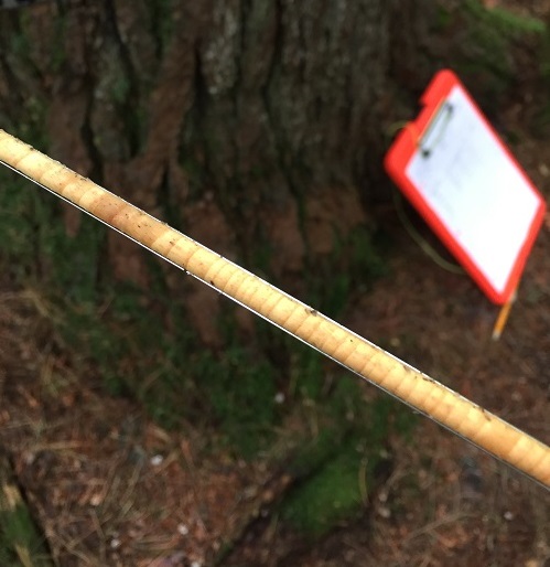 Photo: Paula Murakami
About the DendroEcological Network
The DendroEcological Network (DEN), is a collaborative effort among the U.S.D.A. Forest Service's Northern Research Station, the University of Vermont (College of Arts and Sciences and the Rubenstein School of the Environment and Natural Resources) and the Forest Ecosystem Monitoring Cooperative. The goal of the database is to provide a central, long-term archiving platform for data derived from dendroecological studies, including tree-ring-based chronologies and their associated ecological data. Currently, no such integrative database exists and many dendroecological collections are unavailable to the research and management communities for comparative and larger-scale analyses.
The DEN also includes species and age classes not commonly found in other databases. DEN is intended for the free and public use by the scientific and natural resource communities, facilitating the investigation and synthesis of dendroecological and forest ecology data across space and time. DEN fully supports information sharing, collaboration and discovery, and implements the best available standards for data archive, documentation and interoperability including the Tree Ring Data Standard and Ecological Metadata Language.
Read the DendroEcological Network Version 1.0 Technical Report to learn more about the data model and technical implementation of the DEN

 Photo: Paula Murakami
Why Contribute Your Data?
DEN offers both a long-term archiving platform for dendroecological and associated data and the cyberinfrastructure to share, explore and integrate data from multiple sites. These benefits help scientists to meet granting agency requirements for the storage and dissemination of publicly funded data collection and research, increase visibility of research through the tracking and citation of data, and extend and leverage data in combination with other studies archived on the site.
Through DEN, data usability is enhanced, furthering, for example, large scale modeling studies, mixed method studies combining remote sensing and dendroecological data, or productivity studies within and across species, space and time. The more data are shared on DEN, the greater the return will be for the individual user, and the scientific and natural resource communities.
To maintain the rigor of the overall resource, the DEN is currently limited to only accept datasets containing cores that were cross-dated.
We are currently working on a web-based interface for adding data to the database directly, giving contributors ultimate control over how their data are accessed. We expect this feature to be available later in 2018.
Interested in archiving data in the DendroEcological Network? We can help get your data stored with one-on-one service! Please contact us or e-mail the Forest Ecosystem Monitoring Cooperative at femc@uvm.edu to learn more about how you can get involved!
We have also provided a Data Management Plan Template you can use in grant proposals requiring data archiving at the end of the project.
The People Behind the DendroEcological Network
This cooperative effort was initiated by nearly a dozen people interested in bringing together ecological field data with dendrochronological data on trees. The people working to continue the initial construction of the database are:
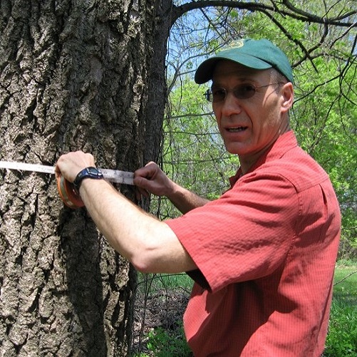
Paul Schaberg
Research Plant Physiologist, USDA Forest Service Northern Research Station
Shelly Rayback
Associate Professor, Department of Geography, University of Vermont
Chris Hansen
Research Technician, Rubenstein School of Environment and Natural Resources, University of Vermont
Paula Murakami
Biological Sciences Laboratory Technician, USDA Forest Service Northern Research Station
Contact Us
 Photo: Paula Murakami
Questions about the DendroEcological Network? Have a suggestion for the team? We would love to hear from you!
Please visit the contact page to send us a message, or you can reach the team by e-mailing the Forest Ecosystem Monitoring Cooperative at femc@uvm.edu.