 |
||||
Brush Photointerpretation Keys
Anderson et al. (1976):
The eastern brushlands are typically former croplands or pasture lands (cleared from original forest land) which now have grown up in brush in transition back to forest land to the extent that they are no longer identifiable as cropland or pasture from remote sensor imagery. Many of these brushlands are grazed in an extensive manner by livestock and provide wildlife habitat. These areas usually remain as part of the farm enterprise, even though not being used at their former levels of intensity. After sufficient forest growth has occurred, they should be classified as either Deciduous, Evergreen, or Mixed Forest Land.


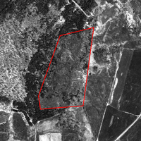
Shrubberies (32)
Shrubberies (32)