Vermont Barn Census
Chittenden County Student Research Project - 2010
History
Agricultural History of Underhill, Vermontby Eric R. NystromThe town of Underhill is in the northeast corner of Chittenden County. At the time when Vermont was part of the New Hampshire grants, Governor Benning Wentworth issued a charter to Joseph Sackett Jr. and sixty-four associates on June 8, 1763. [1] The grant was for 23,040 acres. The sum paid for the charter was $230.40, which is one cent per acre. [2] These men were land speculators and it is not clear if any of these men ever settled in Underhill or ever set foot in the town. Although granted in 1763, settlement in Underhill was delayed by the Revolutionary War. [3] The first settlers in Underhill were Elijah Benedict and Abner Eaton in 1786. [4] The town is comprised of three smaller communities, Underhill Flats, Underhill Center and North Underhill. There are conflicting reports about how Underhill received its name. Most believe that Underhill received its name from Benjamin Underhill, one of the original proprietors, and not from its location under Mt. Mansfield as might be supposed. [5] Early Settlement and Agriculture Farming and timber dominated the early years of the community. Underhill is situated on the western side of the Green Mountains. It was heavily forested and many areas had to be cleared before farming could begin. The earliest agricultural practice consisted of land clearing for the production of crops and livestock. [6] As a result of the demand for lumber, there were many sawmills that dotted the landscape, wherever there was a stream that supplied a steady flow of water. [7] The Wallings map of 1857 indicates that there were ten saw mills operating at that time. [8] [Figure 1] Timber remained a staple of many farmers’ income until the turn of the twentieth century. The lumber industry and related activities survived into the early 1900’s until the mountain slopes had been timbered off. [9]
Early settlers in Underhill included Martin Mead, Simeon Mead, Jonas Humphrey, William Flynn and Timothy Burdick in addition to Benedict and Eaton. The early settlers were likely drawn to the Underhill Flats area given the extensive level, rich farmlands located along the creek and Brown’s River.[10] Many of these farms still exist in Underhill. The Mead farm is still in operation on River Road. (Figure 2.) These early farms were mostly subsistence farms. By the mid-nineteenth century the farms were beginning to be more prosperous. Crops such as wheat, corn, potatoes, rye, barley, and hay were grown for on-farm use as well as for sale or exchange. [11] Livestock was also important to the town. The raising of livestock, such as cattle, horses, sheep, and pigs were important economic activities. [12] The raising of sheep for wool production became the primary occupation on some farms in mountainous Underhill. [13]
The agricultural census of 1840 reveals the crops and livestock that sustained the farmers of Underhill. The totals for livestock were 174 horses, 1089 cattle, 3361 sheep. Crops were recorded in number of bushels produced. They are as follows, wheat 1,186, corn 1,954, oats 2,934, and potatoes 30,075 bushels. In addition to these crops the town produced 8,010 pounds of wool and 1,556 tons of hay. Being a mountainous town, there was an ample supply of maple trees. These trees produced 30,824 pounds of maple sugar. [14] By the mid nineteenth century farming practices began to change in Underhill. The Civil War also impacted Underhill. The war had taken a heavy toll from farms and hamlets of those men who would have been most energetic in all kinds of private and civic enterprises. [15] Sheep farming began to be unprofitable as competition from western states and the financial panic of 1847 drove prices down. There are still a few remaining sheep farms in Underhill. (Figure 3) The change from sheep to dairy farming occurred gradually over this decade. During this period the farming landscape was reorganized around what is generally recognized as the shift from sheep and wool production to dairy farming. [16] A comparison of censuses from 1850 through 1870 reveals this change. The censuses included 178 farms in 1850 and 126 in both 1860 and 1870. Livestock numbers are difficult to decipher. The number of cattle increased from 520 in 1850 to 953 in 1870, and then declined again in 1870 to 722. Sheep declined from 1829 in 1850 to 821 in 1860, but then increased to 1161 in 1870. Horses remained relatively constant from 278 in 1850 to 262 in 1870, but then jumped to 352 in 1870. [17]
Most crop production increased during this time. Wheat crops had a steady increase over the three censuses, climbing from 1237 to a high of 4004 bushels in 1870. 1850 was the zenith for rye production with a high of 629 bushels. By 1870 Underhill produced only 10 bushels of rye. The production of corn increased from 9413 bushels to 13,194 in 1870. Oat production doubled from 1850 to 1860 rising to 28,374 bushels, where it leveled off to 26,320 bushels in 1870. The other major cash crop, potatoes, had a slow decline but remained constant over the years ranging from 33,775, 29,963 to 28,769 bushels. [18] As was noted earlier the number of sheep fluctuated from census to census. Coinciding with this was the amount of wool produced. It dropped from its zenith of 8,010 pounds in 1840 to 3865 pounds in 1860, and then increased slightly 4,066 pounds in 1870. The other staple crops continued to increase during the mid nineteenth century. The amount of hay the town produced steadily increased to 6,019 tons by 1870. The amount of maple sugar produced doubled from 1850 to 1860 to 61,510 pounds. It saw a further increase to 75,470 pounds in 1870. There was one strange anomaly that occurred during the 1860 census. A farmer by the name of Asa Lane produced 1,000 pounds of hops. It is the only mention of hops on any of the censuses. [19] Dairy products first appear on the 1850 census demonstrating the shift from wool to dairy production. The census recorded 824 milch cows producing 51,125 pounds of butter and 73,085 pound of cheese in 1850. [20] By 1860 the change was being fully recognized. The census records of that year show the number of milch cows almost doubling to 1,768. This large increase explains the amount of butter tripling to 155,980 pounds. Much of the milk produced by the cows went to make the butter, and hence the amount of cheese produced dropped to 42,195 pounds. [21] In 1870 the amount of butter increased to 196,900 pounds, while cheese production fell again to 26,280 pounds. [22]
The agricultural census of 1880 was more comprehensive than the previous ones. It reveals a greater diversity to Underhill’s agriculture practices. The number of farms increased to 254. Horses and cattle increased to 453 and 1,959. Sheep however declined to 626 and the wool they produced also fell to 3,874 pounds. Oat production increased to 31,781 bushels. The production of barley became prominent with 673 bushels produced. The amount of corn and wheat both fell slightly from their previous highs to 10,313 and 2,027 bushels. Potato and hay production increased slightly to 30,917 pounds and 6, 077 tons. Dairy production concentrated on butter as 269,550 pounds of butter were produced. The significant development in dairy production was there was no cheese produced. The loss of cheese was offset by two farmers, S.W. Mead and S. M. Mead, who produced 13,500 gallons of milk. In addition to these products, poultry became an important economic activity. Underhill farmers raised 4,157 chickens tha tproduced 31,228 dozens of eggs. Farmers began to grow apples on small plots of their farms. They produced 7,750 bushels of apples. [23] The maple sugar production continued to increase to 86,421 pounds. The production of maple syrup remains a staple of Underhill’s economy. There are many “Maple Syrup Sold Here” signs dotting the landscape. Most of the maple sugar houses are set back in the woods, where the sugar maple trees are. Some sugar houses are closer to the residences where the syrup can be processed and sold easier. (Figure 5)
Underhill’s population was 212 in the 1800 census. It reached a high of 1,637 in 1860. The population slowly declined until the 1970’s when many people wanted to escape the city and return to a more peaceful existence. [24] Today the census estimates the population at 3,058. [25] Emily Flynn, the granddaughter of William Flynn, a lifelong resident of Underhill remarked in 1941that, “Underhill is essentially a farming town with a few good river farms but mostly hill farms which are fast being abandoned.”[26] Beginning in the last decades of the nineteenth century and extending through the first half of the twentieth century, population, farming, and lumbering began a gradual decline.[27] Today Underhill is a quiet residential community dotted with a few remaining farms. Underhill’s farming population was replaced by increasing number of inhabitants whose livelihoods were oriented toward the urban culture of Burlington and its environs. [28] |
|||||
Notes [1] Loraine S. Dwyer, The History of Underhill, Vermont: The Town Under The Mountain (Underhill Historical Society, 1976), 1. |
|||||
| Figure 1 1857 Wallings Map courtesy of Bailey/Howe Library Special Collections Figure 2,3,4,5 Photos by E.R. Nystrom |
|||||
References Chittenden County Historical Society. Look Around Jericho, Underhill, Westyford, Vermont. Burlington: George Little Press, 1972. |
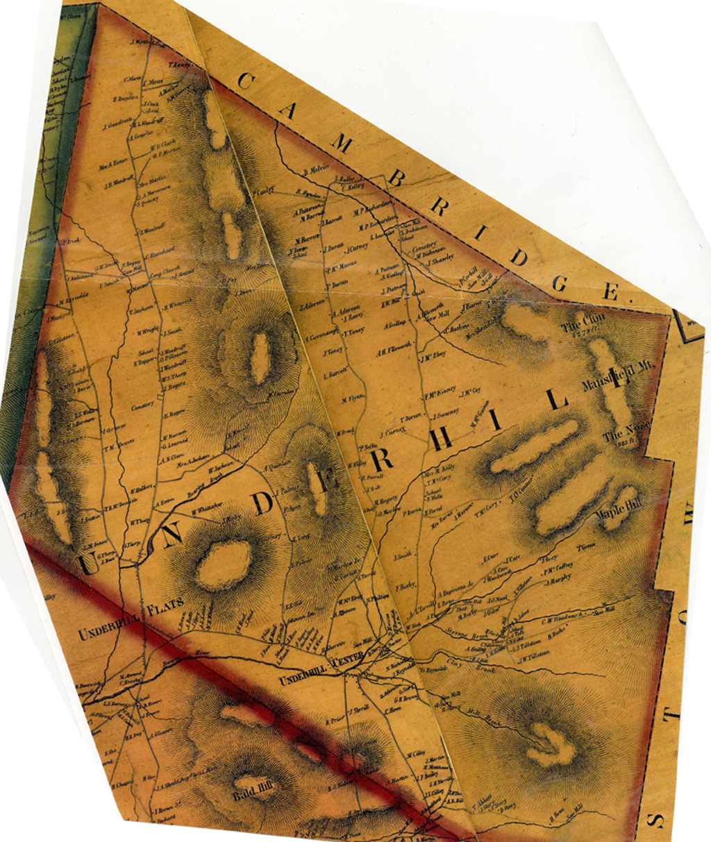 Figure 1
  Figure 2
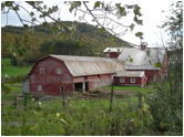 Figure 3
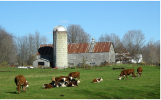 Figure 4
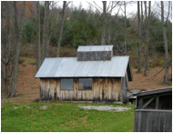 Figure 5