« BACK
Stories & Galleries
The Burlington Ravine
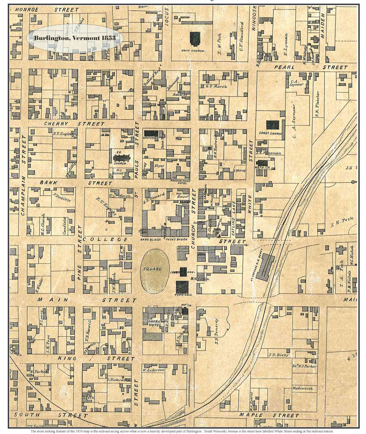
1853 Map of Burlington (detail - click to see full size)
It's hard to imagine now, but at one time there was a ravine that sliced across Burlington. Formed thousands of years ago, it was the path once taken by the Winooski River to Lake Champlain. In more recent history, 125 or so years ago, it was a path for a railroad and home to a train depot to boot. During the late 1800s, this deep channel was mostly filled in and we might not be aware of it today if not for a few vestigial traces on the landscape and the work of some dogged researchers. A few of their stories:
» “What lies beneath Burlington?”* by Joel Banner Baird,
Burlington Free Press, August 3, 2013
» “A Ravine safari for the incurably curious”* by Joel Banner Baird,
Burlington Free Press, August 3, 2013
» “An Engineer and 'Map Geek' Unearths Burlington's Past ”* by Ethan de Seife,
Seven Days, December 3, 2014
» “Disappearing Act: Burlington’s lost ravine” by Chad Abramovich,
Obscure Vermont (blog)
Burlington Free Press, August 3, 2013
» “A Ravine safari for the incurably curious”* by Joel Banner Baird,
Burlington Free Press, August 3, 2013
» “An Engineer and 'Map Geek' Unearths Burlington's Past ”* by Ethan de Seife,
Seven Days, December 3, 2014
» “Disappearing Act: Burlington’s lost ravine” by Chad Abramovich,
Obscure Vermont (blog)
* Many thanks to the Burlington Free Press for republishing these articles online.
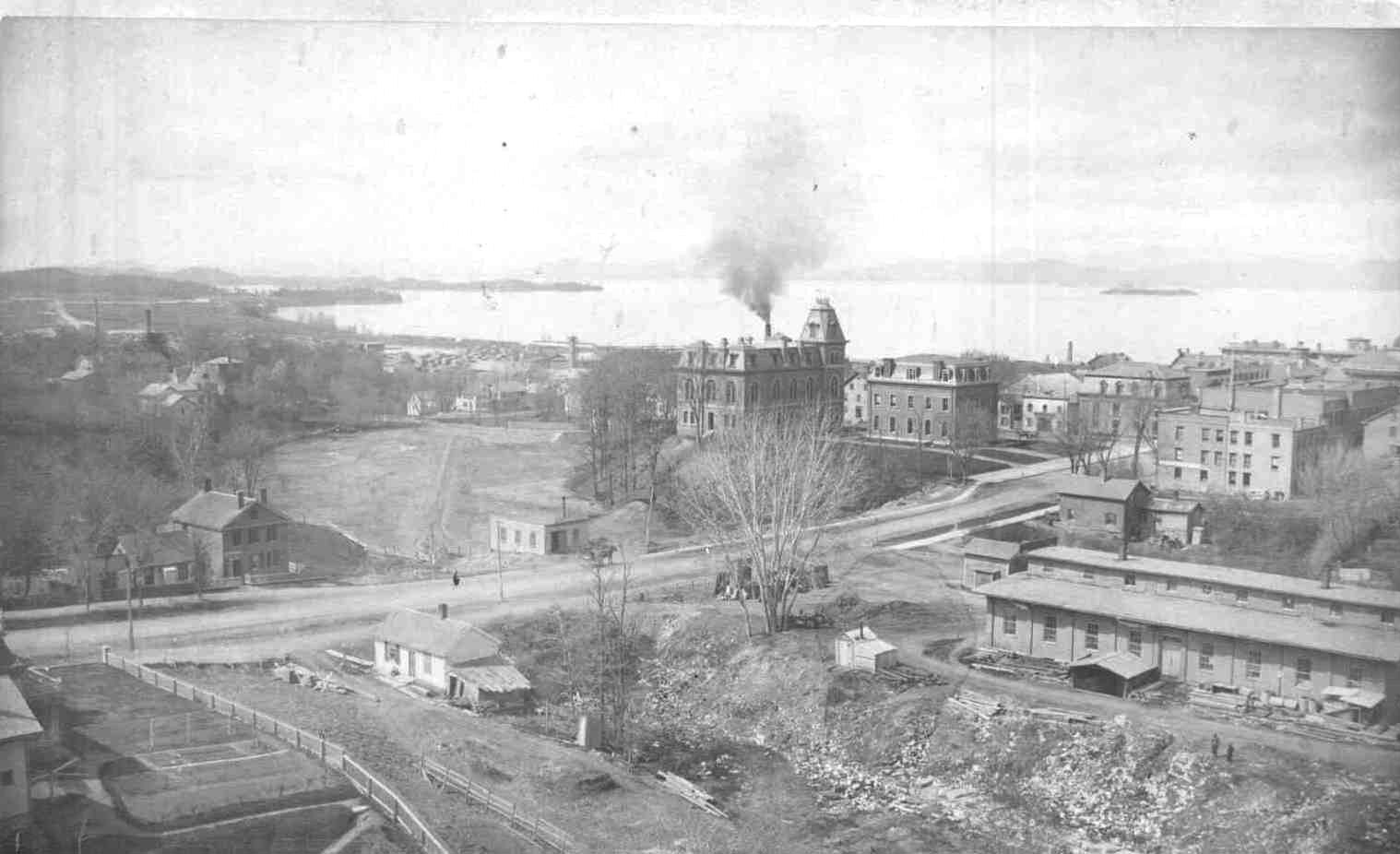
Burlington, circa 1870, ravine in foreground - photo detail