Landscape Lenses
Physical Landscape : Surficial Geology
The surficial geology of Vermont is largely a legacy of the glaciers that receded from this area about 13,500 years ago. Glacial till, gravel, sand, and clay are the most common surficial deposits that remain from the retreat of the glaciers. These deposits are smeared across hillsides, and even fill entire valleys. 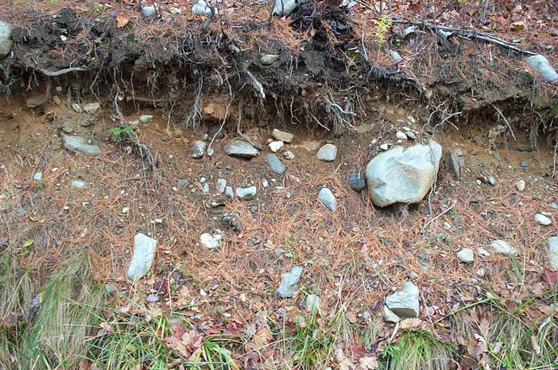
glacial till They may be several feet thick and create structure and form independent from the underlying bedrock. Other surficial deposits include pebbly and fine sand, silt, and clay, most commonly found in in the Champlain Valley.
Surficial deposits are important players in the landscape as they generally provide the “parent material” for the soils that have been developing over the last 10,000 years. The texture and chemical composition of this parent material has a profound influence on important factors such as soil productivity and moisture-holding capacity, and often holds the key to understanding patterns of agricultural activity and plant community distribution.
In addition, surficial deposits are often quarried (think of sand and gravel), and because of variations in depth and drainage, they control where development can or cannot occur. For example, sandy deposits generally make for poor agricultural soils because they provide scant nutrients and don’t retain adequate moisture. But they may have prime potential for development because they're easily excavated and eminently suitable for septic drainage.
Glacial till, a jumbled mix of different sediment sizes (ranging from clay to boulder), is by far the most common surficial deposit on the Vermont landscape, however, for reasons explained below, it's far less common in and around Burlington. Originally scraped from the bedrock and redistributed on the landscape under the advancing ice sheet, till—derived from the Scottish term meaning “stubborn land”—tends to give birth to soils that are rocky, dense, and poorly drained. The rocky and acidic nature of these soils often led some 19th century Vermont farmers to abandon their farms in search of soils that were more fertile and easier to plow.
In Burlington and the surrounding area, glacial till is mostly overlain by finer sediments, such as sand, silt, and clay. This pattern is a result of the large lakes and rivers that existed at the time of the melting glacier. As the glacier melted away from the landscape, tremendous amounts of glacial meltwater flowed in huge rivers over the recently uncovered till. 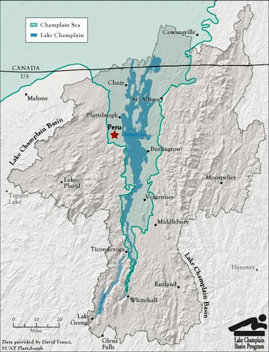
Map of Champlain Sea
15,000-13,000 years ago
Lake Champlain Basin Program
http://www.lcbp.org/This flowing water carried and sorted the component particles varying distances from their source depending on the size of the particle and the energy of the flow. Cobble-sized rocks require extremely fast, high-energy flows to move them, while smaller sand particles can be easily transported by fast flowing water, but are quickly deposited when the rate of flow slows, such as when a flowing river meets a still lake.
The lake that these huge ancient rivers flowed into was not the same Lake Champlain that we know today. When the glacier first was receding, huge amounts of freshwater filled the Champlain Valley creating a much larger body of water we call Lake Vermont, where the shoreline would have been as high as the hill upon which the University of Vermont sits. Once the glacier retreated far enough to the north into the St. Lawrence River valley, seawater flowed in from the north, mixing with the fresh waters to create a Champlain Sea in which marine creatures lived (such as the famous Charlotte Whale, whose skeleton is on display at the Perkins Museum of Geology at UVM). The land took a long time to rebound after the weight of the glaciers was lifted, and once this “isostatic rebound” was complete, seawater no longer flowed into the lake, and Lake Champlain as we know it was complete with its outflow to the north into the Richelieu River and then the Gulf of St. Lawrence.
You can sometimes find surficial sediment exposed in road cuts or riverbanks, but usually the best way to explore the surficial sediments is to start digging. You’ll want to look for transitions in soil color and texture, notice the shape and size of any rocks that you encounter, and depth and nature of plant roots. As always, keep your eye on the surrounding features—natural and human-made.
Map image credit: Lake Champlain Basin Program,
http://www.lcbp.org/about-the-basin/history-timeline/