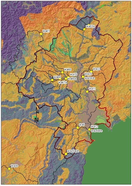
replace this figure with something showing different regions of the basin
|
Other Sample Types:
|
|
Terrace Samples
|
|
Calibration Depth Profiles
|
|
Core Samples
|
|
Bedrock Samples
|
|
Modern River Samples:
|
|
Catchments to the north and south
|
|
Relict Basins
|
back to top
| Description: | Basin Area km2: |
May, 2004
|
March, 2005
|
Aug, 2008
|
08 flood dep
|
| Mangatu Forest - Above Te Weraroa confluence | |||||
| Mangatu Forest - Below Te Weraroa confluence | |||||
| Mid-gorge sample (may be very low inset terrace...bola?) | |||||
| Gorge outlet. pre-Whatatutu mix | |||||
| Whatatutu mix - intermediate sample (pre-Melange) | |||||
| Whatatutu mix - final sample | |||||
| Mainstem between Whatatutu and Te Karaka | |||||
| Te Karaka - Kanakanai Station | |||||
| Te Karaka - pre-western mix | |||||
| Te Karaka - post-western mix | |||||
| Poverty Bay Flats - upstream | |||||
| Poverty Bay Flats - downstream | |||||
| Waipaoa Mouth - wave action |
back to top
| Description: | Basin Area km2: |
May, 2004
|
March, 2005
|
Aug, 2008
|
08 flood dep
|
| Waimatau - ss headwater basin uppermost | |||||
| Tikihore - ss headwater basin next down | |||||
| Te Weraroa - Western headwater trib - less gullied | |||||
| Te Weraroa - Eastern headwater trib - more gullied | |||||
| Te Weraroa - channel seds near Tarndale | |||||
| Te Weraroa - Tarndale channel | |||||
| Te Weraroa - Tarndale terrace | |||||
| Te Weraroa - Channel terrace downstream of Tarndale | |||||
| Te Weraroa - Western draw #1 - less gullied | |||||
| Te Weraroa - Western draw #1 terrace | |||||
| Te Weraroa - Western draw #2 - less gullied | |||||
| Te Weraroa - Northern Trib - somewhat heavily gullied | |||||
| Te Weraroa - Northern Trib - Fan Terrace | |||||
| Te Weraroa - outlet | |||||
| Mongoarongo - longitudinal sample | |||||
| Mongoarongo - outlet | |||||
| Mainstem - upstream of Te Weraroa | |||||
| Mainstem - downstream of Te Weraroa | |||||
| Mainstem - mid-gorge sample (low inset terrace) | |||||
| Mainstem - Gorge/ Waipaoa outlet | |||||
| Mangatu Outlet | |||||
| Waingaromia Outlet |
back to top
| Description: | Basin Area km2: |
May, 2004
|
March, 2005
|
Aug, 2008
|
08 flood dep
|
| Waikohu trib outlet before western confluence | |||||
| Waihuka upstream longitudinal sample | |||||
| Waihuka Relict Basin Sample | |||||
| Waihuka ag basin upstream | |||||
| Waihuka ag basin outlet | |||||
| Waihuka outlet | |||||
| Wharekopea / Totangi mix before western confluence | |||||
| Western tributaries mixed outlet sample |
back to top
| Description: | Basin Area km2: |
May, 2004
|
March, 2005
|
Aug, 2008
|
08 flood dep
|
| Waihora upstream (headwaters). Above gradient change. | |||||
| Waihora midbasin. Starting to see paleo-floodplain logs | |||||
| Waihora outlet |
back to top
| Description: | Basin Area km2: |
May, 2004
|
March, 2005
|
Aug, 2008
|
08 flood dep
|
| Waterworks sub-basin | |||||
| Waterworks outlet | |||||
| Waingake upstream near ss/ms contact | |||||
| Waimata - tiny trib feeding from the north | |||||
| Waimata longitudinal sample upstream | |||||
| Waimata hillslope feeder channel (matt's slope) | |||||
| Waimata longitudinal sample near matt's hillslope | |||||
| Mid-basin with 2008 grain size splits | |||||
| Te Arain downstream outlet |
back to top
| Description: | Basin Area km2: |
May, 2004
|
March, 2005
|
Aug, 2008
|
08 flood dep
|